
Many of the rides are climbs described in John Summerson’s book, The Complete Guide to Climbing (by Bike). When describing one of these climbs, I use Summerson’s distance and elevation gained. I also include (S-#) in the name to indicate that the ride is described in his book. The # shows the climb’s category given by Summerson (1, 2, HC=hors categorie). When I describe a climb, the distance is usually one-way, to the top.
Note: MM = Mile Marker
Individual Pages
Five Big Colorado Loops
Cycling Pikes Peak
Mount Evans from Boulder
The Boulder Big 8
Cycling around Boulder
Cycling in Summit County
Cycling around Grand Junction
In This Page
Here are rides in other parts of Colorado that I haven’t broken out into separate pages.
Estes Park
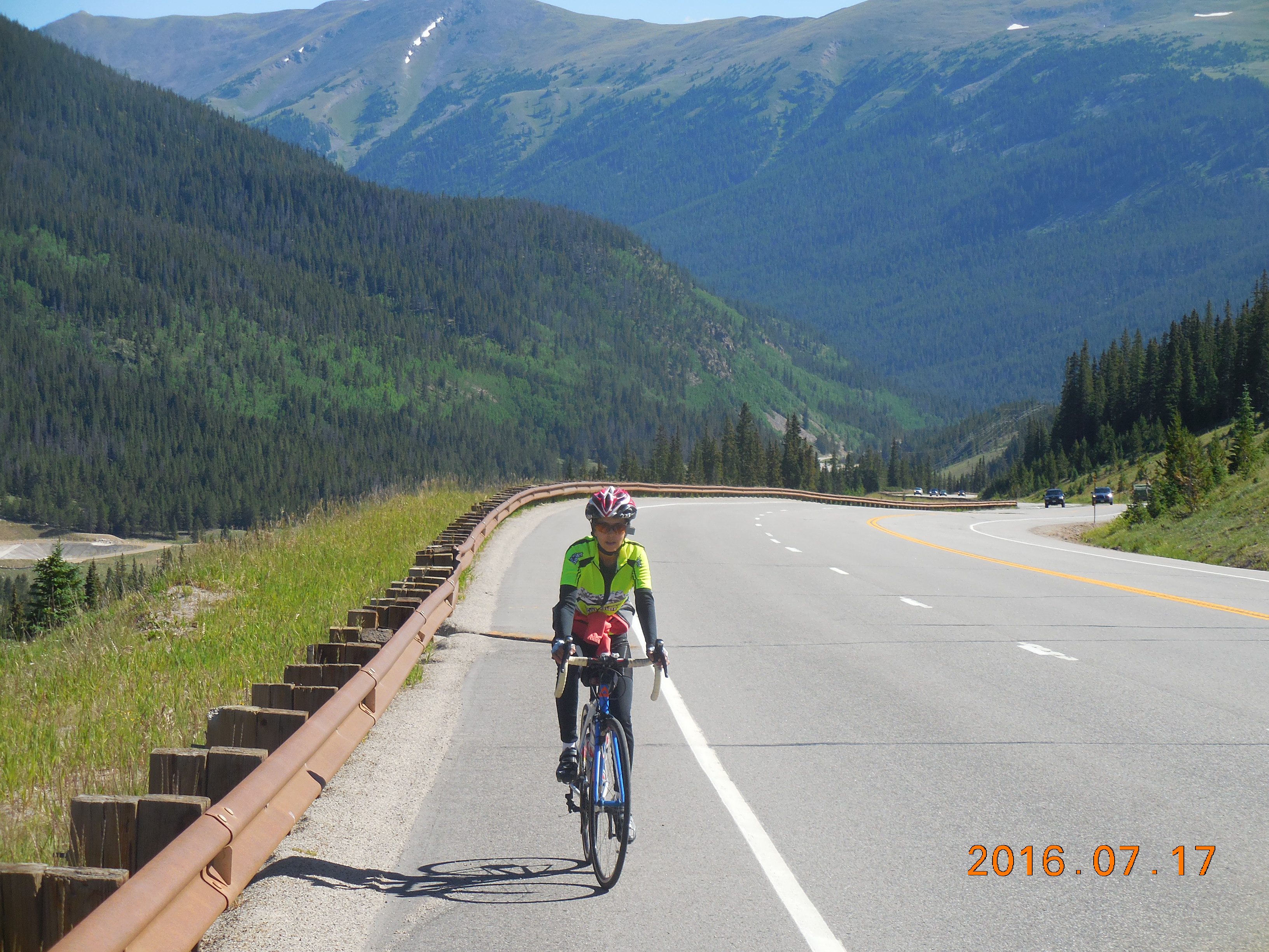
Trail Ridge Road East (S-HC/1)
 Trail Ridge Road is one of the great rides in Colorado, especially from the Estes Park side. It is apparently the highest continuous paved road in the United States, reaching an elevation of 12,183 feet. It crosses Rocky Mountain National Park from Estes Park in the east to Grand Lake in the west.
From the Beaver Meadows Visitor Center on Hwy 36 just west of Estes Park, the ride to the Alpine Visitor Center is a round trip of about 43 miles with about 5,050 feet of climbing. (Alternately, you can start at the Fall River Visitor Center on Hwy 34 west of Estes Park.)
The road is never very steep, with a maximum gradient of 7%, and travels through three distinct zones. First you climb gently through meadow terrain to the first switchback at about 6.5 miles, then you contour up through trees to the Rainbow Curve overlook which you reach in another 5.5 miles.
Above Rainbow Curve the trees disappear and you are in alpine tundra country, with spectacular views of the mountains around you. Because there are no trees to protect you it can be windy up here.
After about 9 miles of high alpine tundra above Rainbow Curve, you reach the Alpine Visitor Center. But what a 9 miles! Sensational views, lots of uphill, and also significant sections of downhill which will need to be climbed on the way back.
After a long climb above Rainbow Curve, you will pass through a rock cutting then descend to Iceberg Pass (especially unprotected from the wind), and switchback up to the unmarked high point of the climb. You could of course simply turn around at the high point but since you got this far you might as well descend about 1.8 miles to the Alpine Visitor Center – then turn around.
[The climb from the Kawuneeche Visitor Center near Grand Lake to the Visitor Center is about 21 miles but to my mind is not nearly as spectacular as the climb from the east as it misses out on most of the high alpine tundra.]
Update: July 2021. Another way up to the Alpine Visitor Center is to ride the one-way Old Fall River Road, which climbs mainly up a gravel road. This road is easily rideable on a road bike but I’ve written about it in the gravel pages.
Golden
Lookout Mountain
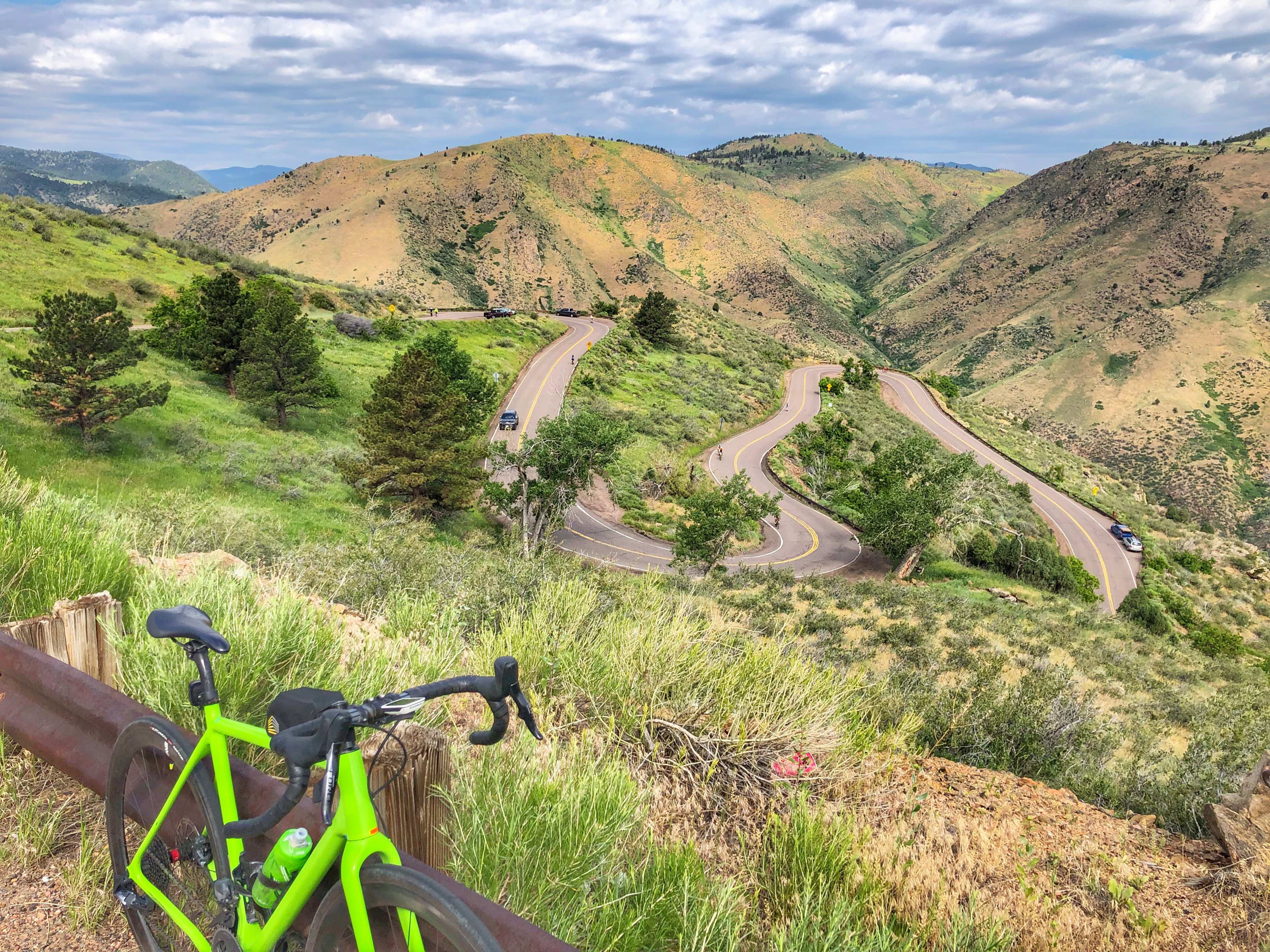 Lookout Mountain is a wonderful short climb out of Golden with some gorgeous switchbacks that are a delight to descend. Because it’s so close to Golden it is a very popular climb and you are likely to see many cyclists on it.
If you are driving to it, a popular parking spot is a few hundred yards up 19th Street at the parking lot for Beverly Heights Park, shortly before the two pillars that designate the “official” start of the climb.
From the parking area to the most common finish at the turnoff to the Buffalo Bill Museum and Grave, it’s about 4.6 miles and 1,231 feet of ascent, but the climbing continues on for more than a mile. If you do the short ascent to the Museum parking lot, then continue up the main road, you will reach where the road starts going downhill at about 6 miles and 1,440 feet of ascent.
Golden Gate Canyon
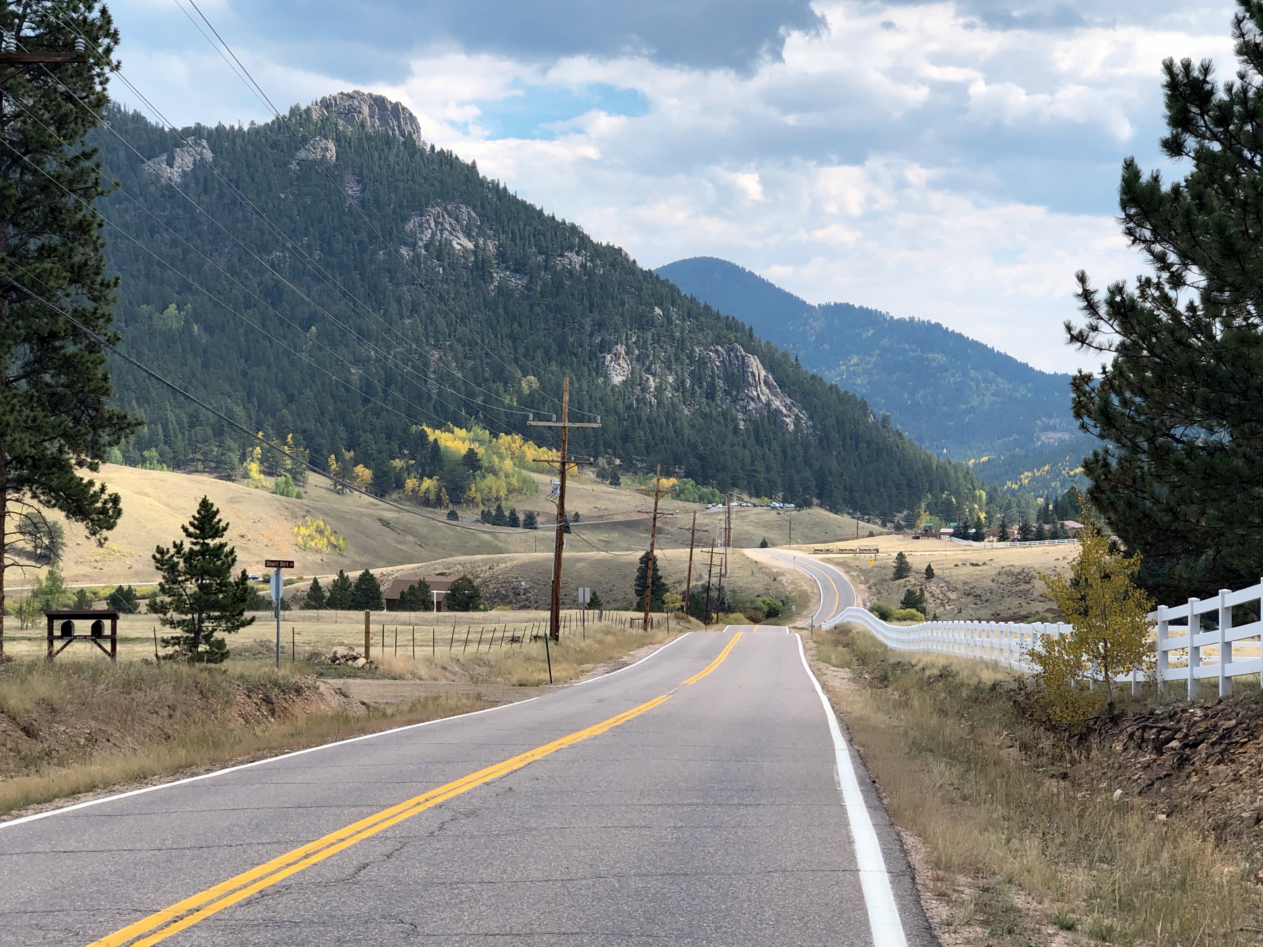 Golden Gate Canyon (GGC) is a pretty canyon out of Golden, leading up to the Peak to Peak Highway. It’s very popular at weekends and can see quite a bit of traffic, so it’s probably better to ride it during the week.
In the past I’ve ridden GGC as part of a big loop starting in Boulder, and also as part of a loop that descends Coal Creek Canyon. But here I’ll describe the out-and-back ride.
Golden Gate Canyon Road (GGCR) starts at the northern end of Golden and is well-signed. Strangely, it starts as County Road 70 but finishes as State Road 46. There are two big descents on the ascent, which add to the variety and make the descent more interesting. There is a good dirt parking lot at the start of GGCR on the left.
The obvious way to ride GGC is to follow GGCR up to the Peak to Peak highway then return the same way, which gives a ride of about 36 miles with 4,970 feet of climbing, about 800 feet of which are on the way back.
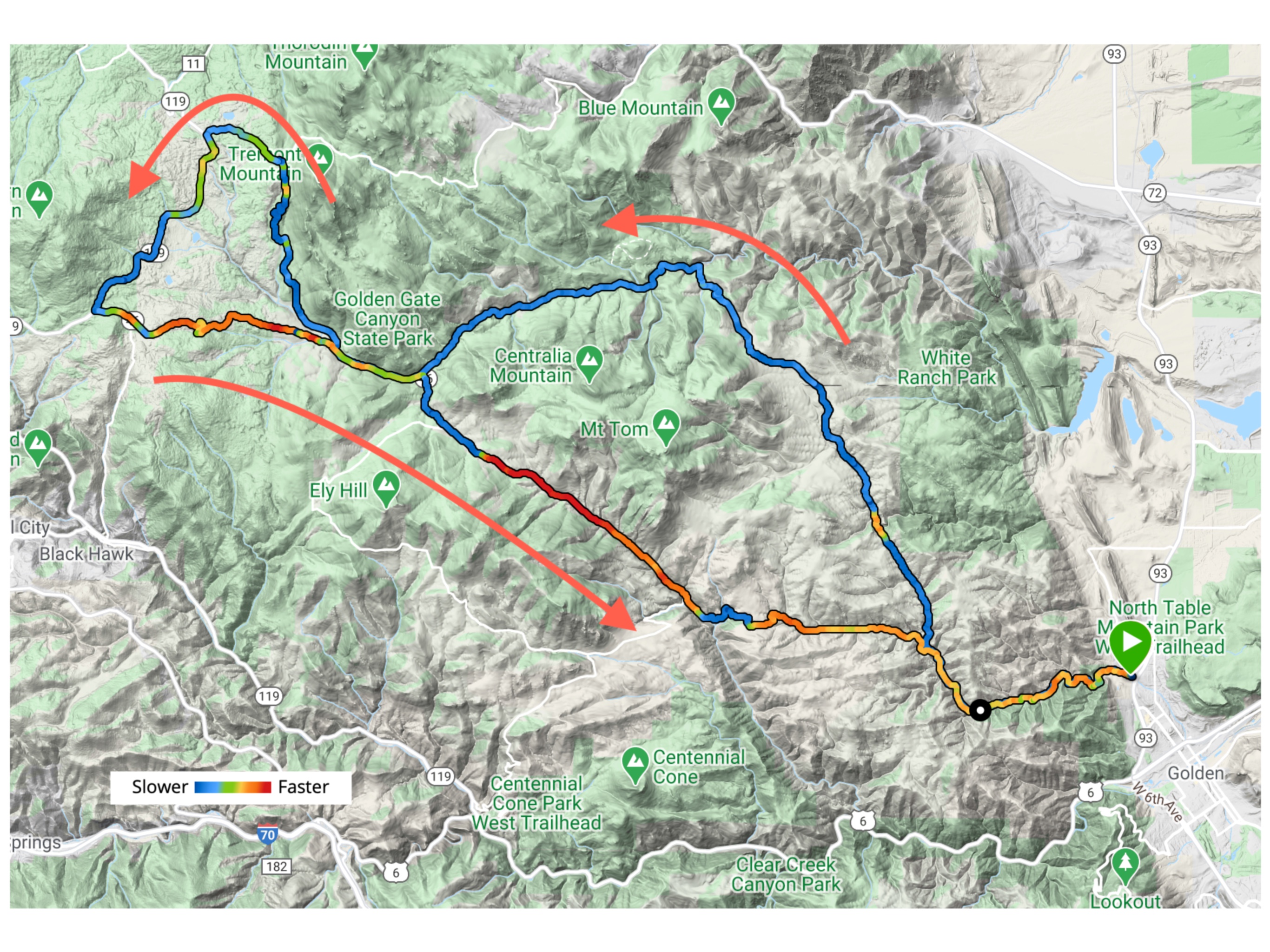 But I will describe a more interesting way of riding GGC, a sort-of Figure-8 which gives a ride of about 41 miles and 5,060 feet of climbing.
So, ride up GGCR for about 4 miles and turn right on Crawford Gulch Road. This road has less traffic which makes the riding more pleasant. Eventually, after several miles, the road turns to gravel for a couple of miles of descent, and the surface varies between loose gravel, washboard, hardpack, and the occasional asphalt. Some of this descent is both loose and very steep so be careful.
Eventually you get to the bottom of the descent and the asphalt returns. Continue up until after about 15 miles of riding you rejoin GGCR. Turn right and after another mile turn right on Mountain Base Road. Don’t be intimidated by the signs that warn of 19% or 20% gradients – my Garmin showed a maximum of 16% on the 3.2 miles of Mountain Base Road. At the junction at the top, turn left and ride down the hard packed dirt road for just over one mile to the Peak to Peak Highway.
Turn left and follow the rolling Peak to Peak for about 7 miles until at the top of a hill you turn left on Highway 46 and follow GGCR back down to Golden, with two delicious ascents to break up the fast and fun descent.
Other
Mesa Verde
 In southwest Colorado, on Hwy 160 between Mancos and Cortez, lie the spectacular Indian cliff dwellings of Mesa Verde.
The road up into Mesa Verde is a pretty climb, varied and with some lovely views, especially on the way down. You can see the initial part of the climb slashing diagonally left across the side of the mesa as you drive west on Hwy 160 from Mancos.
The climb from the Visitor Center to Park Point, the highest point in the park, is 11.2 miles with 1,880′ of climbing – plus 393′ of descent. So for the out-and-back you will climb 2,273′. The gradient varies, with plenty of 3-5% a small amount of 6-7%, plus two decent length descents that you climb on the way back. Depending on the time of year and day, there may be a lot of traffic. Early morning is best if you don’t like traffic.
There is a tunnel, a few hundred feet long, and the park service requires that “Each bicycle must exhibit a white light on the front visible from 500 feet and a red light or reflector on the rear visible for 300 feet during periods of low visibility and in the tunnel.” Personally I think that just a reflector in the tunnel is asking for trouble, and highly recommend a good rear light.
Park at the Visitor Center then ride up past the pay station ($10 for bicycles if you don’t have a Pass). The first 3.5 miles are the main part of the climb, then you have a long gradual downhill, followed by the tunnel. More climbing with a few good curves leads to the second downhill. Another uphill, then at 10.6 miles turn right following the sign for Park Point, which you reach at 11.2 miles.
 If you want a longer ride, you can follow the rolling main road along the mesa to Far View Terrace, then the Chapin Mesa road out towards the Cliff Palace and Balcony House cliff dwellings. As an out-and-back this will give you an additional 25 miles and 2,113′ of climbing.
After the ride, treat yourself to a chocolate macaroon at the Absolute Bakery in Mancos.
Links and Other Clicks
Ride the Rockies. RTR is a wonderful week-long tour around Colorado. It’s usually done starting in one place and finishing in another.
Bicycle Tour of Colorado was another wonderful week-long tour around Colorado, lower-key than RTR. It was always done as a loop, which made getting there and back easier than with RTR. But alas, as of 2019 this ride is no more.
