
Colorado has many beautiful and fun gravel rides, most of which I have not done. In fact I’ve only done a few. Here are some of them.
I list several great sites for gravel rides in the Links and Other Clicks section at the bottom of this page.
Boulder
Nederland
Estes Park
Winter Park
Idaho Springs
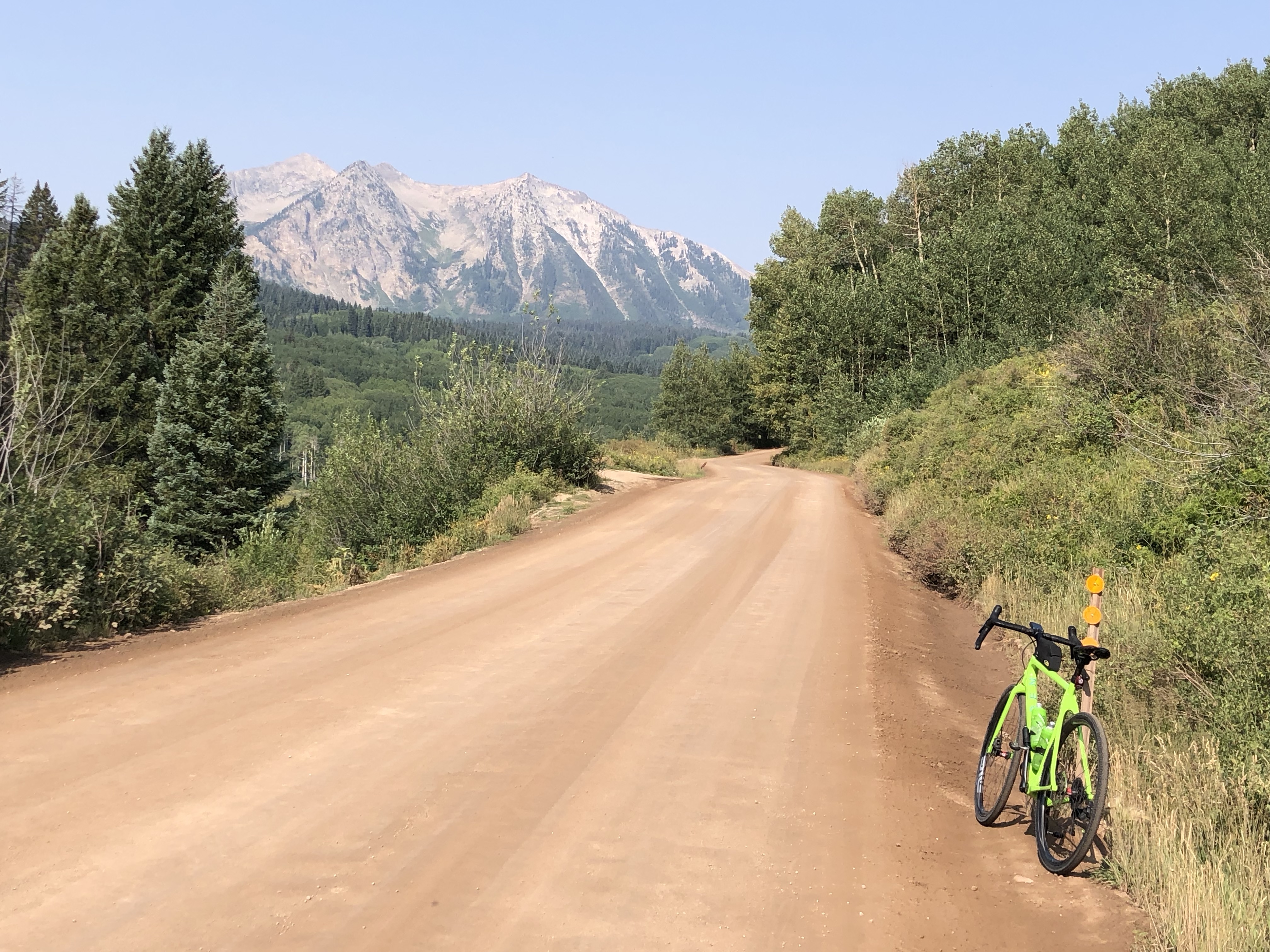
Crested Butte
Cañon City
Grand Junction
Boulder
Four Mile Canyon – Wall Street – Switzerland Trail
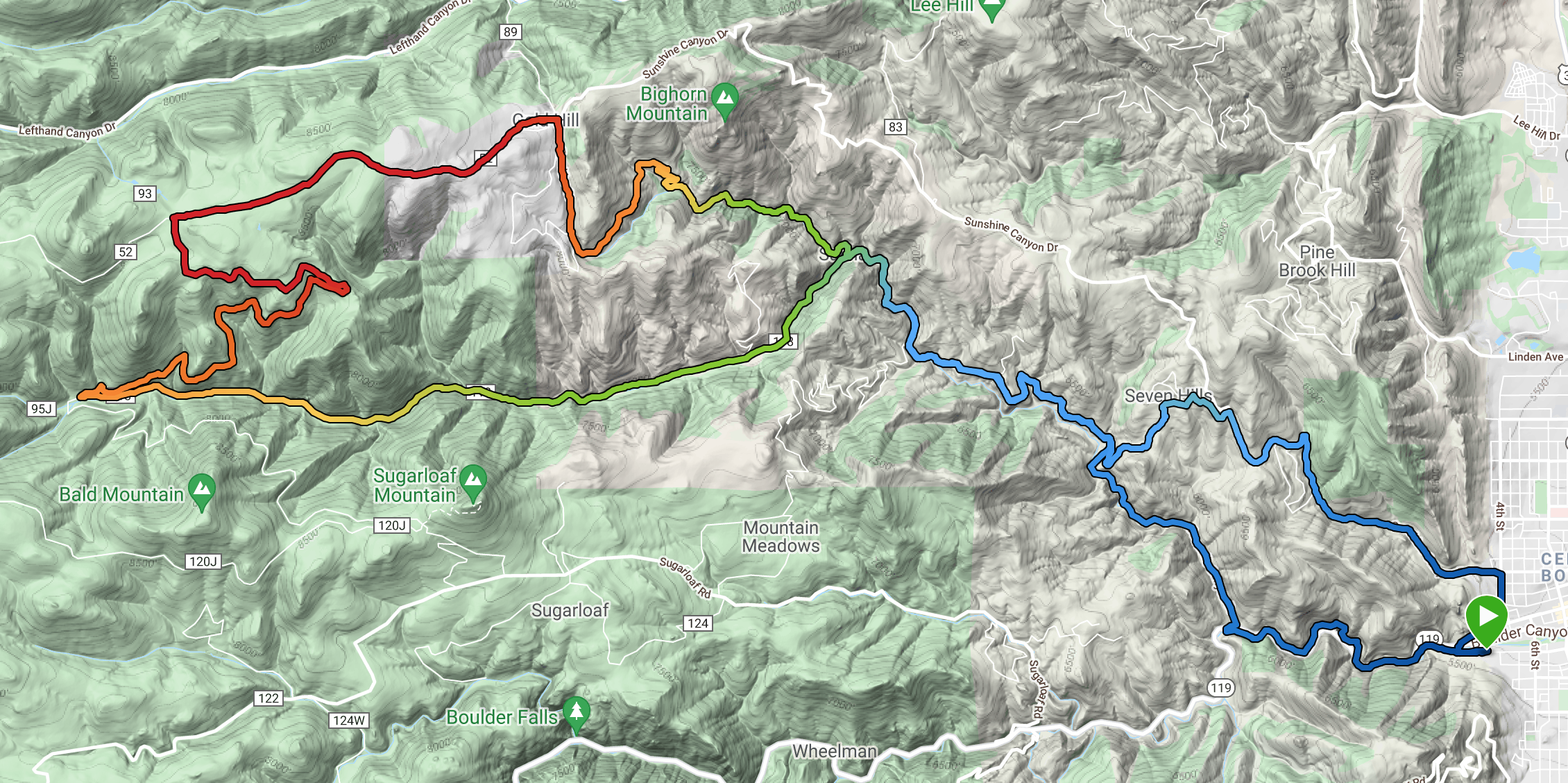 This is a beautiful mixed ride, varying between good pavement, hard pack dirt, and the much rockier Switzerland Trail. You won’t see much traffic, especially on the dirt parts of the ride. The ride as described is about 32 miles with 3,600 feet of climbing.
Many years ago I rode the southern part of the Switzerland trail on road bikes with friends and I wouldn’t recommend using a road bike. On this ride we used gravel bikes.
A good place to start is at Eben Fine Park at the west end of Arapahoe in Boulder. Ride the bike path, first on concrete, then dirt, for a bit over 2 miles up to the base of Four Mile Canyon. Ride for about 5 miles up the beautiful twisty Four Mile Canyon to the intersection where turning right goes to Salina and left to Wall Street. Turn left and follow the road for almost 6 miles, past Wall Street, where the pavement changes to dirt road, to the big intersection with the Switzerland Trail and Pennsylvania Gulch.
 Turn sharp right and follow the rockier (but not too rocky) Switzerland Trail, with lovely views, for about 4.5 miles until you reach the intersection with the obvious big gravel road. Turn right and continue climbing until a long fast descent takes you into the mountain town of Gold Hill. There’s a good General Store on the right in Gold Hill where you can refuel.
At the low point in the road, just down from the General Store, turn right and follow the lovely gravel road down to Salina, admiring the beautiful views as you descend (this road is also a wonderful climb). Continue down Four Mile Canyon but instead of descending the whole canyon, turn left on Poorman Road about 3 miles below the Salina-Wall Street Intersection. This now gives you more climbing on dirt, steeper than anything you’ve done so far, and after 1.5 miles of this you pop out on Sunshine Canyon. Descend this then at the bottom turn right on 4th Street, and again right at the bottom, and find your way back to Eben Fine Park.
Options. There are quite a few gravelly options from this ride.
- You could take the left hand branch of the Switzerland Trail and end up on Sugarloaf Road. From there either turn left and descend back to Boulder Canyon or turn right and ride more gravel to the Peak to Peak Highway.
- Before you get to the Salina intersection in Four Mile Canyon, there is an obvious big turnoff to the left up Logan Mill Road. Climb this and Escape Route steeply to the crest of the ridge and drop down the other side to join Sugarloaf Road. If you want to make a really big ride out if it, continue up Sugarloaf then do both branches of the Switzerland Trail to Gold Hill then back down to Four Mile Canyon.
Sunshine Canyon – Gold Hill – Four Mile Canyon
 Another lovely mixed pavement and gravel ride with beautiful views. It can obviously be ridden either way, but there is often a fair amount of washboard on the upper, gravel part of Sunshine Canyon which can be very jarring to descend. On the other hand, the gravel road above Salina in Four Mile Canyon is a delight to ride both up and down.
The ride as described is about 20.5 miles with 3,500 feet of climbing. Start at 4th and Mapleton in Boulder then ride west on Mapleton and up Sunshine Canyon. In about 5.7 miles and 1,800 feet of climbing the pavement changes to gravel and you now have just under 4 miles of gravel before you reach the small town of Gold Hill, with the 1,240 feet of climbing concentrated in the first two miles.
In Gold Hill you’ll often find other cyclists refueling at the General Store about 100 yards up the main road. Once sated, return to the low point on the road, where Lick Skillet descends steeply to the north, and the lovely gravel road to Salina descends at a much more reasonable gradient to the south. Continue past Salina for just over three miles then take the gravel Poorman Road to the left. Climb steeply to where it levels off, and after about 1.5 miles of gravel you will reach Sunshine Canyon again, and descend to your starting point.
Gross Reservoir – Gap Road Loop
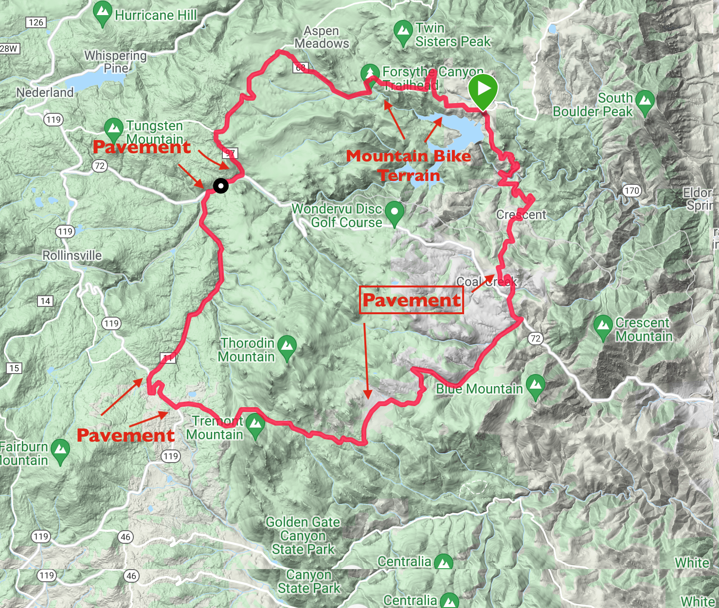 This is a lovely ride, mainly on gravel roads, with some beautiful views. It starts with about two miles of very technical riding, but then the gravel roads are all easy to ride (except maybe the last climb back to the car.) The ride is about 31.8 miles with 3,800 feet of climbing, about 640 of which are in the final climb from the dam back to the car.
The ride is best done counter-clockwise as this way much of the climbing is on gravel rather than pavement, and the northern road out from the dam often has lots of washboard which makes descending it painful.
There is a big parking area at Gross Reservoir if you drive up Flagstaff Road. The ride goes west along Lakeshore Drive. This soon becomes much narrower and then becomes more technical, more mountain bike riding rather than what you’d expect from a gravel ride. I walked two parts of this section. But this part only lasts for about two miles. The section is shown between the two arrowheads in the upper part of the map.
Once over the technical section, you ride up CR 68 to the T-junction with Magnolia Road. Turn left on this and ride to the junction with Lazy Z Road on the left. Turn right and in a couple of hundred yards turn left on CR 97. This gives a beautiful downhill to Coal Creek Canyon, Hwy 72. Turn right on 72 and in 0.7 miles of pavement turn left on S. Beaver Creek Road.
 Follow S. Beaver Creek Road easily until it joins Hwy 119, the Peak to Peak Highway. Turn left and ride on pavement for 1.3 miles to Gap Road on the left. Turn left and follow Gap Road for a long way through gorgeous country until you finally reach Hwy 72 again. The last 4.7 miles are on pavement, including a sensational steep descent. Turn left on Hwy 72 then in half a mile, at the traffic light, turn right on Crescent Park Drive. Climb this steeply up and left to join the gravel Gross Dam Road.
Turn right and follow the lovely road as it descends in twists and turns to below the dam. Turn right at the intersection at the bottom then climb steeply up the steeper, and often very washboardy road back to the car.
We rode this loop after seeing it on Ride with GPS. The author described it as “technical riding sections, minimal pavement with amazing views and little traffic. My new favorite local ride.” The author started in Coal Creek Canyon, which has the advantage that you finish with the sensational paved downhill.
Nederland
Ned Gravel Gold Course
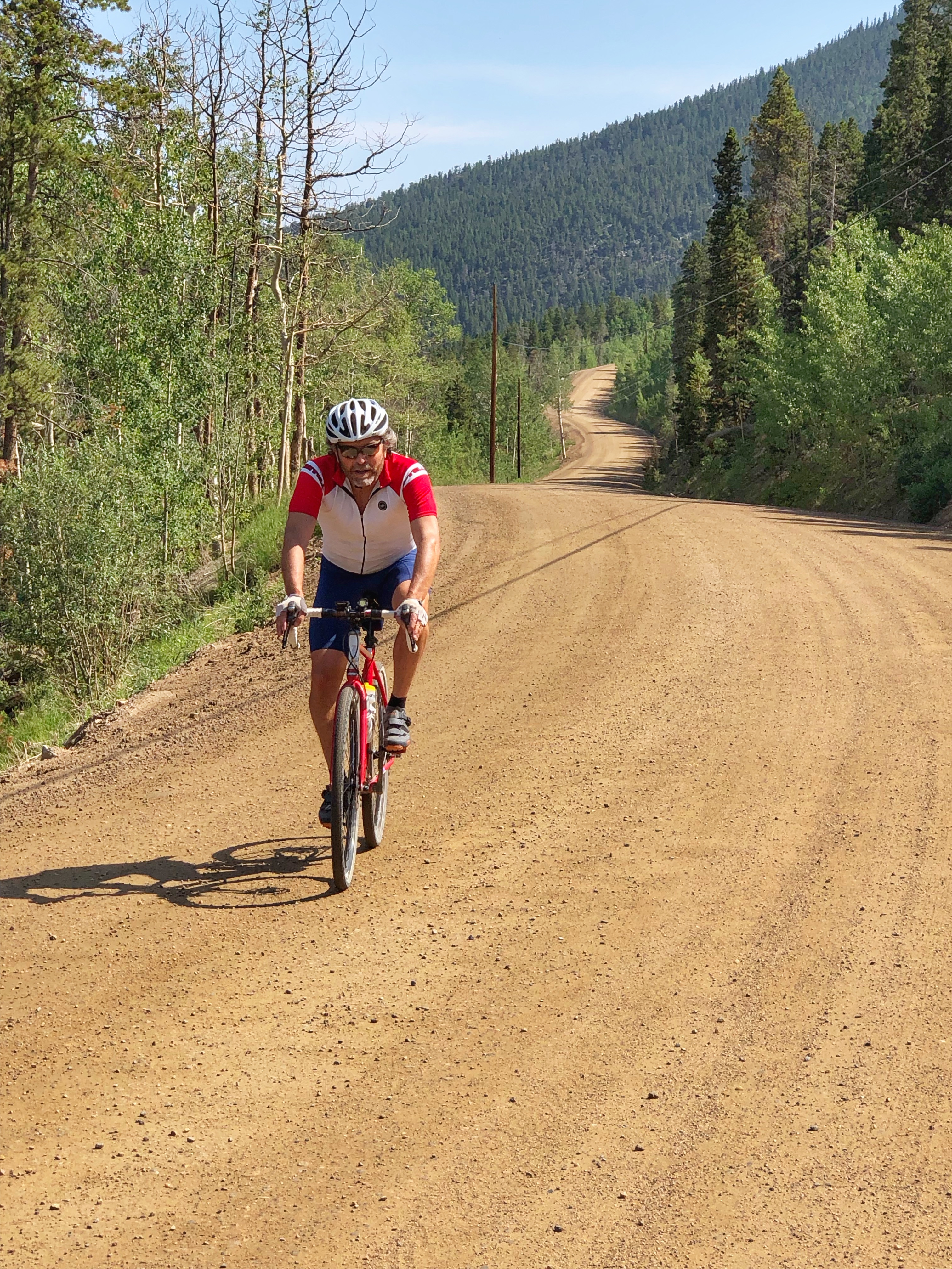
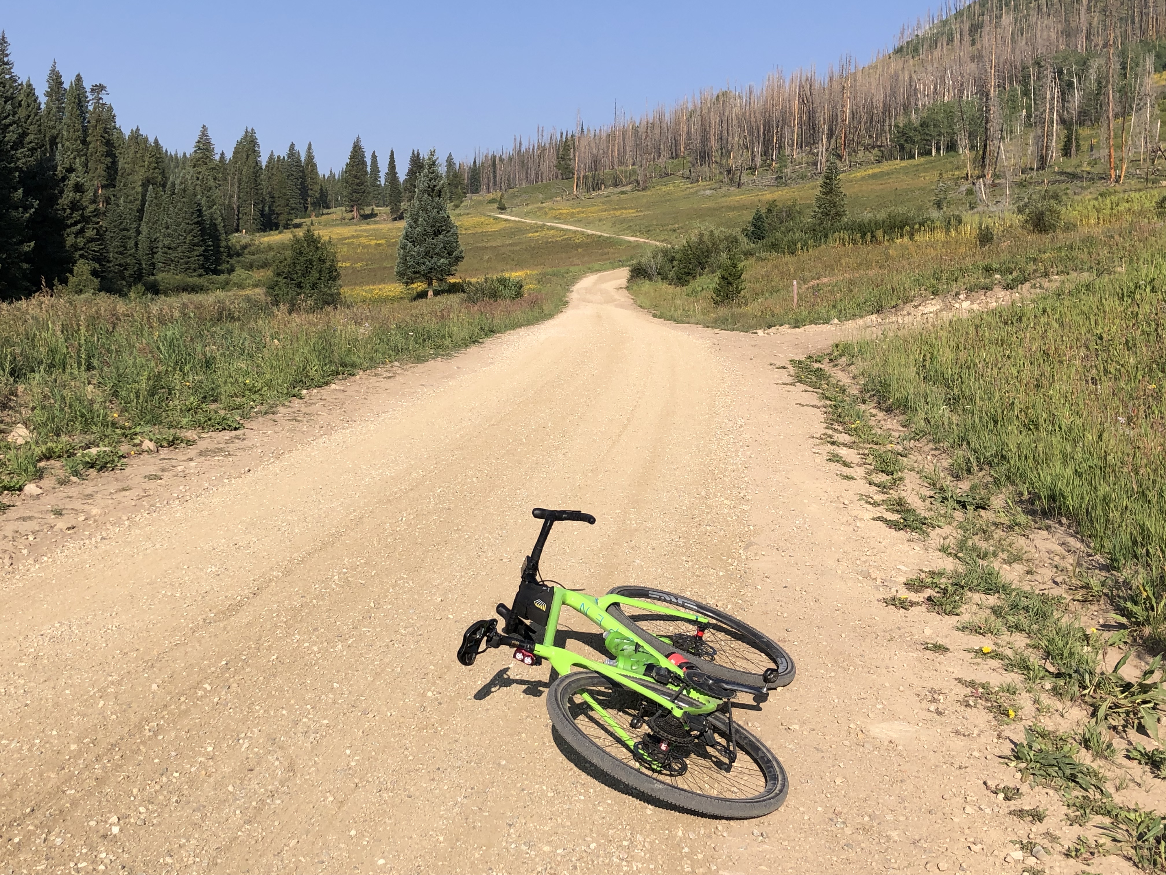
 I read about the Ned Gravel race – there are three courses: Silver, Gold, and Tungsten, and decided to ride the Gold course by myself. My numbers are a bit different to the “official” numbers, and my Karoo 2 told me I’d ridden 38 miles with 3,875 feet of climbing.
The ride felt a bit contrived, trying to fit together bits of gravel where they could be found, and I found some of it much rougher than I’d expect from a classic gravel ride. In particular, the route descends the south branch of the Switzerland Trail from Sugarloaf Road to Sunset, then climbs the north branch from Sunset to the Gold Hill road, both of which were much rockier and rougher than I wanted. Here’s a link to my ride on RideWithGPS, and here’s a link to the Ned Gravel ride.
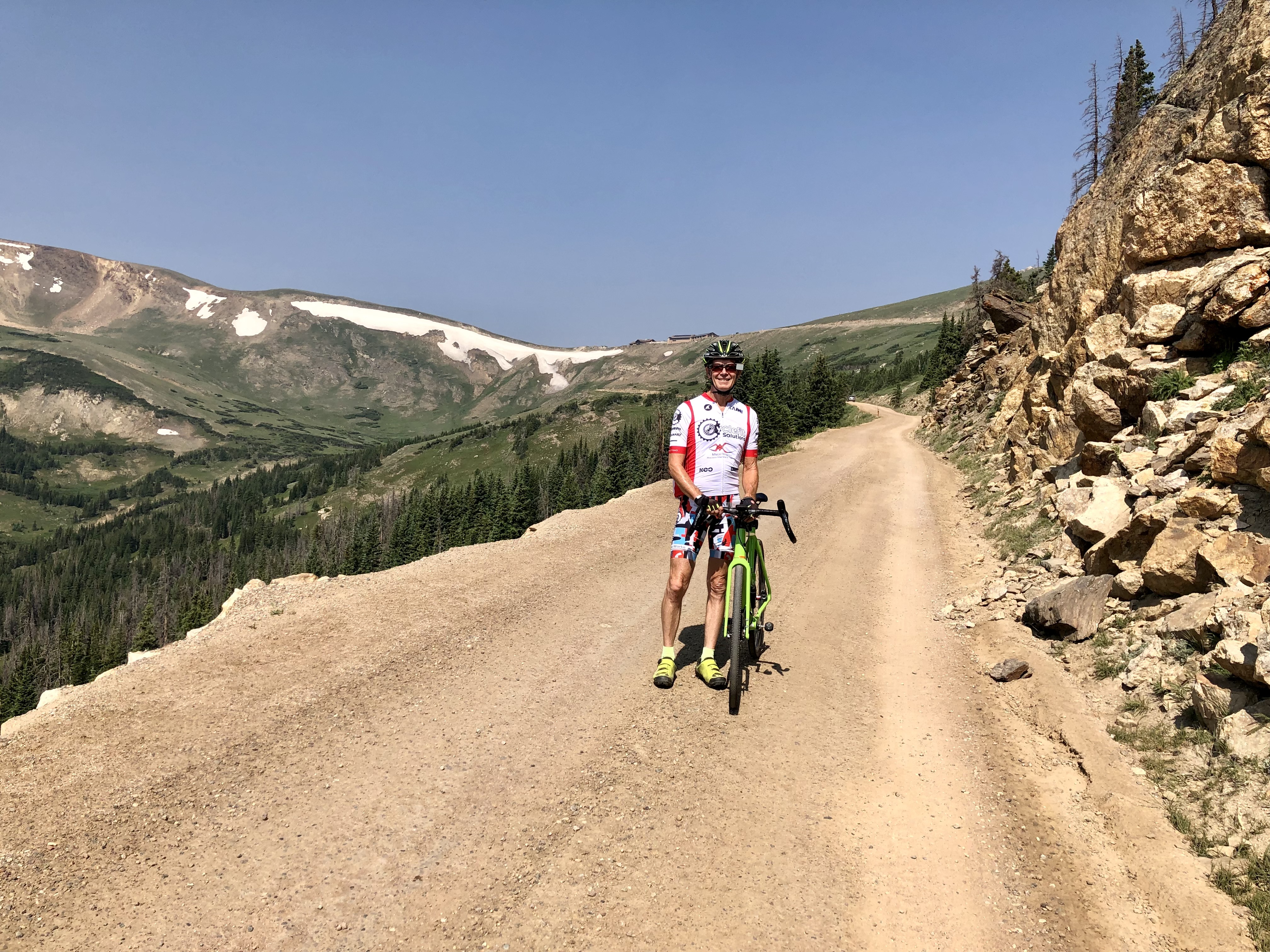
I parked at the Park-n-Ride in Nederland and rode from there. I thought of giving directions in this page but towards the end on CR 126 the directions get pretty complicated so it’s better to download the GPX file and follow that. My favorite part of the ride was down CR 103. The photo above shows the Switzerland Trail part of the ride.
Estes Park
Old Fall River Road
This is barely a gravel bike ride as the 9 miles of gravel are easily ridden on a road bike. But here it is anyway. It’s a lovely ride up the one-way Old Fall River Road to the Alpine Visitor Center on Trail Ridge Road, with beautiful views in the upper section. It’s a popular drive so you’ll be passed by quite a few vehicles, but they are rarely annoying. The whole loop is about 30 miles and 3,800 feet of climbing. It feels longer than its actual mileage.
 Currently (July 2021) you need a reservation to enter Rocky Mountain National Park unless you enter the park before 9 a.m. Start at the Lawn Lake trailhead parking lot which is pretty much at the intersection of Hwy 34 and Old Fall River Road. Ride west up the paved road, then after about 1.6 miles it turns to gravel and continues this way to the Alpine Visitor Center, which you reach in about 10.5 miles after leaving the parking area.
From here, turn left and climb, descend, and climb (maybe 700 feet of total ascent) until you finally start doing the long and spectacular descent back down. If you are lucky you won’t be slowed by traffic on the descent. Eventually, down in the valley, after a short climb, you’ll turn left on Hwy 34 and descend some more back to your car.
Winter Park
Crooked Gravel
This is the shorter version of the Roll Massif race, and I shortened it even more by starting in Fraser rather than Winter Park, so for me it was 59.1 miles with 4,425 feet of climbing. There were 42 miles of gravel and 17 miles of paved road.
 It’s an okay ride, with the first 19 miles having a wonderful remote feeling, the next 11 miles being on very fast gravel, almost paved, then 9 miles of pavement through rugged Byers Canyon and the small town of Hot Sulphur Springs.
At the end of HSS you go back onto gravel, and the next 4 miles are brutal, very steep with big gravel chunks. I was exhausted by the top of the climb. Fortunately the next 6 miles are fast and easy.
You then reach Hwy 40 and follow this for about a mile, turning right on more gravel. The next part is tricky and I went wrong. You soon turn left on a paved road, then very quickly turn right on a lovely gravel path (which I missed and had to climb down to later).
Eventually you turn right on CR 5, a beautiful silky paved road with little traffic. Enjoy this for about 6 miles until you reach Fraser.
Okay, where to park. I parked in Fraser on Eisenhower Drive, just off Hwy 40. There are several designated parking spots here, but if they are full, there is plenty of parking just round the corner, at the Amtrak station on Railroad Ave. If you want to download the GPX file for the ride, here’s my ride (but remember the turn onto the gravel path which I missed), or you can download the Roll Massif file.
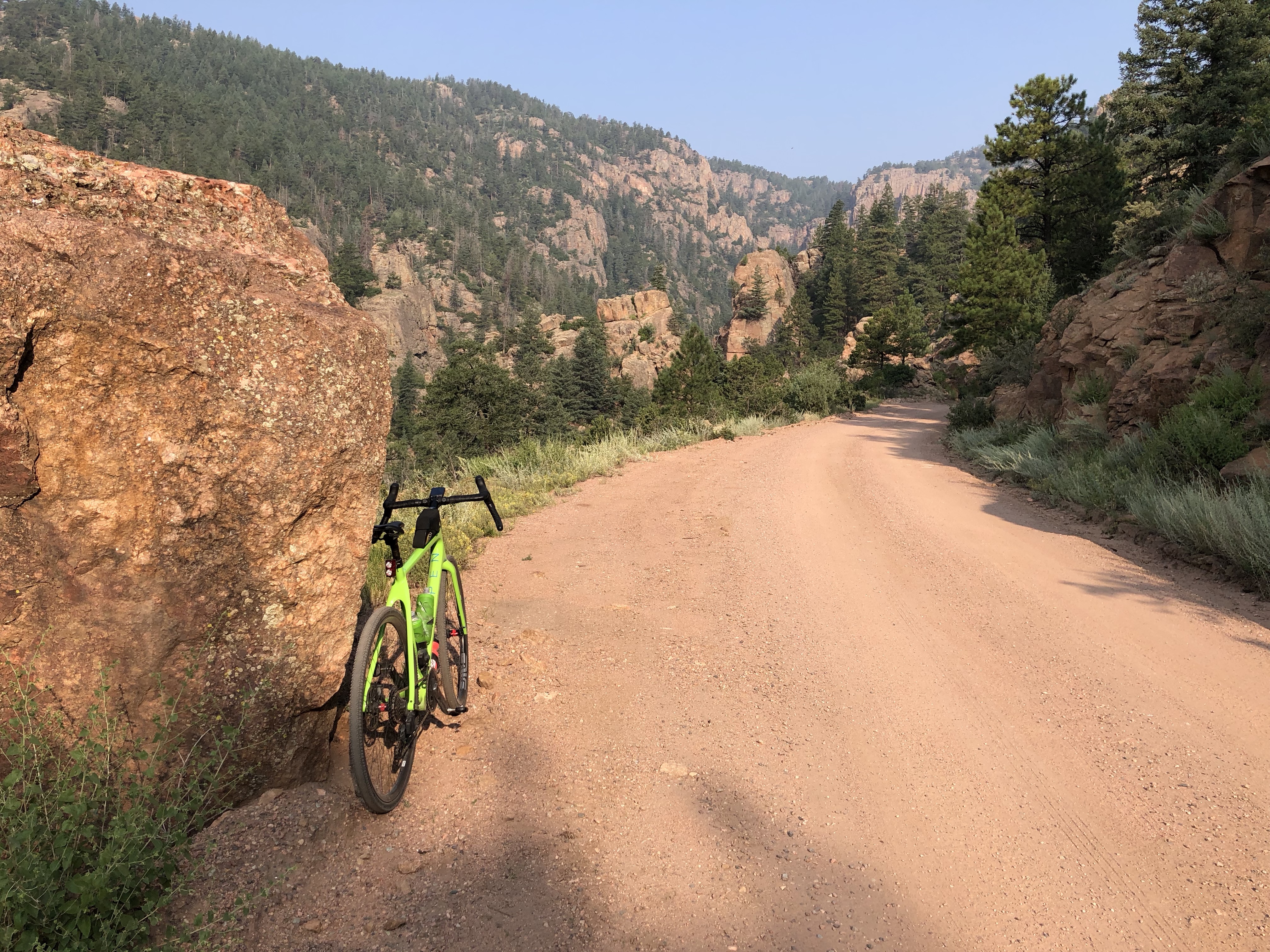
Idaho Springs
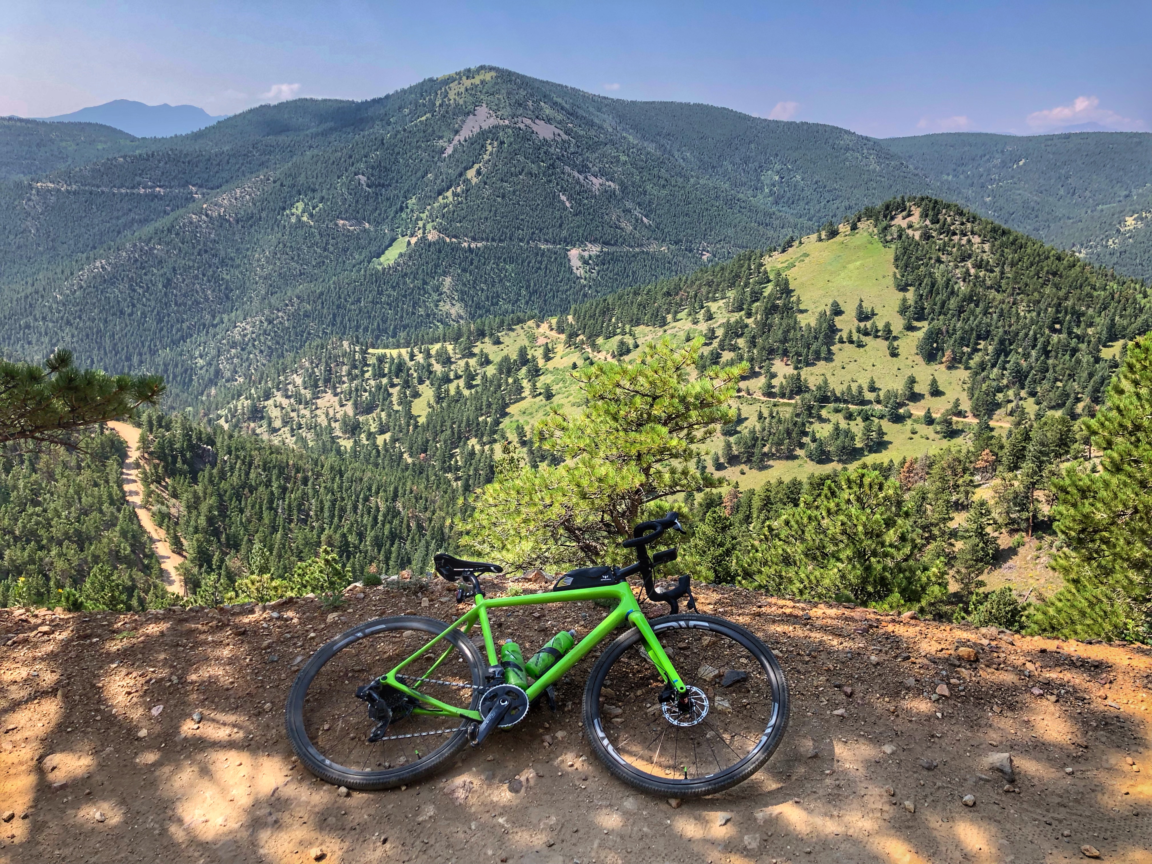
Gold Digger Lollipop
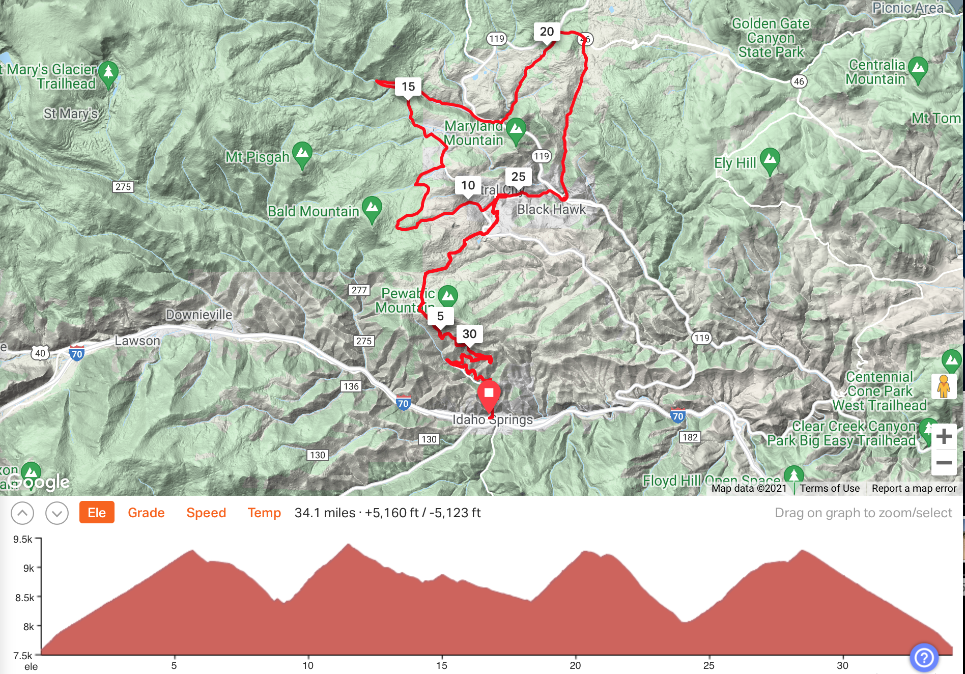
 This is a wildly varied ride, filled with long descents and steep climbs, mainly on gravel but with a brutal stretch of paved uphill through Blackhawk and Central City. The whole ride is about 33.5 miles with 5,050 feet of climbing. But it feels much longer and harder than the numbers suggest. I thought this was one of the best gravel rides I’ve done in a long time (7/26/21).
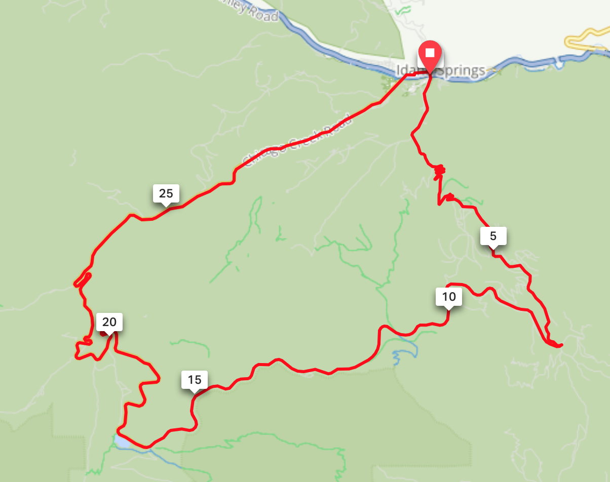
It’s a lollipop that starts in Idaho Springs, starting up Virginia Canyon Road, which is also knows as OMG Road or Oh My God Road for its spectacular meanderings up the sides of the canyon. After reaching Central City the route follows a big loop through some beautiful open country and before returning to Central City and retracing the stick of the lollipop.
 Start in Idaho Springs (I parked in the free parking area on Soda Creek Road just under I-70) and climb Virginia Canyon Road for 0.6 miles. You can continue straight up the canyon on Two Brothers Road but I think it’s much more enjoyable to turn right on Virginia Canyon Road and climb more gradually as the road switchbacks spectacularly above the canyon. At 3.6 miles stay left following the sign for Virginia Canyon Road. At about mile 4.5 the road turns to asphalt for about a mile before turning back to dirt and you follow this with some beautiful views of wide open country and old mines, until you cross over the Central City Parkway. Follow the paved road steeply down into Central City.
As you enter Central City turn very sharp left, almost doubling back on yourself and climb the road up towards the Central City Parkway. (I spent a while getting confused in Central City but cleaned up the GPX file. Don’t go into CC, really. Turn extremely sharp left and climb up the Central City Parkway road. Really.) When the road you are climbing turns left, turn right instead on the Nevadaville Road and climb this. At about 10.3 miles the road bears left and changes name to Bald Mountain Road. Follow this until you reach a T-junction by Boodle Mill and a bunch of out-of-place-looking condos.
Turn left on Upper Apex Road and follow this through beautiful country until you descend into a canyon and reach a T-junction. Turn right on Apex Valley Road and follow this rather boringly down for a few miles until you reach Hwy 119. Turn right and follow this for a couple of hundred yards then turn left on the gravel Hughesville Road.
Climb steeply up until the road splits. Stay to the right, even though the sign says No Outlet. Continue up and where the road bears sharply right on Bristlecone, instead continue straight on the much narrower and rougher road, even though there are signs saying Private and No Trespassing. I didn’t like this part much but ignore any trepidation and continue for a few hundred yards until you pop out on Hwy 119 again.
Turn right on Hwy 119 and almost immediately turn right again on CO-46, then in 1/2 a mile turn right again on Dory Hill Road. Follow this up past the Sheriff’s department and continue as it turns to dirt and bears down to the right. Continue down for several miles until you reach Hwy 119 again in Blackhawk. Cross 119 then turn right on Main Street. Follow this until it reaches Gregory Street at the light. Turn left and follow Gregory Street up into Central City. Turn left on Spring Street and you will reach the point where you entered Central City. Return back the way you came, initially by climbing very steeply up the road you came in, until you reach Virginia Canyon Road again, and eventually, after a wonderful descent, your car.
Here’s a link to the ride I did on Ride with GPS. Here’s the page that inspired me, but the first few miles are different to the (better) route I took.
Little Bear Creek Loop
 I wanted to ride Little Bear Creek Road as it’s an uphill gravel road for almost 7 miles, but it wasn’t that much fun as the views weren’t great and it was an overcast day. Rather than simply descend the same way I decided to make a loop out of it. So it’s about a 30 mile loop with 3,450 feet of climbing. Most of the loop is on paved road and Little Bear Creek Road is flat and hard-packed enough that you could ride it on a road bike. Even though it’s in the gravel page, it’s probably a better road bike ride. So, here goes.
I parked on Soda Creek Road, just south of I-70. You reach this from Miner Street in Idaho Springs. Ride up the paved Soda Creek Road for about a mile then turn left on Little Bear Creek Road. You are now riding gravel until you reach Squaw Pass Road after about 7.2 miles and 2,065 feet of climbing.
 Turn right on Squaw Pass Road and keep climbing and climbing, with some descents in between the climbs, until you finally descend to Echo Lake. Turn right and ride the lovely descent back to Idaho Springs. Here’s a link to the ride on Ride with GPS.
Crested Butte
Kebler Pass
 Kebler Pass is only 7 miles from Crested Butte, and mainly paved, but you can make a much longer ride by going down the other side until you reach Hwy 133, the road between Carbondale and Paonia, then coming back the same way. This gives you a ride of about 62 miles with 5,370 feet of climbing. The ride from Kebler Pass to Hwy 133 goes through some spectacular country, with beautiful mountains and dramatic cliffs.
While the Crested Butte side is mainly paved, the other side is mainly gravel. It’s hard pack so would be easy on a road bike, but since you’ll be riding about 21 miles of downhill on gravel, a gravel bike is probably more comfortable.
To start, head west on Whiterock Avenue to 1st Street. The ride continues west up the hill. Just before you reach Hwy 133 you pass Kebler Corner, where you can find a general store with some groceries.
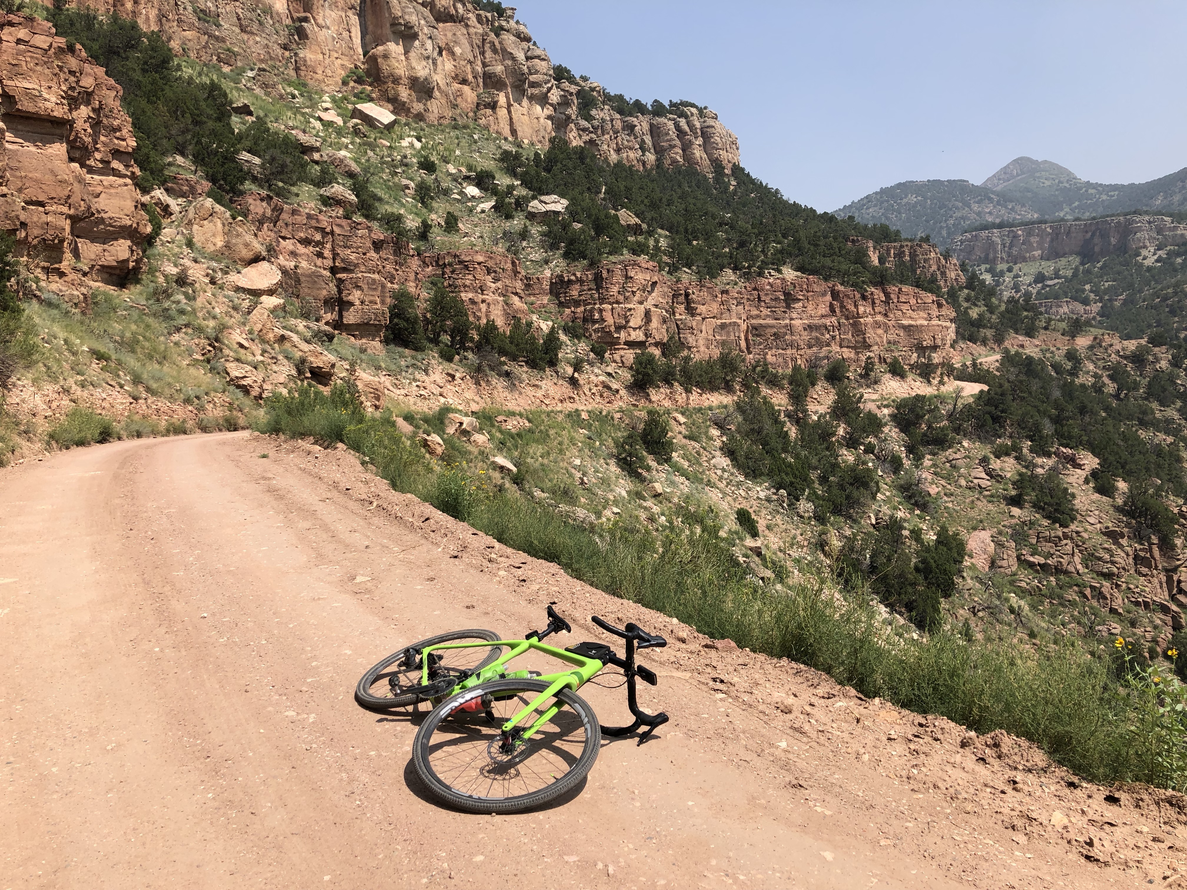
Cañon City
Gold Belt Loop
 A lovely loop that starts in Cañon City, climbs the pretty Phantom Canyon to the cute town of Victor, traverses below an enormous open pit gold mine to Cripple Creek, then descends the spectacular Shelf Road back to Cañon City. The ride is about 64 miles with 4,900 feet of climbing. It is about 40% pavement and 60% gravel, with about 24.5 miles of gravel up Phantom Canyon and 13 miles of gravel down Shelf Road.
Here’s a link to the ride on Ride With GPS – strangely the elevation gain they show is different than my Karoo 2 recorded.
I started at the intersection of N. Raynolds Ave and Hwy 50 and rode east along the Frontage Road, further than I should have done. At some point you’ll need to get on Hwy 50 and head east until after about 1.6 from the start you turn left on to get onto CR 123, heading toward Phantom Canyon. Ride this then turn at mile 5.4 turn left on CR 67. In another 3.3 miles the road turns to hard pack dirt, and you’ll now start climbing the pretty Phantom Canyon. It’s an old railroad so the gradient rarely goes above 3%.
 Eventually you leave the canyon and everything opens up. At mile 32.6 you’ll turn left on a big gravel road, with views of the enormous open pit gold mine above the cute little town of Victor. At mile 33.2 the gravel ends and you ride into Victor, turn left on 3rd then immediately right on Victor Ave, then follow this road as it descends then climbs, and at mile 38.1, just after Mile Marker 51, turn left on CR 88, Shelf Road.
The 13 mile descent of Shelf Road starts being rather uninteresting and in some places rather rough, but eventually you are on the spectacular shelf, high above the river, and suddenly the ride blossoms and life is wonderful.
All good things come to an end though, and you leave the canyon and the gravel road, and are faced with 13 tedious miles of paved road. At mile 60.7, as you start a short steep hill, turn left on Fields Ave and continue down this, past Central Ave, and turn left on Pear St (there’s a sign for the Gold Belt Loop), and follow this as it turns right and leads you back to where you started.
Grand Junction
Lands End Road (Grand Mesa from the West)
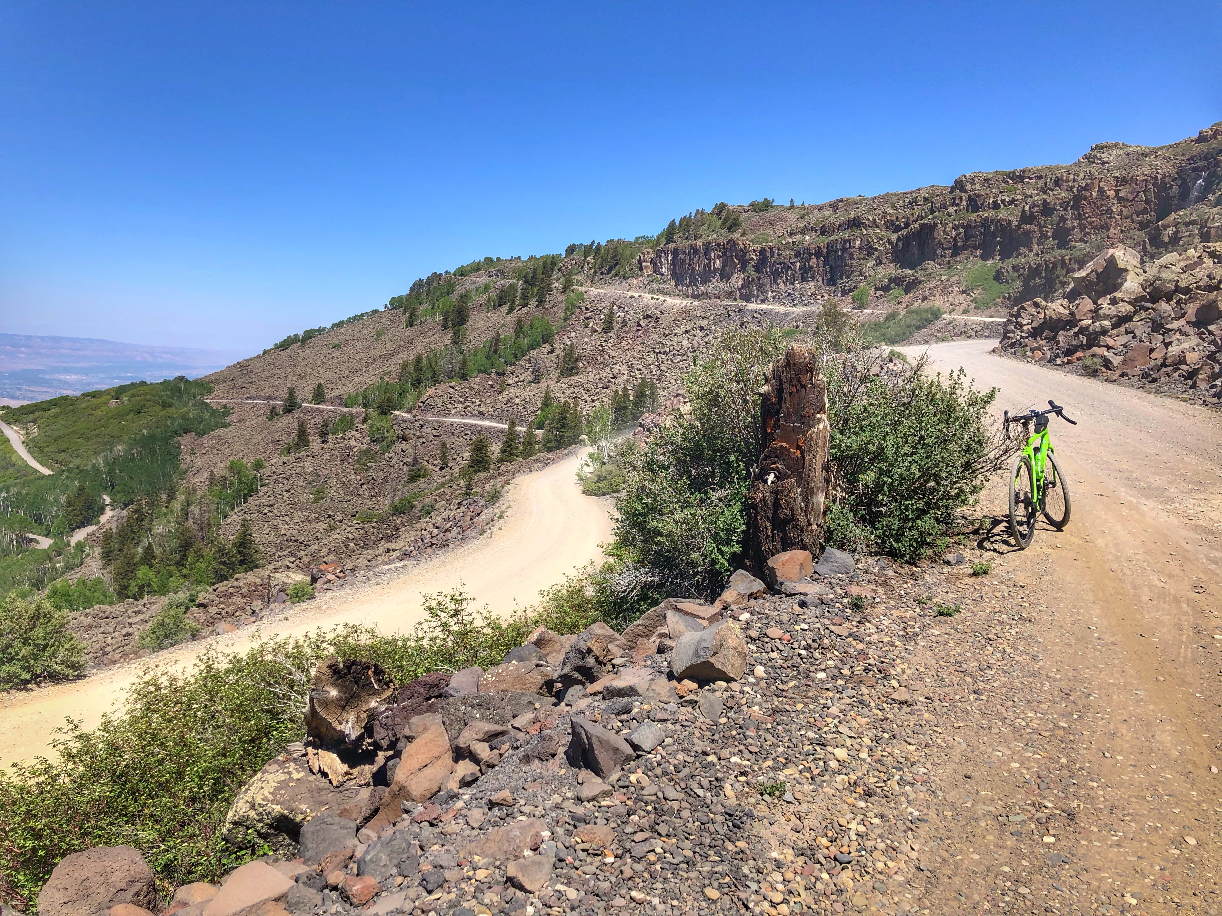
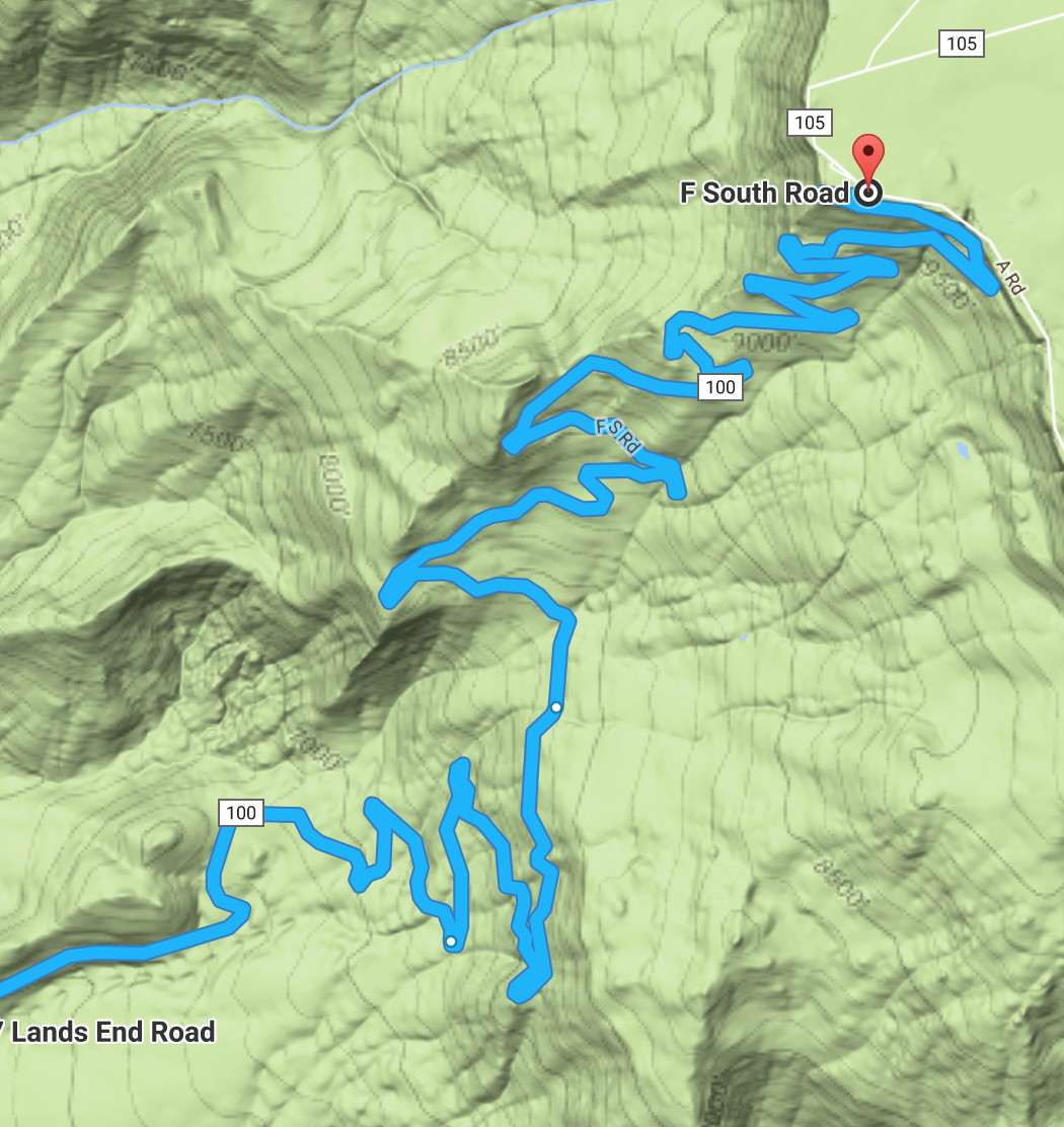
How could you not want to ride these dirt switchbacks?
The third big climb up Grand Mesa is up a paved then dirt road to Land’s End. The dirt road part is beautiful, with many switchbacks and gorgeous views, especially on the way back down. The whole climb is 21 miles with 5,100 feet of climbing. The riding is never particularly steep but is fairly consistent. I rode it on a mountain bike in 2013 and then again in 2021 on a gravel bike.
If you head south from Grand Junction on Hwy 50, between MM 45 and 46 you will see a turnoff to the east signed for Land’s End. You start up the paved Kannah Creek Road, which becomes Land’s End Road. After about 9 miles the paved road ends and you now ride a dirt road to the top, which you reach in another 12 miles. From Land’s End you can continue another 12 miles of flattish riding to Hwy 65, or just return the way you came.
Two notes: 1) If you want to ride mainly the dirt part of Lands End Road, there’s a large parking area about 7.7 miles from the intersection of Hwy 50 and Kannah Creek Road, about 1.4 miles before the dirt starts. 2) Around 9 miles from the start of the dirt a mountain bike trail crosses the road. This is the Palisade Plunge, a 32 mile singletrack descent from the top of Grand Mesa to the town of Palisade.
Links and Other Clicks
Gravel Bike Adventures – “Curated gravel routes by women”. A lovely website about gravel rides around the country, with lots of them being in Colorado.
The Dirty Roads – “A Collection of Colorado’s Best Gravel & Adventure Cycling Routes”
Gravel Map – “An interactive database of gravel and dirt roads and paths, submitted and managed entirely by people who ride them.”
Gravel rides around Trinidad. “Trinidad is poised to become a gravel bike destination for cyclists to explore in Colorado.”
Gravel Adventure Guide, Trinidad Colorado – a web page from which you can download a PDF guide to the gravel rides around Trinidad. “Trinidad is encouraged by the potential of becoming the next big adventure hub for gravel bike enthusiasts in the state.”
Ride with GPS Colorado gravel rides
