
Early March, 2026
KmM = Kilometer Marker
My experience: Tenerife is a windy island with very variable weather and weather forecasts that can’t be counted on. So it’s worth mainly ignoring the forecasts and just ride. I wasted at least two good days waiting for the beautiful days that the forecasts predicted. One thing to be aware of is that the weather up high, around Teide, can be spectacular with gorgeous blue skies, when down below you are surrounded by clouds.
And the traffic can be horrific, especially around the middle of the day. As of early March, anyway. I preferred Gran Canaria, but to be fair, we were there in mid-September and the weather was perfect most of the time.
I was in Tenerife specifically to climb the volcano Teide, and to do the Masca ride to the lighthouse and back. Teide is of course probably the reason why many, if not most, cyclists come here.
Where to Stay
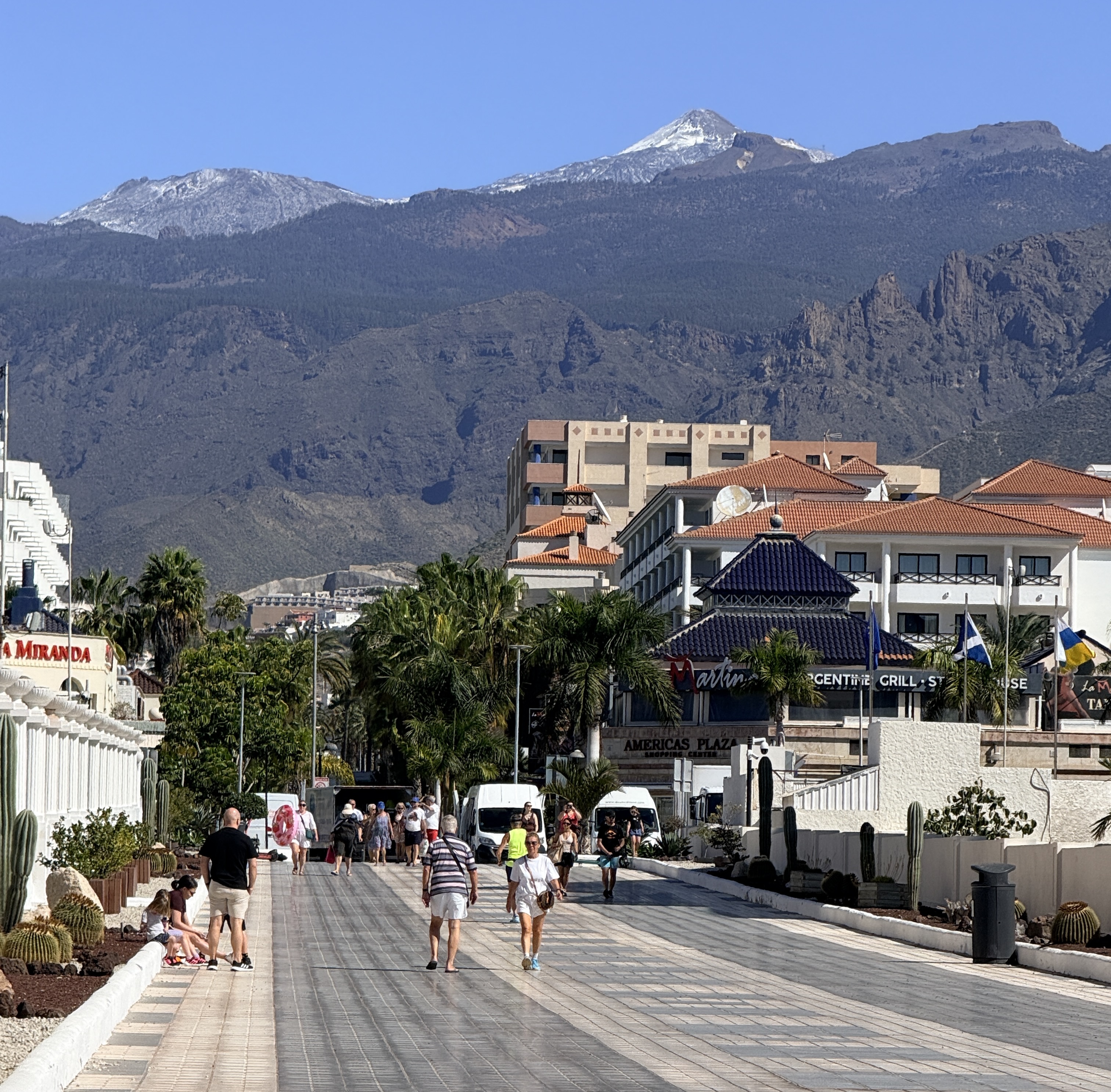
I stayed in Los Cristianos, which is a mind-bogglingly touristy area. There are apartment complexes here, there, and everywhere. And there are lots and lots of people speaking English, almost all of them Brits. After walking around quite a bit, my sense is that Los Cristianos is the low-rent district, and Playa de las Américas is a bit more high-end, with nicer looking hotels.
One of the good things about Los Cristianos is that one of the classic rides up Teide starts right from the town. Another thing is that there are so many restaurants that you will be overwhelmed by choice. If you are a Brit, there are lots of restaurants, bars, and stores run by Brits. In particular, if you are missing British chocolates and so on, there is a British supermarket, The Food Co, at the SE part of Los Cristianos.
Bikes
I didn’t bring my bike. Instead, I rented a bike at Free-Motion, which is about a 20 minute walk from where I was staying. If you choose to rent a bike, book it well in advance as it’s usually impossible to just walk in and rent a bike, at least in high season.
I made my decision to come to Tenerife only about 3 weeks before I flew, and at that time the only bike available for the days I wanted was a Cannondale Topstone Carbon 3 Grx Gravel bike. All the pure road bikes had already been booked. However, with its easier gears (43-30, 11-36) and its low rolling resistance Continental Terra Speed tires, I loved the bike.
The Rides
Many of the good rides on Tenerife involve cycling up hills. Which is why you are here, of course. Cycle Fiesta has an interactive map showing where many of the climbs are.
Teide
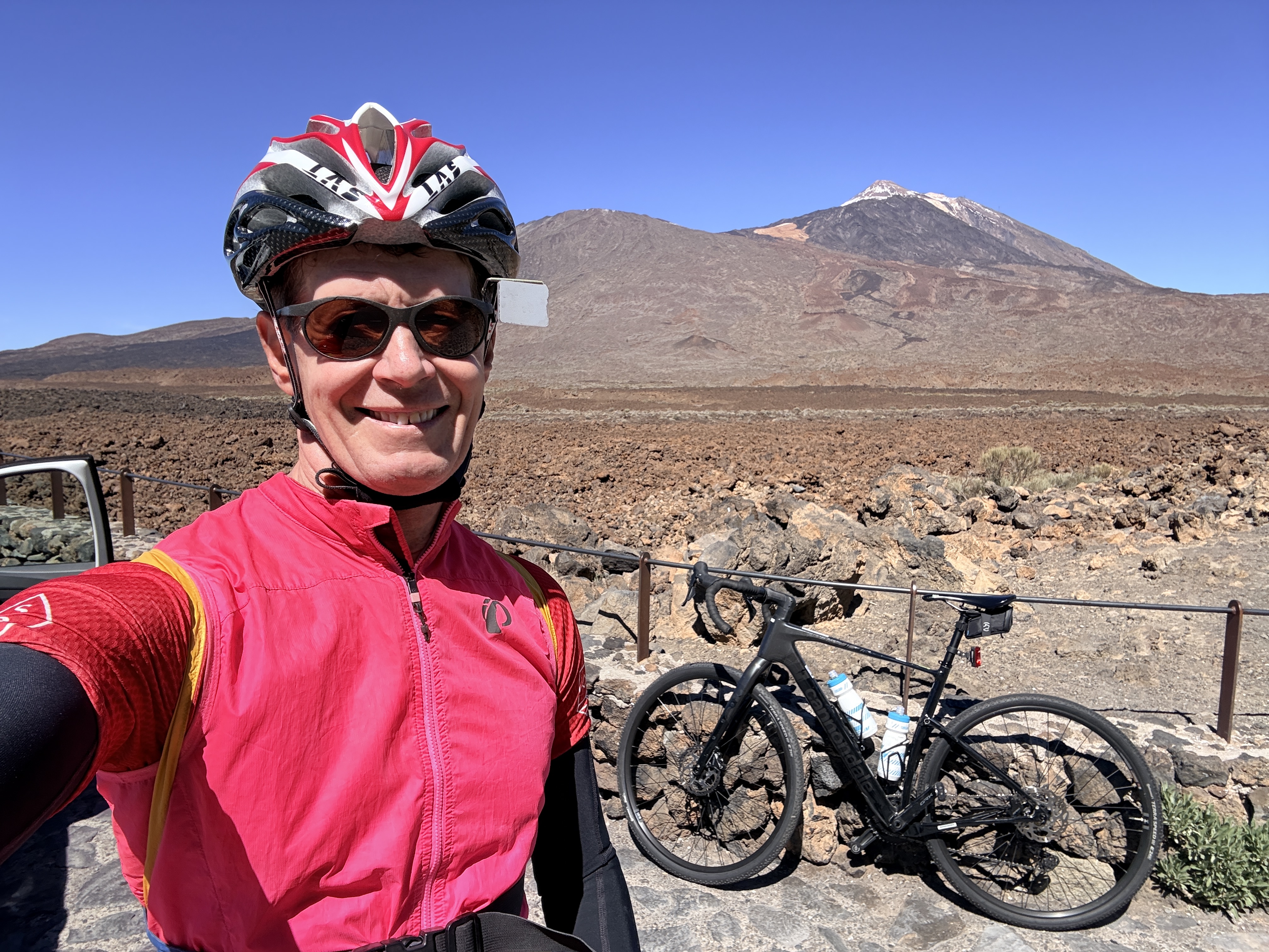 Teide is the big ride (or rides) on Tenerife. There are several ways to climb it, and I chose to start in Los Cristianos, where I was staying. The climb itself was about 50.8 km with 8,288 feet of climbing. There is some downhill on the ascent, and the out-and-back trip was about 101.5 km with 9,074 feet of climbing.
The weather forecasts looked rather dire and it was quite cloudy when I rode. I had made up my mind that I would make it up the climb, even if I was in clouds the whole way. It couldn’t be worse than some of the days I’ve had in Colorado or in the Pyrenees.
I was also told by the people at Free Motion that while you can stay warm on the climb, it can be very cold on the way down and that it’s worth taking warm clothes, include wind jacket and long-finger gloves.
Well, after about 29 kilometers of riding under or in clouds, suddenly I was above the clouds and had perfect blue skies for the last 22 kms. Shorts and jersey weather. Perfect.
Coming back down was a different story though. I put on arm warmers and a vest, then once I reached the cloud layer again, I put on a wind jacket and my long-fingered gloves. Don’t say you weren’t warned – although of course it depends on the season and the weather.
So, the details. From Los Cristianos, ride up the rather busy TF-655 towards the TF-1 motorway. Be careful at the big roundabout at the TF-1 because it feels quite dangerous. Continue under the TF-1 and up the TF-28. Keep following signs for El Teide (you will see them at every intersection).
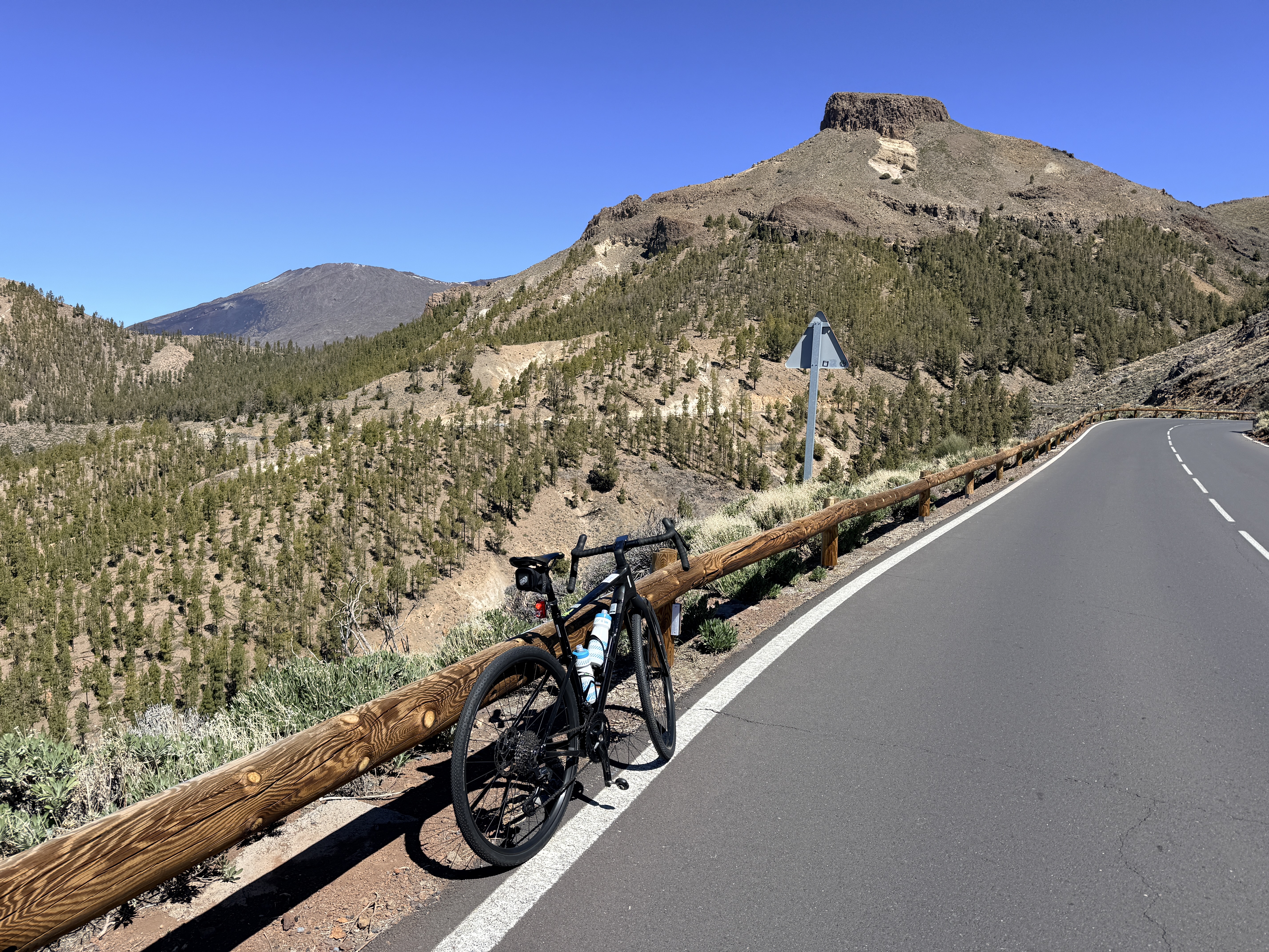
You’ll turn left on the TF-51, go through Arona towards Vilaflor, then turn left on the TF-21 and go through Vilaflor. After Vilaflor the road turns much more peaceful and quiet, and you climb up through trees until eventually you reach some gorgeous views. As you look around, you might even think you see Teide, but forget it. Once you actually see Teide it is so obvious, so dramatic, and nothing really prepares you for it.
After a wonderful long downhill, you reach the intersection with the TF-38 coming in from the left. Follow the TF-21 to the right for another 12 km, past the teleferique station. Some of this is even slightly downhill. This whole section can be very busy with tourists, and there are several car parks where you have to pay attention. The high point is unmarked, and I continued for a bit to the obvious parking lot and turn around point at the start of the main hiking trail up Teide.
Here’s the ride on Ride with GPS.
But two days later, the weather was perfect down by the sea and up on Teide. You just never know!
Teide again, from Playa San Juan
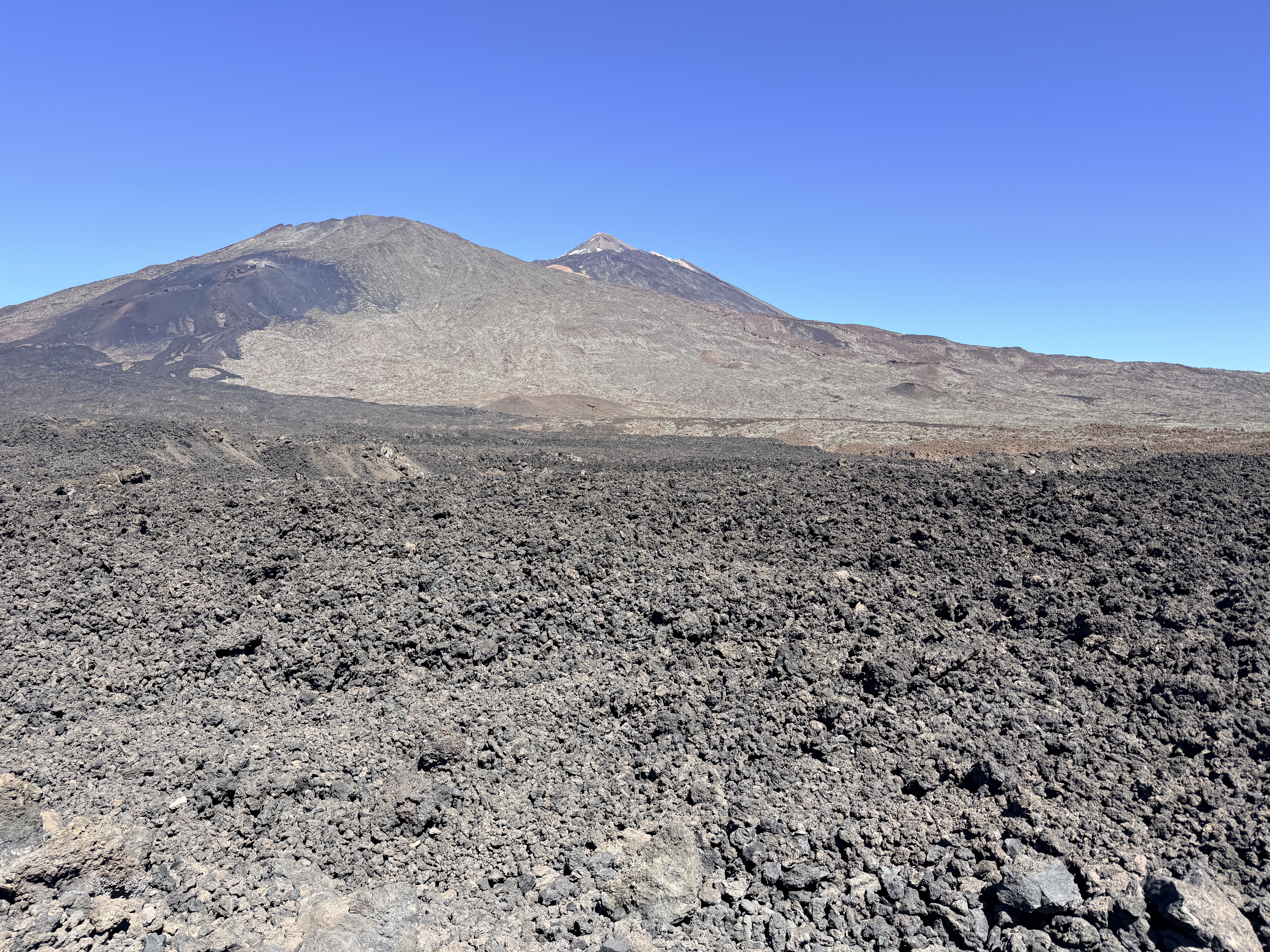 This was my last day and I decided I might as well ride Teide again, from Playa San Juan this time. The upper part of the climb, on the TF-38, is on a lovely road but is not as interesting or pretty as the climb above Vilaflor. But you do get to see many, many incredible lava fields.
The most exciting part of the ride was the section through the village of Chiguerque. When I’d mapped the ride this seemed like the best way to go because it avoided riding extra kilometers through Chio. Well, it was shorter, but it was steep. There are three short climb options through the village. The first looked ridiculously steep, as did the second, so I headed through the village and was faced with the third, which also looked ridiculously steep. In fact my bike computer claimed it was 27%. Take you chances or go through Chio.
Coming back down, the descent of the TF-463 below the TF-1 is fantastic. Very twisty and highly enjoyable.
Here’s the ride on Ride with GPS.
Masca out-and-back
What can I say about the ride from Santiago del Teide through Masca and down to Buenavista del Norte, then back?
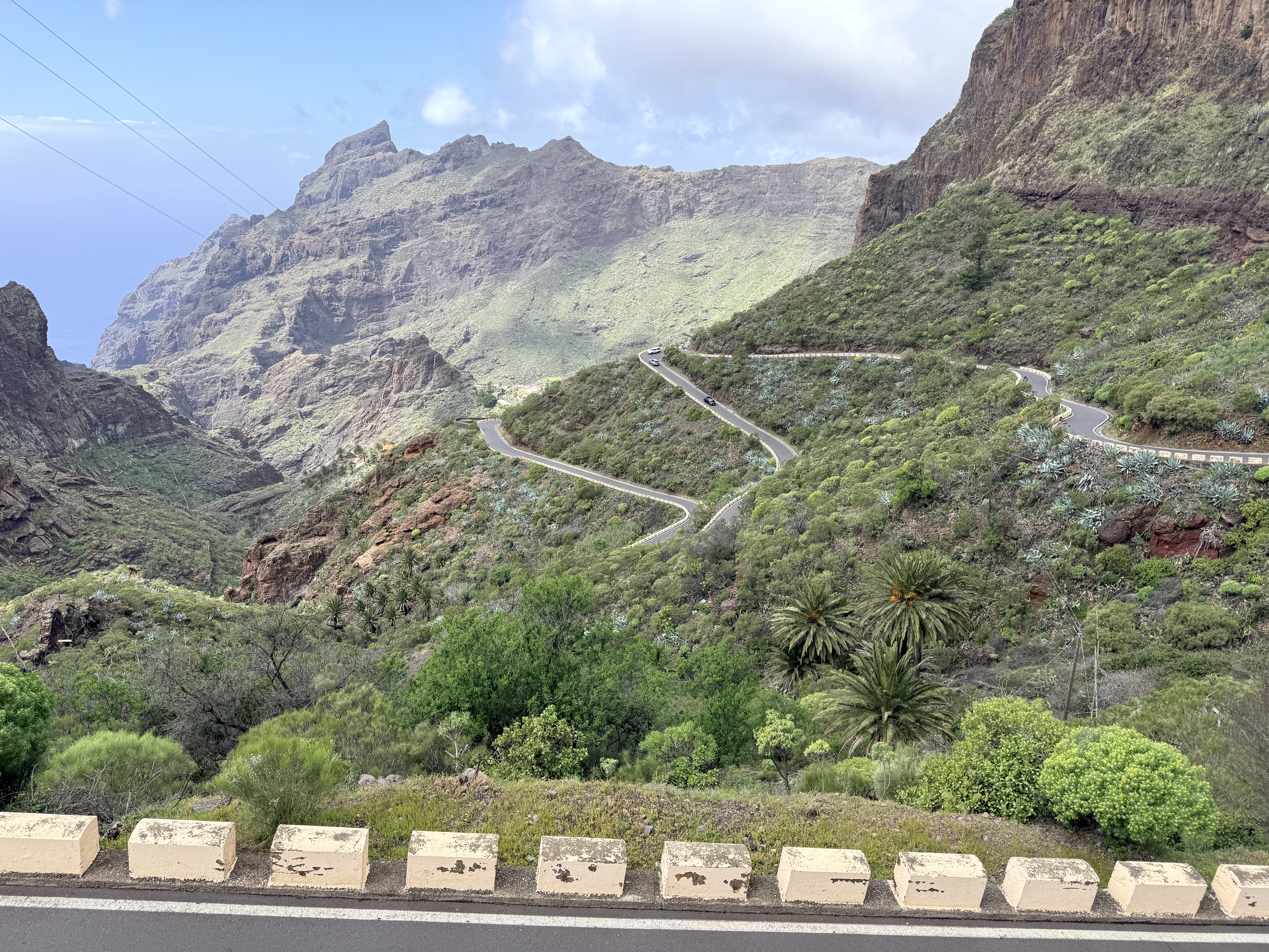
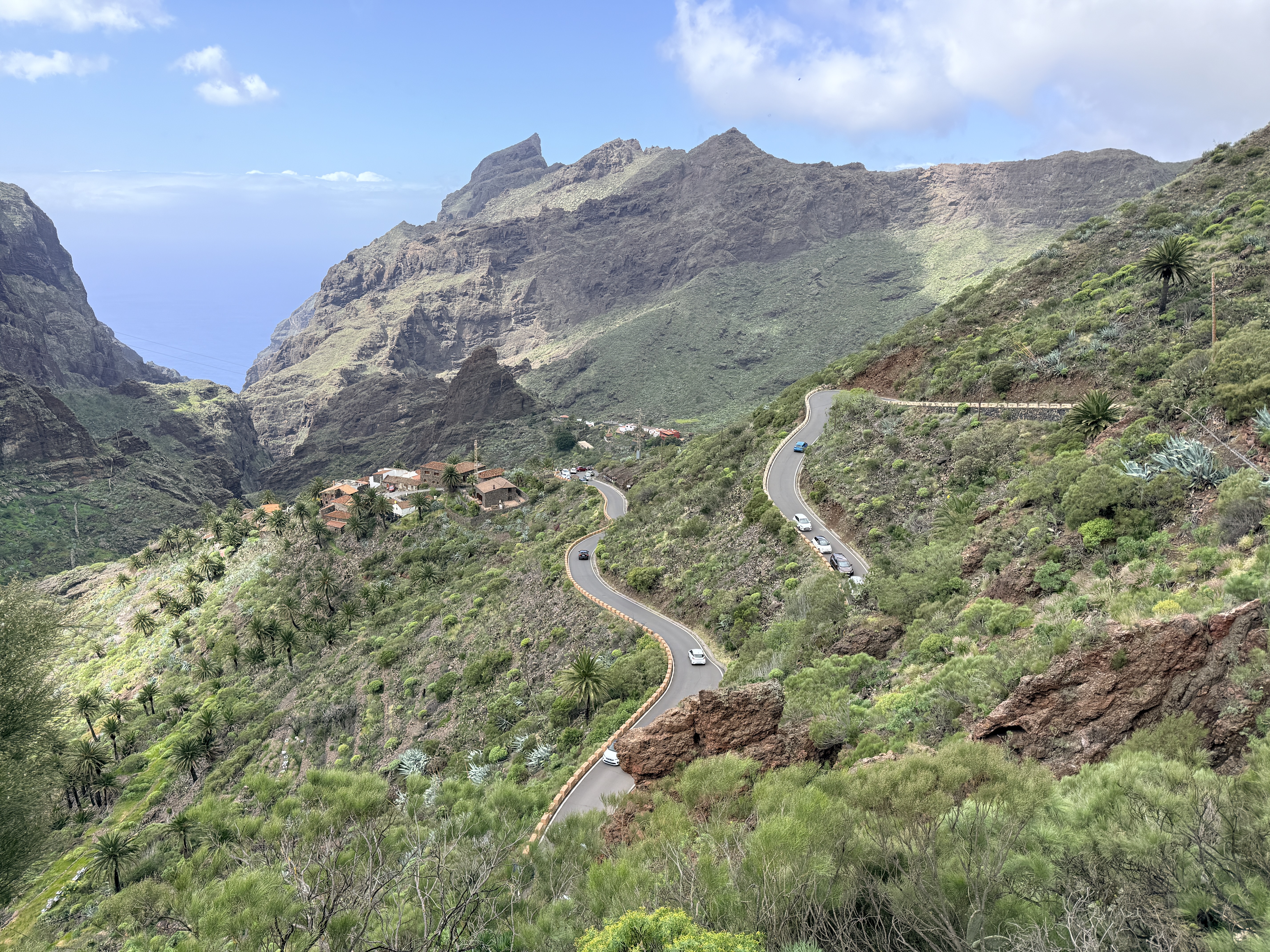
It’s stunning, outrageous, one of the best rides you can do. And the Wall of Masca, the 4 km climb (it feels longer) from Masca back up to Santiago del Teide is one of the most stunning climbs I’ve done. It’s relentless, with lots of 15% and one section of 18%. I had to stand for some sections on this climb. At one point I wondered if my brakes were rubbing so I stopped and spun the wheels. No, the brakes weren’t rubbing, the climb was just steep and hard.
Okay, now that I’ve inspired you, some details. The way I did it—from Santiago del Teide as an out-and-back with a side excursion up the Teno Alto climb—was 54.6 km with 6,700 feet of climbing. I think the Teno Alto climb was about 1,110 feet, so without that the Masca out-and-back would be about 5,600 feet of climbing.
Parking in Santiago del Teide is easy if you are there early. Lots of parking along the side of the main street. I parked a short way past the Masca turnoff (the TF-436). When I got back to the town, the parking was much more limited.
Leaving Santiago del Teide on the TF-436 you are immediately faced with a steep climb of just over 1 km. Then you have a wonderful curvy, switchbacky descent to Masca. After Masca there are two places where huge canyons head down to the left and you might wonder if the road goes down there. No, in both cases the road heads steeply up to the right. The second of these uphills is particularly brutal, with a short section of 18%.
Then the road goes ever onwards, down and down to Buenavista del Norte. Once you are there, you can turn left and ride about 2.5 to where the accessible road ends. The road actually continues to the lighthouse at Punta de Teno and it’s supposed to be a wonderful and beautiful ride. But as of March, 2026, the road is now closed, except to taxis and buses.
So, either ride to the road closure or simply turn around in Buenvista del Norte and climb back up. I did the short climb to Teno Alto on the way up as a sort of consolation prize as I wasn’t able to ride to the lighthouse at Punta de Teno.
One thing to note is that the area around Masca gets incredibly busy in the middle of the day, with parked cars reducing the road to a single lane and a constant stream of cars coming down the hill. Fortunately, at this time there are not that many cars going up the Wall of Masca, so you can enjoy its brutal beauty.
Here’s the ride on Ride with GPS.
Masca Lollipop
 I had intended to ride Teide from Playa la Arena, but the TF-82 from Tamaimo towards Chio was closed, so that put paid to my Teide ride. Instead I continued up to Santiago del Teide and did a counter-clockwise loop, finishing up the Masca Wall. This was just as stunning and steep and difficult as last time.
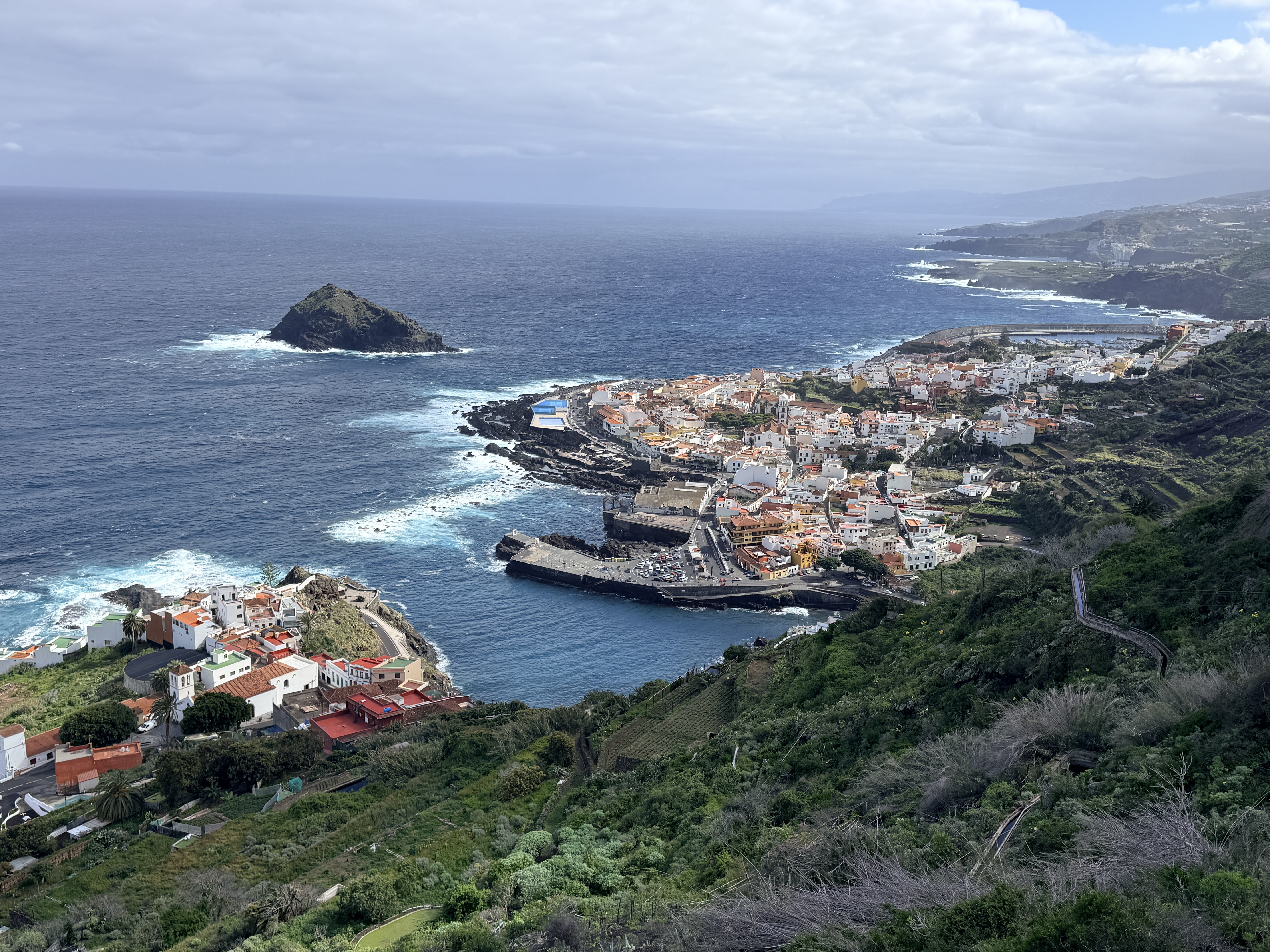
One of the most fun parts, with a big Wow! factor was the TF-421 heading down to the sea. Fantastic switchbacks and beautiful views of Garachico. The whole ride was 81 km with about 8,200 feet of climbing.
Here’s the ride on Ride with GPS.
Links and Other Clicks
Epic Road Rides has a great page about cycling in Tenerife.
Cycle Fiesta’s interactive map showing the location of many of the climbs.
Cycle Fiesta’s page about climbing Teno Alto.
Mountain Forecast shows weather forecasts for Teide. This can be useful as it may be cloudy lower down, with blue skies around Teide.
The Spanish Met office supposedly gives the best weather forecasts for Tenerife.
A page about the closure of the road to Punta de Teno.
My web page about cycling on Gran Canaria
