
 The Canary Islands belong to Spain, but are located off the west coast of southern Morocco. They are a popular cycling destination for North Europeans in their colder winter months. The main cycling season here is October 1 through April 30. The two most popular islands for cycling are Gran Canaria and Tenerife. Tenerife is famous for the big long climbs up Mount Teide, the volcano that dominates the island, while Gran Canaria perhaps has the greater number of different rides. Many of the rides are long loops with a fair amount of rolling riding along the GC-500 between coastal towns.
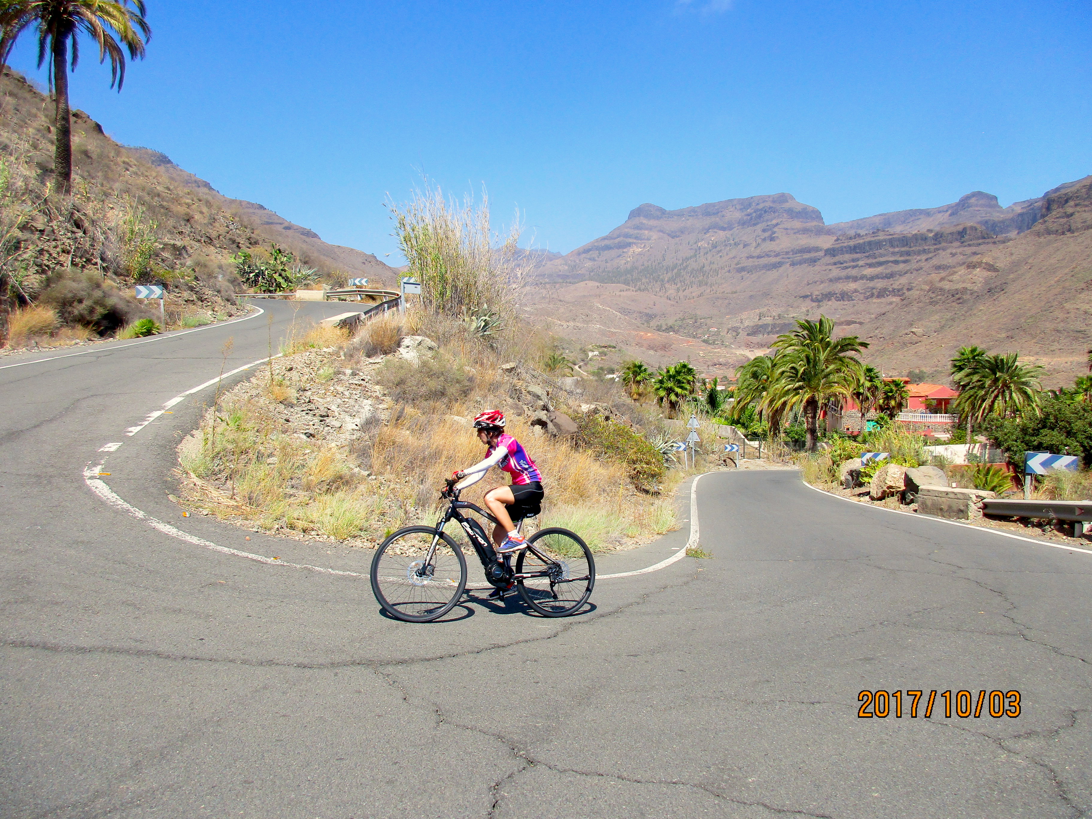
We flew to Gran Canaria in mid-September, 2017, leaving our bikes in Barcelona and planning to rent bikes on the island. I ended up not doing as much riding as I had originally hoped, partly because I didn’t want to do the long loops by myself and partly because I put too much trust in the weather forecasts, and having to reserve a bicycle ahead of time meant that I missed many of the beautiful days. I finally just rented a bike for 8 days rather than trying to predict the weather. Tanya decided to rent an e-bike for some of the rides, a decision she was delighted with. Gran Canaria was a wonderful place to finish our European summer: warm and sunny after some rather cold and wet times in France and Switzerland.
NOTES to first time visitors to Gran Canaria:
- We were told that we should not drink the water from the taps but instead buy bottled water in the supermarkets. Gran Canaria has few natural water sources and most of the water is desalinated sea water. It has lots of chlorine and other minerals and can cause upset stomachs – as I can testify.
- If you need things that you would typically find in a pharmacy – such as suntan lotion or medications, go to a Farmacia. Do NOT go to a Parafarmacia. They prey on tourists who don’t know the difference and charge vastly more for things. We price compared suntan lotion and it was more than twice as expensive in the Parafarmacia as the Farmacia.
Maps
I’m not showing maps here. The best thing to do is buy your own map then mark up the routes you are considering based on what I’ve described below. I name all the roads so the rides are easy to find on the map. The map we bought before coming to Gran Canaria was this map. Once you are on the island you can buy a very good map of the cycling routes from Free Motion. It has a map on one side and profiles and statistics of the rides on the other side.
The Weather
The north side of the island is windier and rainier than the south side, which means the south side is calmer, dryer, and sunnier than the north side. Which is one reason most of the cycling is done on the south side.
The weather is generally very good and seems to bear very little relationship to the weather forecasts. I ended up not trusting the forecasting sites that were recommended to me: eltiempo.es and aesmet.es. Also it can sometimes be difficult to predict the weather when you wake up because the sky may be filled with clouds. Fortunately the clouds usually burn off during the day.
The Roads
I am describing the road conditions as they were in September/October 2017.
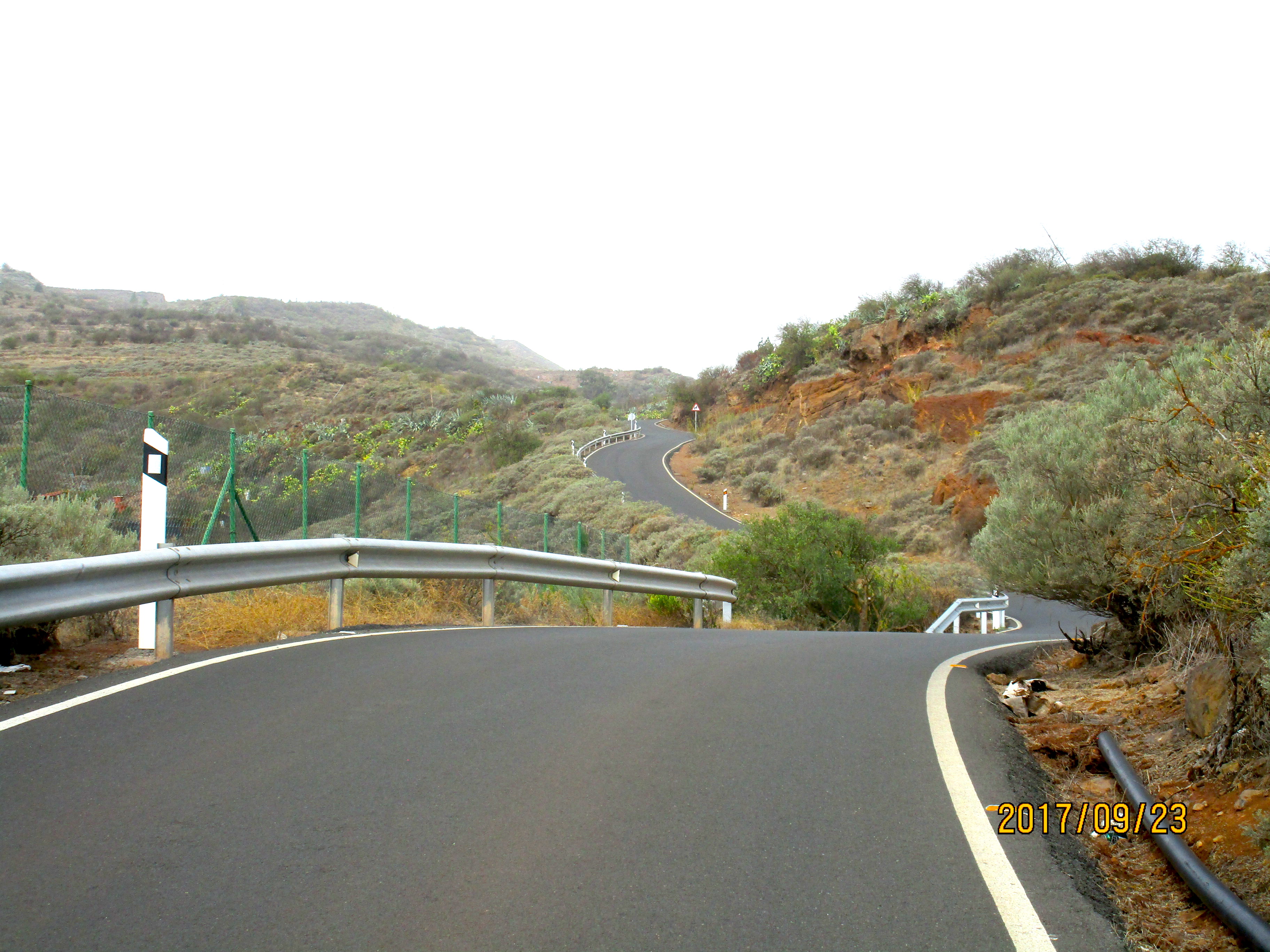
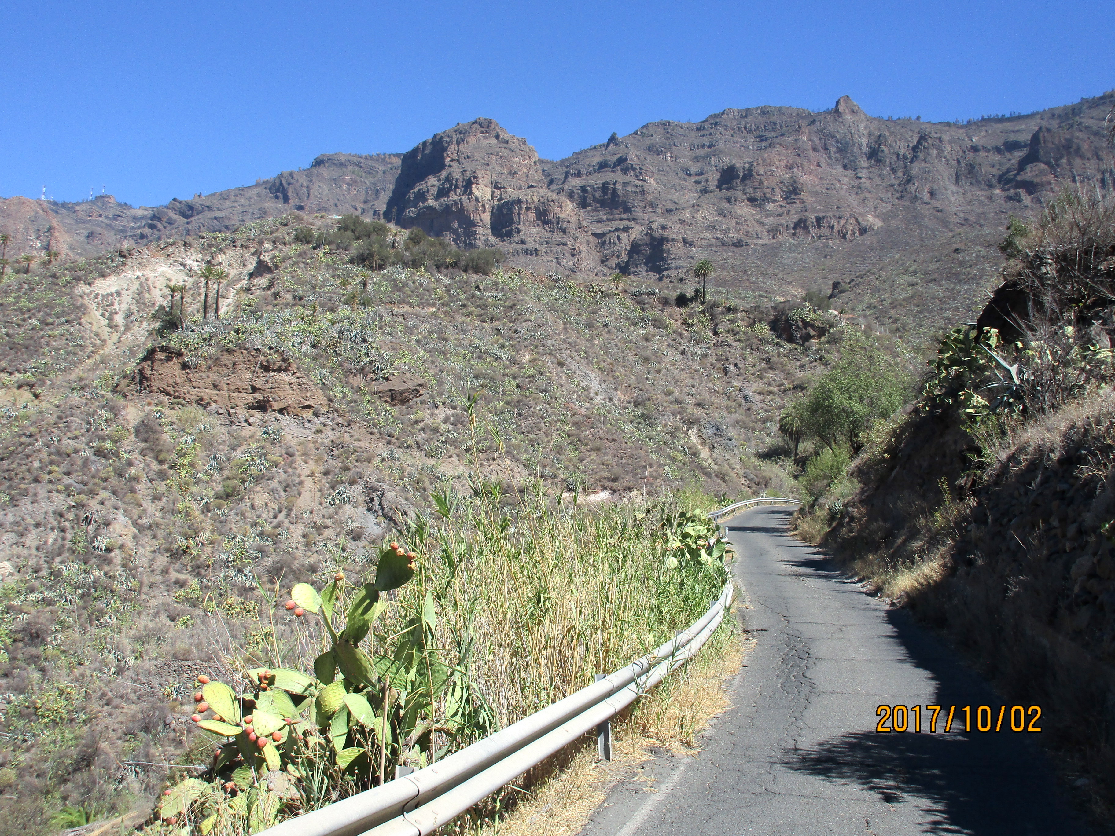
The roads vary from incredibly smooth to good to rough to very rough to horrible, and a single road can encompass all these qualities – for example the GC-605. In general the lower parts of roads are smooth but higher up they become rough. So, for example, the GC-60 is smooth below San Bartolomé and rough above. The climb up to Pico de las Nieves from Ingenio is smooth up to Cazadores then rough above. The climb to Soria is smooth but if you continue up to the GC-605 it becomes very rough. The GC-65 up to Santa Lucia is smooth as is the GC-550. However, some of the less-traveled lower roads are also rough, for example the GC-210 from La Aldea de San Nicolas.
While the smaller roads have little traffic, the coast road GC-500, which you’ll have to ride to start or end the loops, can be quite busy in places. As for the mountain roads, the GC-60 is the busiest, followed by the GC-65 and GC-200. At least this was our experience.
When we arrived there were two big road closures: the GC-500 coast road just east of Puerto de Mogán, and the GC-605 above the Presa de las Niñas lake. You are not allowed to ride bikes on the GC-1 motorway, so this basically prevented any non-shuttle loops out of Puerto de Mogán, where we were staying. The GC-605 is now open again, and the GC-500 will no doubt be open sometime, but it might be worth calling Free Motion (+34 928 777 479) to ask about road closures before deciding where you want to stay in Gran Canaria.
The Rides
The big climbs start from several different places. The rides beginning up the GC-200 to Valley of the Tears and Tauropass start from Puerto de Mogán. The climb up the GC-505 to Soria starts from Arguineguín. The climb up the GC-60 to Fataga and San Bartolomé starts in Maspalomas. The climb up the GC-65 to Santa Lucia starts in Vecindario.
What this means is that for many loop rides you have to ride quite a distance on the rolling GC-500 coast road at the start or end (or both) of your ride. You can obviously drive out, park, and do an out-and-back on the climbs but the best riding tends to be loops.
And of course you can create loops and super-loops. You are limited only by how many kilometers you want to ride and which roads you want to ride. For example, we met a German girl who rode Pico de las Nieves as Arguineguín, Soria, Ayacarta, Pico de las Nieves, San Bartolomé, Maspalomas, Arguineguín.
Where to Stay
Puerto de Mogán is a very cute little town with a lovely harbor area, and is the best place to ride the Valley of Tears as you can do a lollipop-loop ride directly from town. For the ride to Soria, Arguineguín is a better place to stay. But the Maspalomas / Playa del Inglés area is more convenient for more rides, and it’s where all the Free Motion rides start. But it’s more crowded than the other towns. We didn’t do enough research (my fault) and spent our time in Puerto de Mogán and Arguineguín, which turned out to not be the best decision. A couple of days in each then more time in the Maspalomas area would have been a better choice.
Bike Rental
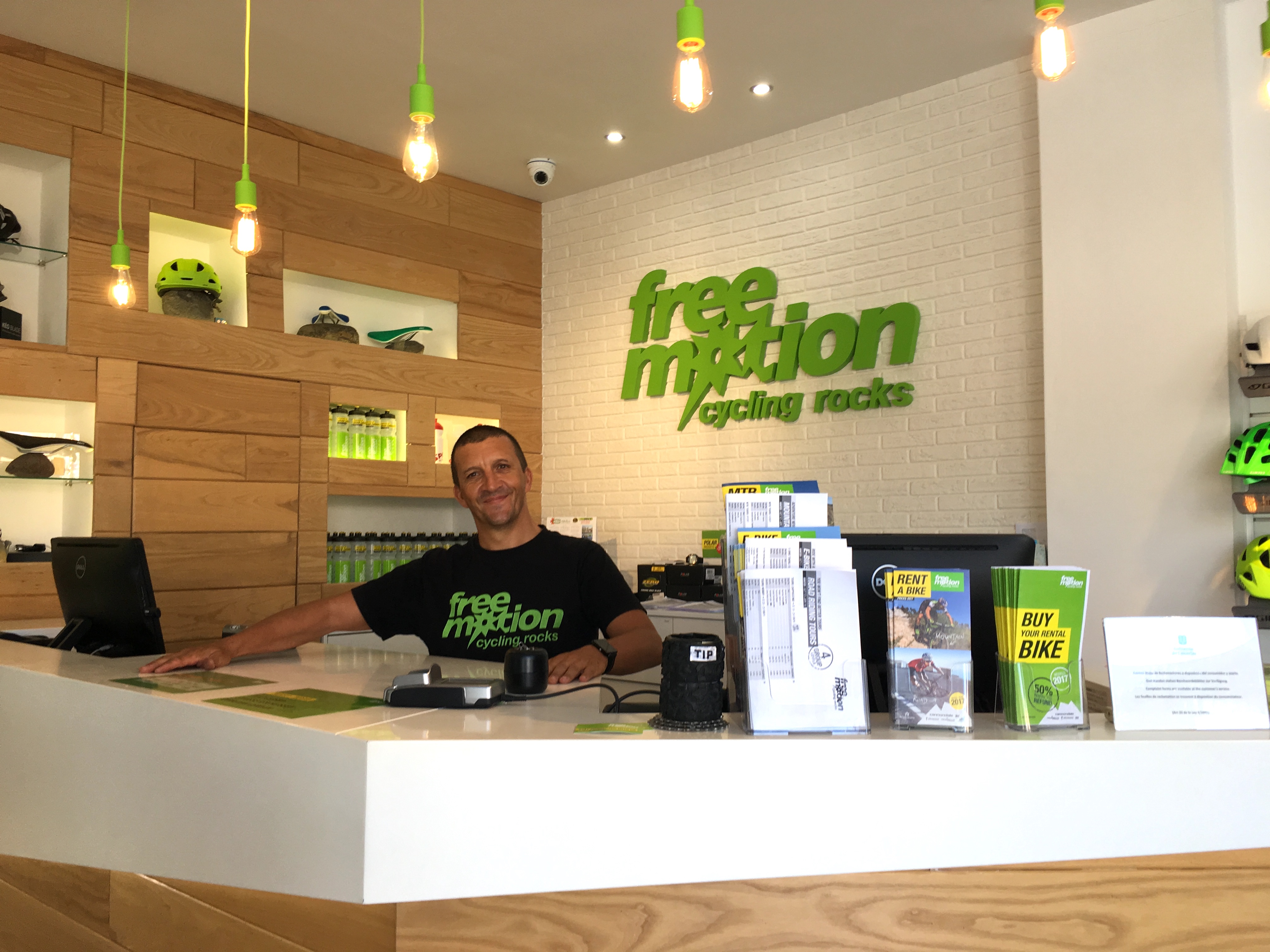
Free Motion store in Arguineguín
There are several places that rent bikes and do tours, the best known being Free Motion, which has stores in several towns. The best rides are in the south part of the island, and Free Motion has stores in Playa del Inglés (where all their rides start), Arguineguín, Puerto de Mogán, Meloneras, San Agustín, and Las Palmas. You can rent road bikes, which all come with compact (50-34) cranks and either 11-28 or 11-32 cassettes. You can also sign up for individual tours, or for a package. As of the time of writing there are two packages: 7 days rental + 5 tours, or 5 days rental + 3 tours. Free Motion also sells a very good map of the cycling routes – map on one side and profiles and statistics of all the rides on the other side. Well worth buying.
However, Free Motion doesn’t do many tours in the summer months: May 1 through September 30. The main season is the winter season: October 1 through April 30. So we were here too early for most of the big tours. They don’t do the Valley of Tears tour until early November,
The other big cycling company in Gran Canaria is Cycle Gran Canaria, run by Ray Leddy. They do a 6-day guided tour of Gran Canaria, and also a Road Cycling Camp. They also rent bicycles and seem to be based in Maspalomas. They also have an iPhone app with information about the various rides on Gran Canaria. It looks very good but I was unable to download it, getting the message “The item you’ve requested is not currently available in the U.S. store.”
The Rides I / We Did
- Valley of the Tears
- Tauropass
- Pico de las Nieves from Ingenio
- Pico de las Nieves from Maspalomas
- Fataga – Santa Lucia Loop
- Soria and Beyond
- Santa Lucia Loops
- Ayagaures
Valley of the Tears
Not my photo 😦
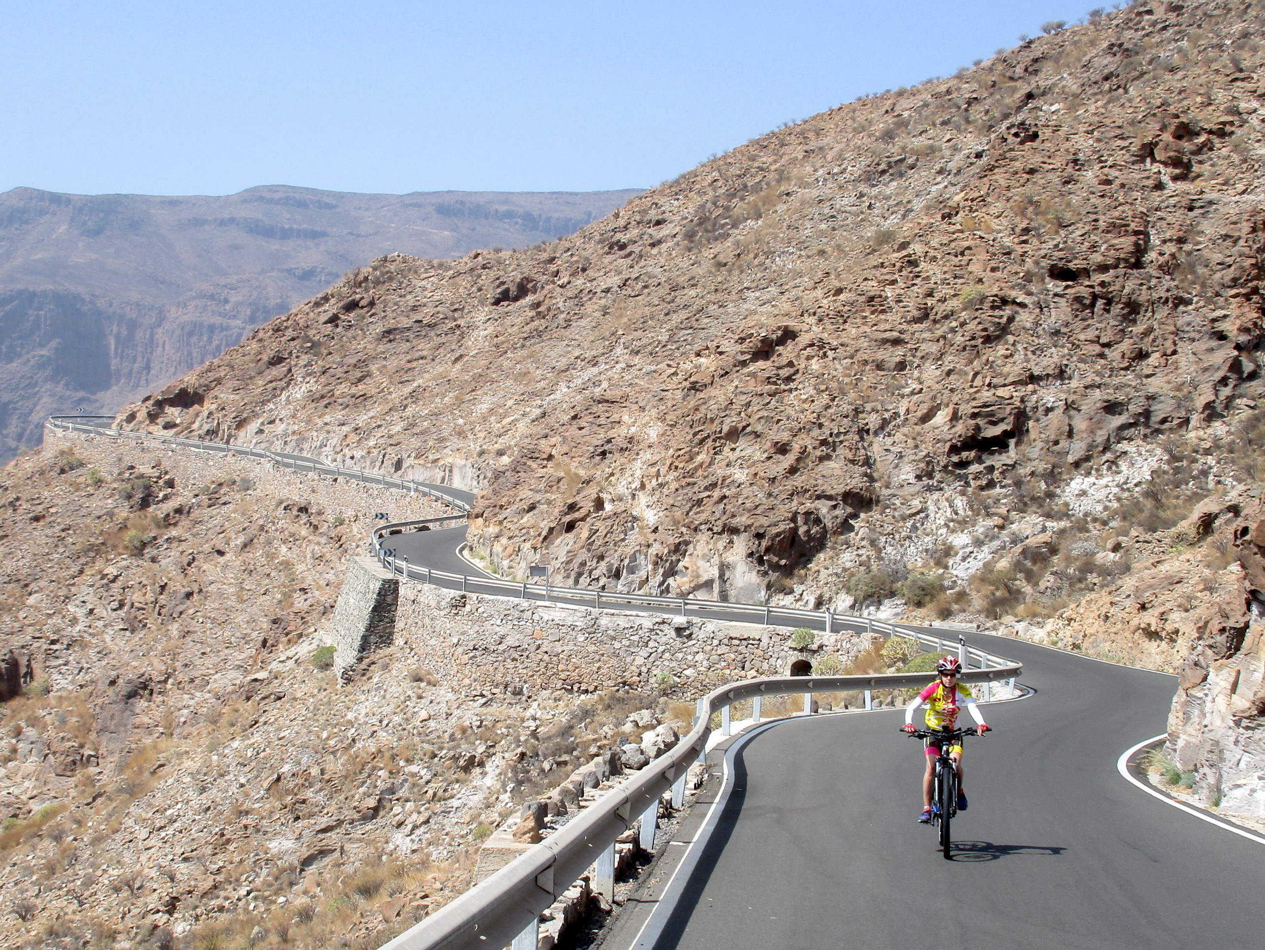
This is probably the most notorious of the rides on Gran Canaria, and the ride I most wanted to do. The actual Valley of the Tears (VOTT) part is about 12 km with a lot of horrifically steep climbing on not-so-good road surfaces. It’s probably the most difficult climb on Gran Canaria – and some people say it’s one of the most difficult climbs in Europe. Other people say Pico de las Nieves from Ingenio might be more difficult but I thought VOTT was considerably harder.
The bike I rented had 50-34 chainrings and an 11-32 cassette, and I was standing in my 34-32 for many sections of the VOTT.
Tanya and I drove the VOTT the day after we arrived in Gran Canaria and I was a bit intimidated by its remoteness and the poor quality of the road surfaces and decided not to ride it by myself. But time helps us forget and eventually I forgot my worries and rode it by myself anyway, as a lollipop starting and finishing in Puerto de Mogán. However, I did carry my Tevas with me in case anything went wrong with the bike and I had to walk back to civilization 😀.
The loop is about 93 km with 2,500 meters of climbing. From the roundabout where the GC-500 meets the GC-200 just north of Puerto de Mogán, ride fairly easily up the GC-200 for about 9.6 km to where the GC-605 heads up to the right. Continue on the GC-200 as it curves round to the left and follow this until around km 23 you start the descent to La Aldea de San Nicolas. Unfortunately the road surface on the first part of the descent is rather rough and bone-jarring.
The GC-200 reaches a T-Junction in San Nicolas. Turn right and zig-zag through town following the signs for GC-210 to Artenara. You’ll pass a Spar supermarket on the left where you can refuel – I bought water here. As you leave town the road narrows and the road surface gets dramatically worse and you’ll wonder if you are on the right road. You are. And the road stays rough for another 12 km to where the GC-606 heads up to the right, with a few short sections of better road.
The GC-210 soon enters a narrow rocky valley and rolls along to the GC-606. There is plenty of climbing, including two sets of tight switchbacks, and several long descents. Although it’s rolling, it’s definitely rolling in an upward kind of way, gaining four times as much height as it loses.
After about 44 km, at KmM 22, the GC-606 (VOTT) heads steeply up to the right. The first set of switchbacks are brutally steep with gradients over 20%. To make it worse, the road surface gets much rougher than it was on the GC-210. Fortunately after a while it returns to normal rough. On the GC-606 you see kilometers markers (KmM) and they count down to where the road reaches the GC-60, so you always know how far you have to go.
 After KmM 10 you descend then ride easily for a kilometer and then reach the white village of El Carrizal at KmM 8. There are signs for a bar and restaurant so you can probably get food and drink here if you need it. After El Carrizal the road surface improves considerably. The gradient also increases considerably.
At KmM 5, you enter the village of El Toscón, which is really just a collection of widely spaced buildings. I saw nowhere to get food or water. At about km 55 you do a lovely long downhill then a slight uphill to reach KmM 0 and the GC-60.
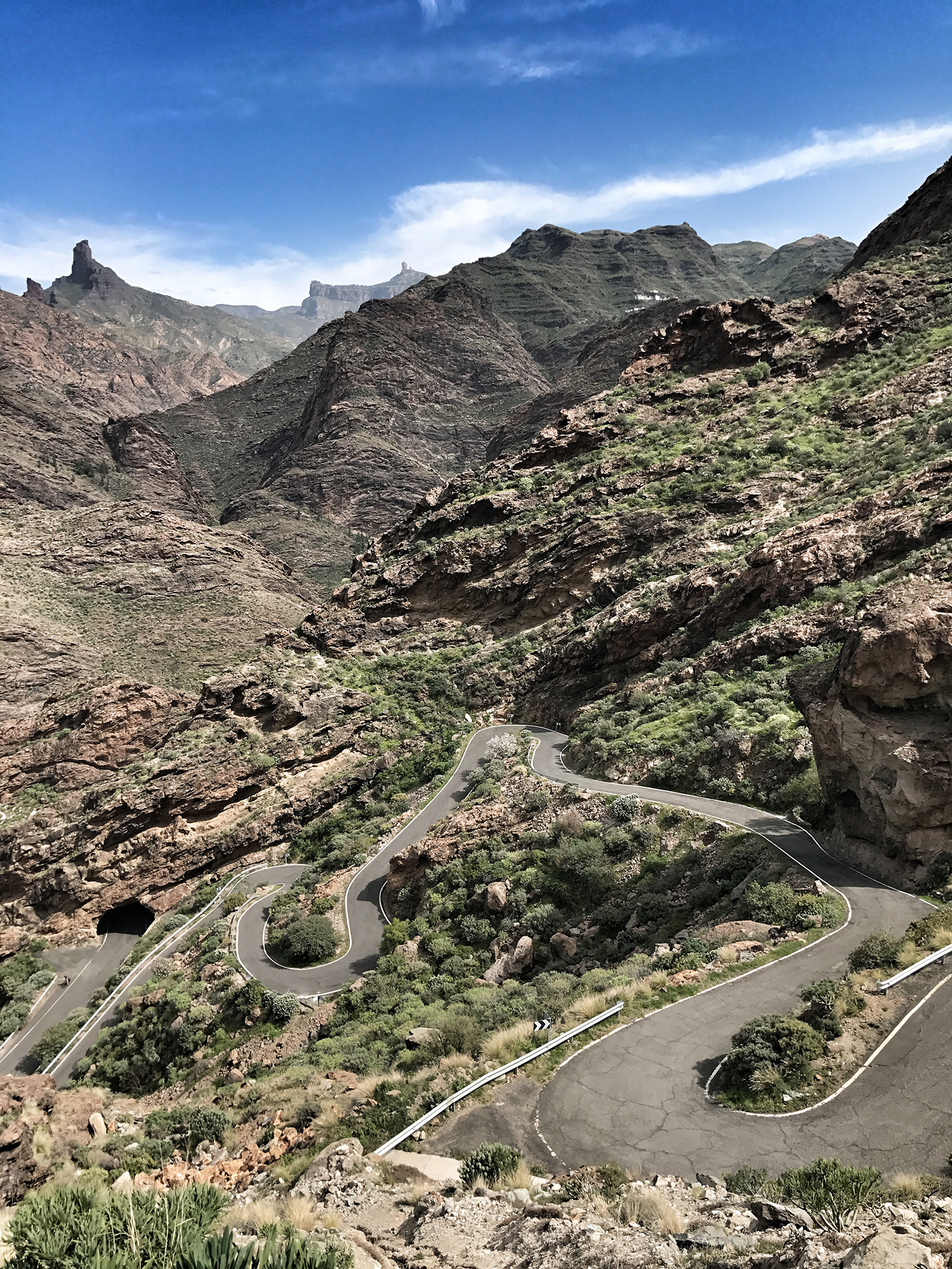
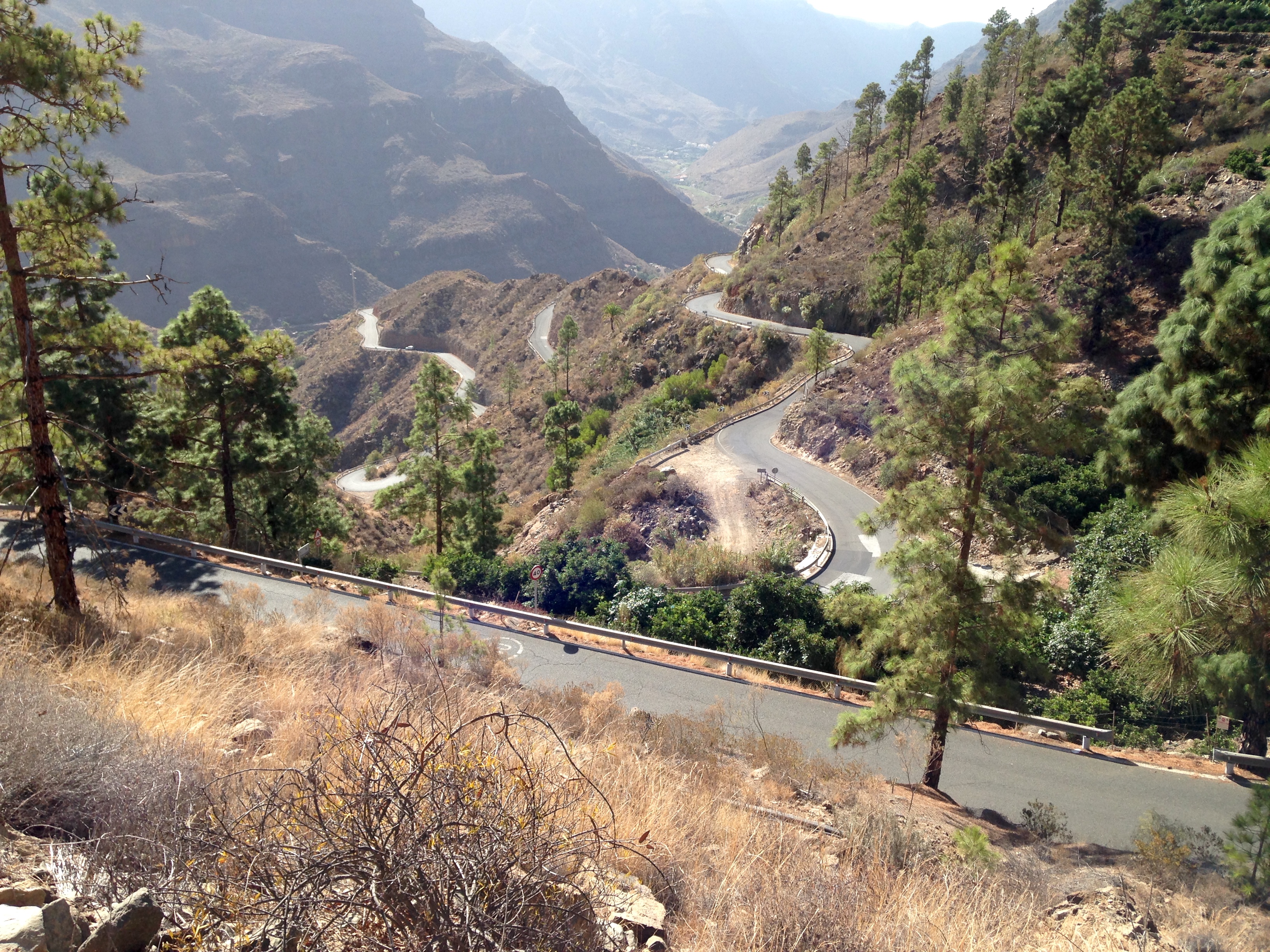
Turn right, climb a short hill then to a beautiful fast descent until you reach the village of Ayacarta, where there is a restaurant often used by cyclists. Just before you enter the village, by KmM 14, turn right on the GC-605. This road goes down through some beautiful country. The road surface for the first 8 km varies widely from ok to horrible, but after about 8 kilometers it becomes wonderfully smooth and you can now really enjoy the scenery. Continue along this lovely road until around KmM 14 you start descending the spectacular switchbacks of Tauropass. After the endless climbing on rough roads, these switchbacks are pure delight.
Back at the GC-200 turn left and ride back to Puerto de Mogán, finishing an extremely satisfying day. Even though so much of the climb is on rough or very rough roads, it doesn’t matter because this is The Valley of the Tears. It’s a bit like King Ridge in California – crappy road that you’d hate anywhere else, but you don’t mind there because it’s King Ridge.
Tauropass
 This is a beautiful climb on a wonderfully smooth road, up switchbacks galore, some barren and bare, others lined with pine trees. Some people say this is their favorite ride in Gran Canaria. It’s also known as the Serenity Climb.
It’s usually done as part of a loop but we were unable to do this because both the GC-605 and the GC-500 were closed (the GC-605 just past Presa de las Niñas) so we did it as an out-and-back.
From the roundabout where the GC-200 and GC-500 meet, just north of Puerto de Mogán, ride fairly easily up the GC-200 for about 9.6 km to where the GC-605 heads very steeply up to the right.
This next 8 km are simply wonderful, just a delight to ride: switchbacks up the valley, then switchbacks up the right-hand slope at the end of the valley. After you’ve ridden 18 km from Puerto de Mogán, with 850 meters of ascent, you reach an intersection. To the right you head to Soria and Arguineguín, and to the left you head to Tejeda and San Bartolomé. At this point you can decide what to do.
If the GC-500 is open you can turn right and in just under 1 km with 50 meters of climbing, on a not so good road, you reach the top. From here you can descend to Arguineguín and back along the GC-500 to Puerto de Mogán, for a trip of about 63 km.
Otherwise you can keep going on the GC-605 on the wonderfully smooth road. After about 1.2 km and 80 meters of climbing you reach the high point and a beautiful open valley. If you want to make a big loop of about 99 km, keep going on the lovely smooth road until around KmM 8 it becomes rough and very rough. At the intersection with the GC-60 at KmM 0, turn right then descend the GC-60 to Maspalomas and return to Puerto de Mogán on the GC-500.
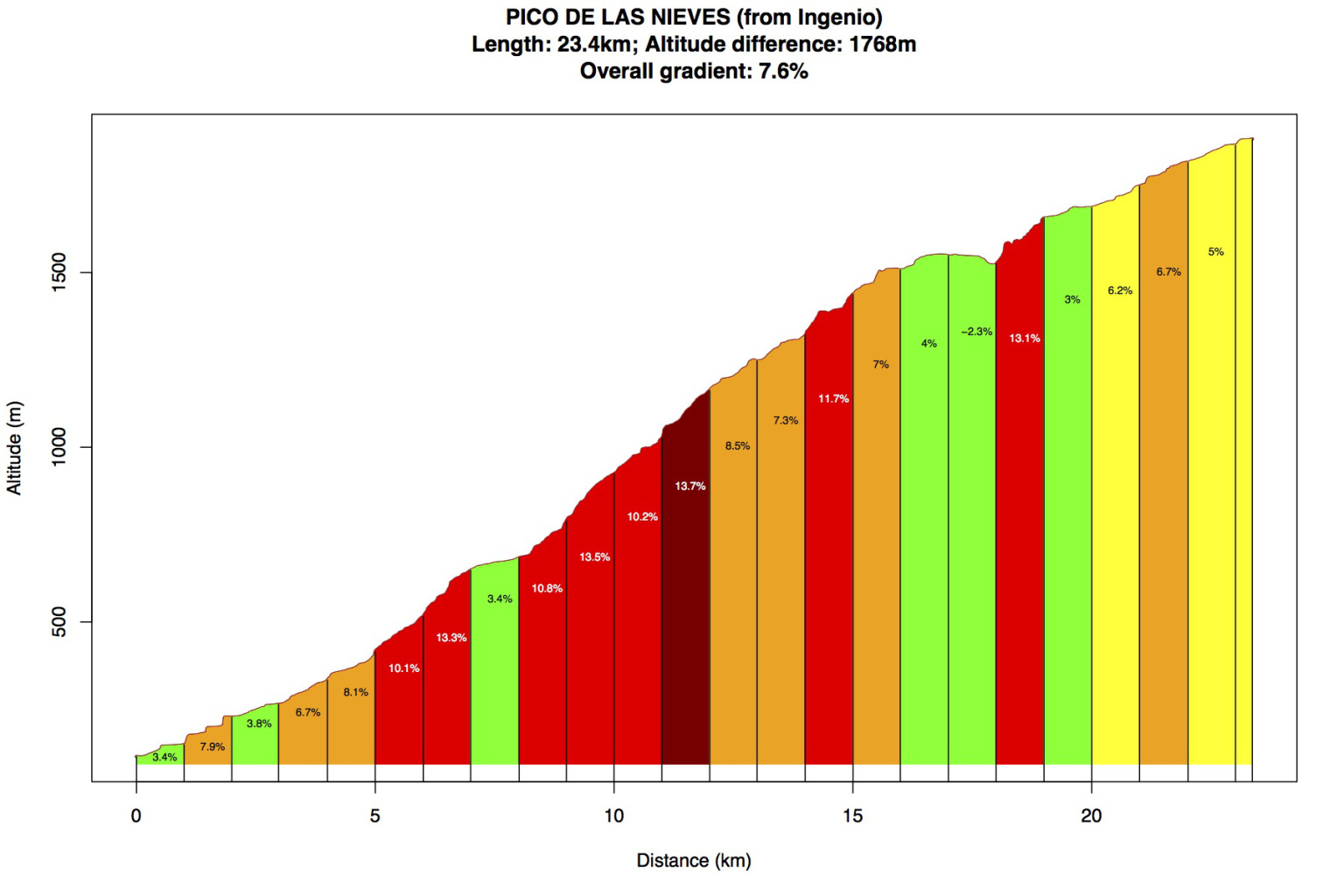
Pico de las Nieves from Ingenio
 This is one of the hardest climbs on Gran Canaria because of the series of viciously steep ramps between La Pasadilla and Cazadores. The climb from Ingenio is 23 km with 1,650 meters of climbing.
I did it on an incredibly windy and overcast day and confess that while I loved the section between La Pasadilla and Cazadores, I didn’t much care for the rest (except the very top.) The first 7 km were ridiculously windy, and the road above Cazadores has a very rough surface, in contrast to the beautifully smooth road below Cazadores. But I’m probably being too harsh as this was my first experience of the rough upper roads and I’m much happier on sunny days.
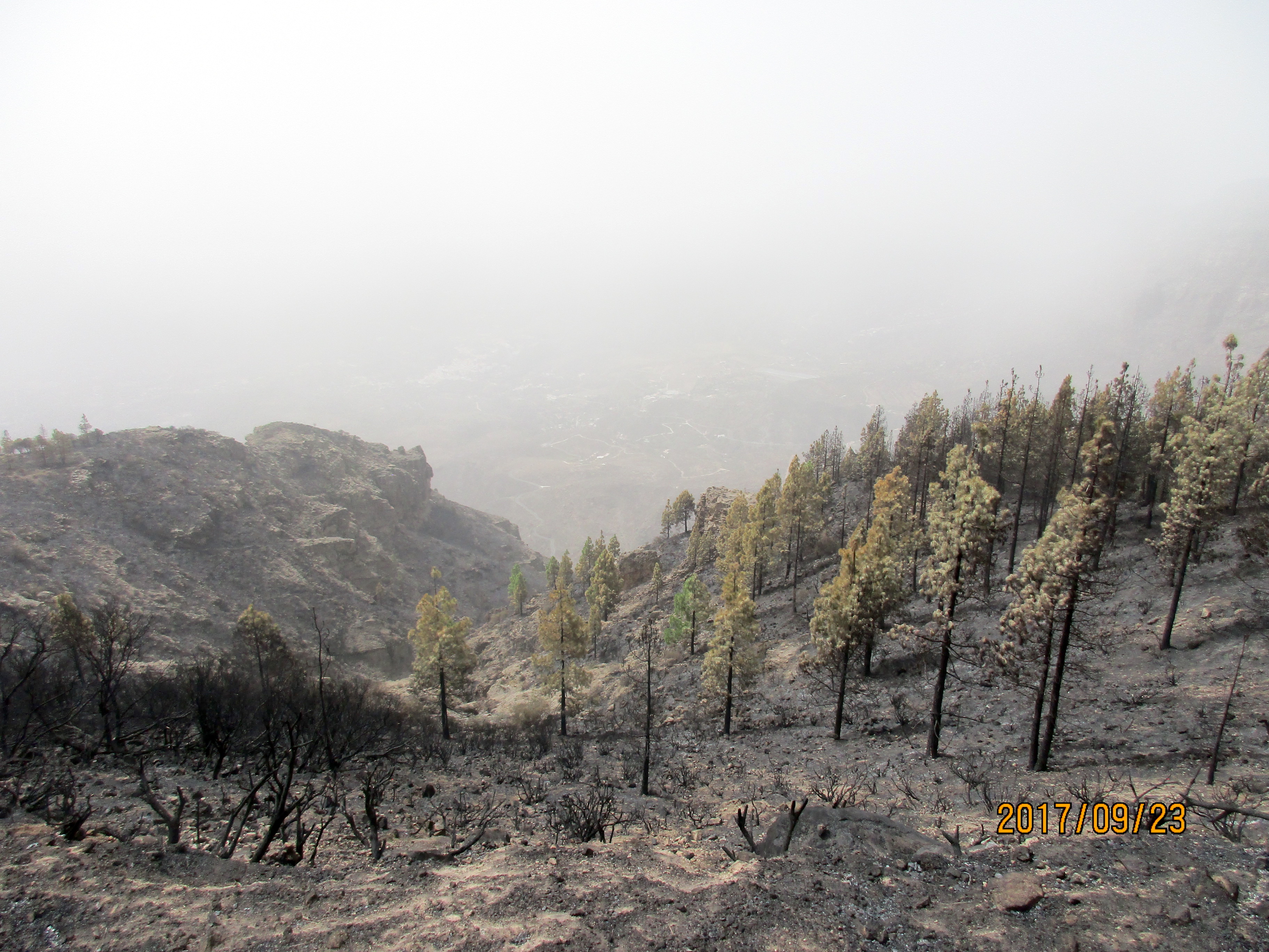
I rode this climb three days after a huge fire which burned about 6,670 acres in the high part of the island. I didn’t know about it when I started the ride and was amazed to see so much burned vegetation in the upper part of the ride, and then firefighters at the top. About 800 people were evacuated and one person died in the blaze. Amazingly the roads were open only three days after the fire started. The Canary News said this about the fire: “The area has a history of at least three intentional fires and no remains of machinery at work, the first suspicion has been of neglected scrub fires, although it could even have been a cigarette butt.” Also amazingly – to me at least – one of the firefighters at the top was smoking a cigarette.
 From the intersection of the GC-100 and Av. de America in Ingenio climb very steeply up through Ingenio. At the roundabout turn right following the GC-120. The next few kilometers are through rather bleak scrubby territory until you reach La Pasadilla, which you reach in about 7 km. From here everything changes. Suddenly the gradient changes from fairly consistent to a constant series of viciously steep ramps with some of them reaching 20+%. Fortunately the gradient eases off somewhat between the ramps 😀. At about 12 km (KmM 0) you reach a T-junction with the GC-130 in Cazadores.
 Turn left and climb the much rougher road until a short descent at km 16.5 takes you to the Caldera de los Marteles, a bowl caused by a volcanic eruption. Now the road steepens again and climbs through pine forests until you reach the intersection with the GC-134 at km 21.7. Turn left and enjoy the contrast of the wonderfully smooth road as you finish the climb up to Pico de las Nieves.
Once you have been to the top of Pico de las Nieves, you can also ride over to Pico de la Gorra which gives you another 3.5 km and 100 meters of climbing.
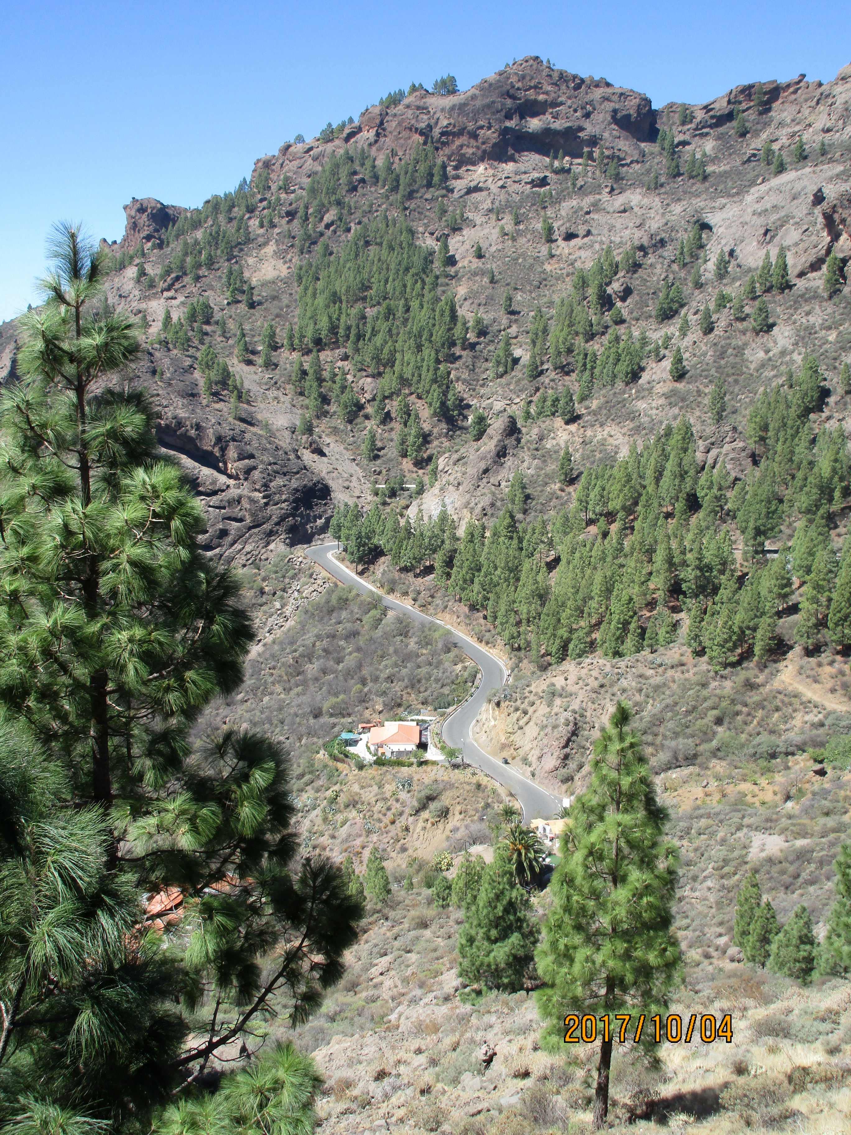
I rode back down the same way as the weather didn’t inspire me to ride further. However, I’d recommend continuing on the GC-130 then GC-600 then GC-60 to San Bartolomé, then taking the GC-65 to Santa Lucia and following the amazing GC-65 until you can turn left on the GC-551 to Agüimes and then back to Ingenio. This will give you a loop of about 76 km. You could turn left in Santa Lucia on the beautiful GC-550 but then you’d miss the fantastic curves of the GC-65 between the 550 and 551.
Pico de las Nieves from Maspalomas

The view from the top: Roque Nublo and Mount Teide.
This is perhaps the classic climb on the island. It’s long (48 km one way with 2,230 meters of climbing), varied (gentle uphill, steep uphill, downhill, flat), with a road surface that varies from wonderful to horrible with everything in between. As a round trip it’s – wait for it – 96 km, with 2,580 meters of climbing. The additional climbing is because there’s downhill on the ascent and thus uphill on the descent. It’s a great climb and well worth doing.
 I signed up with Free Motion to do this on one of their tours. We had two wonderful Norwegian guides, Martin and Erik, who made the ride a lot of fun. I was glad to do it with other people rather than by myself.
Starting at the Free Motion store in Playa del Ingles, climb the cobblestones until they end after one kilometer than turn right and follow signs for the GC-60 and Fataga. After 9 km you reach a lovely overlook, and as you approach this you are likely to hear aboriginal music coming from the replica aboriginal settlement on the left. After the overlook you a wonderful 4 km descent – which you’ll have to climb back up on the way out 😀.
As you climb up the valley you see the high cliffs of the volcano crater walls ahead of you. On the top are the radio masts on Pico de la Gorra, and to the left of them is the pointy triangular rock that indicates the top of Pico de las Nieves. At times you can see the large spherical military radar beside the rock. However, you can’t approach Pico de las Nieves directly because of the cliffs, and you have to contour far round to the left then approach the summit from the far side.
Going through San Bartolomé you have a choice – you can ride through the town, or bypass it by climbing the steep GC-603. We did the 603 on the way up and the town on the way down.
So, ride on to Ayacarta, which you reach about 36 km from the start. Turn right up the GC-600 and climb more steeply up the switchbacks for 3 km. Once you pass the big Roque Nublo parking lot you will be hoping that the summit is near, but you see the military radar again across the valley, further away than you hoped. About 8 km from Ayacata turn right on the much smoother GC-130 then in just over 2 km turn right again on the GC-134, then right again. Just keep turning right until you reach the radar, the top, and fantastic views.
Coming back down you’ll be faced with a horribly rough road above San Bartolomé, a 1 km climb out of San Bartolomé so that you can drop into the correct valley, then a beautiful switchback descent followed by the 4 km climb to the lookout. But after the exhilaration of reaching the top of Pico de las Nieves this climb will be nothing to you 😀.
Fataga – Santa Lucia Loop
 This is a classic shorter loop that is good in either direction. We chose to ride it clockwise because the descent of the GC-65 is simply wonderful: smooth road, never too steep, delicious curves, and great views. Some people consider this the best descent on the island.
Starting at the Free Motion store in Playa del Ingles, climb the cobblestones until they end after one kilometer than turn right and follow signs for the GC-60 and Fataga. After 9 km you reach a lovely overlook, and as you approach this you are likely to hear aboriginal music coming from the replica aboriginal settlement on the left. After the overlook you a wonderful 4 km descent then a long climb through Fataga and up the switchbacks to another overlook at about 23 km. From here you roll for 1 km then do a 1 km descent to a stop sign where the road splits.
Turn right on the GC-65 towards Santa Lucia and follow the lovely road down, then a short easy climb takes you into Santa Lucia. Continue down the delicious GC-65 as it descends and climbs gently, before a steep descent drops you into Vecindario.
At the third roundabout (with a large metal sculpture in the center) turn right following the sign for Maspalomas. You will immediately be on a lovely red bike lane. Follow this for 2 km then turn left at the roundabout. Keep following signs for Maspalomas and the GC-1, then signs for the GC-500, and ride about 18 km along the GC-500 back to Playa del Inglés.
Soria and Beyond
 A wonderful climb starting in Arguineguín, it can be done as an out-and-back, as an extended out-and-back, or as part of a fantastic loop. Tanya and I rode it as part of a loop that went through Ayacarta, San Bartolomé and Maspalomas. From the intersection of the GC-500 and GC-505 just north of Arguineguín, this loop was about 88 km with 2,024 meters of climbing.
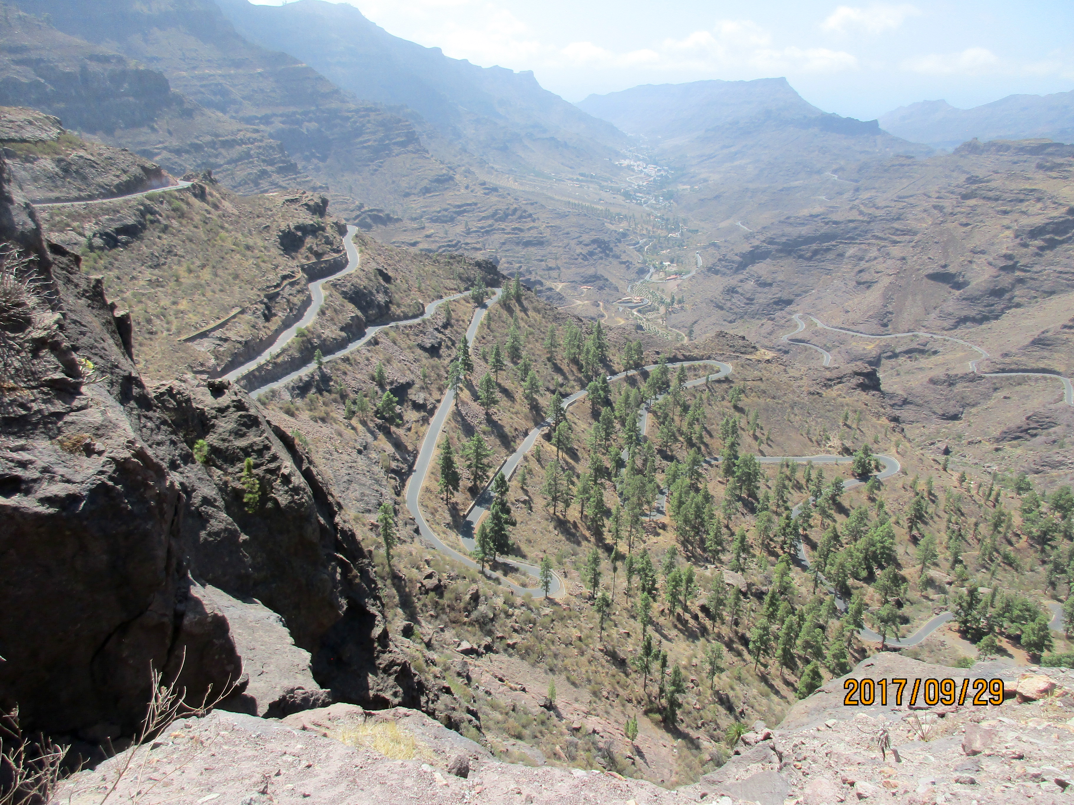
From the intersection, head very easily up the GC-505 for about 14 km. The road is just a gentle climb up to this point. Now it steepens and climbs beautiful switchbacks for the next 5.6 km until it flattens out and at km 19.6 you reach an intersection where the GC-505 continues up left, signed towards San Bartolomé. This is where the standard out-and-back would turn back.
 There’s a sign here that says No Bicycles, then amends that to pretty much say, “Well, go up here if you want but at your own risk”, and lots of cyclists take that risk. The road is rougher and starts steeply. It’s rough and narrow as it winds up between palm trees and is wonderful, a hidden delight. It’s not long, and you reach the high point in about 3.4 km. This is the turn around for the extended climb.
A short descent takes you to the beautifully smooth GC-605. Turn right and follow this for almost 15 km to Ayacata. The road is smooth until around KmM 8, and from there to Ayacata the surface varies between OK, rough, very rough, and horrible.
You reach Ayacata at 38.6 km having climbed 1,475 meters. There’s a restaurant here which is popular with cyclists, although we found the waiter extremely rude. Follow the GC-60 south through San Bartolomé on rather rough roads. A short climb out of San Bartolomé on the GC-60 then you start descending again and are soon on a gloriously smooth road the rest of the way.
After Fataja you will soon be faced with a 4 km climb along the edge of the cliffs until you reach the high point with great views in all directions, having climbed 1,826 meters. Now it’s downhill all the way to Maspalomas. We stopped at the Free Motion store in Playa del Inglés as Tanya had rented an e-bike and the battery was getting low, so we got it recharged before the final rolling 15 km ride along the GC-500 back to Arguineguín.
Update (March 2021): Apparently there are plans to create a large hydroelectric plant in this valley. Please read the comment by Judith Howells at the end of the page.
Santa Lucia Loops
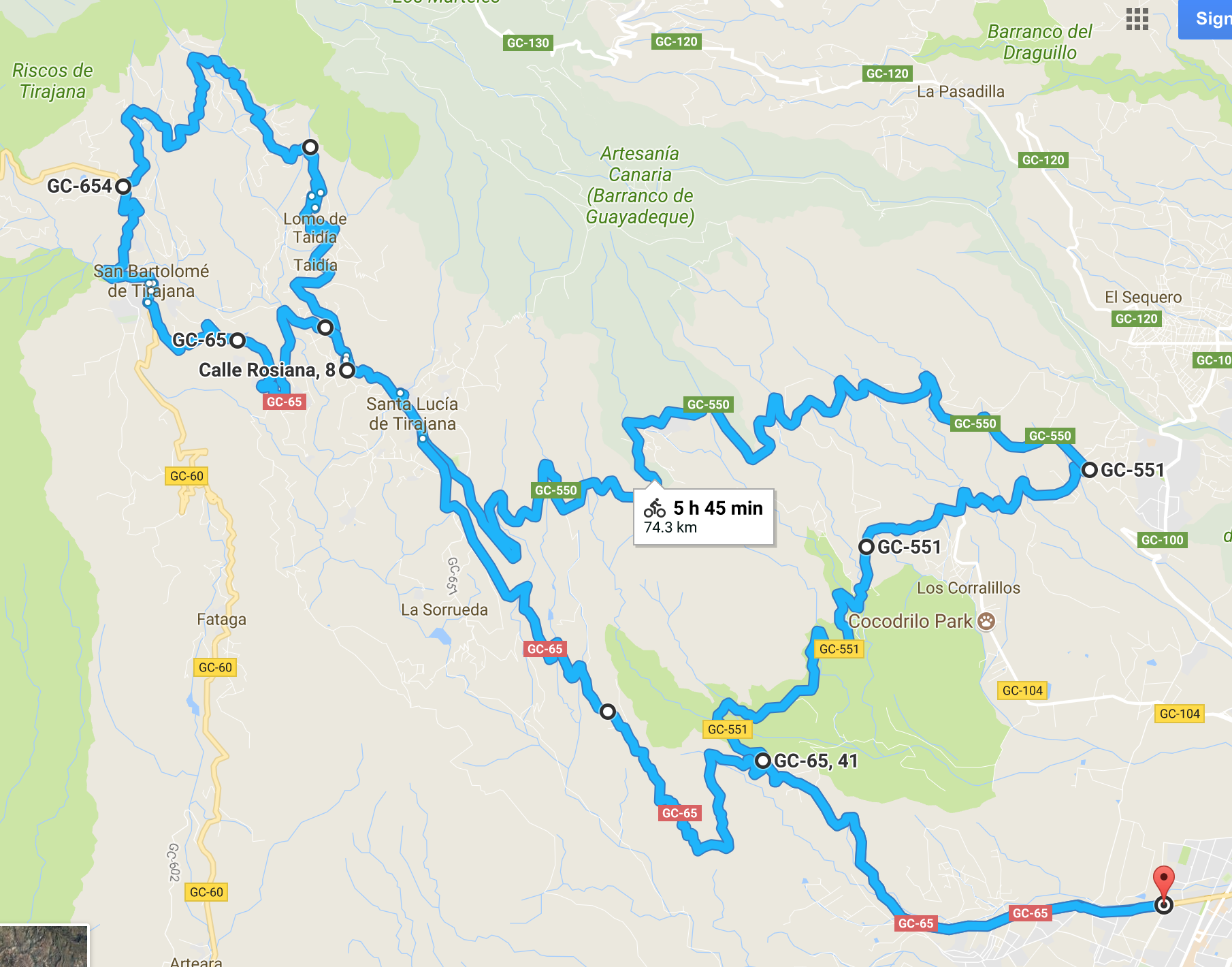 Okay, so I will show one map, just because I like the shape of the route; it looks a bit like some prehistoric animal to me. It starts in Vecindario, goes up the GC-65 towards Santa Lucia, heads down the GC-551 towards Agüimes, heads up the GC-550 to Santa Lucia, goes a bit further up the GC-65 then turns right on the GC-654 and contours around inside the volcano crater walls, doing a sort of semicircle around San Bartolomé, then heads down to San Bartolomé and back down the GC-65 to where you started. The whole ride is about 73 km with 1,600 meters of climbing.
Descent into Santa Lucia on GC-550
Start in Vecindario at the intersection of GC-65 and Av. de las Tirajanas. (If you are heading towards Vecindario on the GC-500 then GC-191, follow the signs for GC-65. This will take you to Av. de las Tirajanas, which has a great bike path at the side of the road. Follow this to the roundabout with a large metal sculpture in the center. This is where I started recording.)
Ride up the GC-65 towards Santa Lucia. After about 6 km you reach the start of the switchbacks, but after a single switchback turn right on the GC-551 towards Agüimes and Ignenio. Follow this, mainly downhill, for about 10 km then turn left on the GC-550 towards Santa Lucia. After climbing for about 10.5 km you reach the high point, and the next 6.5 km are flat and downhill until you reach Santa Lucia and the intersection with the GC-65.
The delightful GC-654
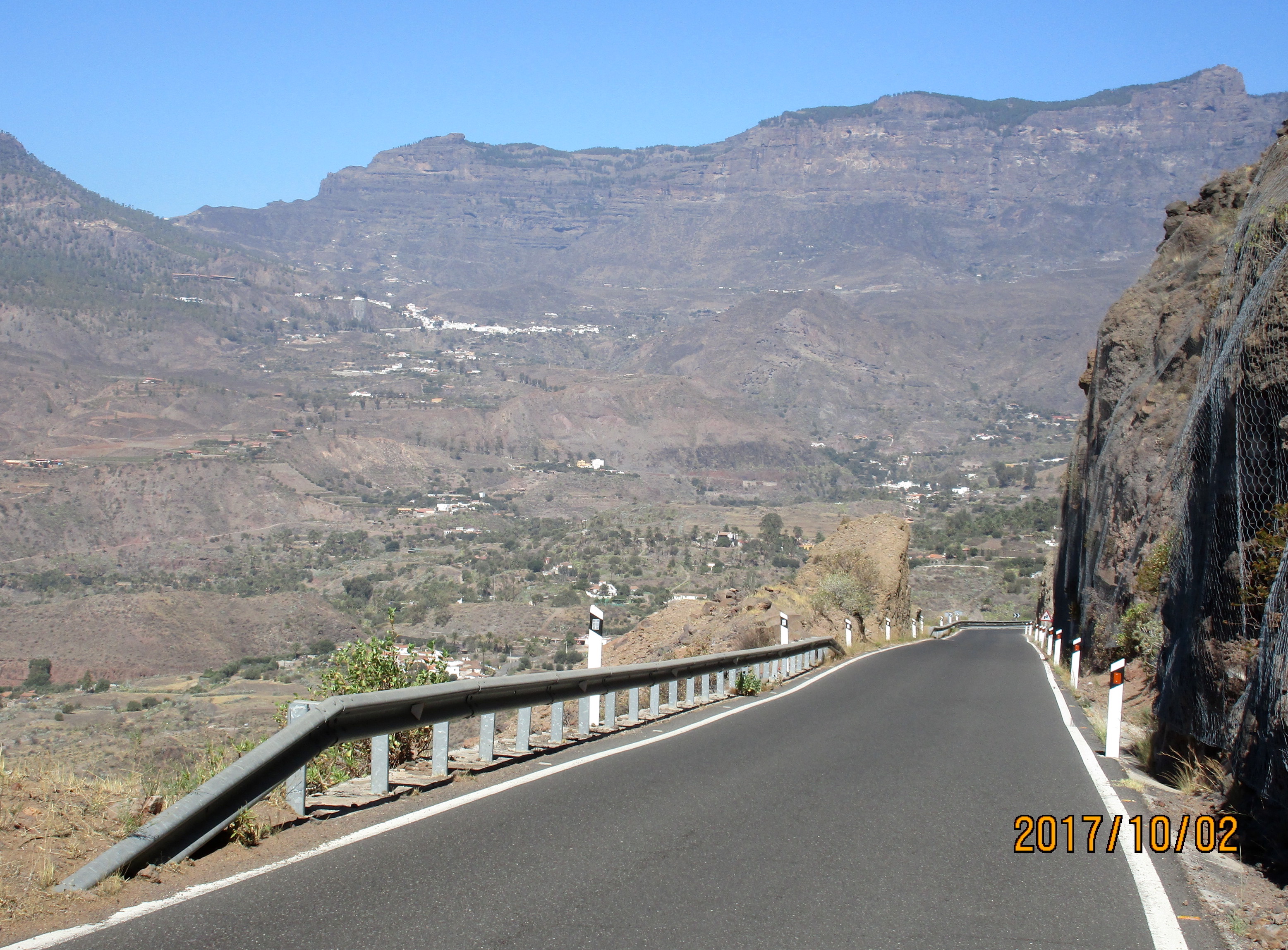
Turn right on the GC-65 and follow this for 2 km until the GC-654 heads up to the right, signed to Taidía. The GC-654 is a fantastic, quiet, peaceful loop of about 10.5 km that forms a vague semi-circle around San Bartolomé, passing through little hamlets below Pico de las Nieves and the steep volcanic crater walls that prevent access on this side.
The first 2 km are wonderfully smooth but once you leave Taidía the road surface gets rougher.There is plenty of 10% and some 16-18%, mainly in the first half. But all good things eventually end and after about 10 km on the GC-654 you reach the GC-60. Incredibly, the road becomes even rougher after you turn left on the GC-60 and head down to San Bartolomé.
Just after you pass through San Bartolomé, turn left on the GC-65 and follow it down to Santa Lucia. The next section between Santa Lucia and the GC-551 is simply divine: wonderfully smooth road, delightful curves, never too steep, and even some gentle uphill. Some people consider the GC-65 the best descent on the island.
Ayagaures
 This is a short and fun little loop near Maspalomas. It’s only about 26 km with 480 meters of climbing, but what what lovely climbing, with the steepest part concentrated into 3.7 km up to and above Ayagaures. I rented an e-bike and Tanya and I rode it on e-bikes. What a great experience – press on the pedal and the bike surges, leaps forward. I rode it again on the road bike as my last ride on the island.
From the intersection of the GC-500 and GC-503, head up the GC-503 towards Aqualand. Just after the amazing Aqualand, with its many water slides (adult cost €28), turn right on the GC-504. The loop can be ridden either way but counter-clockwise is much more popular, because it’s much better.
Climb gently up the quiet valley for 8.5 km until a very sharp left turn starts a series of four switchbacks and a few wiggles into Ayagaures. In the village take a sharp left and the road now becomes the GC-503 again. Climb this as it slashes left and switchbacks up across the hillside to the top.
A short distance down the other side and you can look down at Palmitos Park and see dolphins swimming in the gorgeous blue pool. Continue down past the amazing houses in Monte León, along the ridgeline and through the village of Montaña la Data, then back down to Aqualand and then the GC-500.
If you’d like to see how the 1% live, as you pass through Monte León turn left up Calle Puccini and climb this and Calle Mozart up to Monte León II and the gated community of Montaña Alta. Monte León is apparently “the most exclusive residential area on the southern part of Gran Canaria, or probably the whole island.”
Links and Other Clicks
We rented bikes at Free Motion, which has stores in Las Palmas, Playa del Ingles, Arguinquin, and Puerto de Mogan. Here’s a list of their stores and store hours.
Thomson Bike Tours does a camp on Gran Canaria in February. They also do a camp on Gran Canaria with a day trip over to Tenerife to climb Mount Teide.
Cycle Gran Canaria has several road cycling camps on Gran Canaria during the winter months.
A video from GCN about cycling on Gran Canaria.
An excellent video from The Coll Collective showing an overhead view of cycling Valley of the Tears.
A up-close-and-personal video showing Katie Kookaburra (Katie Butler) riding Valley of the Tears.
The page from which I got the amazing photo of the Valley of the Tears.

Thank you for your article, my best source of inspiration for preparing a week of road biking in Gran Canaria, and what a week!
We chose to stay on Laspalomas as you advised, and we were able to make some beautiful loops whose traces are here https://www.visugpx.com/membres/1/velo-de-route/2019/grande-canarie / if it can inspire others!
Thank you
LikeLike
Please can you make everyone aware that corrupt politicians are planning the wholesale destruction of the beautiful ravine up to Soria. The construction of a huge hydroelectric plant starts off with 4 tons of explosives 6 days a week for 3 years. https://you.wemove.eu/campaigns/salvar-el-barranco-de-arguineguin-del-macroproyecto-hidroelectrico-de-chira-soria-save-the-ravine-of-arguineguin-from-the-macroproject-chira-soria-hydroelectric-project?utm_campaign=YKlqYk7yBv&utm_medium=whatsapp-web&utm_source=share
LikeLike
Great article!
And Judith, any update on the dam?
LikeLike