
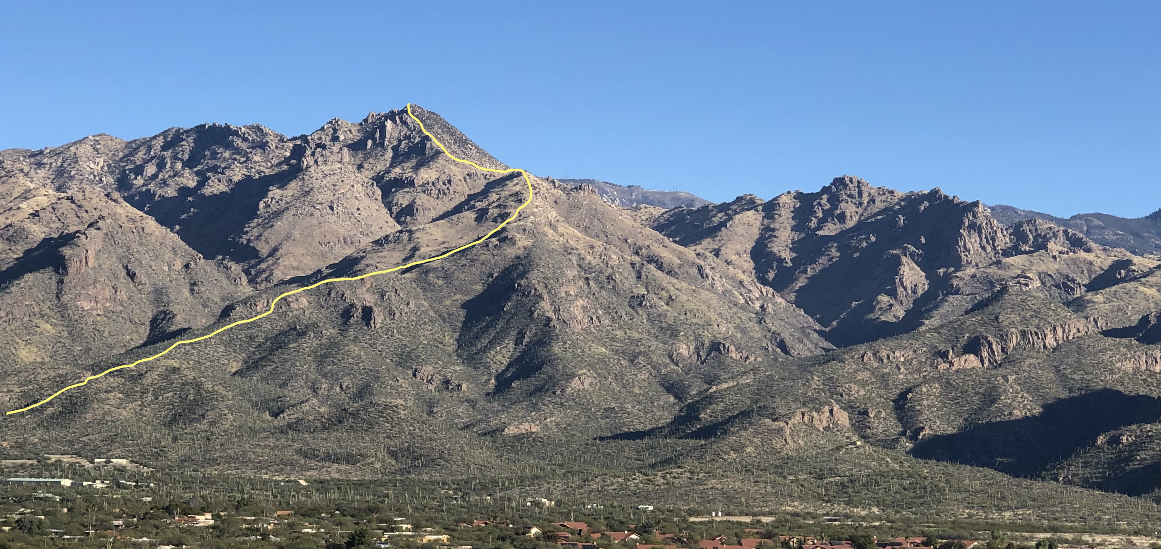
 It can be difficult to distinguish some of the peaks in the Santa Catalinas, but Rattlesnake Peak is the most obvious peak to the west of Sabino Canyon. After leaving the Esperero Trail, it’s bushwhacking the rest of the way, initially through cactus of all types, but then mainly through long grass. I’m not sure how many miles the hike is, but the round-trip took me 7h 15m on 3/11/22.
Start in the Sabino Canyon overflow parking area, about ½ mile north of the main Sabino Canyon parking. This will save you about 2 miles on the out-and-back hike. From the overflow parking area, behind the big water tank, head north on the obvious trail. This is the shortcut to the Esperero Trail and Cardiac Gap.
After some pretty wandering on flattish terrain, you do a short steep climb that turns sharply to the right. A little more easier climbing and the trail flattens a bit. About 100 feet on, there’s another trail (marked with a cairn), that leaves the main trail and then follows the ridge. This is the shortcut to the shortcut, and takes you out on the Esperero Trail exactly where you need to start heading up to Rattlesnake Peak. If you reach a metal sign on the main shortcut, you’ve gone too far.
The shortcut to the shortcut reaches the Esperero Trail at a seeming highpoint, and directly opposite on the north side is another trail that heads towards the cactus and the Rattlesnake Peak ridge. From here on, you’ll be making your own decisions about which way to go, and will sometimes see cairns. These cairns are seldom very useful, and serve mainly to tell you that someone else, at sometime, was here.
Follow the vague trail towards Rattlesnake Peak, heading generally to the left. The trail soon runs out and now you’ll make your way upwards, heading to the right side of the first rock band. There are lots of cactus in this section, and your decisions about which way to go will be mainly based on avoiding the cactus and other spiky bushes. Once you pass the rock band on the right, there are still cactus, but it’s much more obvious which way to go. Fortunately the cactus soon run out and you’ll be hiking on steep grassy slopes.
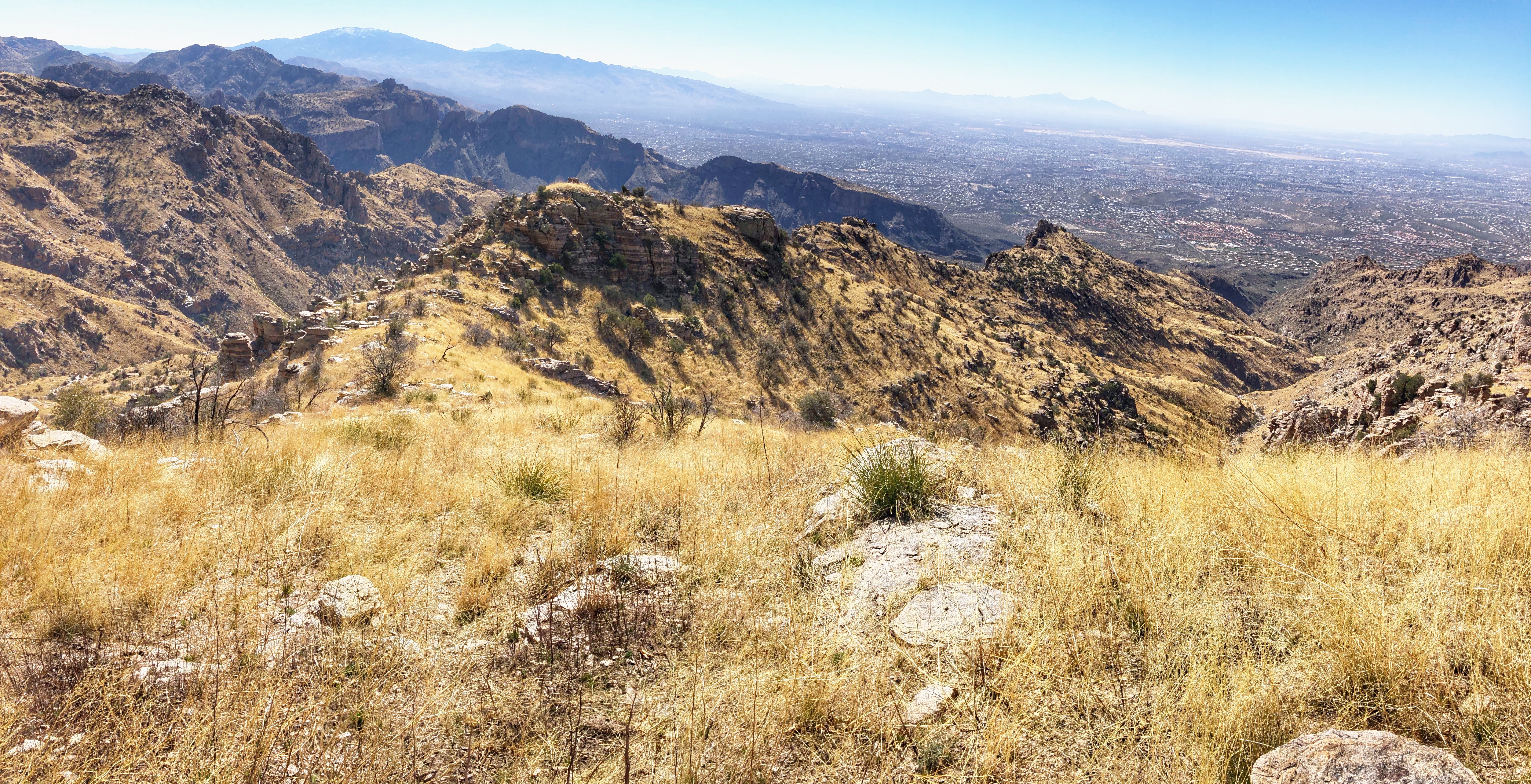
Looking down the ridge from the upper section
Now you basically follow the ridge, generally avoiding the rocky sections on the left. Or you can contour around on the left flank of the ridge line. I’ve done both and contouring feels faster.
 Eventually you reach the final steep rocky section up to the top. This is the most difficult part of the hike. There are a few places where you’ll probably be scrambling easily up the rock, but in general you can avoid the rock on the right. You will have to contend with lots of manzanita bushes though.
Finally you reach the obvious top, with a beautiful rocky perch on the left, with spectacular views over to Cathedral Rock. Up on the rocky perch, behind the cairn, is a metal case with the summit log that you can sign (at least it was there on 3/11/2022).
Once you’ve enjoyed the views and the photographs, head back down the way you came up. If you are like me, you won’t remember the exact way down through the rock band and the cactus and will be again basing your decisions on avoiding cactus and spiky things. Hopefully you’ll end up on the Esperero Trail directly opposite the shortcut to the shortcut trail, and will have a final pleasant hike back to the overflow parking lot.
Links and Other Clicks
Debra Van Winegarden’s wonderful page about Rattlesnake Peak, with lots of photos.
