
Often as I ride along the Hoodoo section of the Mount Lemmon road, I look across at the steep Bug Spring trail, which heads directly up the hill on opposite side of the valley. I wonder what it would be like to hike from the top of that trail leftward along the vague series of somewhat connected ridges to the far-away high point of Guthrie Mountain. Well, on May 8, 2002 I decided to try it and see. If you enjoy bushwhacking and route finding your way through manzanita bushes, you might enjoy this hike. If you prefer to stick to regular trails, then forget it.
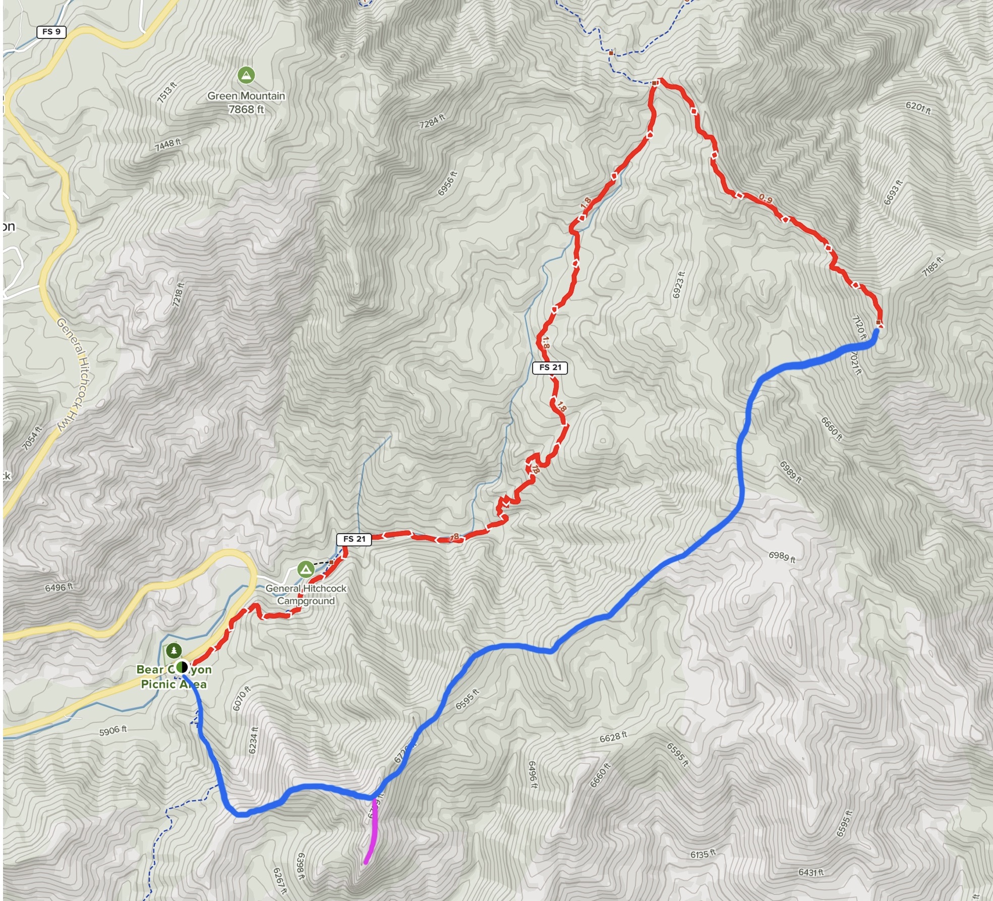
The map above shows the hike I did. The blue is the approximate way I went to reach the top of Guthrie Mountain. The red is the regular route as show by All Trails. The purple is a little side trip to a pretty rock outcrop. All Trails says the regular out-and-back is 6.3 miles, so I assume the blue-then-red is about the same distance, although it will take much longer than the normal out-and-back.
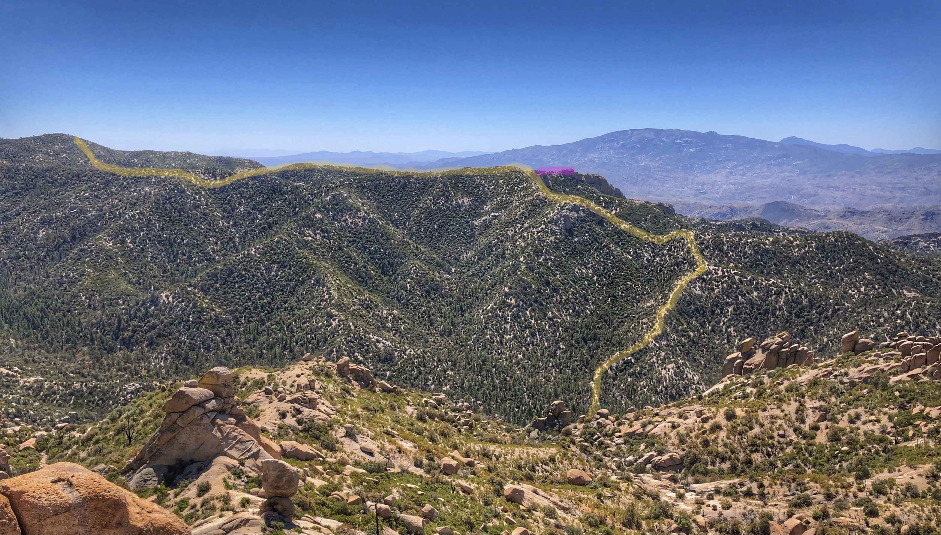 Drive up the Catalina Highway to the Green Mountain / Bug Spring trailhead, between Mile 11 and 12. The photo above, taken from the Hoodoo section of the Mt Lemmon road, shows the the route in yellow, starting up the Bug Spring trail, with the purple spur corresponding to the purple spur on the map.
 From the parking lot hike steeply up the Bug Spring trail to the highpoint where it turns right and heads downhill. Keep heading up and you’ll find yourself on a vague climbers trail that leads up to a bare ‘platform’. Looking left you see a strange rock thumb and a steep hillside with a rock band. Hike and scramble past the thumb, up through the rock band, to the top of the ridge.
Turn right and follow the ridge up to another ridge that heads to the left. (As you look to the right you’ll see a much easier looking traverse over to a lovely rocky outcrop – this is the purple spur in the map. You’ll probably never be here again so you might as well visit the outcrop and see the views from its top.)
Follow the ridge to the left picking your way through lots of manzanita bushes and other plants. Fortunately this area is too high for cactus. From now on, you follow ridge lines to their end, and at each end it becomes obvious how to connect to the next ridgeline, always heading in a general northeast direction towards Guthrie Mountain, and always up ridges covered with bushes.
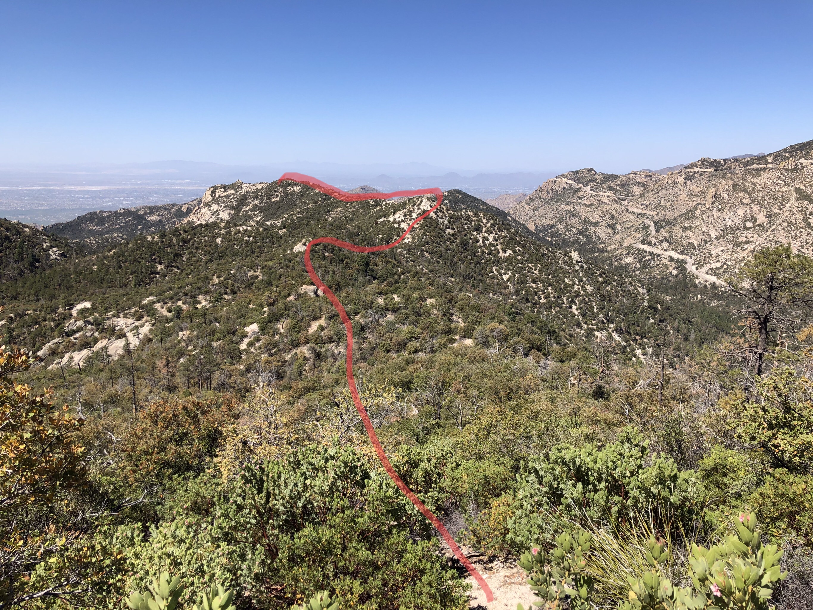 This looking-back picture gives a general impression of the subtlety and yet obviousness of connecting the ridges. Eventually you reach a point where Guthrie Mountain is directly ahead of you, but you are separated by a deep valley which you have to cross. Descending into the valley was the most difficult and least enjoyable part of the hike for me. Take whatever line you like to descend, then climb up the flank of Guthrie Mountain to the top, where you will meet the regular trail.
Follow the regular trail down the long ridge until you reach the obvious meeting point of the Guthrie Mountain and Green Mountain trails. Turn left and follow the trail back down the valley to your car.
