
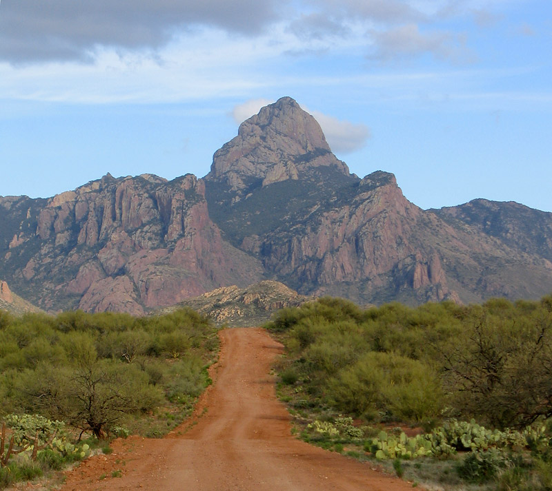
 This picture shows the dramatic Eastern view. However, I took the longer, Western, route to Baboquivari for two reasons. First, any passenger car can do the Western route whereas the Eastern route seems to require a high clearance 4 wheel drive vehicle. Second, the Eastern route requires more rock climbing and seems to have more difficult route navigation. I wanted things to be as easy as possible, even if the drive and hike were a little longer.
Directions
From Tucson, head west on Highway 86 (Ajo Highway) past Kitt Peak to Sells. Turn left (south) through Sells toward Topowa. About 9 miles from the turnoff is an obvious left turn beside a ranger station. You are apparently supposed to buy a pass here, but when I was there the ranger station was closed and there was nowhere I could see to leave money and get a pass. No one checked that I had a pass. The trailhead is about 12 miles from the ranger station.
 Drive down the good dirt road and after about 8 miles there is a major junction. There was a sign saying “Low” (for Low Clearance) and pointing to the right. Take the right fork if you are in a passenger car. The road heads off to the right and very gradually curves around left to the trailhead.
You will pass another obvious fork and there is a sign saying “Park” and pointing to the left. Take the left fork to Baboquivari Park. You will pass two more intersections where you stay on the main road but will have to make choices on the way out. Make a note of which fork you will have to take on the way out (left in both cases).
After a total of about 12 miles from the paved highway you will arrive at the trailhead, where there are obvious picnic areas and a fully functioning bathroom with flush toilets. I read that there is a $3 fee but I was told by the Park custodian, James Martinez, that there is no fee, just a form I had to fill in.
On the way out, take the left fork at the first two intersections, and the right fork at the intersection where the “Park” sign is, then the left fork where the “Low” sign is.
Hiking
From near the end of the parking area go up to the right and find an obvious trail leading towards the mountains. The starting point of the trail is not very obvious, but you can pretty much start anywhere and you’ll hit the trail. Follow the trail towards the mountains, crossing other trails (with signs where it might be confusing). The trail zig zags up the steep slope to the right then follows the edge of the hillside. As you approach the mountain you’ll go through a forest of burned and charred trees.
 Eventually you’ll end up below an obvious rock corner and slab that lead up to the left. Follow this (some easy climbing moves then mainly following a trail) to below the single rock climbing pitch. You’ll recognize this, the “Ladder Pitch” from various bits of metal. The pitch is quite short and was over before I expected. It’s given the rating of 5.5 or 5.6 but seems easier than that. Protection is from two bolt placements (one placement consisting of two bolts), I thought the hardest move was about 15 feet off the ground. There is a very good rap anchor for the way down.
After the Ladder Pitch you can leave your climbing gear and just hike to the top. Near the top you again pass through an area of charred and burned trees. Look back periodically and make a note of which way you came up as things look different when you are going down. People have obviously got lost on the way down as I saw a rappel sling down one gully, when the correct way was easy hiking.
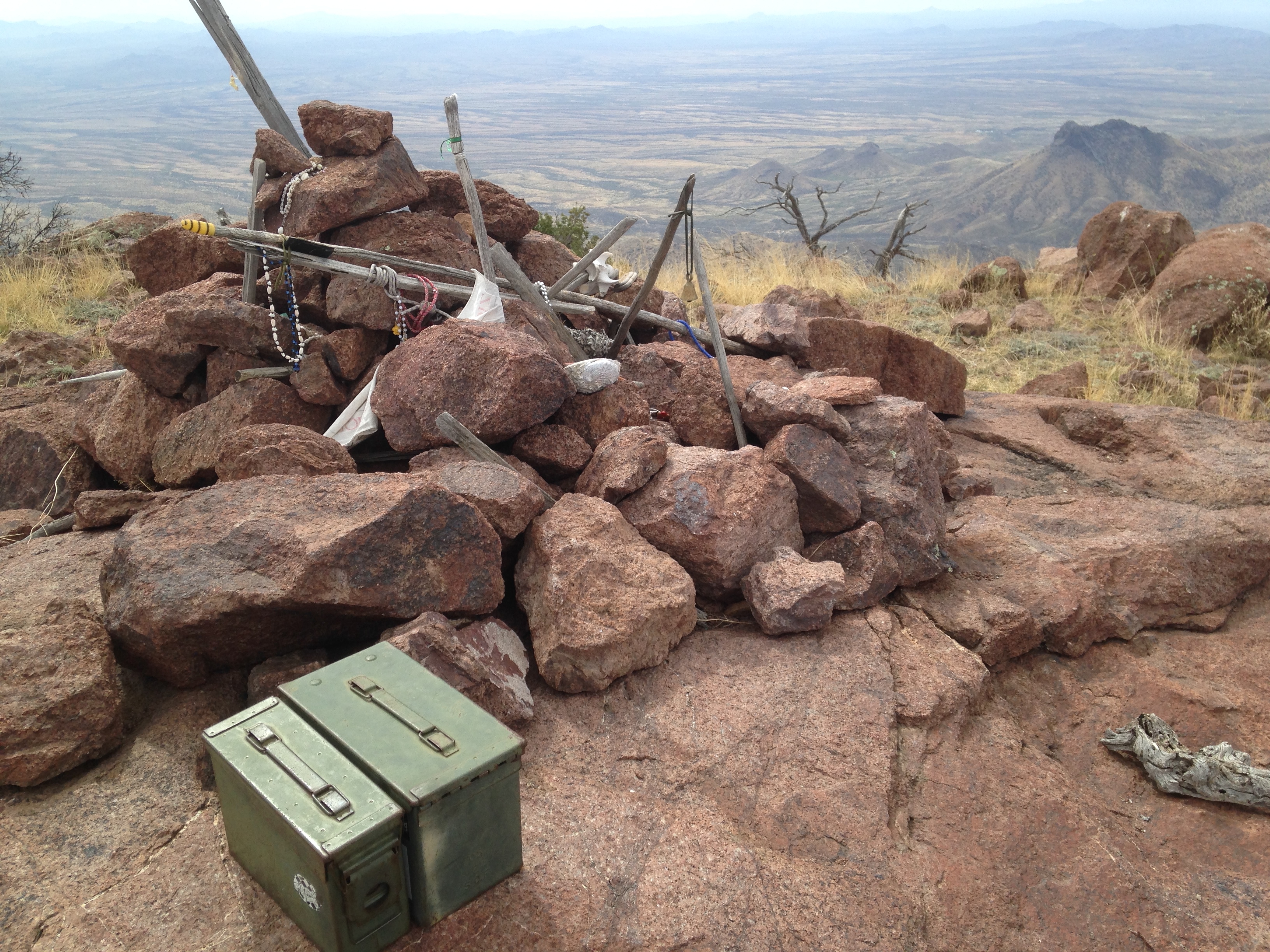 At the top people have left all sorts of things as offerings to the god I’itoi. You’ll find some around the summit stones and sticks, and others in the two ammunition boxes at the top.
Hiked this 3/30/2014
