
July-August 2018
There is so much incredible hiking in France, and I’m only going to mention a select few hikes.
Most trails are well marked, with signposts that tell you how long the hike (or section) will take, and often giving distance as well.
The IGN maps are fantastic for hiking, but in some ways even better is the iPhiGéNie app which uses the IGN maps and also GPS to show you exactly where you are on the trail. There’s an annual subscription to use the maps but if you intend to do much hiking in France the app is invaluable.
Okay, here is some basic information about a few hikes, ones that I would have been glad for more information on.
Canigou
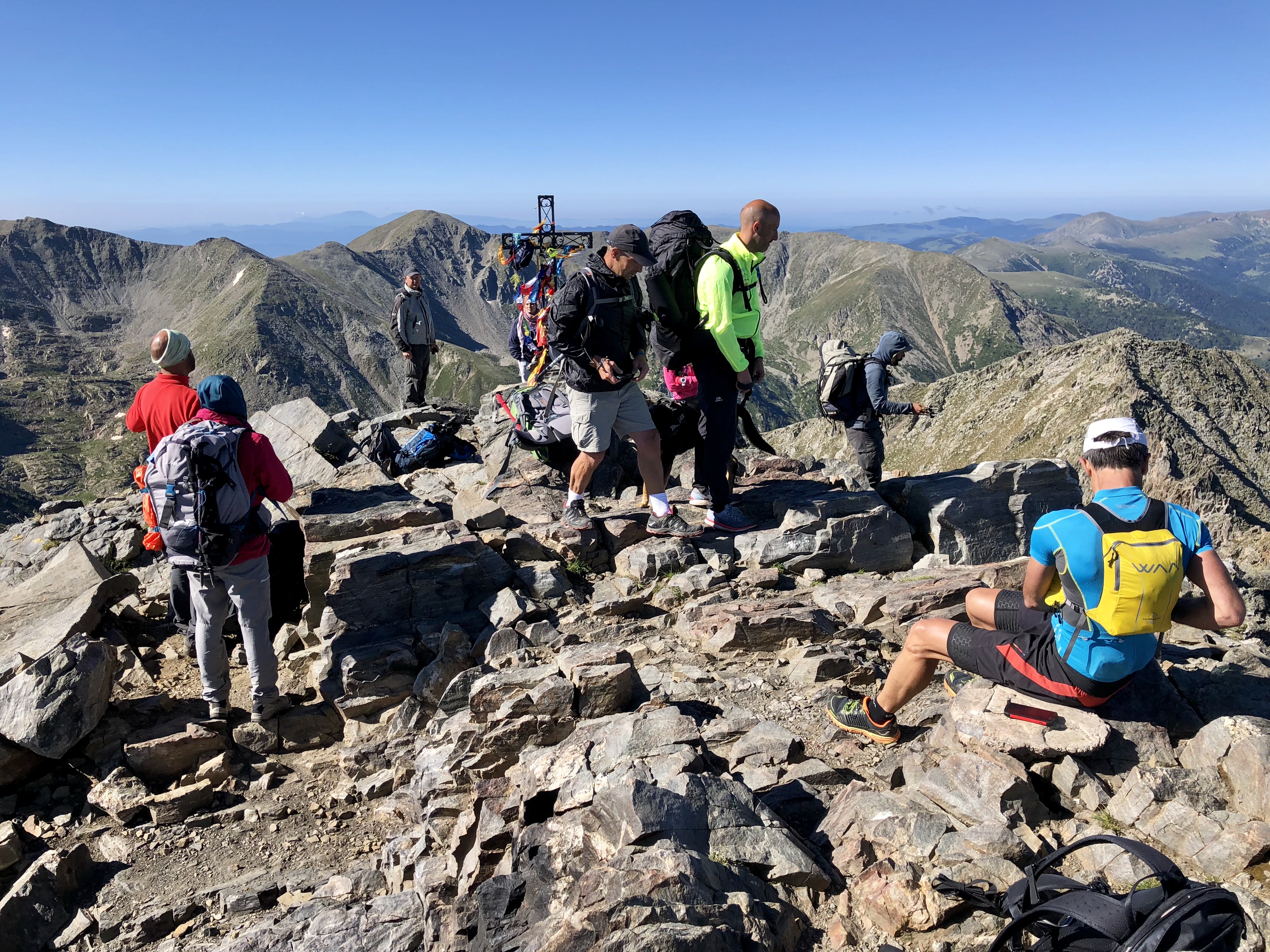
The summit of Canigou
Canigou is the big hulking mountain that dominates the Pyrénées-Orientales. Much of what you read about climbing Canigou seems intimidating, with talk of multi-day trips, but it’s really not that bad. The easiest way is to take a 4×4 taxi up to the Refuge des Cortalets but the classier way is to hike via the Refuge de Mariailles.
It’s not a particularly interesting hike except for the last section which involves some class 2 scrambling then a final section of class 3 scrambling to reach the summit.
Access
From Villefranche-de-Conflent take the D116 up through Vernet-les-Bains to Casteil, which you reach in 8 km. Continue up a paved one-lane road for just under 4 km to the Col de Jou.
You can park at the Col de Jou and walk, but a better option is to continue up the dirt road for 3.4 km to the large parking area at Randé. This road is a bit rocky in places but is easily driven in a normal passenger car.
In July and August Randé is as far as you can drive. Outside of these months, conditions permitting, you can drive another 2 km to the Refuge de Mariailles.
I drove to Randé and walked up the road to the Refuge – there didn’t seem any point in walking this part on the path.
The whole trip from Randé to the summit and back to Randé took me 6h 40m. However, the signs say that it is 40 minutes walk from Randé to the Refuge de Mariailles, then 4 hours from the Refuge to the top. As they say, your mileage may vary.
La Grande Moucherolle
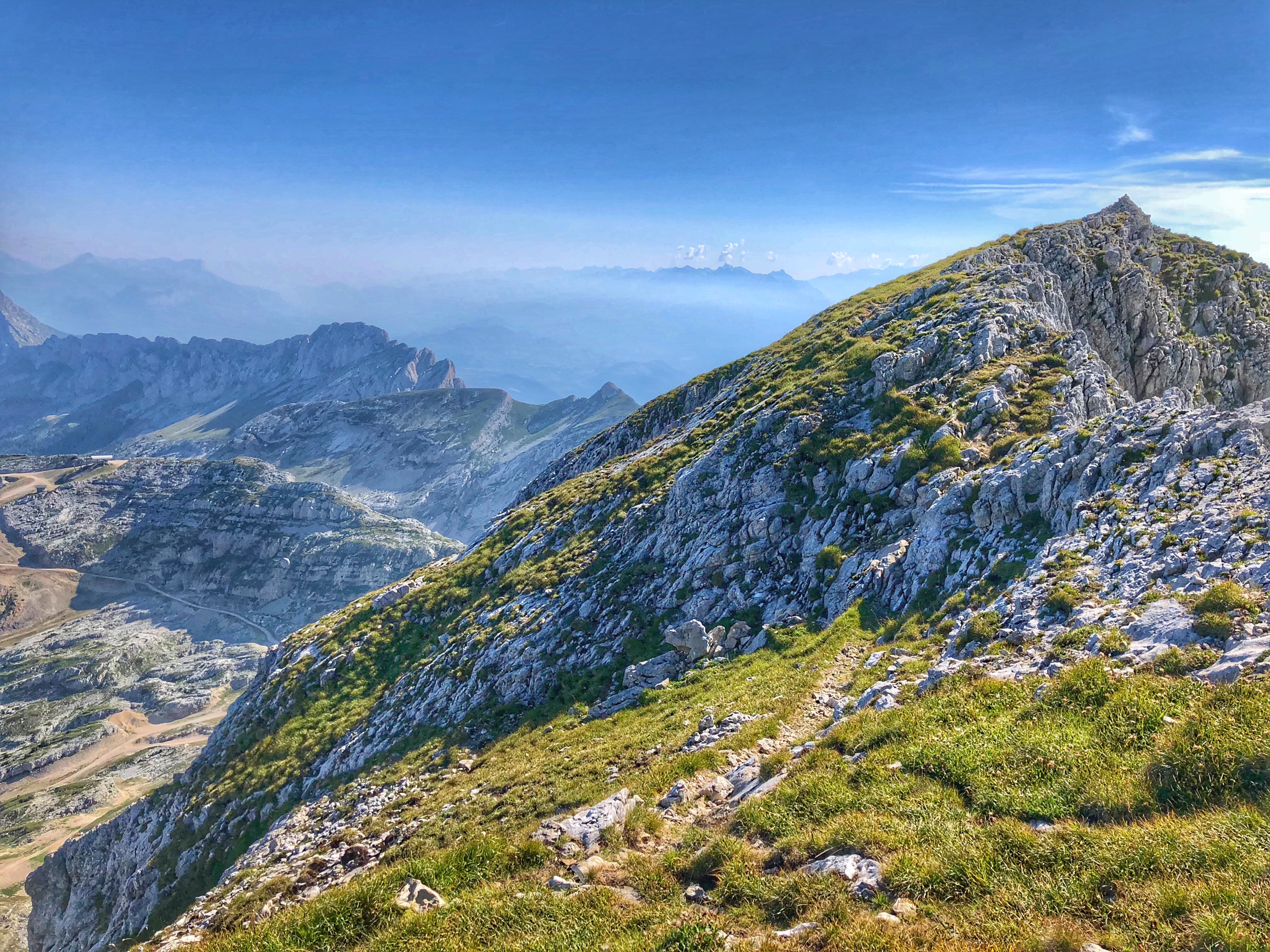
The summit of La Grande Moucherolle
We were staying near Lans-en-Vercors, to the southwest of Grenoble, and La Grande Moucherolle rather dominates the southern end of the wide valley. I’d done several of the other hikes in the area but really wanted to climb the Moucherolle.
The tourist office wouldn’t give me any information on the hike, saying that it was dangerous and they didn’t provide information about dangerous hikes!
Anyway, the easiest place to start is at the huge parking lot at Le Balcon de Villard then to walk south along ski area roads, then up to the Col des Moucherolles. (If you have the map Promenades et randonnées en Vercors: Quatre-Montagnes et Piémont Nord, you follow the trails for Les Marmottons, La Salamandre, Carrefour de l’Ours, Source Bressant, Col de Moucherolles. The map is available at the tourist office. The iPhiGéNie app provides the same info and also shows you where you are.
At the Col des Moucherolles you are faced with a decision – right or left. When I was there I was completely disoriented but fortunately the instruments don’t lie! To the right is the lower Petite Moucherolle, and to the left is the Grande Moucherolle. So turn left and make your way up the rocks to the top. There’s a bit of class 3 scrambling but it’s pretty easy and not scary.
The summit ridge is surprisingly narrow as you traverse it to the far end. Now you descend down a steep narrow ridge. It looks rather scary but fortunately the holds are all good, and the steep section is not very long. Soon you are a more normal trail which you follow down until you can descend to the Lac de la Moucherolle. From here you can descend the ski roads and return the way you came.
Overall it’s not a great hike, spending much too much time on gravelly ski roads, but the final ascent and descent of the peak provides just enough excitement to compensate for the tedious approach.
Update (August 2019): I climbed La Grande Moucherolle from Corrençon, which was more fun and eliminated the need to spend much time on gravelly ski roads. From the top of the Corrençon ski area, follow the gravel road between the chairlifts and up to the right. At the first big turn to the left you’ll see a yellow sign pointing to La Petite Moucherolle. Follow these signs up to the top of the Petite Moucherolle then descend a steep and scary looking ramp to the Col des Moucherolles, then walk and scramble up the Grande Moucherolle. Come back the same way. (Yes, I know that involves climbing back up the Petite Moucherolle but the alternative involves gravelly ski roads and still requires some uphill.) Added Bonus: Since you are going up to Combeauvieux on this hike, instead of heading to La Petite Moucherolle directly, you can instead head to the Col de la Balme then turn right and climb the Tête des Chaudières and the Rocher de la Balme (the slightly higher peak just behind), then come back to the Col de la Balme and head directly up the trail on the other side to reach the Petite Moucherolle.
When I was on the Grande Moucherolle this time, there was an older couple on top, and a young couple with a dog. I wondered how they could have done the class 3 scrambling. Well, it turns out they didn’t. They all headed down the grassy ridge so there is obviously another, easier way to climb the Grande Moucherolle than the classic way from the Col des Moucherolles. That’s all I can tell you, but I suspect the trail will be pretty obvious from the base.
Mont Bego

View from the top of Mont Bego
This fantastic hike is in the far southeast of France in the Alpes-Maritime, near the little hamlet of Castérino. It’s in a spectacular setting, in the Vallée des Merveilles (Valley of Marvels) in the Mercantour National Park. The hike took me 7h 20m round trip.
Drive up the D91 from St-Dalmas de Tende to the Lac des Mesches. Park here. There are two trails that head west and then join – the better one is up past the hydro-electric plant, around a couple of switchbacks. Head west and continue to the Refuge des Merveilles, in absolutely beautiful surroundings. Mont Bego is immediately to the north of you.
Cross the river below the dam and find the trail that leads diagonally up the slope to the left. (Don’t take the horizontal trail to the left. You will have to go slightly to the right to find the correct trail.) Once you have found the trail, follow it left then up the zig-zags, then further left, then up many more zig-zags. Eventually the trail stops zigging and zagging and you continue to the summit, with some scrambling up rocks just before the summit. Enjoy the wonderful views before heading back down.
Links and Other Clicks
The iPhiGéNie web page, with links to the Apple and Google app downloads.
the Alpes-Maritime department has some wonderful free books of hiking trails that you can pick up at the tourist offices. They also have a web page from which you can find the same information.
Canigou Links
A very good description of the hike up Canigou via the Refuge de Mariailles. If you press the button at the bottom labeled “Route (with map)” you will see the description with a map that shows the listed locations.
A good web site about the various ways to hike Canigou from Vernet-les-Bains.
The main Canigou tourist web site. There are some good links in the section labeled “Access the Canigou summit by car”.
