
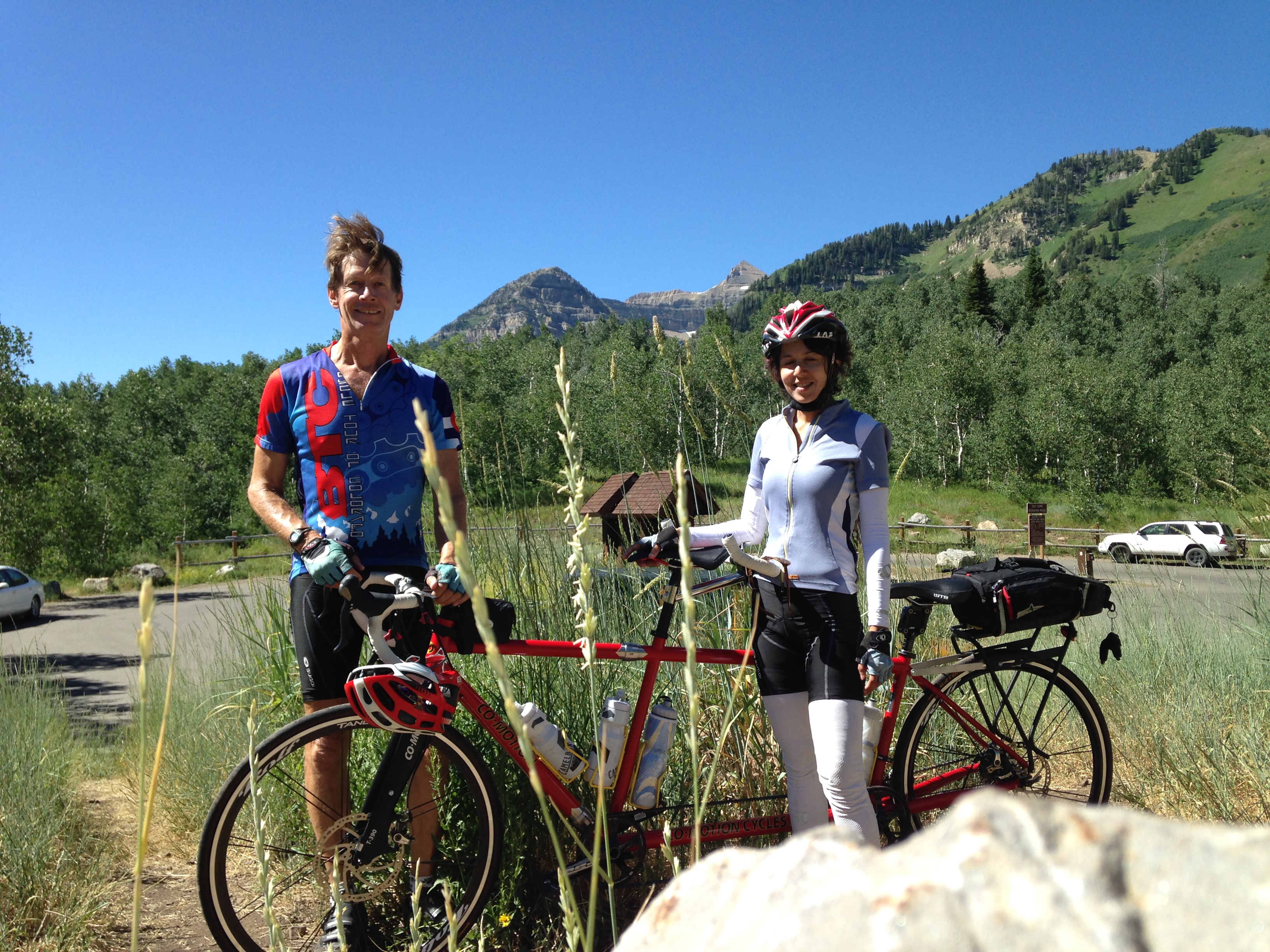
This page started with very brief descriptions of cycling climbs I did, or Tanya and I did on the tandem, in July and August, 2014. We took a road trip to Utah, then Wyoming, back to Utah, finishing in California. All the climbs are from the second edition of John Summerson’s book, The Complete Guide to Climbing (by Bike), and if the climb is in Summerson’s top 100 climbs, I’ve shown Summerson’s rating. For example, #14 means Summerson rates the climb as the 14th hardest in the U.S.
Besides the difficulty ranking, I also show the uphill mileage, and the number of feet climbed for each ride. For example, Big Cottonwood Canyon gets (#35, 17.1m, 4,814′)).
I won’t repeat information Summerson gives in his book, but instead I’m just giving my impressions of the climbs.
Update: Okay, so I’ve ridden in Utah since 2014, but again, doing Summerson climbs. Not that you care when I did them, but I will note the year for these later ones. I will also describe the starting point for the climbs. For more detailed descriptions it’s best to buy Summerson’s book. I’ve also added a link to a page about riding the White Rim Trail starting in Moab.
Utah
The White Rim Trail from Moab
I have a separate page for this.
Salt Lake City Area

Big Cottonwood Canyon (#35, 17.1m, 4,814′). A great climb that follows Big Cottonwood Canyon almost to the top, but just before the Brighton Ski area you turn left and climb out of the valley. This is the best part of the climb and gives you beautiful views. After some very steep sections interspersed with easier angles, you arrive at the top of Guardsman Pass. The first few miles of this ride felt a bit dangerous as we were riding directly into the sun. If you are driving to the start, there’s a big paved Park & Ride at the NE corner of Wasatch Blvd and Big Cottonwood Canyon.
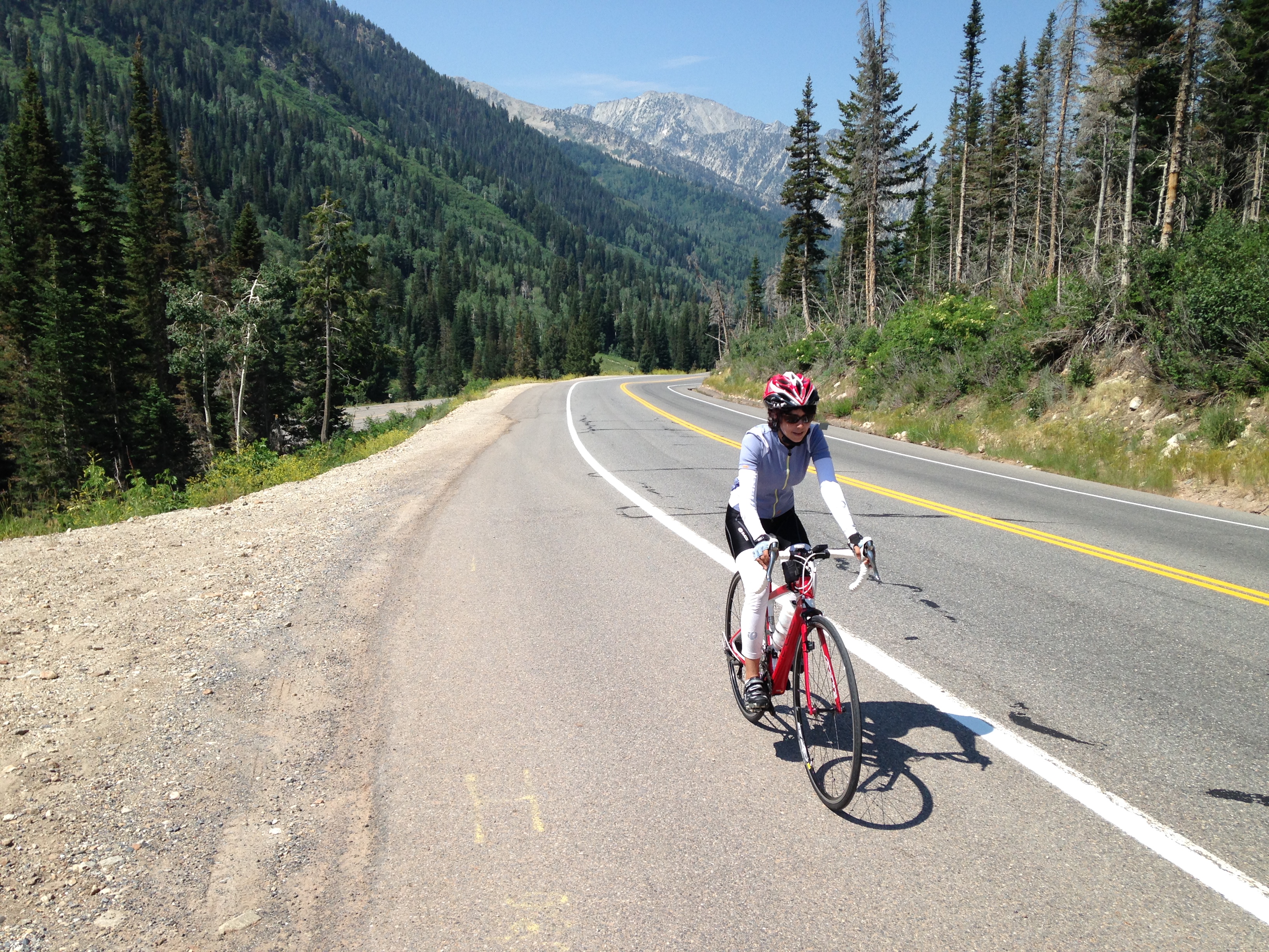
Little Cottonwood Canyon (#44, 8.6m, 3,390′). I loved this climb. The canyon is beautiful, the road surface is excellent, and the views are wonderful. It was so good I rode it twice, once by myself and once with Tanya.
If you are driving to the ride, there’s a small paved parking area at the Bell Canyon Trailhead on Little Cottonwood Canyon Road, just east of Wasatch Blvd, and a much larger dirt parking area just west of Wasatch Blvd.

Not my photo – and not the same time of year!
Millcreek Canyon (8.8m, 2,522′). A very pretty and wooded canyon, it’s very different to the more wide open and less vegetated canyons around here. For some reason it made me think of Lord of the Rings. Not nearly as difficult as the Cottonwood Canyons.
Start at the intersection of Wasatch Blvd and E 3800 S. Go east on 3800, which becomes Millcreek Canyon Road.
Alpine Summit
Alpine Summit (34.6m over-and-back, 5,816′). This was a great ride. We rode Alpine Summit from the west side, then went down the other side, past Sundance (it surprised me to learn that the Sundance Film Festival is based in Park City, not Sundance) to Highway 189. Then we turned round and rode back the way we had come. The steepest part of the whole ride is the two miles back up to Sundance. The scenery is really beautiful, with spectacular views of the Wasatch mountains.
From the intersection of I-15 and Hwy 92, head east on Hwy 92 for about 7 miles to Canyon Road on the right (there is a big parking lot on the left). Continue up to the entrance of canyon then you’ll see a Park-n-Ride lot on the right, below high cliffs. Park here then continue up the canyon.
Empire Pass North (5.6m, 2,094′). A short but steep climb out of Park City to the top of Empire Pass. It doesn’t have the feel of the great outdoors, but is worth doing if you are in the area. I’m told a better way up is to ride Royal Street from the Deer Valley Resort instead of Marsac Avenue – more twisty and less busy.
Empire Pass South (#39, 7.7m, 3,181′). Let the winner of the 2013 and 2014 Tour of Utah, Tom Danielson, describe this climb. “I’d say Empire Pass is probably my favorite climb in the entire world. It’s really, really steep, so you are using arms, and that takes a lot of oxygen out of your body that you have to use for your legs. So it really puts a strain on your lungs and makes it a unique climb.” I agree. I was standing using a 34×32 gear and still barely able to move upwards.
Start at the intersection of Pine Canyon Road and Warm Springs Drive (Hwy 222) just north of Midway, UT. Or, if you are starting from the top, descend to this obvious intersection where the road becomes flat.
(Update August 2020: this road has been repaved since I rode it in 2014 and is a delight to ride. I think that this climb up to the intersection with the Guardsman Pass road is probably the best ride around Salt Lake City. It’s beautiful, it’s twisty, the road surface is fantastic, and the super steep sections are interspersed with easier parts where you can somewhat recover. It’s both an amazing climb and a delightful descent.)

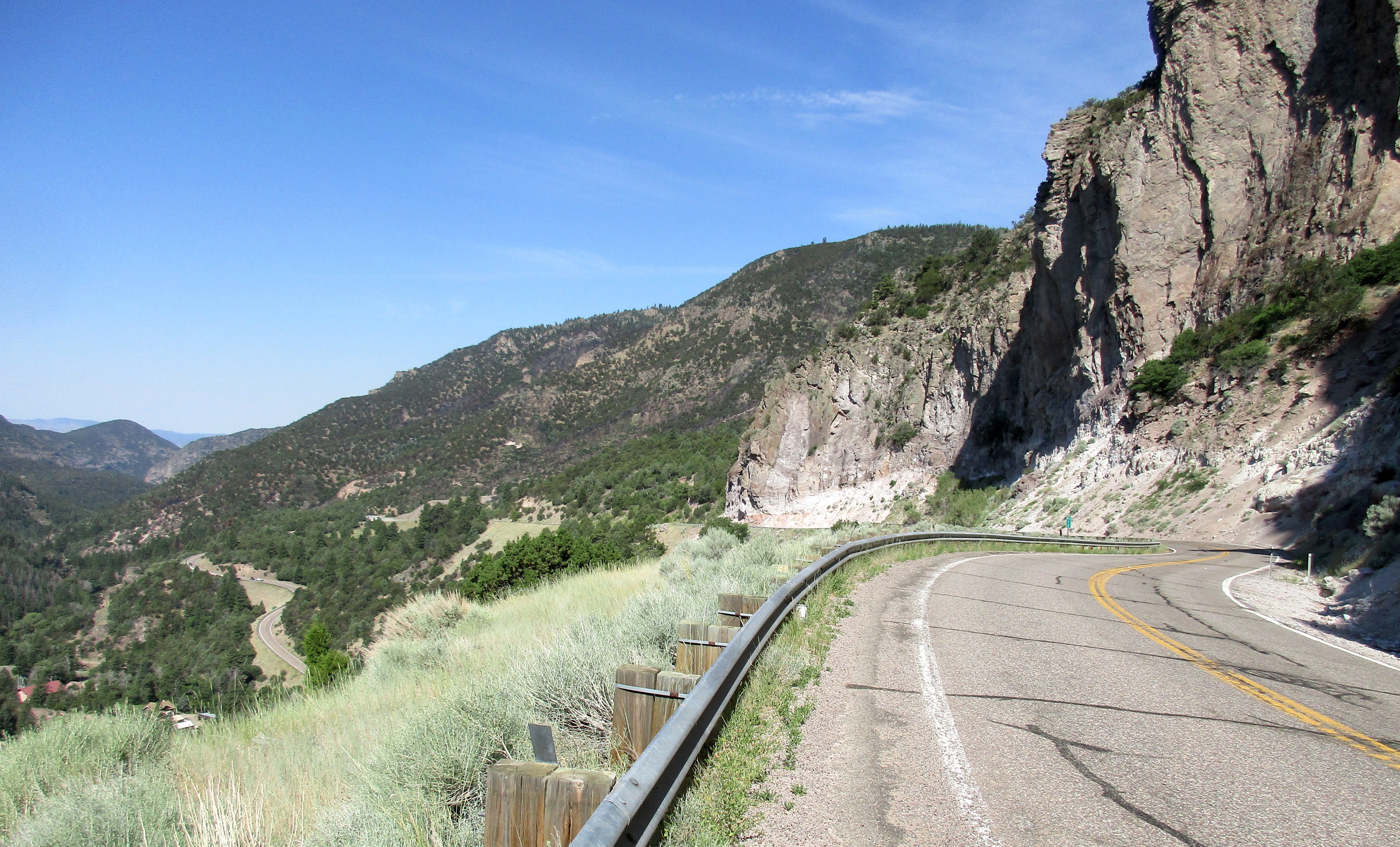
Guardsman Pass East (#10, 8.6m, 3,948′). This is basically Empire Pass with a more difficult finish. You do all the hard climbing on Empire Pass, then where Empire heads over to Park City, you instead continue another 1.5 miles up a very steep and rather rough road to the top of Guardsman Pass. If you do this you can basically say you’ve also done Empire Pass as the Empire finish is pretty easy.
(Update August 2020: the upper 1.5 miles was very rough in 2014 but has been repaved and is now beautifully smooth. The lower section, the main climb of Empire Pass, has also been repaved and is a delight to ride.)
(Update 2 August 2020: I rode Big Cottonwood Canyon – Guardsman Pass East as an over-and-back, which gives a brutally difficult ride of about 51.4 miles with 8,732 feet of climbing.

Powder Mountain (#19, 6.0m, 3,179′). The way Summerson describes Powder Mountain will make a cyclist drool: “There is a monster loose in northern Utah. One of the most difficult overall climbs and with perhaps the most difficult finish in the United States.”
How could you not want to ride this after such a description? It’s definitely a good hard climb, relentlessly steep for a long way. I found it considerably harder than Empire Pass / Guardsman Pass East.
If you are driving to the start, at Eden Meadows, at the intersection of Hwys 162 and 158, turn left on 162 and in a couple of hundred yards there is a big dirt Park-n-Ride on the right hand side. Park here then go back to the intersection and turn left and ride up Hwy 158. This adds about 1.4 miles to the climb.
Extra Credit: Since you are in the area, you might as well climb N. Ogden Canyon Road. This is the spectacular road that slashes up and left across the hillside on the other side of the valley, that you can see from the Powder Mountain road. Drive NW on Hwy 162 to the T-junction in Liberty. Turn left then drive to just before the road steepens. The climb is about 2 miles with about 900 feet of climbing, and has plenty of 10%.
Miscellaneous
143 North (#33, 13.9m, 4,339′). “A contender for the most difficult ascent in southern Utah,” according to Summerson. The first nine miles are reasonable grade, then things kick up for a couple of miles until you reach the small town of Brian Head. The road flattens out then gets steeper to the top. Not the most amazing climb but worth doing if you are in the area. Start in Parowan at the corner of Hwy 143 and City View Drive then continue up 143.
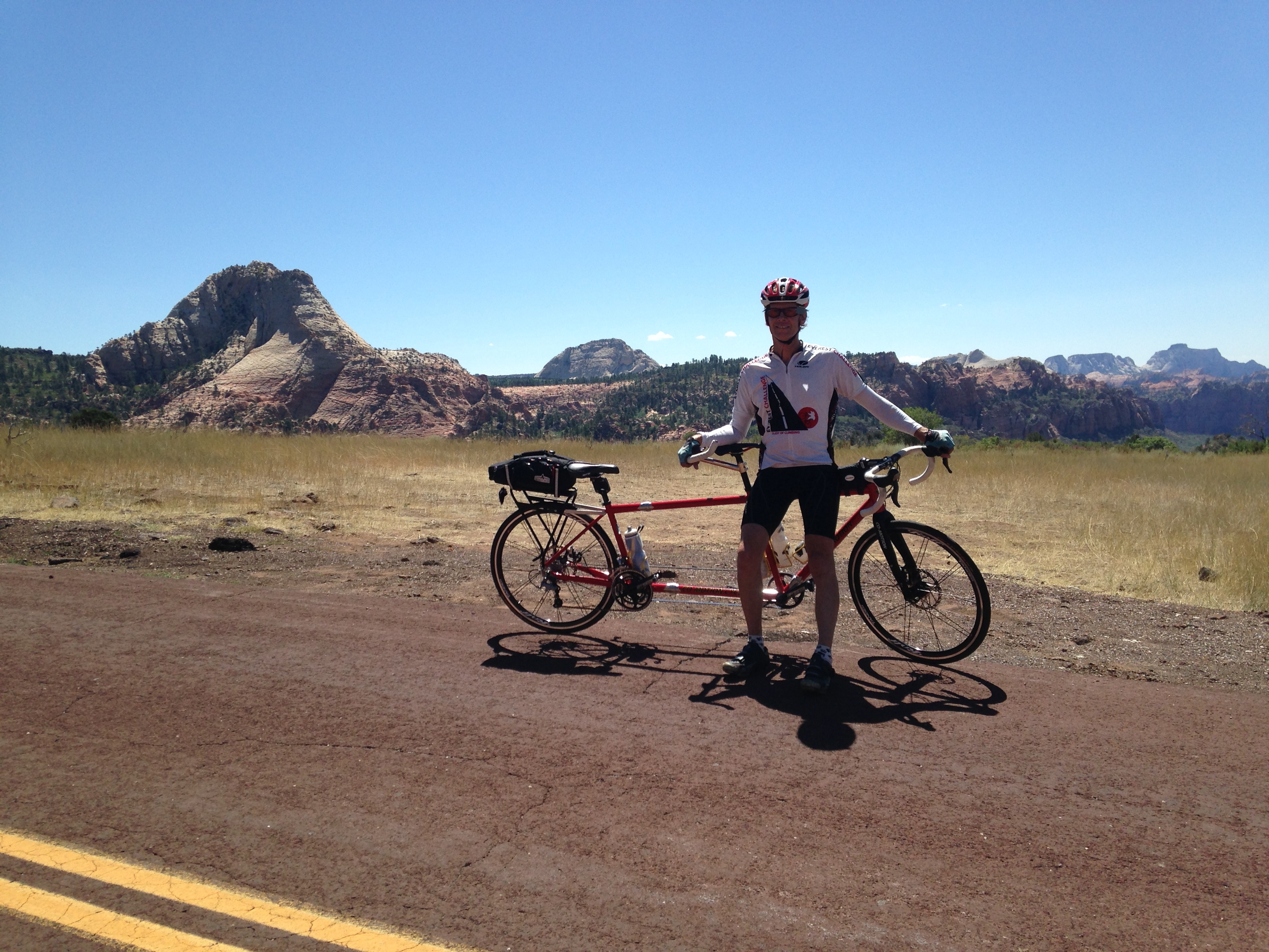 Kolob Reservoir (#80, 14.9m, 4,150′). Very different to all the other climbs described here because it’s in true desert country, just a short distance from Zion National Park.
It’s very steep in places and with wonderful views of sandstone cliffs. We did it on a tandem, which was really hard on those steep sections. Definitely worth doing for the scenery. From Virgin, UT, drive north on Kolob Reservoir Road for 4.4 miles to begin the climb, or just start in Virgin.
 153/Elk Meadows (Eagle Point) (17.8m, 4,266′). Rode in 2017. Summerson starts a bit east of Beaver but you might as well start in the town. The first half is pretty easy as it follows the river valley gently uphill, then a bit after MM 10 you do two big switchbacks to leave the valley.
Now the climb gets interesting and much prettier. After the second switchback you follow a shelf below cliffs then at MM 14 the road flattens for a couple of miles before rearing up again, with some solid 10-11%. Around MM 19 you reach the Eagle Point ski area and just after MM 19 turn left on Upper Meadows Road. This starts steep then eases off and about a mile up the hill you reach the finish at the Skyline Lodge parking lot at the top of one of the chairlifts.
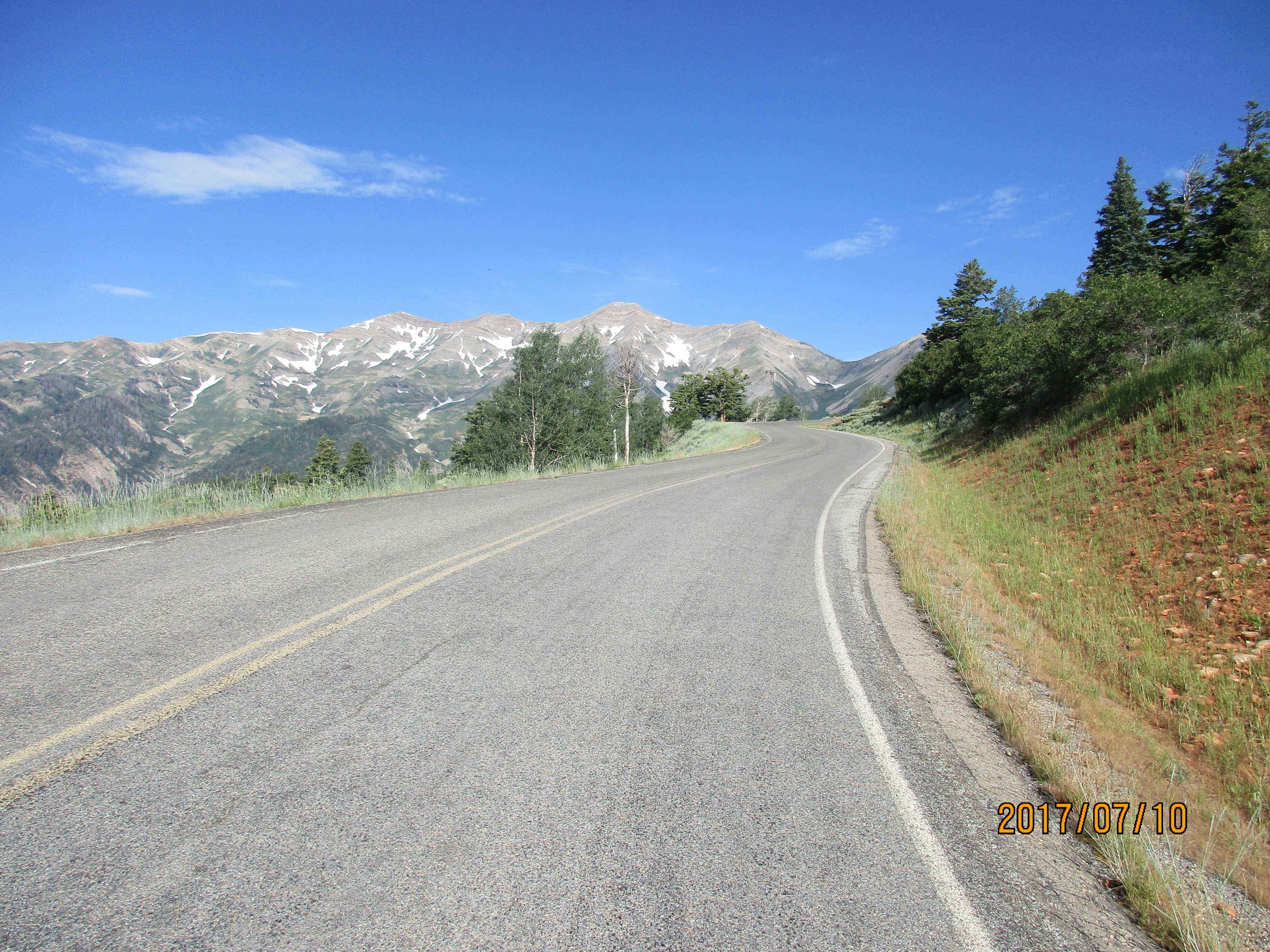
Nebo Loop Scenic Byway. This road bypasses the hulking mass of Mt Nebo to the east. You can do the climb from Nephi or Payson, or do an over-and-back, giving you two climbs for the price of one. This is what I did on 7/10/17, starting in Nephi. It’s about 81.6 miles with 9,750 feet of climbing.
The first few miles from Nephi are gently uphill, then just before mile 5 turn left on the Nebo Loop Scenic Byway. The next three miles are also gently uphill but then the gradient increases. It’s a lovely climb, interesting with gorgeous views of the east side of Mount Nebo, and plenty of steep climbing, sometimes between 8-9% and sometimes 10-11%.
You reach the summit about 18.6 miles from Nephi, or 13.8 miles from the turnoff. Now head downhill towards Payson. There are some vast panoramas as you descend, but I thought the south side was more interesting. Turn around once you reach the houses in Payson and retrace your steps. I found the climb from Payson less interesting and more tedious.
This is a long ride so having enough water is important. Fortunately, about 10.7 miles from the top there is a turnoff to the left to the Payson Lakes Campground. As you pass the campground pay booth, take the left fork, then in about 50 feet there is a water tap on the right.
Obviously you can do this out-and-back from either side but I recommend doing it from the Nephi side. This side is steeper and better to do while you are fresh. Also, it’s a more sensible direction if you plan on refilling your water bottles at Payson Lakes Campground.
