
Note: MM = Mile Marker
Tucson
I have a page devoted to cycling around Tucson.
Phoenix area
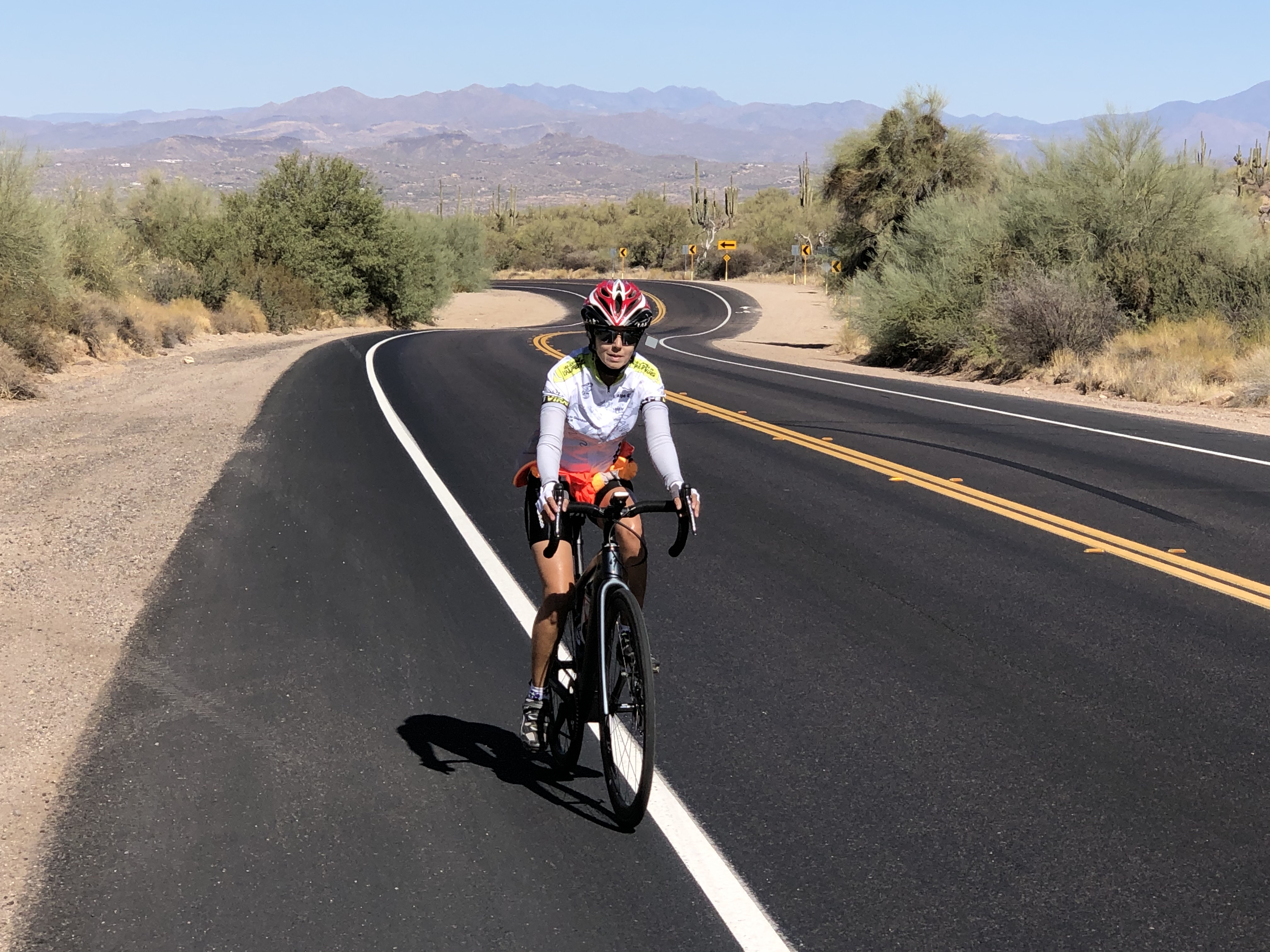
Greater Phoenix is a huge area and while I wouldn’t particularly want to cycle in the busy parts of the city, there are some good rides on the outskirts. Here are three.
Bartlett Lake
 This is a lovely ride with some beautiful views. It starts in a somewhat residential area but soon enters the desert. The ride as we did it was 35 miles with about 3,700 feet of climbing.
You can certainly make this ride longer but the extra cycling is perhaps less enjoyable than the ride as described. We parked in a huge parking lot at Our Lady of Joy Catholic Church at the intersection of N. Pima and Cave Creek Road.
Ride east along Cave Creek Road with a great bike lane through a somewhat residential area for just over 4 miles. At this point the road to Bartlett Lake bears off to the right, enters the true desert, and starts heading downhill.
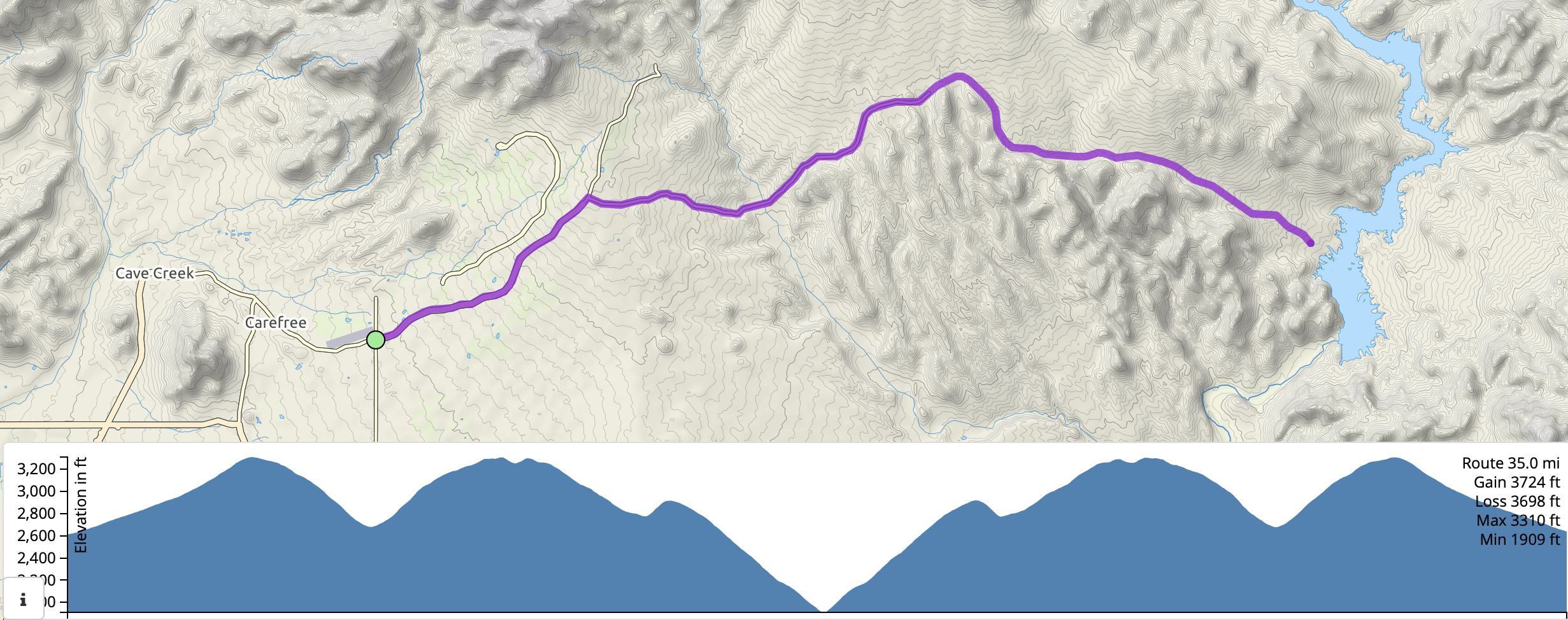 After about 3 miles you start climbing for another three miles, then have a long downhill, broken by a short uphill, down to the marina at Bartlett Lake. Enjoy the views then ride back the way you came.
The views seem prettier on the way back, mainly because you don’t have the sun in your eyes so the colors are richer. One thing to be aware of while doing this ride is the cars/trucks pulling trailers with boats. The trailers are wider than the cars and sometimes the trailers came distressingly close to us as we were riding.
Usery Pass and Bush Highway
 This is an enjoyable ride that goes over Usery Pass then along Bush Highway and past Saguaro Lake, before returning the same way. This ride is often included as part of a longer loop, but this involves riding on busier roads so we chose to ride this as an out and back. The ride as described is about 33.3 miles with 2,200 feet of climbing.
We parked in a large dirt parking area at the N.E. corner of the intersection of N. Ellsworth Rd & E. McKellips Rd.
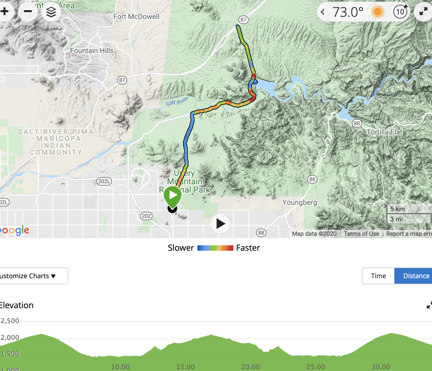 Climb North on N. Ellsworth road up past lots of very fancy houses. You soon enter Usery Mountain Recreation Area, where the houses stop and the desert begins. Continue over Usery Pass and down the other side to the 4-way stop at Bush Highway, which you reach about 7 miles after the start.
Turn right and follow the delightful Bush Highway as it twists and turns and rolls, until you reach Saguaro Lake in another 6 miles. At this point the lovely bike lane pretty much disappears, and you continue riding for another 4 miles to Hwy 87.
Turn round and ride back the way you came, perhaps with a little detour down to the marina at Saguaro Lake to enjoy the view. And remember to turn left at the 4-way stop and head back up over Usery Pass.
South Mountain Park Summit
 This is a fun climb up to the radio and TV towers at the high point of South Mountain Park on the south side of Phoenix. The road twists and turns and goes in seemingly random directions before you finally reach the top. The out-and-back ride is 13.9 miles with about 1,400 feet of climbing.
 We parked at the South Mountain Ranger Station, which is where the climbing starts, although you can obviously start much further out.
Continue up the road, initially following signs for the Summit, and later on following signs for the TV towers, although the direction to go is always pretty obvious. The gradient varies and even includes some short sections of downhill.
At the top there is a large parking areas and if you are lucky you may see people paragliding from here.
Prescott
Skull Valley Loop
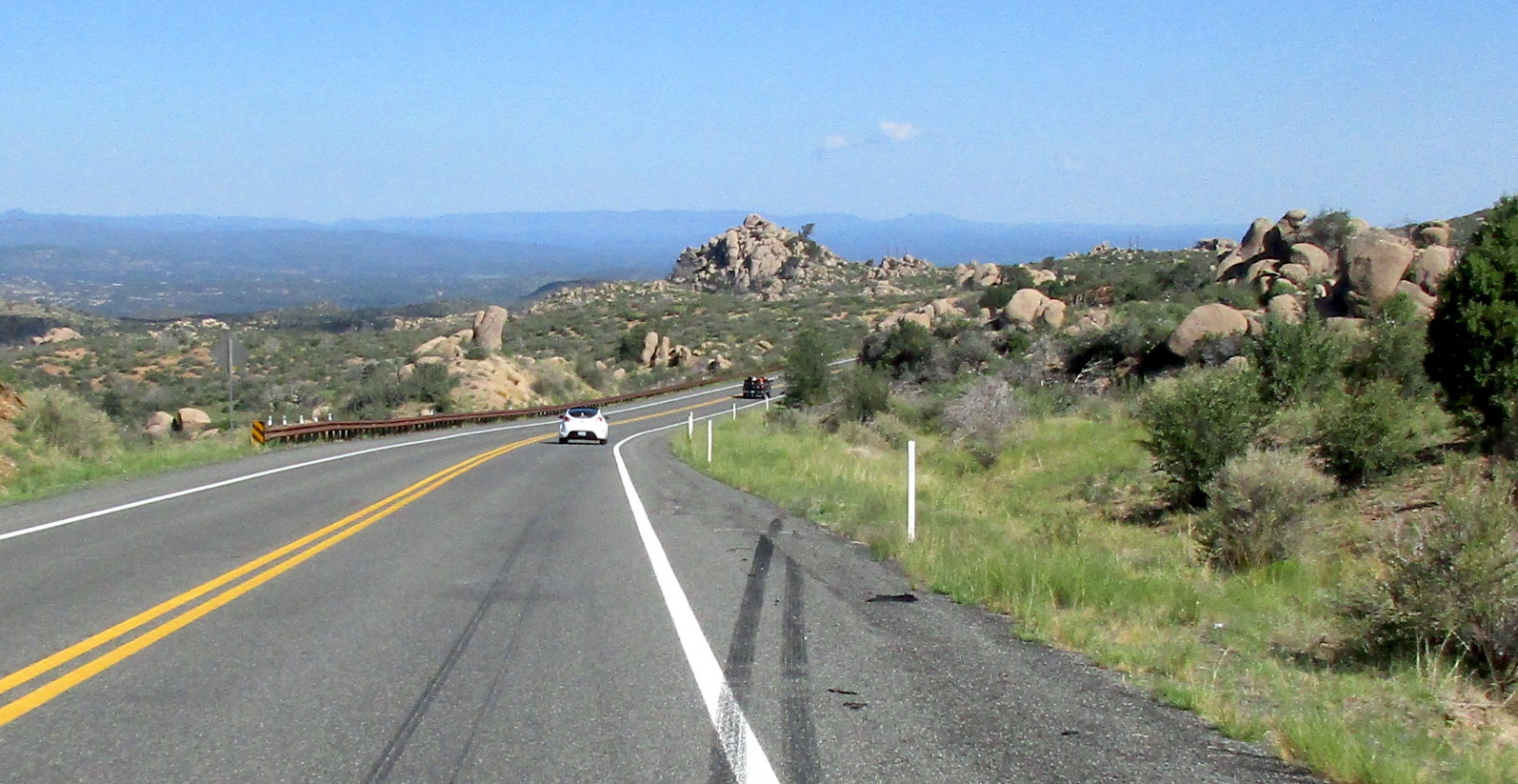 The best-known loop in the Prescott area is the Skull Valley Loop, which is 52.6 miles with about 3,553′ of climbing. While never dramatic or particularly steep, it goes through some pretty country. It’s a very easy loop to follow, with very few decisions to make.
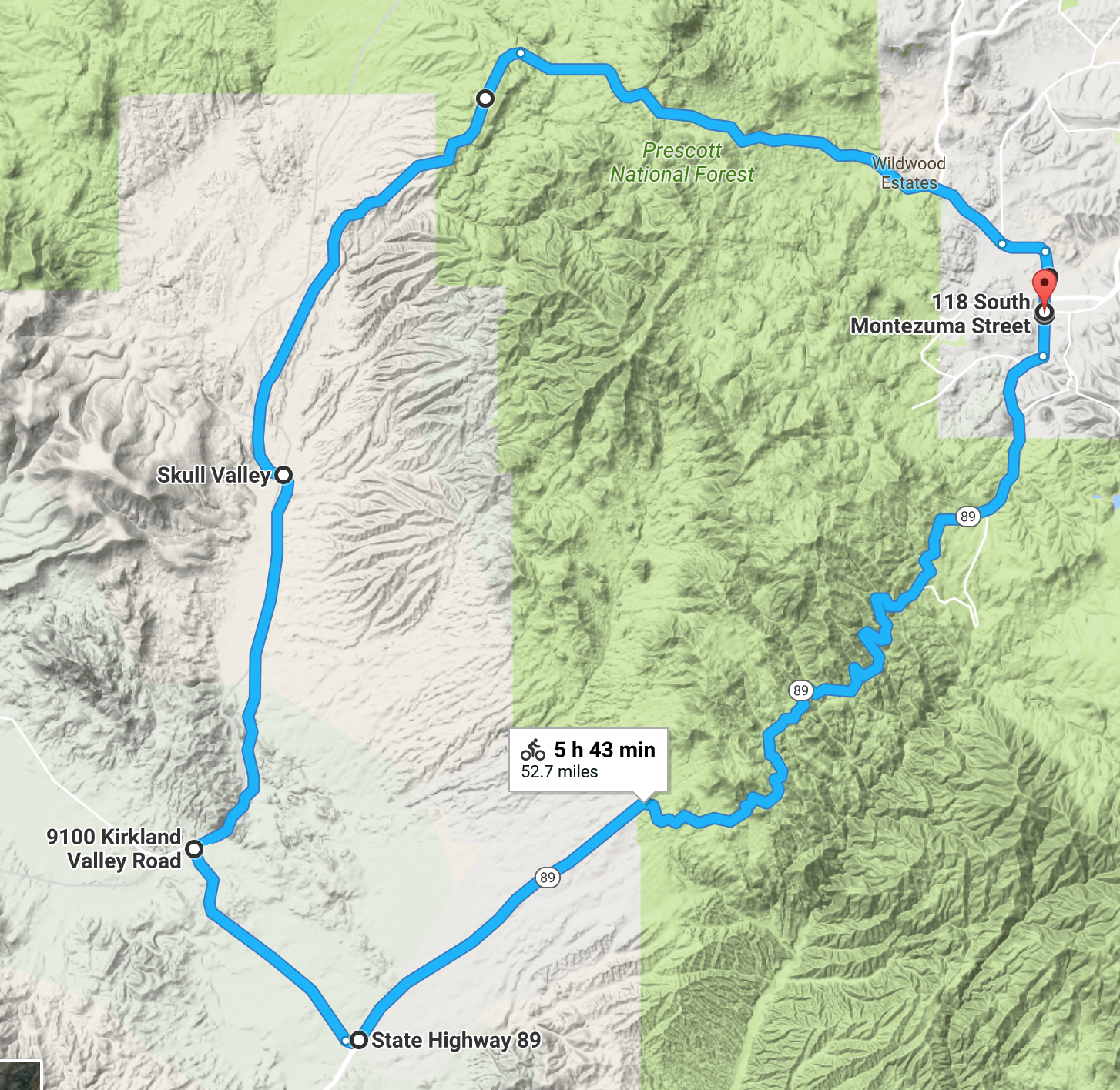 Start in downtown Prescott, at the corner of Montezuma & West Gurley, by Courthouse Square. Head north on Montezuma and follow it as it turns west and becomes Whipple St then Iron Springs Rd. The first 3 miles are built up and commercial, then you enter the countryside. After some initial climbing you do a long, long descent into a wide-open valley covered with small bushes and dotted with rocks and boulders.
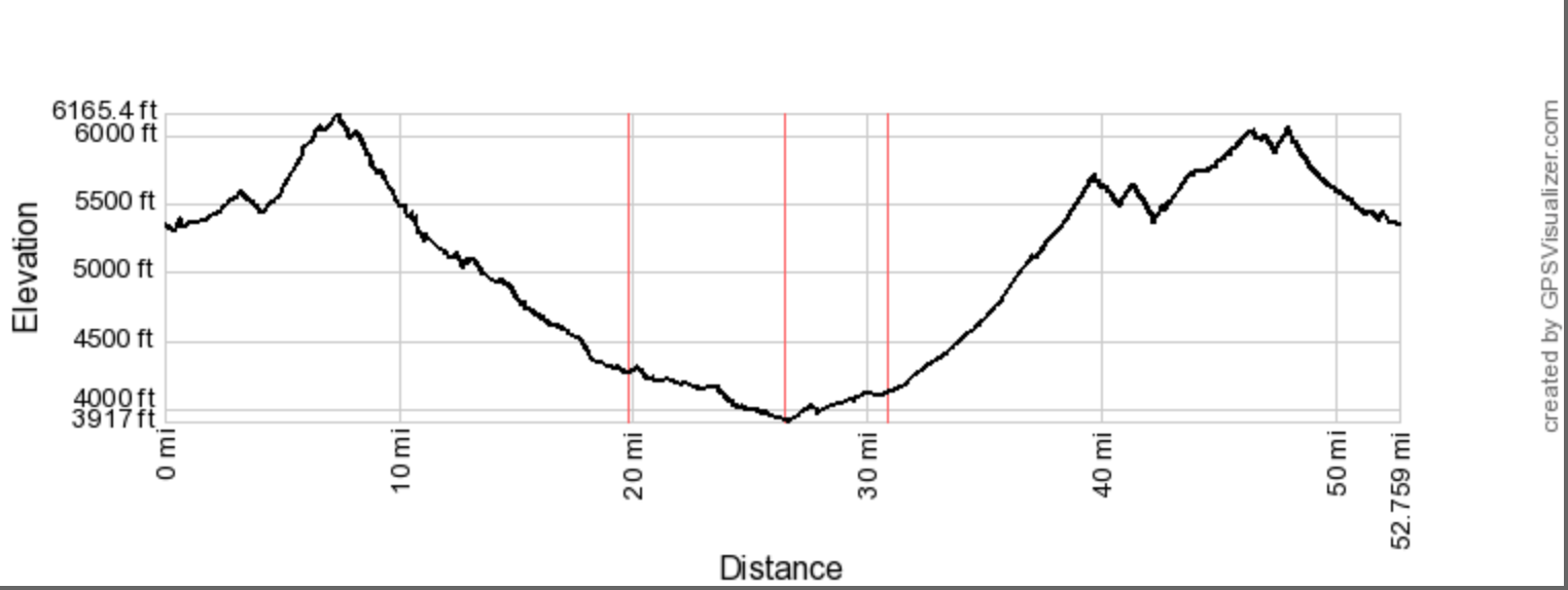 After 19.5 miles you reach the small village of Skull Valley, then after 26.4 miles you reach a Stop sign and T-junction. Turn left here onto Kirkland Valley Rd, then after 30.8 miles you reach another Stop sign and T-junction. Turn left onto Hwy 89.
Keep riding up the gentle hill until at about mile 37 you start climbing the lovely mountain curves. Eventually the road starts rolling, but still mainly climbing until you finally reach the downhill back into Prescott at around 48 miles. Follow the road as it becomes White Spar Rd then Montezuma St.
Sedona area
May 2021. Sedona is much better know for its mountain biking than its road riding. The major roads around the area are heavily trafficked, but there are some delightful shorter rides off the major roads that you can put together. I don’t particularly like riding on busy roads so we generally drove to the small, more interesting rides, and that’s the way they are described here. Obviously you can ride the busier roads like 89A to get to the start of these rides.
Jerome and Mingus Mountain
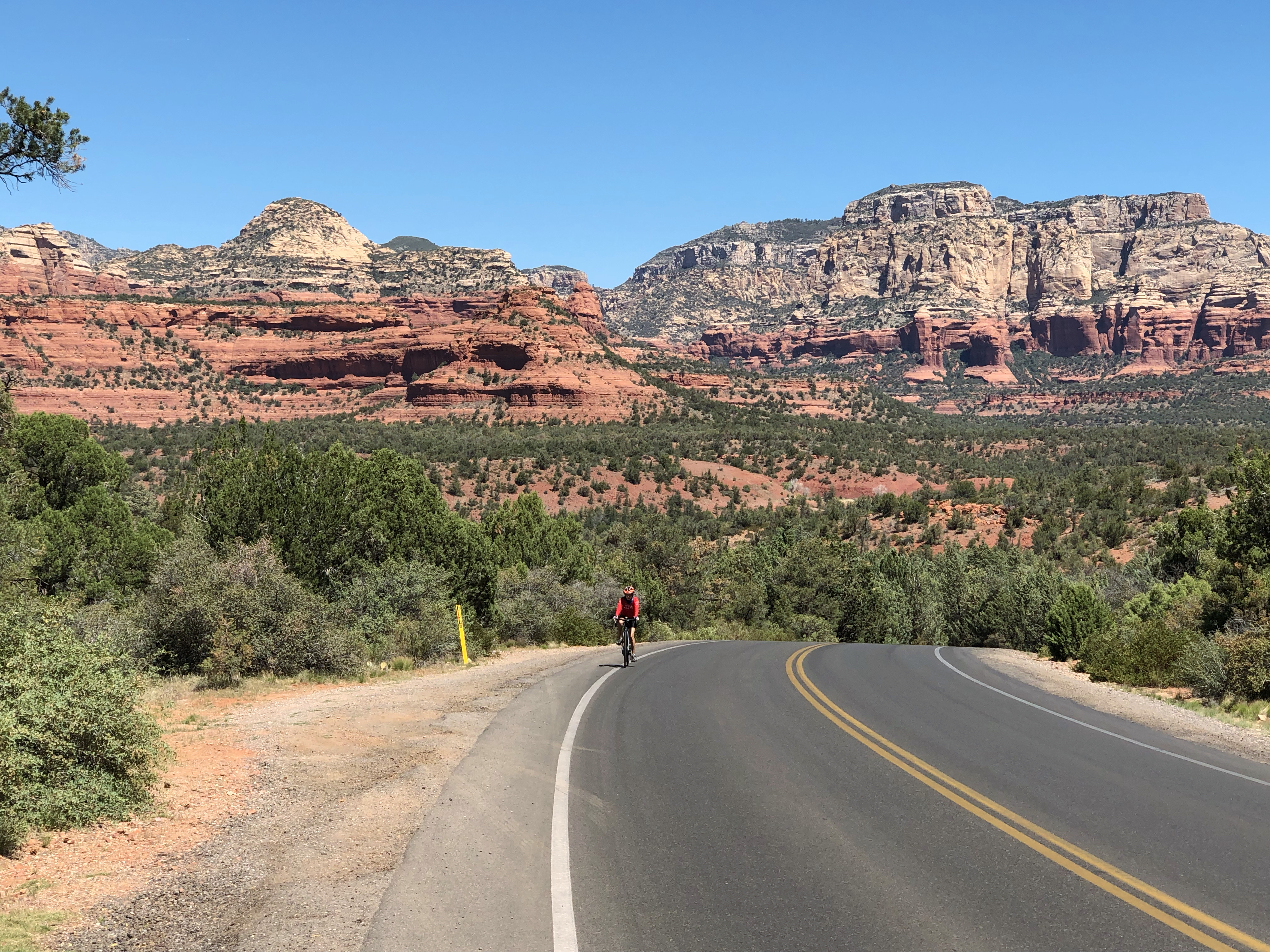
 Okay, having just said I don’t like roads like Hwy 89A, I have to immediately backtrack because if you like to climb, Hwy 89A from Clarkdale through Jerome to near Mingus Lake is the best climb in the area. It goes through the old copper mining town of Jerome, now a tourist destination, up through a beautiful canyon, and up through pine forests. The whole climb is about 13.9 miles and 3,824 feet of ascent.
Park near the the roundabout on 89A and Clarkdale Parkway and #1 Food Store. This is where 89A heads up into the hills towards Jerome. There is parking on the dirt lot by the gas station (ask permission), and there are two dirt pullouts west of the roundabout on Cement Plant Road.
As you enter the center of Jerome after about 4 miles, you’ll meet the steepest part of the climb, about 11%. Wander up through Jerome’s 1-way system, following signs for Prescott. As you leave Jerome you’ll enter the dramatic canyon shown in the photo. At about 9 miles there’s a short downhill, then 3 more miles of uphill before you reach the crest of the hill on 89A, with signs for Potato Patch campground on the right and Mingus Recreation Area on the left. At this point you’ve ridden about 12.4 miles and climbed 3,330 feet.
But you are not done yet. Turn left on Forest Road 104, and after 100 feet of rough road you are now on a beautifully smooth road that climbs and climbs until finally the road turns to dirt at a cattle guard, about one mile before Mingus Lake. You are now done with the climb. Turn around and enjoy a wonderfully fast descent with beautiful views.
Perkinsville Road
 This is a gravel ride that leaves Jerome and heads northwest into the hills. It’s not a very interesting ride, but is something to do if you are here with a gravel bike.
Perkinsville Road leaves Jerome at the apex of the big left turn as you head up and out of Jerome, just beside the fire station. Park in the big public, overflow parking lot a hundred yards up the road.
The start of the ride is paved but will soon hit you with an 18% wall just before you the pavement turns to gravel. The next section climbs quite steeply until at about mile 3.5 you have basically finished climbing. The rest of the way is mainly downhill until you reach the Verde River and the one-lane bridge across it. Cross the bridge then turn around at the T-junction and ride mainly uphill back to the car. The whole out-and-back ride is 32.5 miles, with about 830 feet of climbing on the way out, and 1,120 feet of climbing on the way back.
The dirt road continues past the Verde River, and there are other dirt roads that head down to Chino Valley, but the river seemed a good turnaround point to me.
Oak Creek to Sedona
 Another exception to not riding on the major roads is Hwy 179 between the Village of Oak Creek and Sedona. We parked at the Bell Rock parking area just north of Oak Creek. From here the ride to Sedona and back is about 12 miles with 950 feet of climbing.
The scenery is spectacular, the road twists and turns and rolls, and there is a fantastic bike lane. There are a few roundabouts that have to be navigated but the drivers seem to be very courteous and understanding, and most of the traffic is on Hwy 179 rather than the side streets.
Extra Credit: Go west on Back O’Beyond Road, either on the way to Sedona or the way back. It’s at the closest roundabout to the Bell Rock parking area. You’ll pass the Cathedral Rock trailhead, go past many beautiful houses, and do a small loop at the end. As you look out over the valley from the end you can see the steep hill on Chavez Ranch Road. This little out and back is about 2.5 miles with 275 feet of climbing, including some 10% on the way back.
Verde Valley School Road
 This is a fairly short ride from the Village of Oak Creek to the Verde Valley School, with incredible views of Cathedral Rock. The whole out-and-back ride from Hwy 179 is about 8.2 miles with 450 feet of climbing.
The first two miles are gradually uphill on a decent road, but then the road changes to silky smooth and the scenery opens up, with spectacular views of Cathedral Rock.
Ride downhill for two miles, past ritzy gated areas on the right, until the road turns to gravel. On the left is the Verde Valley School. Ride up this road to where it turns to dirt, then retrace your steps.
Jack’s Canyon and Lee Mountain Roads
 Directly across Hwy 179 from Verde Valley School Road is Jack’s Canyon Road. This, combined with Lee Mountain Road, makes a fun ride with great views at the ends of the roads. This little excursion is about 11.5 miles with 920 feet of climbing.
From Hwy 179 ride up for almost a mile then turn sharp right, staying on Jack’s Canyon Road (continuing straight on is Lee Mountain Road, which you will be climbing on your way back). At the end of Jack’s Canyon Road is a lovely housing area, beautiful and peaceful. Continue on Valley Vista Drive, then go up and down every road and loop in this area.
When you are done with all the little roads, ride back down Jack’s Canyon Road then turn right and climb Lee Mountain Road to its end, where it turns to dirt. The area up here is beautiful and serene. Turn round at the dirt and ride back down to Hwy 179.
Boynton Canyon Area
 I use this name to describe the area up Dry Creek Road that includes Devils Bridge, Boynton Canyon, Bear Mountain.
Riding up most of the roads in the area gives a ride of about 17 miles and 1,200 feet of climbing. The scenery is stunning, the roads are rolling, and many of them (but not all) are silky smooth.
We parked at the Sedona Library, just a short way up Dry Creek Road from Hwy 89A in West Sedona. From here head up Dry Creek Road to the T-junction. Turn right and ride up to the Seven Canyons Club entrance.
Return to the junction and continue along Boynton Pass Road. At the next stop sign, turn right and ride up to Enchantment Resort. Return and continue along Boynton Pass Road (the road surface is now not as good) to where the pavement ends and the gravel road begins.
Turn round and ride back up then turn right and ride up Aerie Road to its end at a gate protecting a beautiful, isolated, and exclusive housing area. Turn round and descend the hill and turn left up to the vista.
Now return back the way you came, leaving out the side trips. If this sounds complicated, it’s not. You are basically just going up all the roads you come across on this ride.
Page Springs Road
 Starting at the intersection with Hwy 89A, this is a pleasant out-and-back ride of about 14.6 miles and 660 feet of climbing down to Cornville Road and back.
It’s a pretty area, with lots of beautiful trees along the river, and goes past several wineries with tasting rooms, and a fish hatchery.
You can park on Page Springs Road just off the intersection with Hwy 89A.
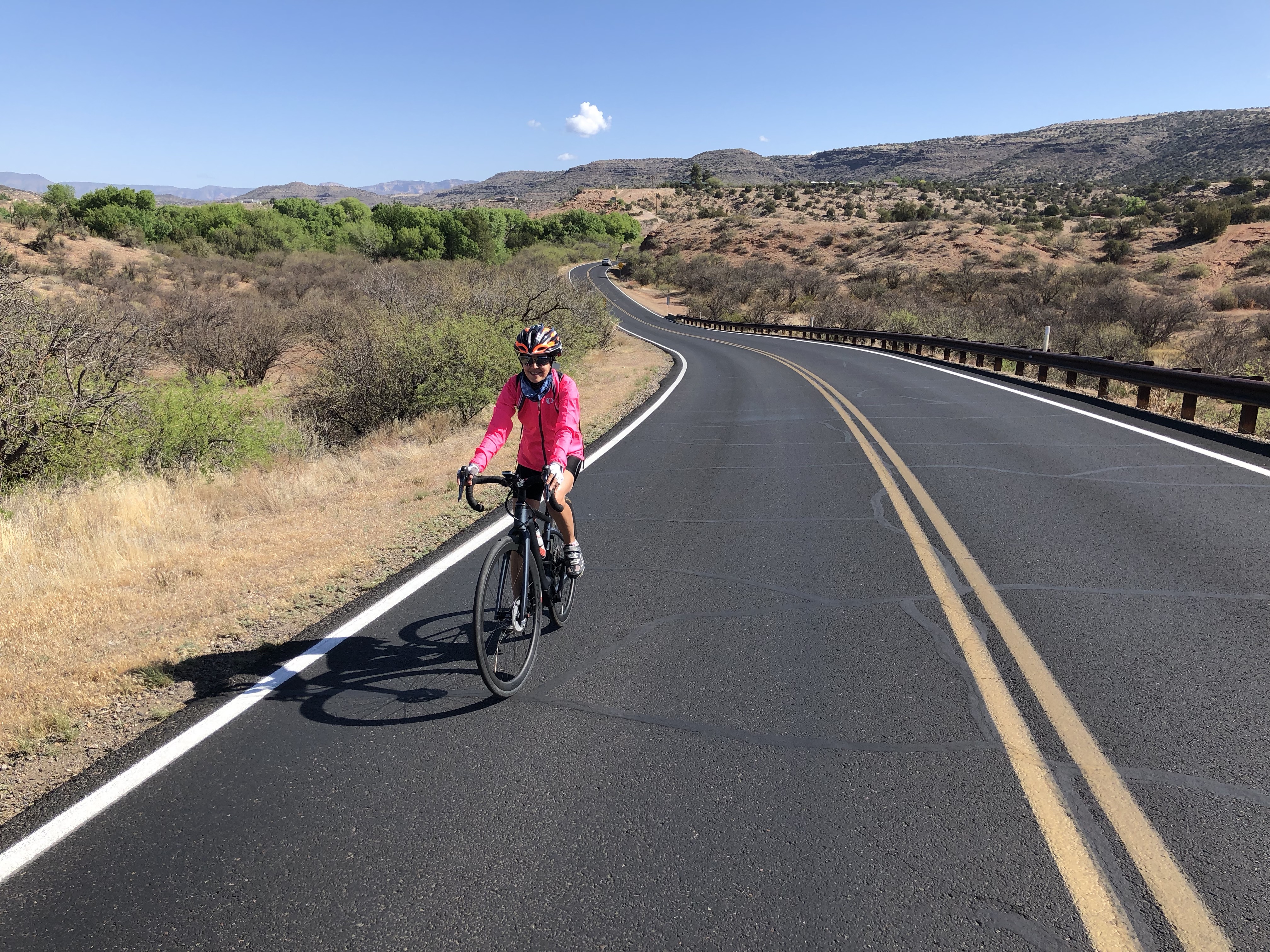
Red Rock Loop Road

Notice the amazing clifftop house
A few miles northeast of Page Springs Road up Hwy 89A is Red Rock Loop Road (RRLR), signed to Red Rock State Park. You can park on RRLR just south of the intersection.
Riding to the northeast end of RRLR (to where it reaches Hwy 89A again) and back is a wonderful ride of 15 miles with about 1,420 feet of climbing. It’s rolling and twisty and pretty, with the steepest and most sustained climbing at the northeastern end.
One of the more interesting parts is shown in the photo above, where you’ll see a house perched at the top of the cliff. It’s fascinating to look at it from below, and it has a cable system leading from the base to the house.
Extra Credit: Near the east-most part of the loop is Chavez Ranch Road. This makes a wonderful addition to the ride, and adds almost 4 miles and 600 feet of climbing. The road climbs for a while then turns left and drops precipitously into a lovely valley. At the end of the valley, where the road turns to dirt, is a new housing development up on the left. The gate was open when we were there so we rode steeply up Hilltop Road and around. Coming back out the precipitous hill rears up at 14% for some delicious climbing.
