
Early September, 2017.
We had no idea where to stay in this area so when someone recommended Villars-sur-Ollon we readily agreed. In retrospect it was probably not the best choice as it’s halfway up the mountain, which meant that any ride involved getting down the mountain, doing the ride, then going back up the mountain. Without knowing anything more I think I’d recommend Bex or Aigle. Aigle is the headquarters of the UCI (Union Cycliste Internationale) and you can see wonderful colored bicycle art around the town. There are many roads leading up into the mountains in this area and we did only a small fraction of the rides.
Sion
Col du Sanetsch
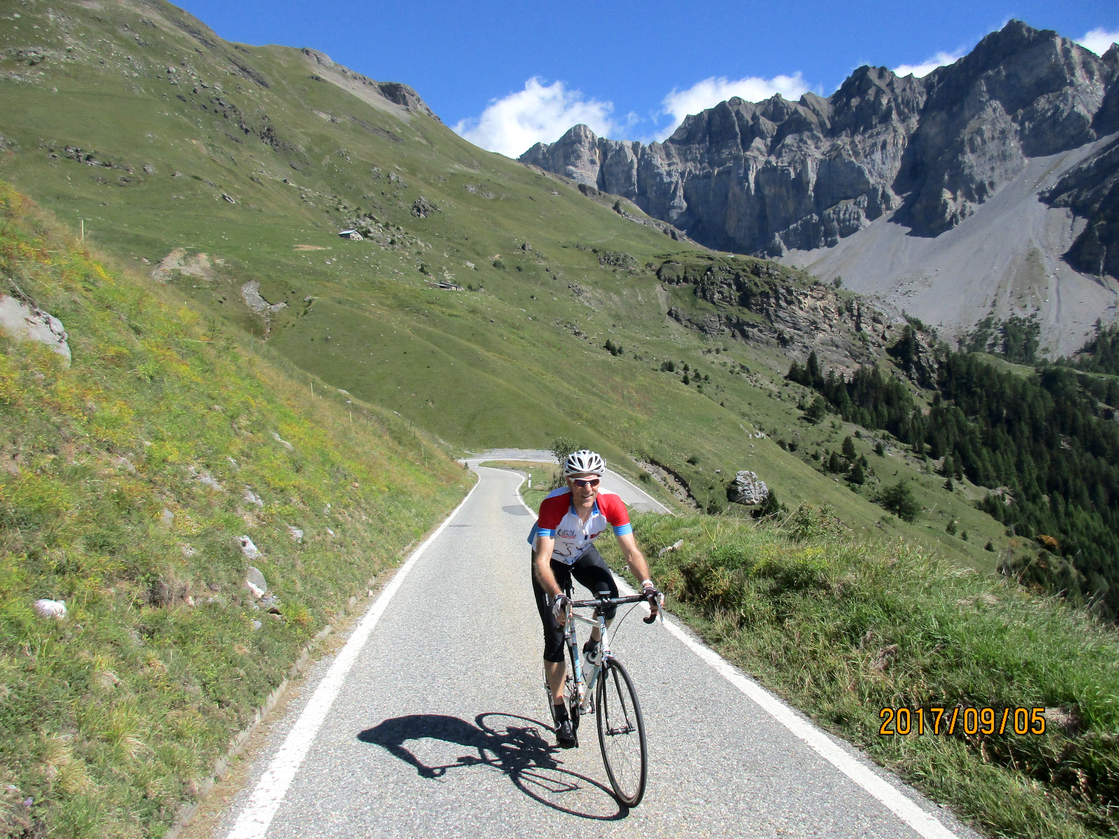 What a fantastic ride, big, wild, and beautiful. This is one of those rides you should only do on a lovely day because the whole point is do do it for its beauty. It’s about 25.5 km with 1,770 meters of climbing, although this varies a bit depending on your starting route. The climb is steep, with plenty of 8-9%.
Start in Conthey, just west of Sion, at the intersection of Route de Savoie (Hwy 9) and Route de la Morge. There are signs for Deborence, Sanetsch, Conthey, and Vuisse.
You have two choices: we went up the left-hand route (LHR) and down the right-hand route (RHR), but I’d recommend going up the RHR as it’s quieter with less traffic. There’s also a little bit more climbing on the RHR as you have a descent after the village of Chandolin. And of course you can go up one and down the other. If you come down the RTR make sure you take the sharp right turn in Chandolin to Vuisse.
LHR: Start up the Route de la Morge and continue up the somewhat busy road as it switchbacks up the big slope. After a long switchback to the left you’ll reach the village of Erde where you will leave the main road and turn right, following the sign for Sanetsch. Now continue up the road, following signs for Sanetsch where there’s a choice.
RHR: Almost immediately after starting up Route de la Morge, turn right on Route de Vuisse, then left. Follow the Route de Vuisse as it switchbacks quietly up to the village of Chandolin. Turn left here and shortly after the village ride downhill until you are in the canyon, then follow the canyon steeply uphill until a few switchbacks bring you to the intersection with the LHR.
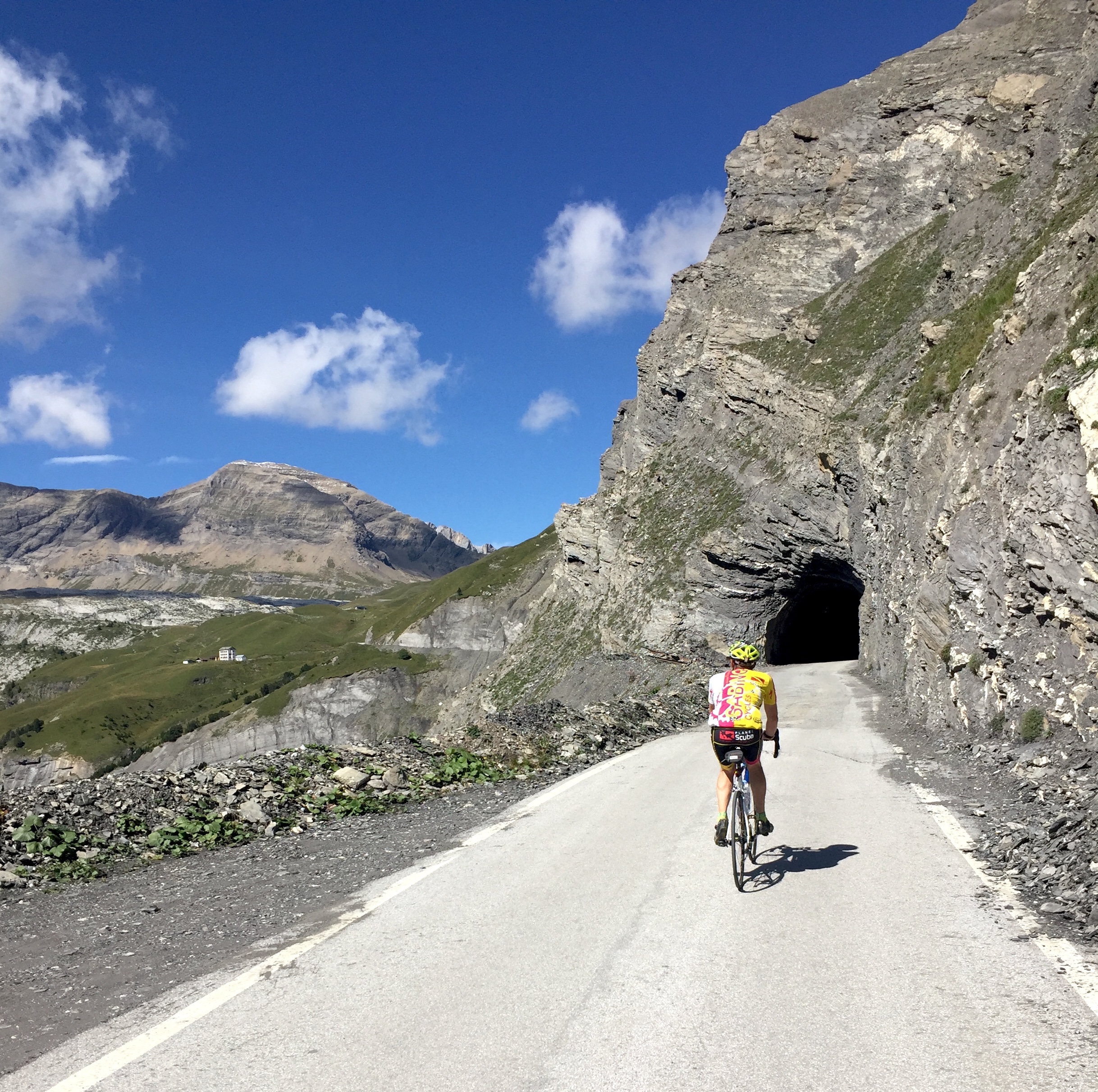 From the intersection of the LHR and RHR keep climbing and switchbacking with increasingly lovely views until about 3 km from the top you reach a 800 meter tunnel which cuts through the side of the hill to avoid a rocky area.
The tunnel is lit, goes gently uphill, and is paved with cobblestones for the last 100 meters. From the end of the tunnel keep climbing past the Hotel du Sanetsch to the pass where you’ll find a bus stop and a large parking area for hikers.
There’s another big climb in the area called Derborence but we didn’t ride this.
Aigle
Morcles and beyond
A wonderful little climb, very steep and well worth doing. Start in Lavey-le-Bains – I parked in Parking Area D after the hot springs. The climb is about 9.7 km with 1,060 meters of climbing, a lot of it in the 12+% range, and it has 47 delightful switchbacks. I know because the first 29 are marked and I decided to keep counting.
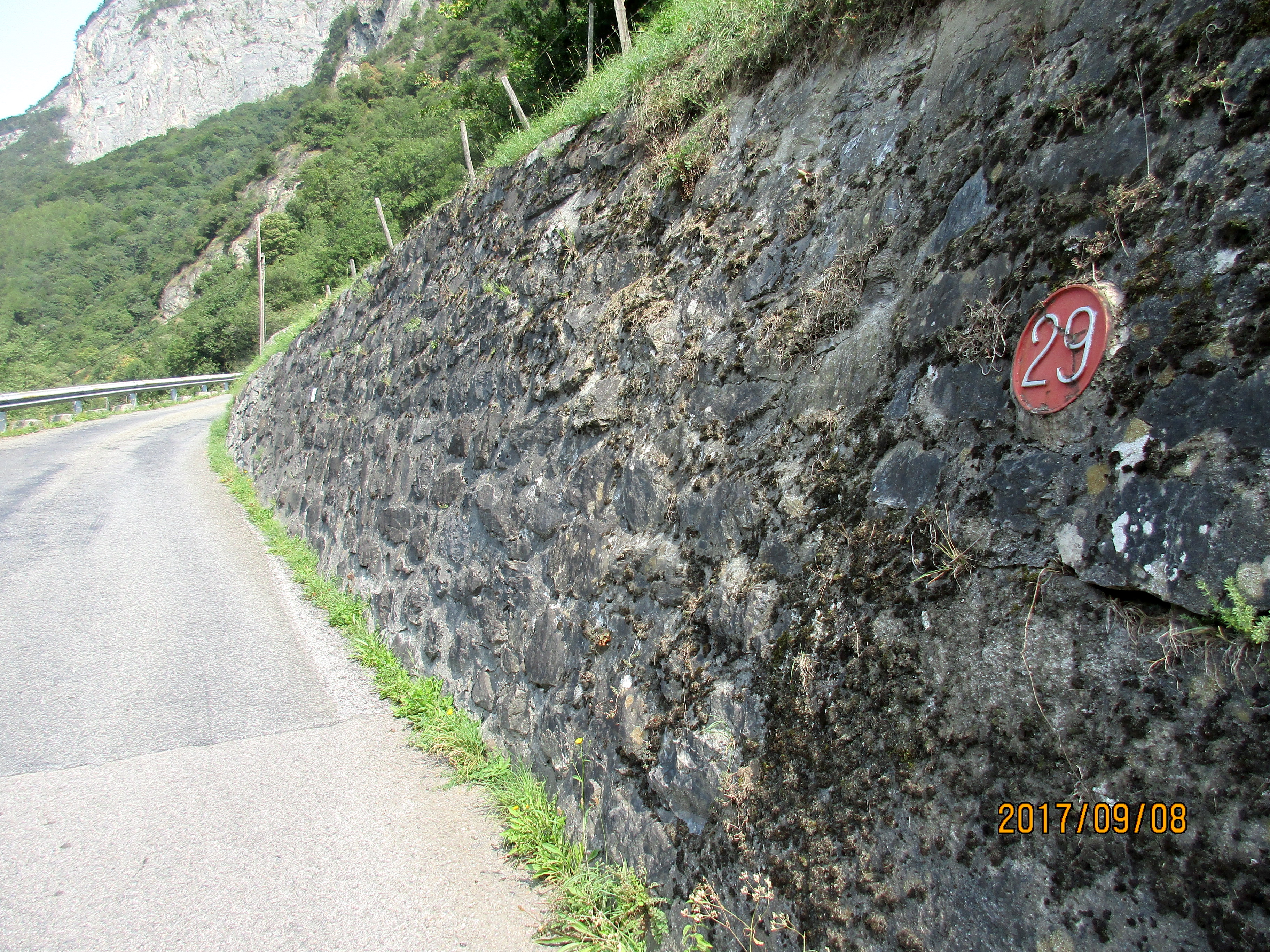 After a short flat ride south along a tree lined road you reach your first switchback and see a pink plaque with the number 29.
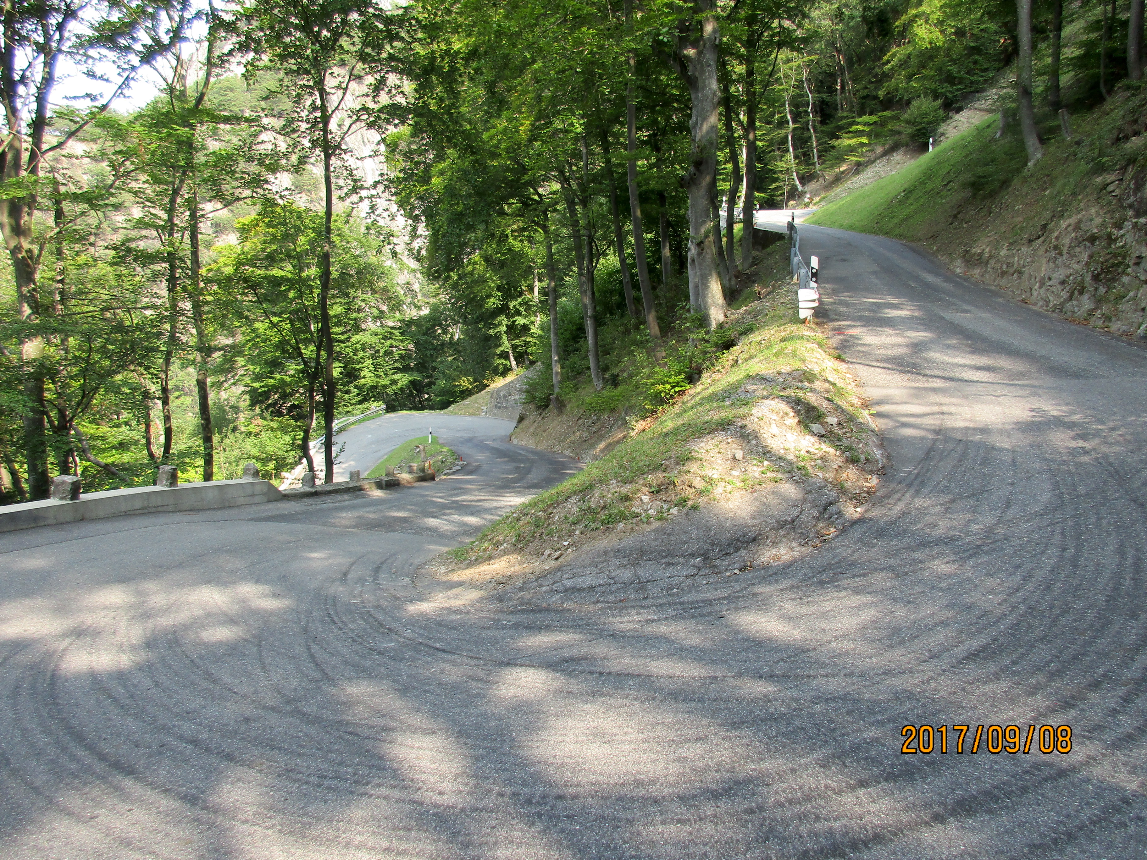
The road switchbacks tightly up a very steep hillside, so steep that I wondered why anyone wanted to create a road up there. You are in trees the whole way but at switchback 12 there’s a great view of a waterfall.
The view from switchback 7
After switchback 3 you head back into the valley and at switchback 1 you enter the little village of Morcles. One switchback takes you through the village, then after 5 more switchbacks you reach a T-junction.
Turn right and follow the road easily to a beautiful open green valley, with steep switchbacks leading out of the valley at its end. After another 12 switchbacks you reach a small barrier across the road, where it turns to dirt.
Tunnel de la Sarse
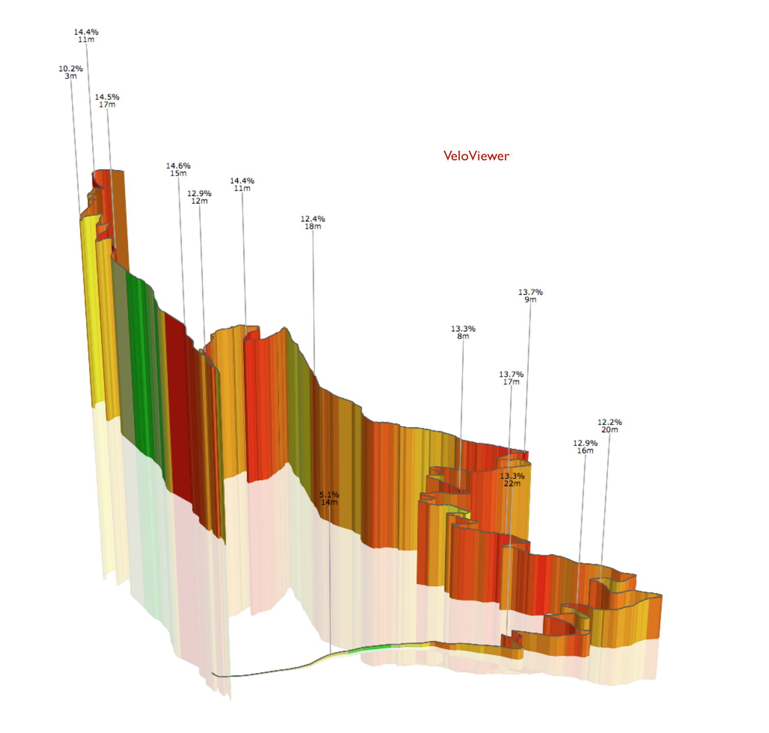
 A short but steep and varied climb that climbs from Aigle to the Tunnel de la Sarse, a dark, one-way tunnel (the tunnel is also known as the Tunnel des Agites and the Tunnel des Agittes.)
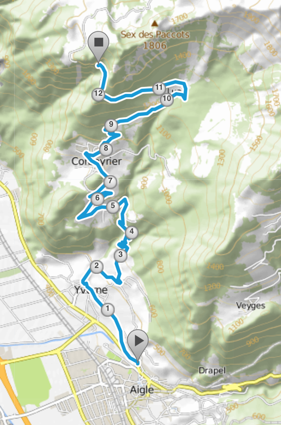
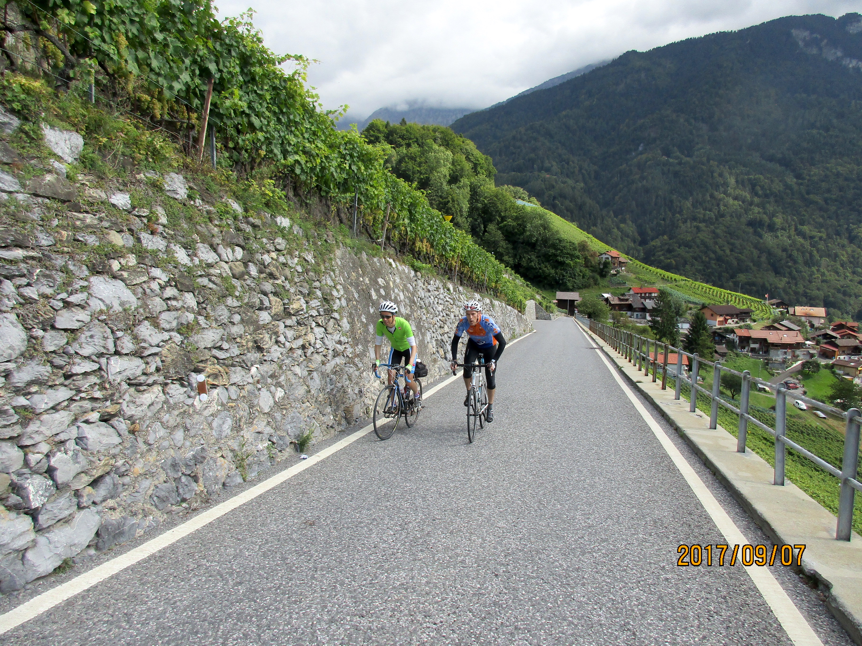
The ride starts by climbing through vineyards then switchbacking up through trees to Corbeyrier and beyond. Then it levels out as it goes through the village of Luan, before steepening again up to the tunnel. It’s about 12 km with 1,030 meters of climbing. Definitely worth doing if you are looking for a short but pretty climb.
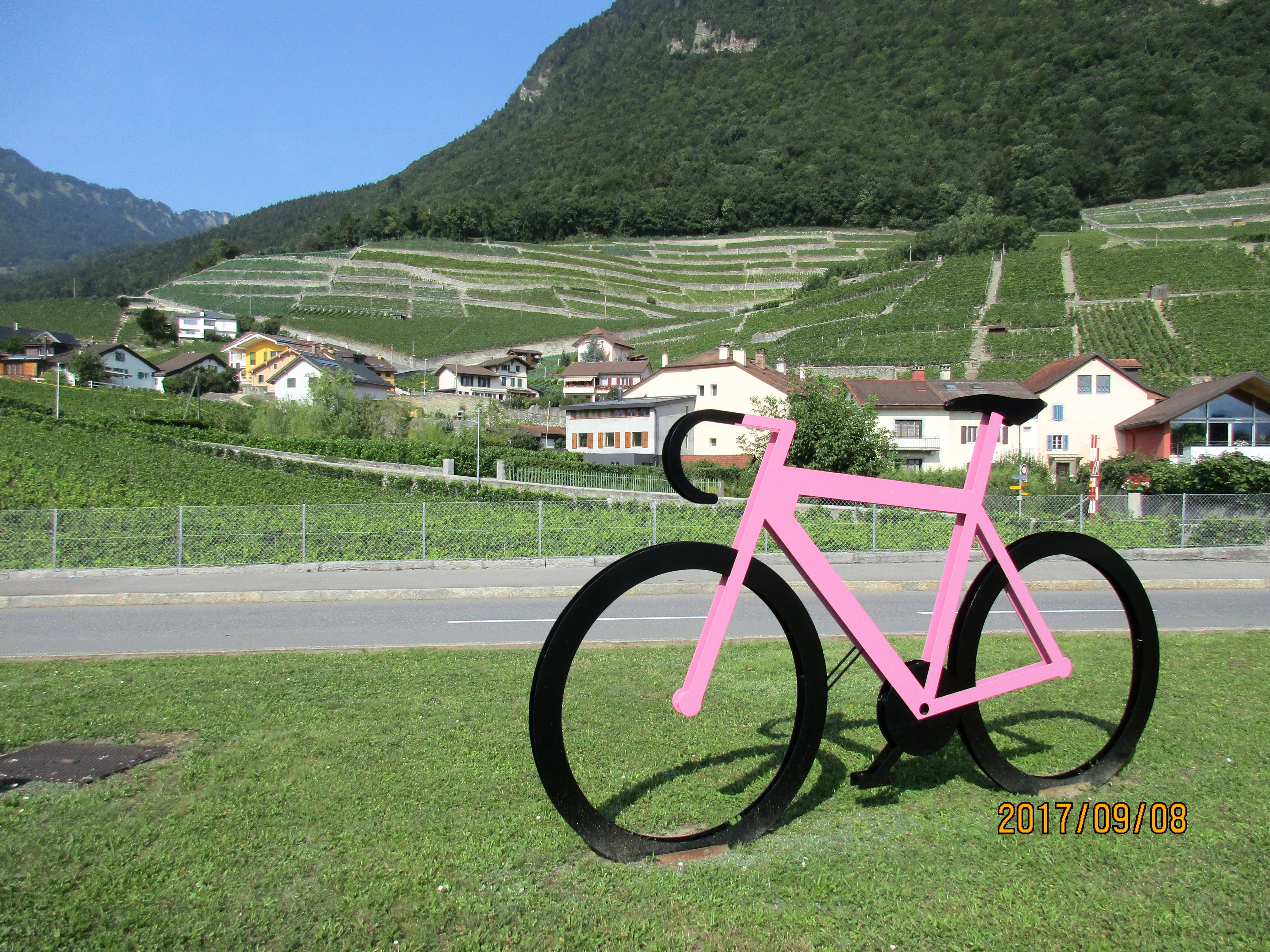 Start at the north end of Aigle, at the intersection of Hwy 9 (Route de Lausanne) and Boulevard d’Yvorne, by the pink bicycle. Follow the road up through the vineyards for just under 1 km to Yvorne. Leaving Yvorne the road steepens dramatically, reaching 11%, then it switchbacks more easily up through the trees to Corbeyrier.
Riding up to the water trough in the center of Corbeyrier is steep and my Garmin showed 13%. Keep going straight at the trough. Leaving Corbeyrier is incredibly steep and my Garmin metaphorically threw up its hands and stopped showing the gradient at this point. Keep climbing quite steeply until the road flattens going into the small pretty village of Luan. But the respite is short because the next two kilometers to the tunnel are again very steep.
 The tunnel is one-way, and traffic is only allowed through the tunnel from the Luan side at quarter-past-the-hour. If you want to continue through the tunnel and do a loop ride, Cycling Challenge has a page about this. Otherwise do as I did and ride back down after a tough but good climb.
Col de la Croix
 This is a big climb from the Villars side, and there are two ways to start the climb. I didn’t actually do the climb, but we rode the lower section from Bex, and drove up to Villars several times, so I figured I might as well describe the climb. The whole ride is about 1,300 meters of climbing.
There are two ways to start – either from Ollon or from Bex. The climb from Ollon to Villars is the steeper climb and is about 11 km, and can be very busy with cars driving fast. The road from Bex is longer – about 15 km – and much quieter and goes through several pretty villages.
I would highly recommend starting in Bex, but you’ll have to pay attention as you cross the railroad tracks several times. Once in Villars, follow the signs to the Col de la Croix, which you reach in another 8 km. The upper section is pretty but nothing special.
Les Crosets
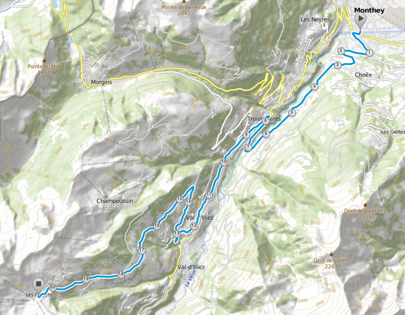
A rather long climb, which is a bit of a grind as there aren’t many switchbacks and it just goes on and on. Of course I may be biased as we rode it on a cloudy, miserable day. It’s about 20 km with 1,300 meters of climbing.
We avoided the busy main road from Monthey to Chambery by starting up the road towards Choëx. I didn’t pay much attention to the actual route though as the weather was miserable, so you’ll have to look at the map in the picture and figure it out yourself. Sorry.
Links and Other Clicks
ClimbByBike‘s web site where you can see profiles of many, many climbs.
Cycling Challenge’s page about the Col du Sanetsch
A very good Swiss map that has a wonderful zoom mechanism.
The UCI web page.
