
Riding around Bormio is more like riding in the French Alps than riding in the Dolomites. The climbs are long and in real mountains. The Dolomites are spectacular but feel a bit like a toy wonderland. The riding around Bormio is big and bold, and often remote.
There are four classic loops out of Bormio, and three of them go into Switzerland – the Stelvio Lollipop, the Foscagno – Umbrail Loop, and the Tirano – Livigno Loop. I took my passport with me just to be safe, but was never stopped or asked for it.
If you do either of the latter two loops, you will visit Livigno and its surrounding area. You’ll probably be surprised to see all the Duty Free shops, and surprised to see how cheap gas is (when I was there, diesel was €0.85 a liter, while it was €1.40 in Bormio.) After all, Switzerland is still quite a few kilometers away.
It turns out that in 1805 Napoleon gave Livigno an exemption from excise tax and amazingly, more than 200 years later, it still has the exemption. There is a customs booth at the top of Passo del Foscagno just in case the authorities want to prevent Italians buying too much duty free stuff and bringing it back to Bormio.
At the tourist office in Bormio I picked up two cycling guides: Valtellina Legendary Cycling, and another one without a catchy name. I could find neither of these brochures online.
The Mortirolo – Gavia Loop
Looking down the south side of Passo Gavia
This is one of the classic loops around Bormio, with two of the hardest climbs. It’s about 110 km and 3,000 meters (9,843′) of climbing. You get to exhaust your legs on the brutally steep Mortirolo, then finish them off on the big, impressive Gavia.
From Bormio head south towards Tirona. Bicycles are not allowed in the tunnels on the SS-38 so avoid all temptations to get on it. You will instead be following the SP-27. In about 30 km you turn left and cross the river to reach Mazzo di Valtellina. As you reach the town, turn right following the sign for Passo della Foppa / Mortirolo, then in four hundred meters turn left following the sign.
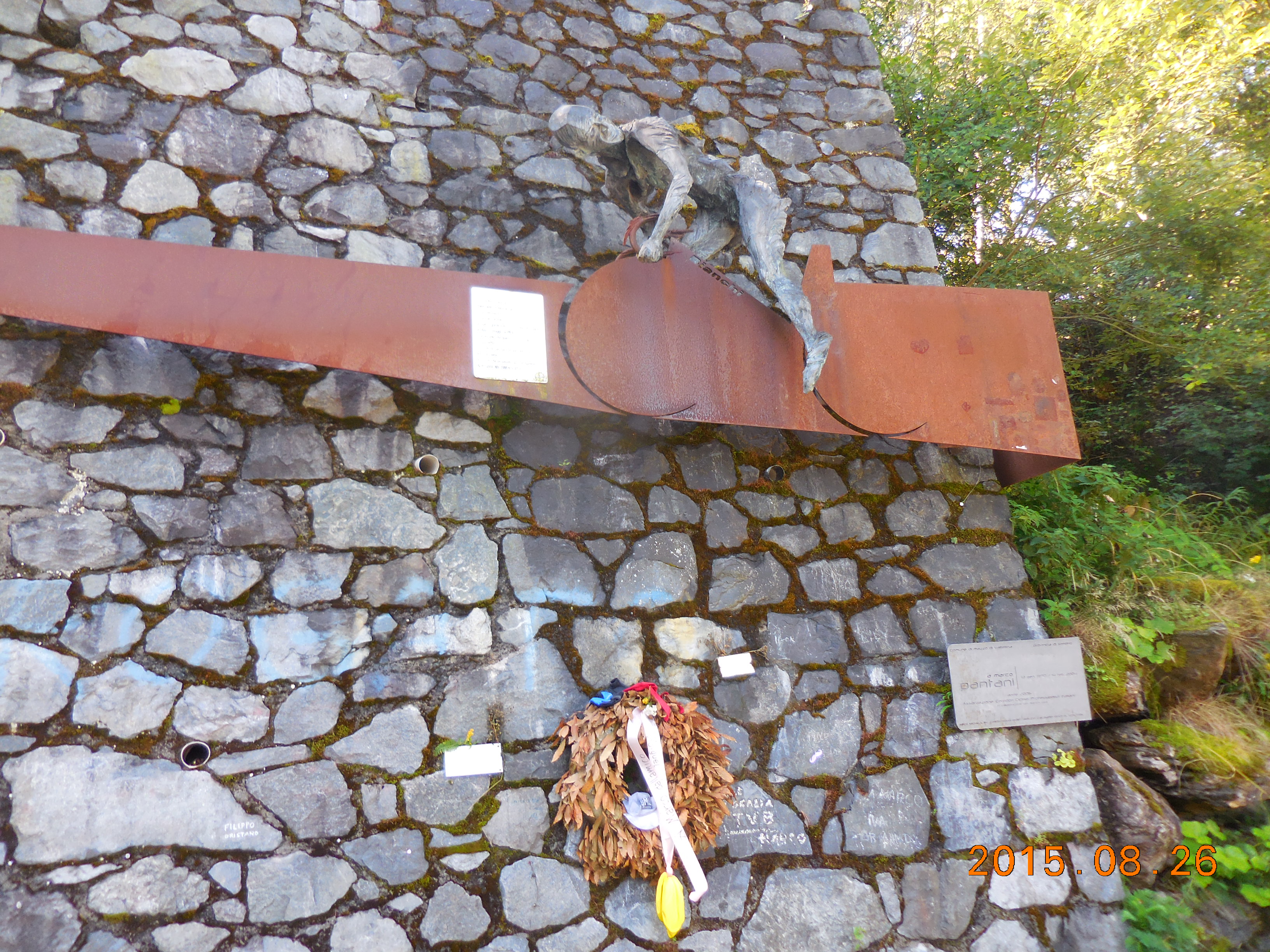 The Passo del Mortirolo (also known as Passo della Foppa) is one of the most famous and most feared climbs in Italy. From Mazzo di Valtellina it’s 12.4 km with 1,300 meters (4,265′) of climbing. The climb is steep and sustained, relentless even, as it follows the narrow road up for 33 hairpin bends. At bend 11 there is a memorial to Marco Pantani. It’s not a very scenic climb except for the odd moment, but somehow that’s okay, because it’s the Mortirolo. There were times when I rode it like Contador in the 2015 Giro d’Italia. No, not fast, but standing – it was too steep for me to sit and I had to stand to keep moving.
(There is another route up the Mortirolo that is supposedly even harder. It starts at Tovo S. Agata, just down the road from Mazzo, although the climb is not shown on most maps.)
From the Passo del Mortirolo head down following signs for Monno – there are some lovely switchbacks near the top. Once you reach the bottom, turn left and follow the SS-42 for 14.5 km to Ponte di Legno. If you are simply going to continue up the Passo Gavia, follow the signs. If you want to eat, follow the sign into Ponte di Legno. The downtown area is a beautiful pedestrian only area – I got lost in it and had to use Google Maps to extricate myself.
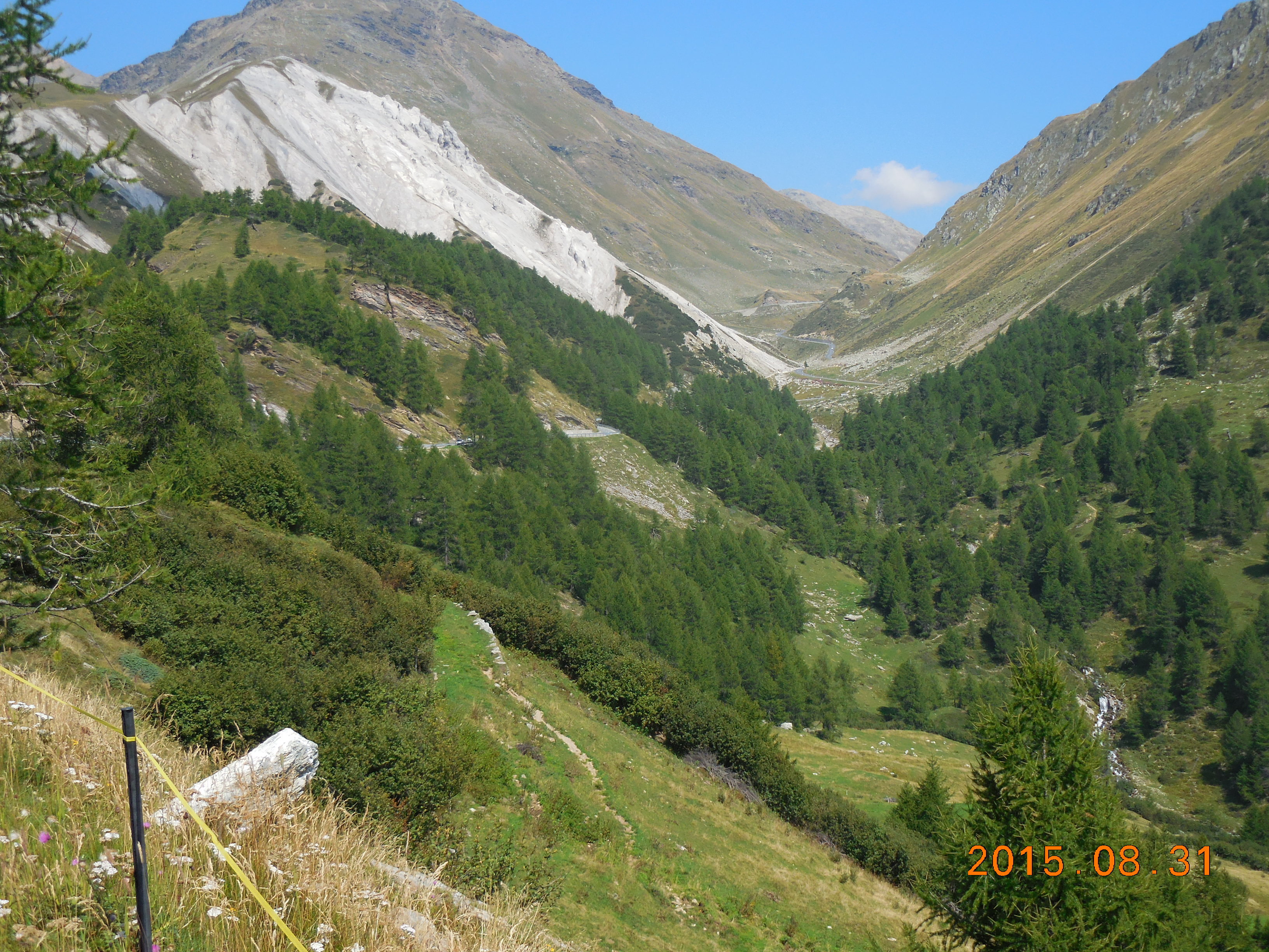
From Ponte di Legno, the Passo Gavia is about 17.3 km with 1,363 meters (4,472′) of climbing. This side is much harder than the north side, brutally steep at times. It’s big, bold, and dramatic, one of the big Italian climbs. For an American it’s famous because it’s where Andy Hampsten won the Giro d’Italia in 1988 in a snowstorm.
The road surface is very good except for the last 2 km which has a horrible surface. The climb starts fairly sedately for 7 km but about 10 km from the top the road narrows and steepens dramatically. Some of the next section felt as hard to me as anything on the Mortirolo (maybe because the Mortirolo had already worked over my legs). The upper part is remote and wild. About 3 km from the top you go through a tunnel, for which a rear light is useful. After the tunnel you have a series of switchbacks to finish. Then you have the lovely long descent of the north side. Some of the switchbacks just above Santa Caterina Valfurva are really tight and easy to take too fast.
Passo Gavia – north side
 From the north, from Bormio, the Gavia about 25.6 km with 1,404 meters (4,606′) of climbing. The gradient varies a lot, sometimes very steep and time quite relaxing. The first 13 km follow the valley up along the river. The road goes through a few villages, the most interesting being Sant Antonio because you have to ride over a sort of cobblestone through the downtown area. After Santa Catelina Valfurva, at KmM 13, the road starts switchbacking up the hillside. After about KmM 16 the road narrows and everything feels more wild and remote. There is some lovely riding up here and some great views. The only problem is that that the north side suffers from the comparison with the south side.
The Stelvio Lollipop
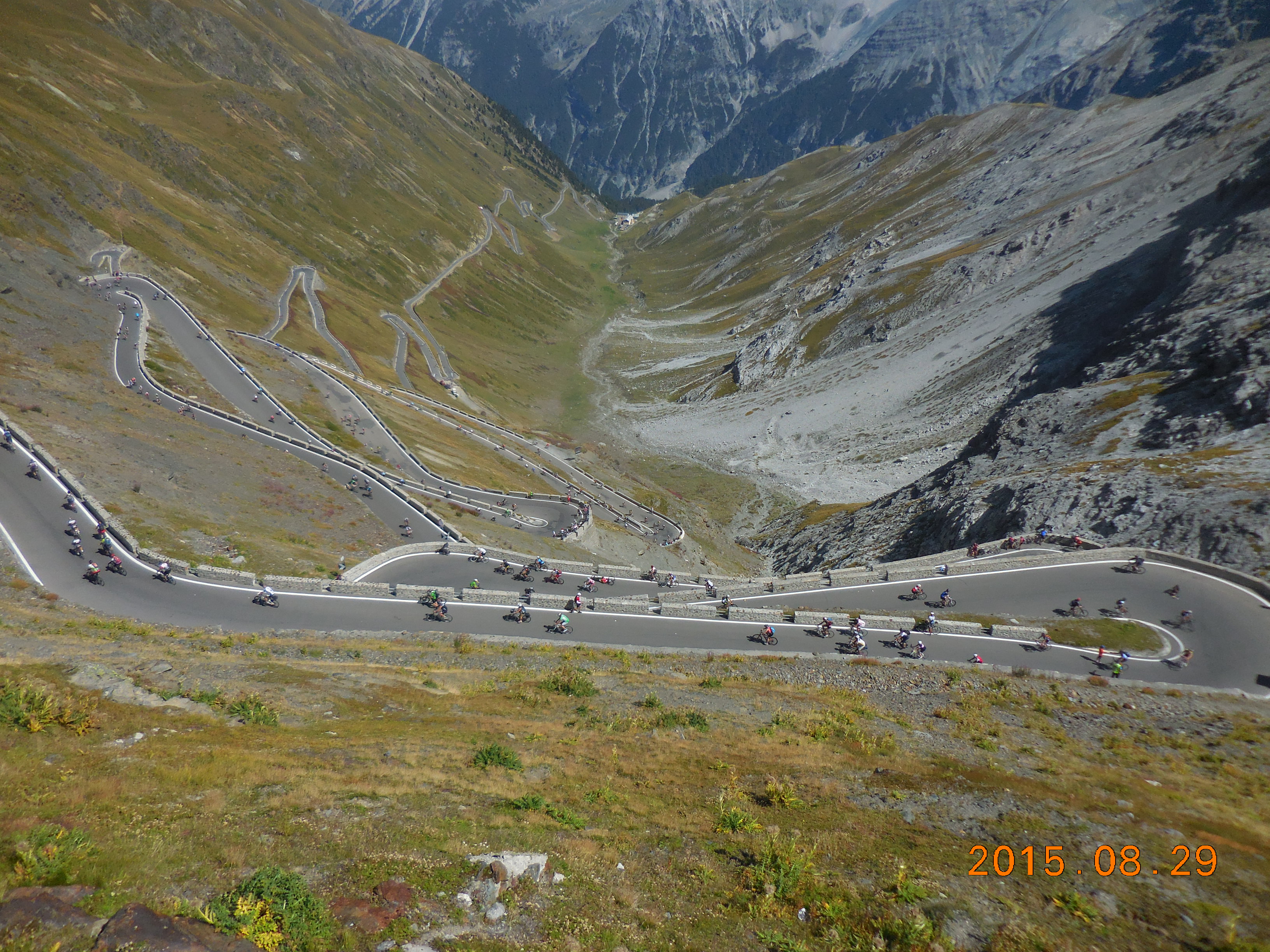
Looking down the north side of the Stelvio at the famous switchbacks
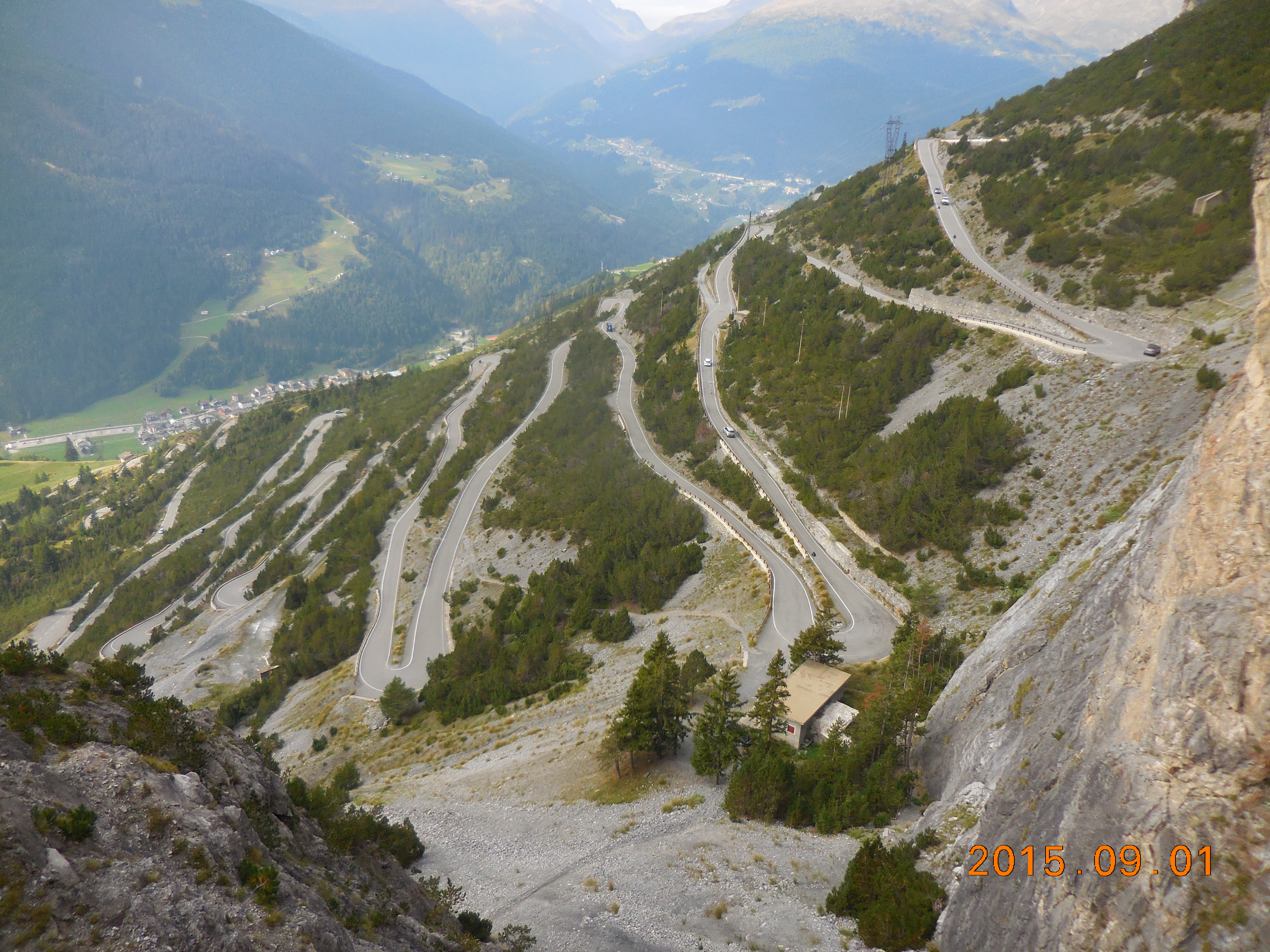
The Stelvio is one of the great passes in Italy – it’s big and long from either the south (Bormio) or the north (Prato allo Stelvio). But if there is only one climb you do in Italy, it should be the north side of the Stelvio, from Prato allo Stelvio. It is just amazing, fantastic, awesome. It’s one of those climbs you should definitely experience sometime in your cycling life.
One of the classic trips from Bormio is to ride up the south side of the Stelvio, descend the Passo dell’Umbrail, ride round to Prato allo Stelvio, then climb up the north side of the Stelvio. I’d call it a loop but it’s more like a lollipop – or a balloon. The whole trip is about 107 km with 3,420 meters (11,220′) of climbing. The south side is about 21.5 km with 1,558 meters (5,112′) of climbing, and the north side is about 25 km with 1,848 meters (6,063′) of climbing.
 From the south, from Bormio, there are 40 numbered hairpin bends to the top of the Stelvio. There are some long straightaways, and there’s a lovely section of 14 hairpins (#28 – #15) between the lower valley and the upper valley. When you finally make it past turn #1, you reach a standard brown summit sign showing Passo dello Stelvio. Strangely, it’s another 300 meters to the actual top of the pass, and there’s another hairpin bend but it doesn’t have a number. It’s almost as though someone is saying, “You only rode the lesser side. You can’t come to the very top.”
But if you made it to the top (and not everyone doing the lollipop does because it’s 3.2 km from the Umbrail turnoff to the top), turn round and ride back down to the Passo dell’Umbrail turnoff. Ride down this (it is completely paved now). At the bottom turn right and follow the valley down for about 11 km. Then turn right, following signs for Prato allo Stelvio and the Stelvio pass.
In Prato allo Stelvio turn right (unless you want to find food) and ride up the valley. There are 48 hairpin turns but you have to ride rather boringly up the valley until you reach the first turn. Once you reach turn #47 you get your first view of the beautiful Ortles mountains and their glaciers, and you now start to really feel that you are in the mountains.
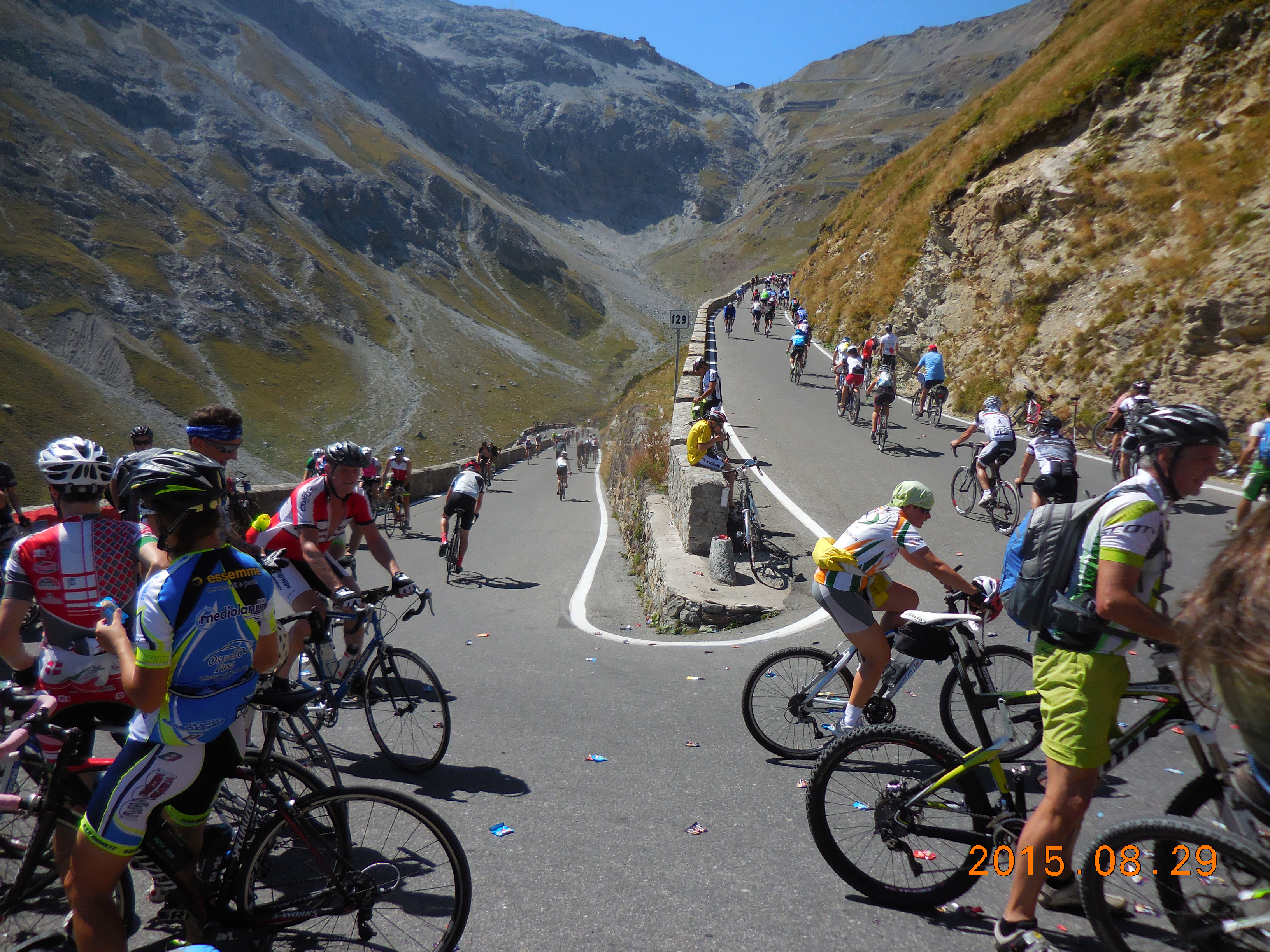 At turn #44 you begin to leave the valley and climb up a seemingly never-ending series of switchbacks, mainly in the trees. There is no sign of the switchbacks that the Stelvio is famous for. Finally, just before turn #24 you see the valley wall up ahead of you, covered with switchbacks. This is what you’ve been waiting for, and there are 24 delicious hairpin bends to go! I rode it on Stelvio Bike Day, when all three roads up the Stelvio were closed to cars and motorbikes. Fantastic.
Once you get to the top, descend the south side, back down the way you came. Take care in the tunnels – two of them are scarily narrow and the road surface is not the best in a couple of places.
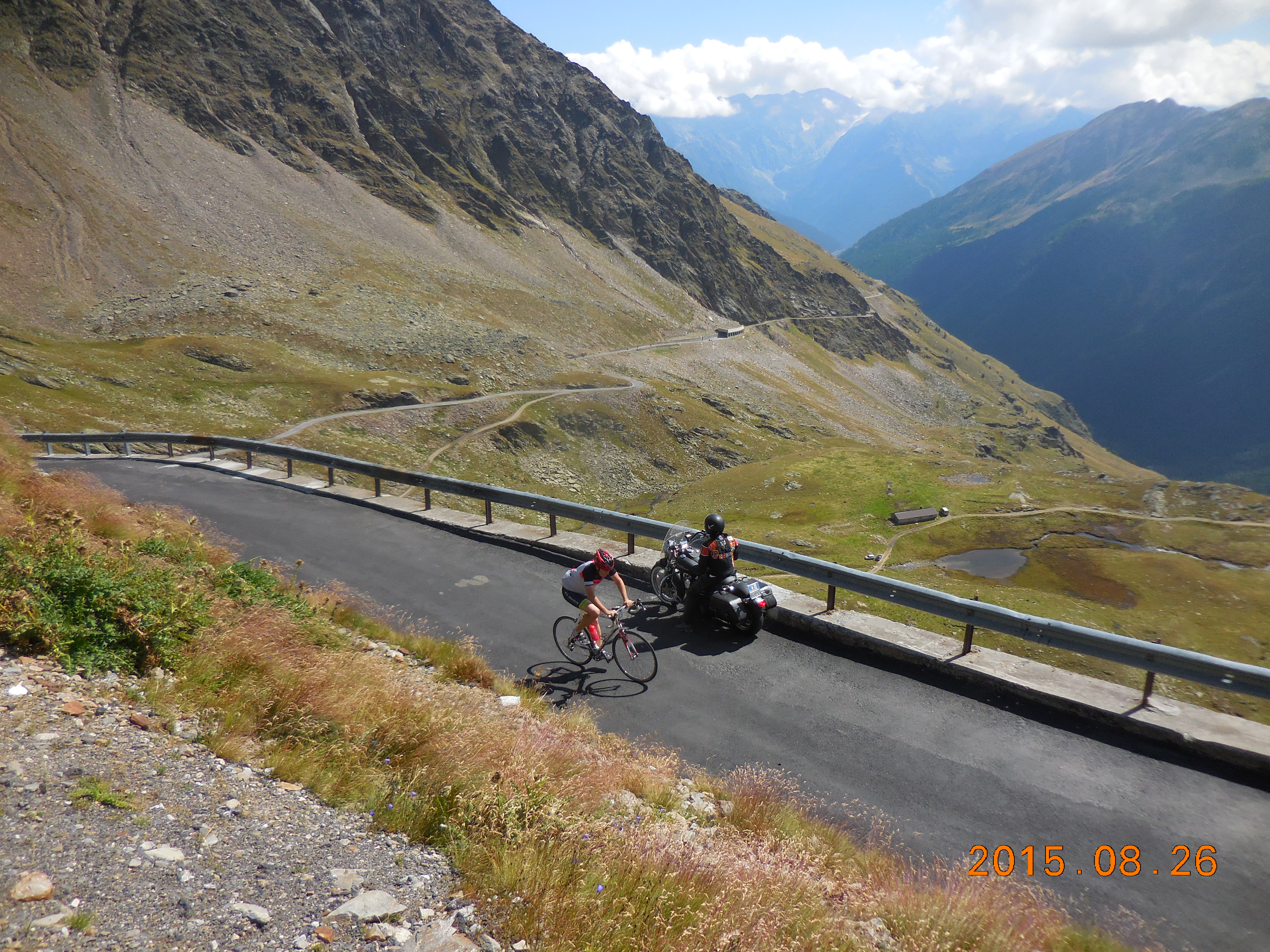
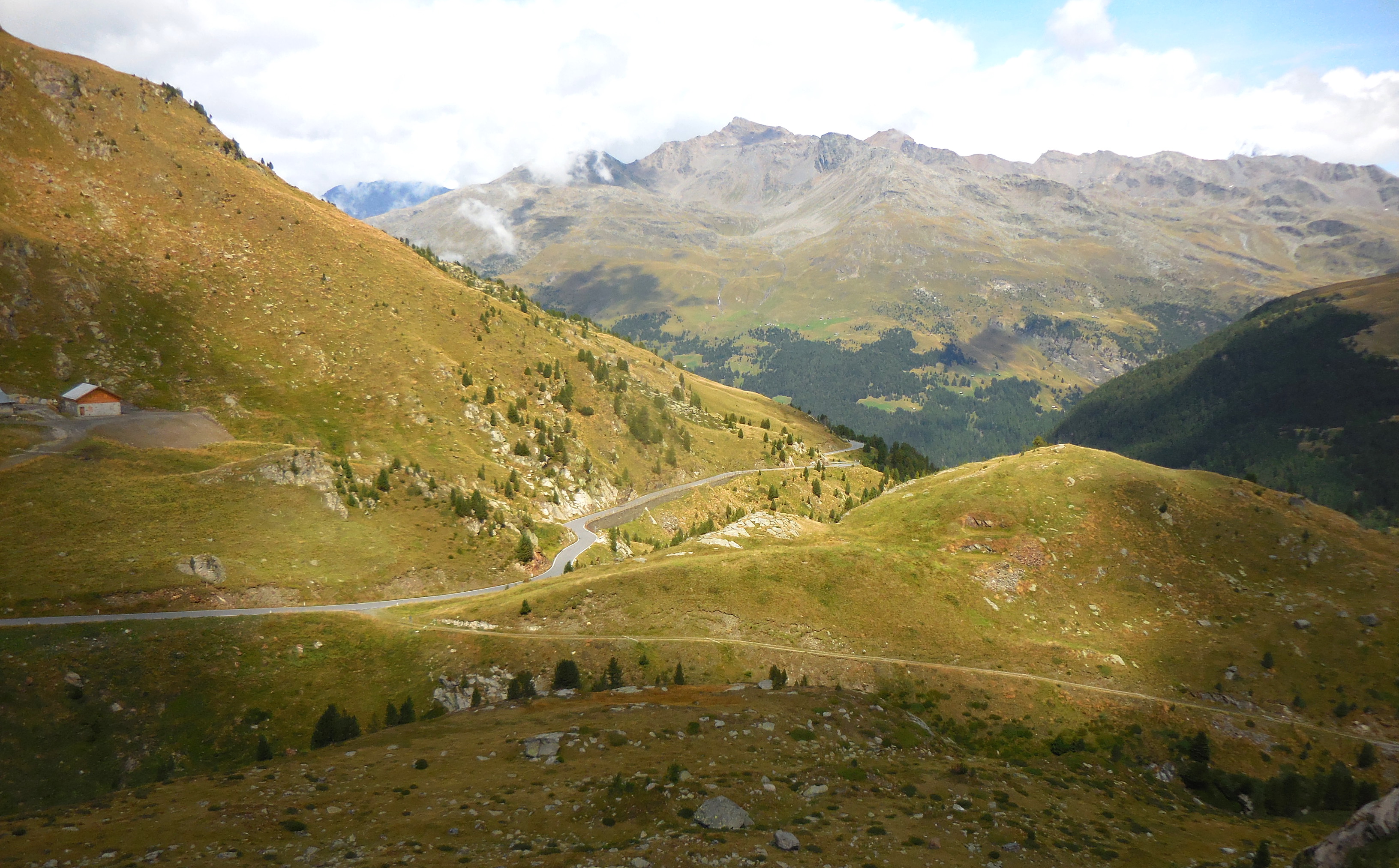
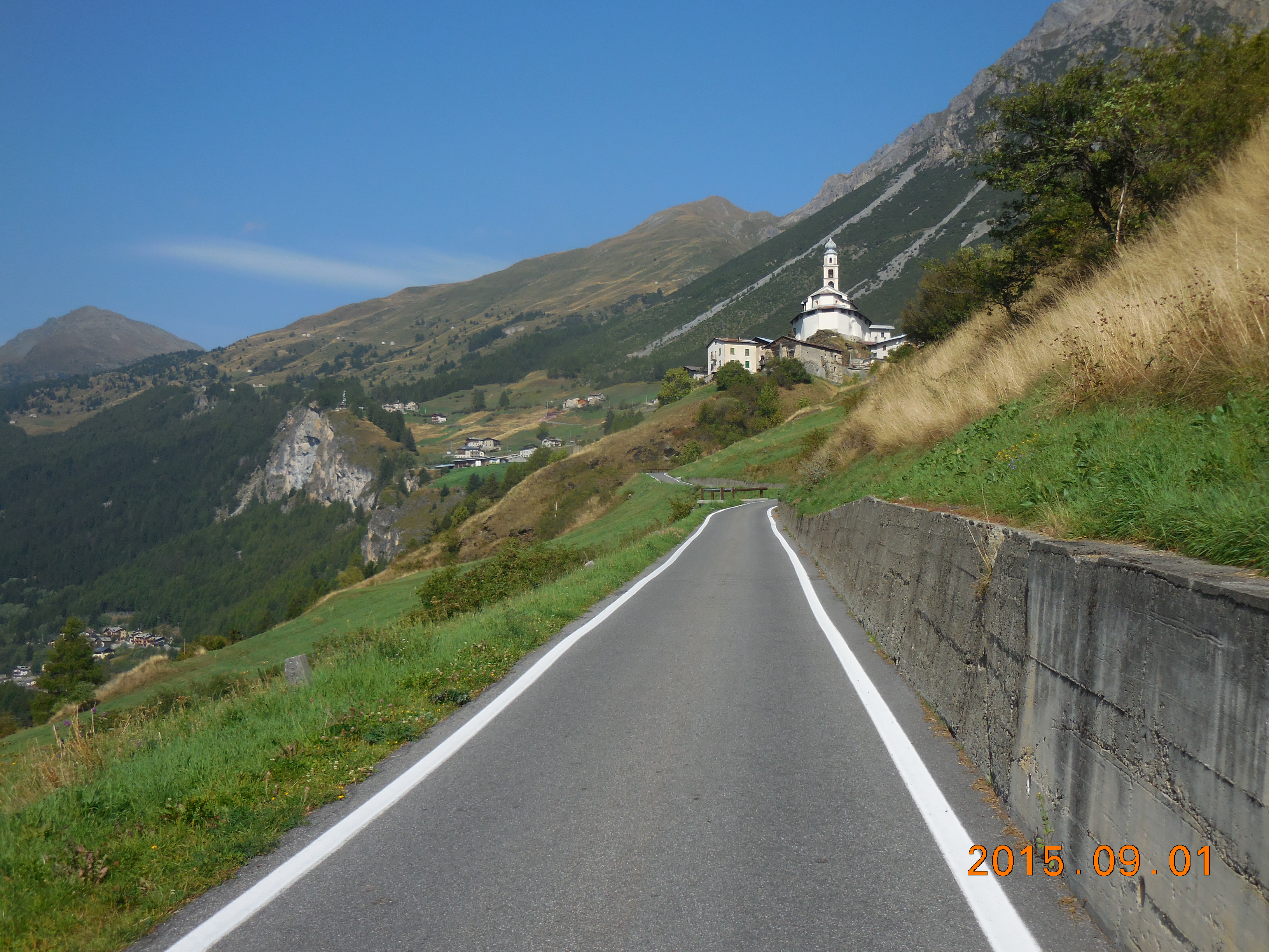
Foscagno – Ofenpass – Umbrail Loop
On Passo dell’Umbrail
This is a beautiful loop, not as hard as the Mortirolo – Gavia loop but definitely worth doing. It’s made more interesting because there is a one-lane tunnel between Italy and Switzerland that you have to go through, but bikes are not allowed in it. Fortunately there’s a bike shuttle that will transport you.
The loop is about 108 km with 2,880 meters (9,449′) of climbing. From Bormio, start as for the Stelvio then at turn #38 follow signs for Livigno. Climb the Passo del Foscagno, which is quite long (24 km from Bormio) but not too hard.
A short downhill brings you to the pretty town of Trepalle then another uphill takes you to the top of Passo Eira, then another descent takes you into Livigno. In Livigno turn right and follow the road towards Switzerland. It’s pretty weird because once you reach the lake you spend most of your time in “galleria” or galleries – tunnels with an open side or windows in one side. A rear light isn’t really necessary here.
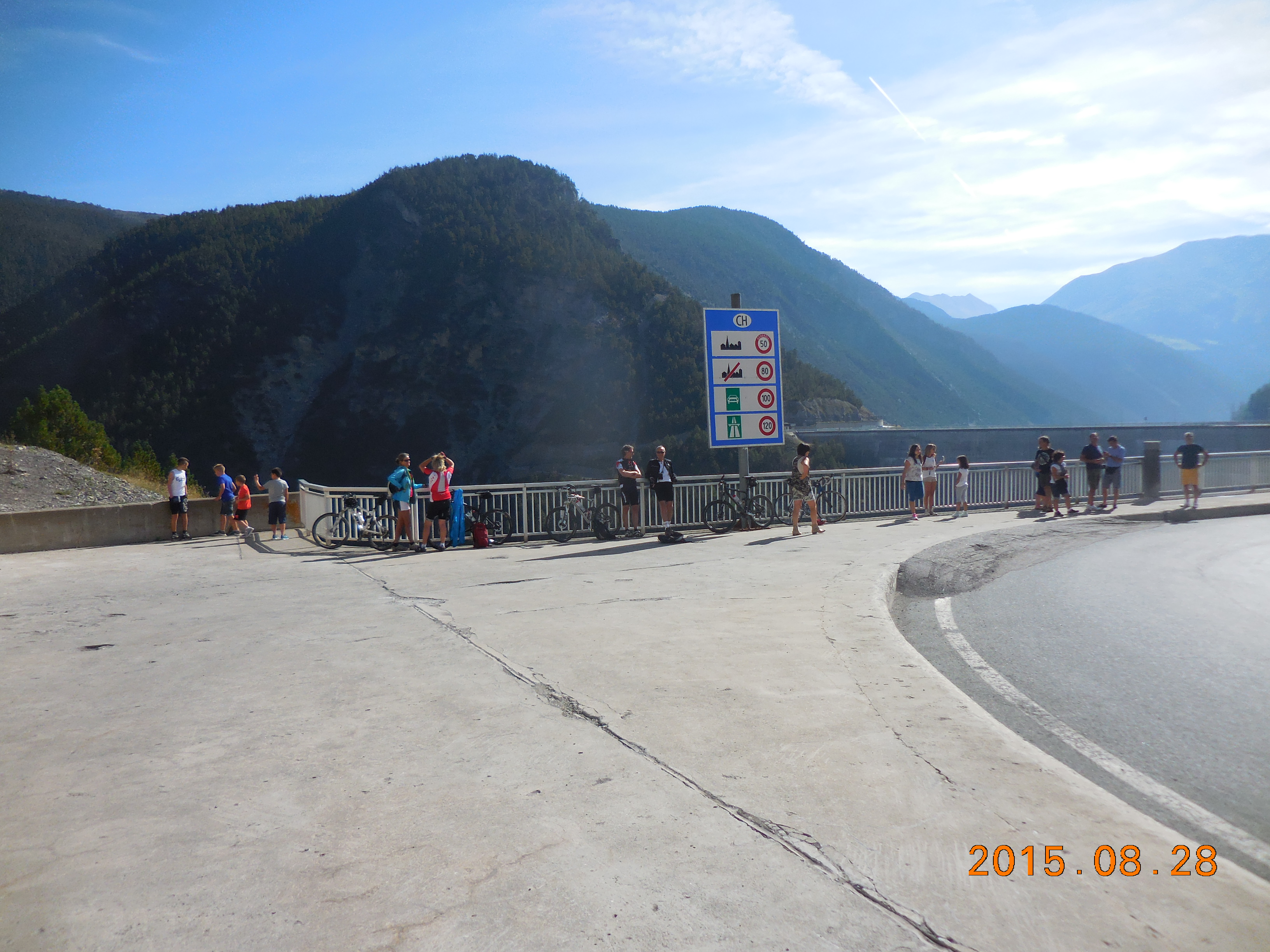 Just before the dam, and just after the customs post, there’s a large concrete area on the left with an obvious asphalt ramp from the road to the concrete. This is where the shuttle van parks, so wait here for it. In 2015 this cost €5 and ran through the summer. Strangely, there’s no sign indicating this is the shuttle stop.
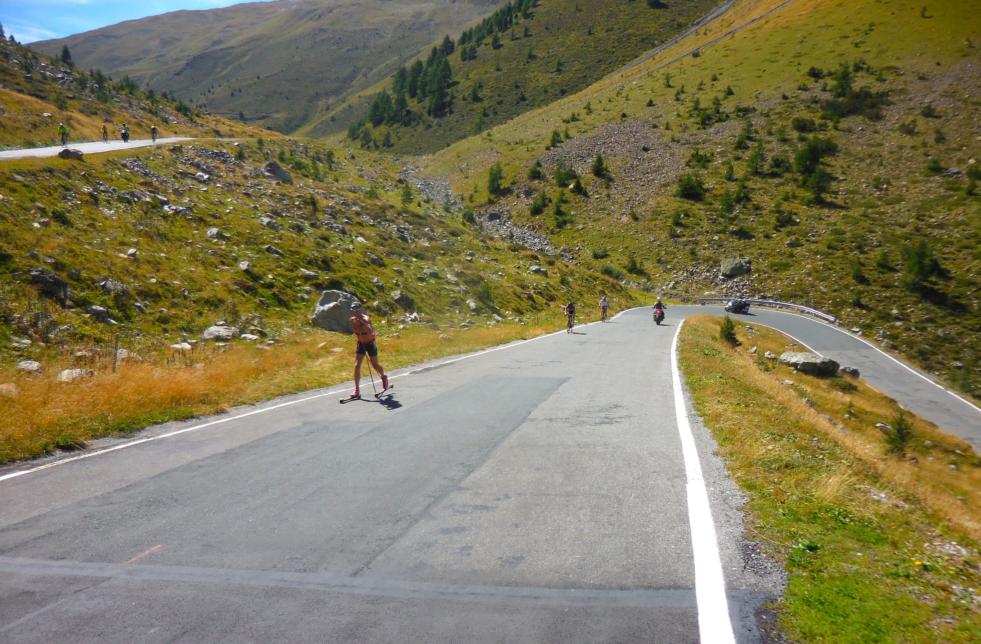
After you get through the tunnel, turn right and head over Ofenpass (also called Pass dal Fuorn). This whole valley is very pretty and quite different to the Italian side. From the top of the pass descend to Santa Maria im Müstair and in the center of town turn right, following the signs for the Umbrail pass. There are some beautiful switchbacks before you reach the upper valley. Until recently there was a section of dirt about a mile long in this valley but the road is now completely paved. (There was a XC skier on roller skis who skied past me on the Umbrail – and kept going up the Stelvio. Impressive.)
Eventually reach the top of the pass and the main road up the Stelvio from Bormio (the SS-38). Turn right here and descend into Bormio.
Extra Credit: From the intersection with the SS-38 turn left and climb to the top of the Stelvio. This is about 3.2 km, with 11 hairpin bends (I know, the signs say 10 bends but there’s one unnumbered hairpin just before the summit), and 260 meters of climbing.
Tirano – Livigno loop
Lookup at the steep climb to the Forcola di Livigno
This is another great loop which climbs the Forcola di Livigno, Passo Eira, and Passo del Foscagno. For just a small amount of extra effort, you can also climb the Passo del Bernina.
From Bormio ride down the SP-27 to Tirano. Resist all temptation to get on the SS-38 as bikes are not allowed through the tunnels. However, just a few kilometers from Tirano, in Lovero, the SP-27 peters out. I ended up riding along a small frontage road by an orchard till that ran out, then I rode the SS-38 into Tirano. Looking at Google Maps it seems that I should have turned left somewhere in Lovero and found the SP-26.
Ride through Tirano along the main street (SS-38) and at the end you reach a roundabout by a church with a lovely bell tower. Turn right here, following signs for St Moritz. You are still on the SS-38 but once you cross into Switzerland it becomes the 29. Initially the road parallels train tracks, and you have to cross the tracks twice – be careful here.
After about 16 km of fairly easy climbing or flat riding you reach Poschiavo and the gradient steepens. Almost 15 km later you are at an intersection. The main road turns left towards Passo del Bernina, while the road you want turns turns right towards Livigno.
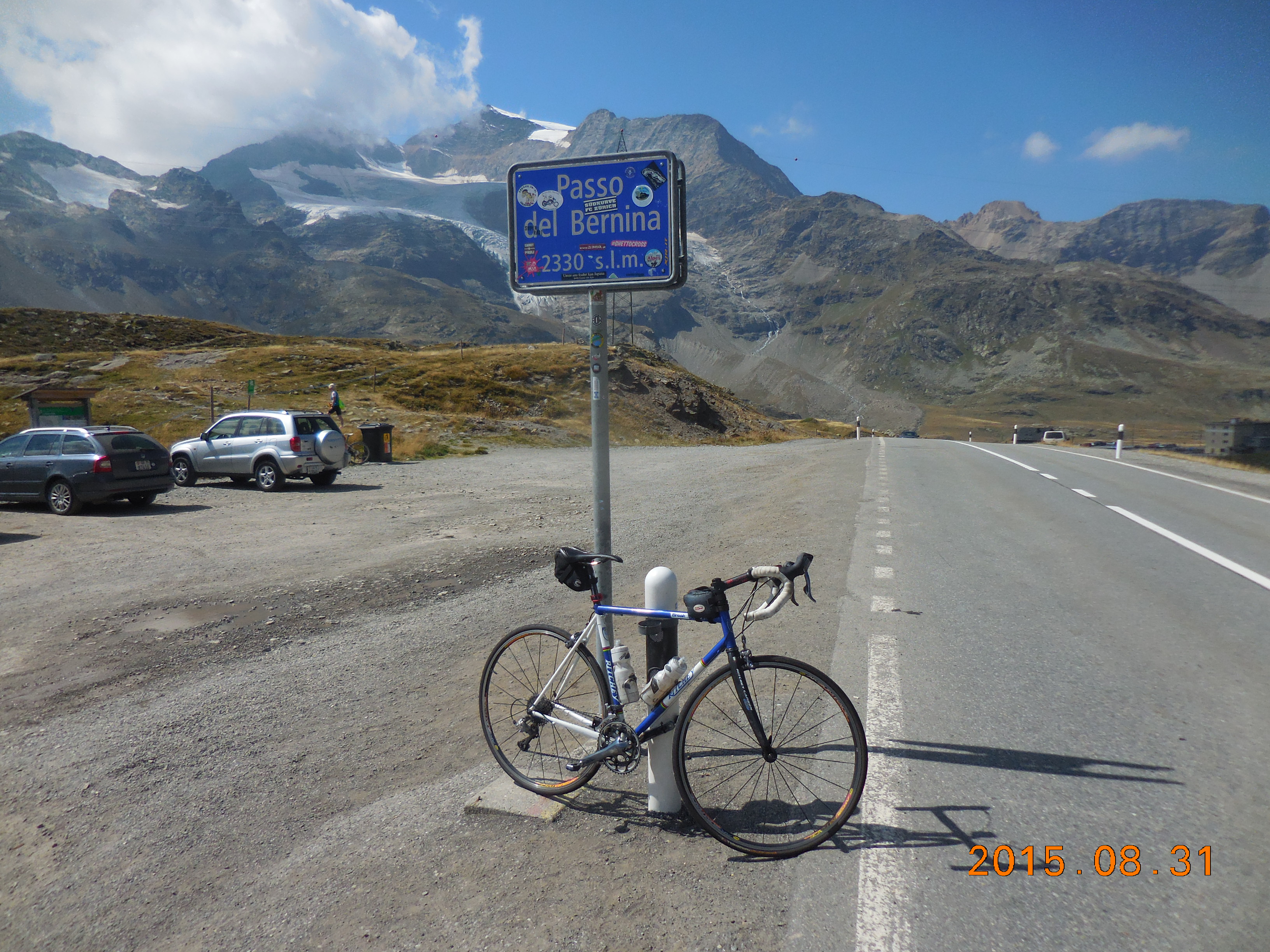 However, since you probably will never be here again, I would recommend doing an out-and-back to Passo del Bernina. It’s about 3.3 km to the top with 280 meters of climbing. The climbing is easier than what you’ve just done and easier than what lies ahead.
At the intersection (whether back from Passo del Bernina or having never left), go past the customs area and follow the road up the valley (which feels wild and remote), easily at first but then steeply up to the Forcola di Livigno. A lovely downhill and some almost flat riding lead you into Livigno.
Turn right in Livigno following the signs for Bormio. Climb the fairly short climbs of Passo Eira and Passo del Foscagno, then make the wonderful, long descent into Bormio.
The loop is about 123 km with 2,600 meters (8,530′) of climbing. If you add Passo del Bernina, you are looking at 129.6 km and 2,880 meters (9,449′) of climbing.
Torri di Fraele
A little gem of a climb, full of switchbacks, and close to Bormio. It’s about 14 km to the top with 790 meters (2,592′) of climbing. The usual way to ride it is to start as for the Stelvio, then at turn #39, turn left as for Livigno. In a couple of kilometers turn right following the sign to Pedenosso and Torri di Fraele. In 300 meters turn right again following the sign for Torri di Fraele. Follow this road all the way to the two towers at the top.
However, there are much more interesting alternatives. One early alternative is to turn left at turn #40 towards Premadio. Climb steeply through Premadio, turn left at the T-junction, then when you reach the main Livigno road, cross it, following the sign for Pedenosso and Torri di Fraele as above.
The next alternative is to continue into Pedenasso, and as you enter town, turn right following the sign for Laghi di Cancano. Meander up various roads until you join the standard route.
 The best alternative is start through Premadio, then continue along the main road towards Livigno. In the town of Piandelvino-Pece, where the road turns sharply left across the river, instead turn right and climb the steep little road called Dei Campi. Follow this to the center of Pedenosso then cross the main square and continue very steeply up the road on the other side. Again, meander up various roads until you join the standard route.
Links and other Clicks
I rode the Stelvio on Stelvio Bike Day. Apparently 12,100 people rode the Stelvio that day, 9,550 from the north and 2,550 from the south.
