
June 2017 (Updated July 2026 where shown)
KmM = Kilometer Marker. Where the markers are specifically for cyclists, they count down towards the top.
Read this page for a lot of background information about cycling in the French Pyrenees.
I’ve been to many charming mountain villages but Saint-Lary-Soulon is not one of them. I found it rather gray and bleak. However, the cycling is pretty good. Right out of town are the climbs of Pla d’Adet, Coll du Portet, and Col de Val Louron-Azet, then heading south you have Piau Engaly, and the fantastic Lac de Cap de Long and the Route des Lacs. To the north is the Col d’Aspin – regularly used in the Tour de France – and the Hourquette d’Ancizan.
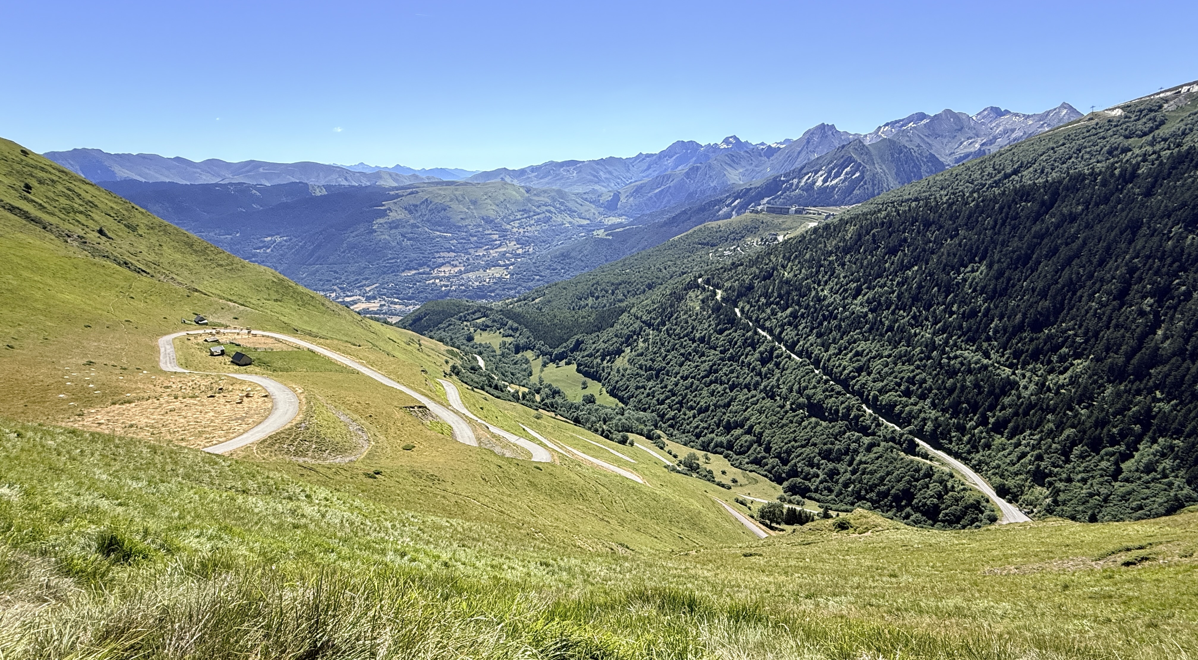
Pla d’Adet
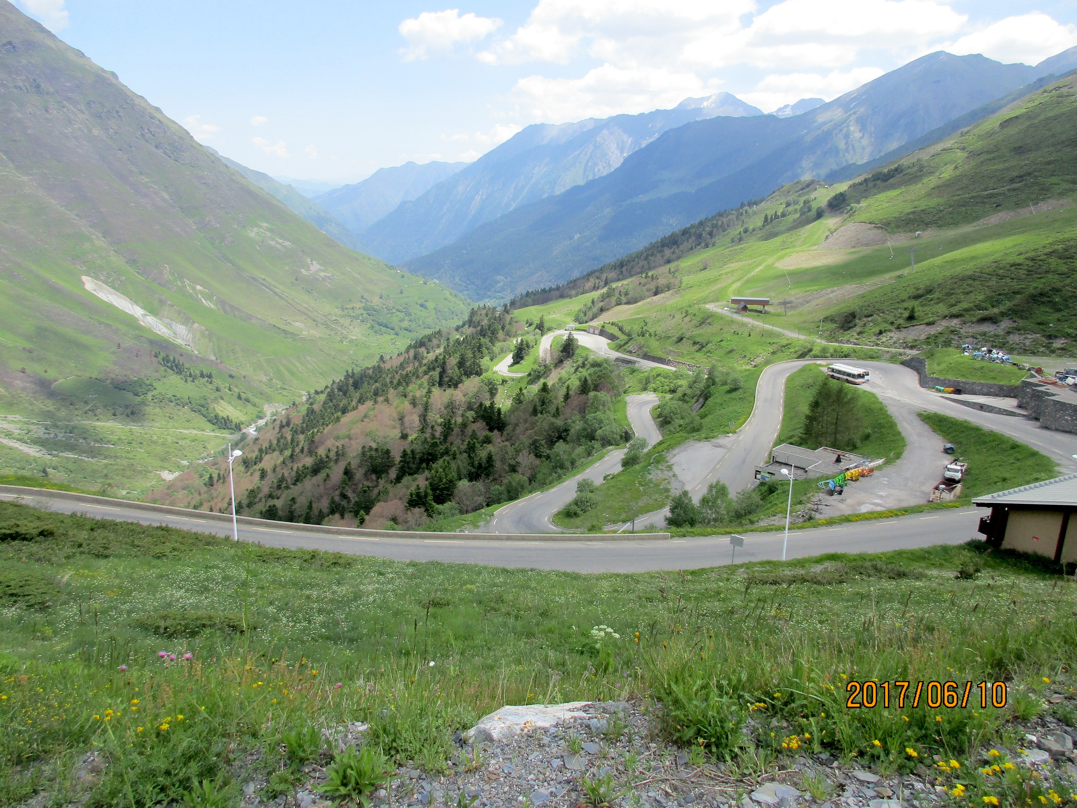
 This is perhaps the most famous of the rides around Saint-Lary-Soulon as it’s been used as the finishing climb in the Tour de France (Well, maybe not anymore. Perhaps Col du Portet is more famous since it’s been paved all the way to the col). Pla d’Adet is a ski area and the buildings at the top dominate the western skyline, looking vaguely like something from Star Wars. As you look more closely you see the huge switchbacks to the right leading you upwards.
Make your way to Vignec, a small village at the base of the big switchbacks. From here it’s 10 km to the top with 820 meters of climbing. Unlike some climbs where the steepest section is at the end, Pla d’Adet starts off steep, averaging 10% and 9% for several kilometers. Start up the huge switchbacks following signs for Pla d’Adet (also known as St Lary 1700). After about 5 km you go through the small village of Soulon and it feels almost flat. Soon you head back into a valley for a couple of kilometers until the road sweeps round to the left to Pla d’Adet. (To the right is St Lary 1900). Now you only have some 7% climbing left to the top and the bleak buildings of Pla d’Adet.
Col du Portet
 July 2026: Back in 2017 when riding Pla d’Adet I also rode up the Col du Portet road to where the road turned to dirt. In 2018 the road was paved all the way up to the Col so that it could be used in the Tour de France. It was first used on Stage 17 of the 2021 Tour, a stage won by Tadej Pogačar.
It’s a beautiful ride, supposedly one of the hardest in the Pyrenees. You start up Pla d’Adet and follow this for somewhere around 8 km then at the obvious intersection (where there’s a statue of Raymond Poulidor) turn right following the signs for the Col du Portet. Rather than going into Espiaube you make a very sharp right hand turn, again following the signs.
Interestingly, the initial climb up Pla d’Adet is steeper and more sustained than the section up to the Col du Portet. However the Col du Portet part is infinitely more beautiful than the Pla d’Adet part, absolutely worth doing, a dream ride.
After you’ve ridden the Col, you might as well finish up Pla d’Adet since you are almost there. If you do that, the whole ride from Saint-Lary-Soulan is about 41 km with 5,100 feet of climbing.
(When I rode this, the parking area at the top was completely packed with cars, but there were few people around. It turned out this was the weekend of the Salmo Trek, a strange competitive fishing event where the competitors have to carry tents, sleeping bags, and food, and fish competitively in mountain lakes for three days. Here’s an article about the event.)
Here’s the ride on Ride with GPS.
Col d’Aspin + Hourquette d’Ancizan
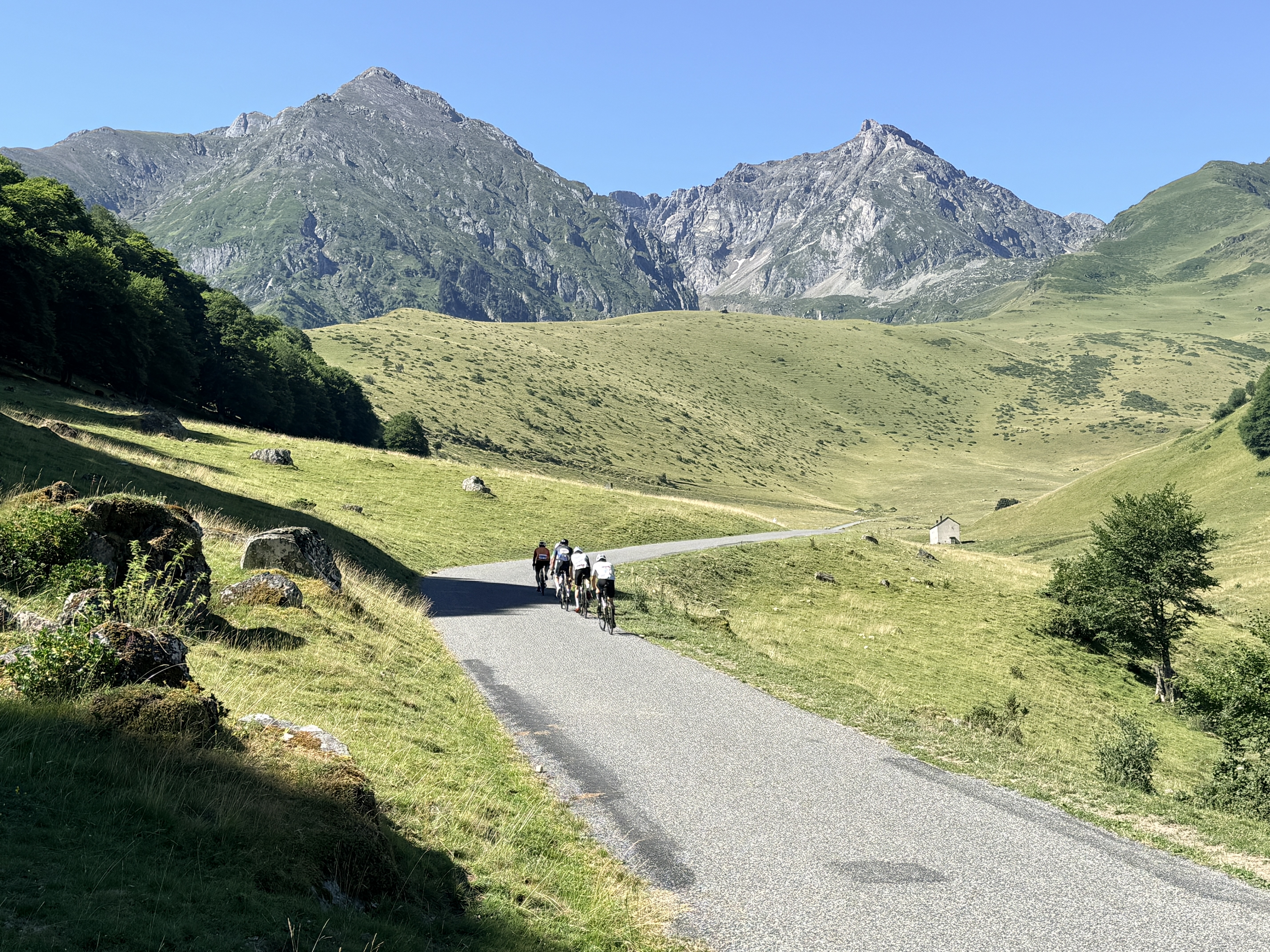 July 2026: A wonderful loop when done counter-clockwise. The east side of the Col d’Aspin is the better climb, and the west side is a delicious descent down to Payolle. Then the Hourquette d’Ancizan, well that is a stunning climb from the west side, just beautiful, magical. The east side of the Hourquette is nothing special, but at least you are descending so it’s over fairly soon. The loop is about 56 km with 4,500 feet of climbing.
I rode this on the day when La Pyrénéenne Cyclosportive was being held. There’s nothing like being passed at speed on the Hourquette by a host of young, slender riders to make you feel your age 🤣.
Here’s the loop on Ride with GPS. Ignore the few hundred meters below Payolle. I briefly thought of continuing to ride the Tourmalet but came to my senses.
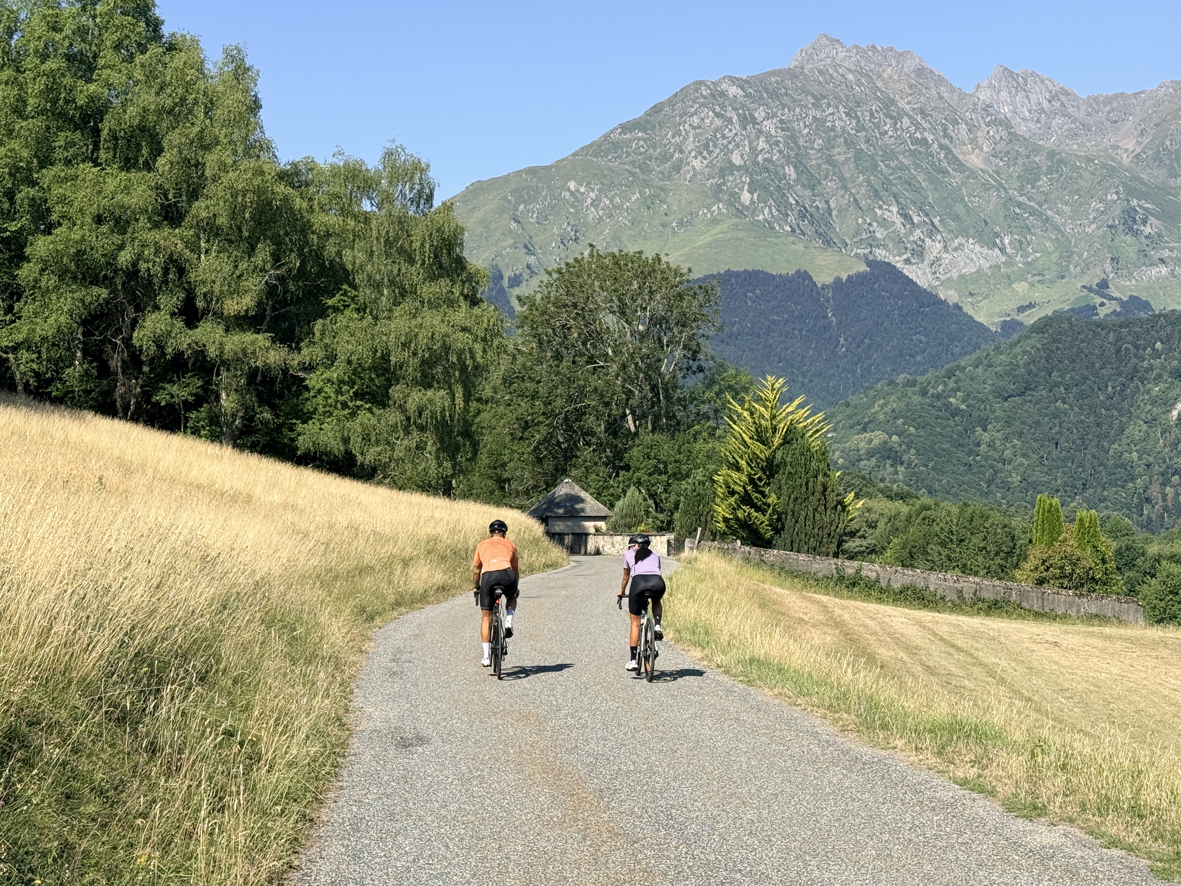
Col de Val Louron-Azet
 Sometimes known as the Col d’Azet, this is a wonderful ride. It’s worth doing as an over-and-back so you get both sides. The over-and-back is about 36 km with 4,400 feet of climbing.
The east side, from Génos is shorter and starts with about 12 switchbacks, mainly in the trees. It has a couple of kilometers that average 10% and a couple that average 8%.
The west side, from St Lary is far more appealing; it’s varied and has much better views. It’s not quite as steep as the east side, only averaging 8% and 9% for a few kilometers(!) and I found it by far the most enjoyable side.
From the roundabout at the very south end of Saint-Lary-Soulan, ride south for maybe 100 meters then turn left on the D-25 towards Azet. Continue easily through the little village of Sailhan, then meander steeply up through Azet. The next 5 kilometers are beautiful with spectacular views.
At the top head down for 7.5 km to Génos. This is a lovely descent. As you enter the village turn round at the roundabout and retrace your steps. You have about 4 km of switchbacks in the trees then you enter open country and things become prettier. A bit under 6 km from Génos turn right following the sign for Azet and St Lary.
Col d’Azet + Lançon Loop
 July 2026. This is a nice loop, combining the Col d’Azet (Col de Val Louron-Azet) with a return along quiet narrow roads. Start at the south end of Saint-Lary-Soulan, as described in the section above. Once in Génos, continue north to Bordères-Louron then turn left on the D25. Climb steeply for about 3 km then continue along the pretty road to Lançon. Continue along the D25 to Gouaux, then continue through Grailhen, Camparan, and Estensan, then back down to Saint-Lary-Soulan. The loop is about 47 km with 4,300 feet of climbing.
Here’s the route on Ride with GPS.
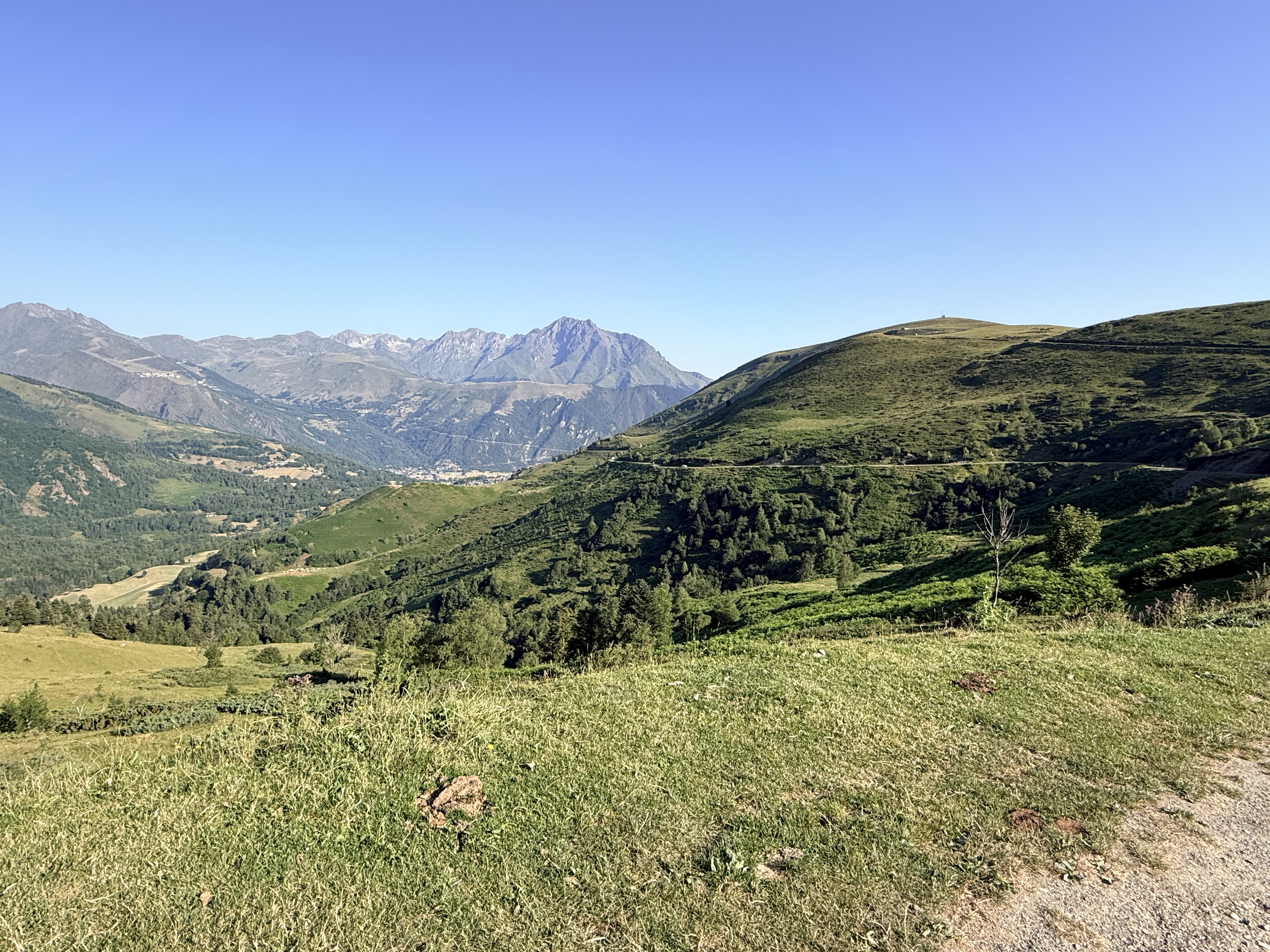
Lac de Cap de Long and Route de Lacs
 A stunning ride with spectacular views. Will, at Cycling-Challenge, says ‘Top-to-bottom, the best road-bike climb that I have done in the French Pyrenées.” Cycle Fiesta says “Route des Lacs is one of the most spectacular cycling climbs that you will ever do.” I’m not going to disagree with either.
Route de Lacs may not give you bragging rights like the Tourmalet but it’s an even better ride. About 5 km from the top there are two branches, one that goes to Lac de Cap de Long and the other to Lac d’Aubert. Do both. If you can only do one, I’d recommend the left branch to Lac de Cap de Long. Going to both lakes from St Lary gives you about 56 km and 1,760 meters of climbing.
From the roundabout at the very south end of Saint-Lary-Soulon, ride southwest along the D929. This is not too steep but the road surface sometimes could be better. After about 5.5 km you pass through Eget Cité with its big hydro power plant. At almost 9 km turn right (still on the D929) following the sign for lac de Cap de Long. Immediately the road narrows and you enter a deep narrow valley. At times the road is almost flat and at other times it rears up to 9-11%.
The valley widens out then at one point you climb a short series of tight switchbacks which are fun. Eventually you reach a junction with a big lake (lac d’Orédon) down below to the right. Take the left-hand fork towards lac de Cap de Long. Shortly before 18 km from St Lary you get a fantastic view of the huge dam up ahead of you. This is your destination. Follow the road as it curves around the left side of the basin then cuts across the hillside towards the dam. A series of steep switchbacks leads to the top of the dam and views of lac de Cap de Long.
Descend about 4 km to the intersection then descend down to lac d’Orédon. Continue up the road and after about 6.5 km from the intersection you’ll reach the end of the road at lac d’Aubert, and more fantastic views.
July 2026. I rode this again, and this time I recorded the ride on Ride with GPS.
 Extra credit: Piau Engaly. An additional 21.4 km and 685 meters of climbing. Once you have descended all the way back down to the main road, turn right on the D118 following the signs for Spain and Piau Engaly. After just over 3 km turn right for Piau Engaly. Another 7 km takes you to the ski area building at the top. This climb is fairly consistent at the 7-7.5% gradient range.
 Extra extra credit: Tunnel d’Aragnouet-Bielsa. An additional 12 km and 446 meters of climbing. Once you have descended from Piau Engaly to the intersection of the D118 and D173, turn right following signs for Spain and the Tunnel d’Aragnouet-Bielsa. Follow the road up several switchbacks then continue straight back into a beautiful open valley and the entrance to the tunnel. Turn round at the tunnel entrance and ride back down.
