
June 2017
KmM = Kilometer Marker. Where the markers are specifically for cyclists, they count down towards the top.
Read this page for a lot of background information about cycling in the French Pyrenees.
Col d’Aubisque
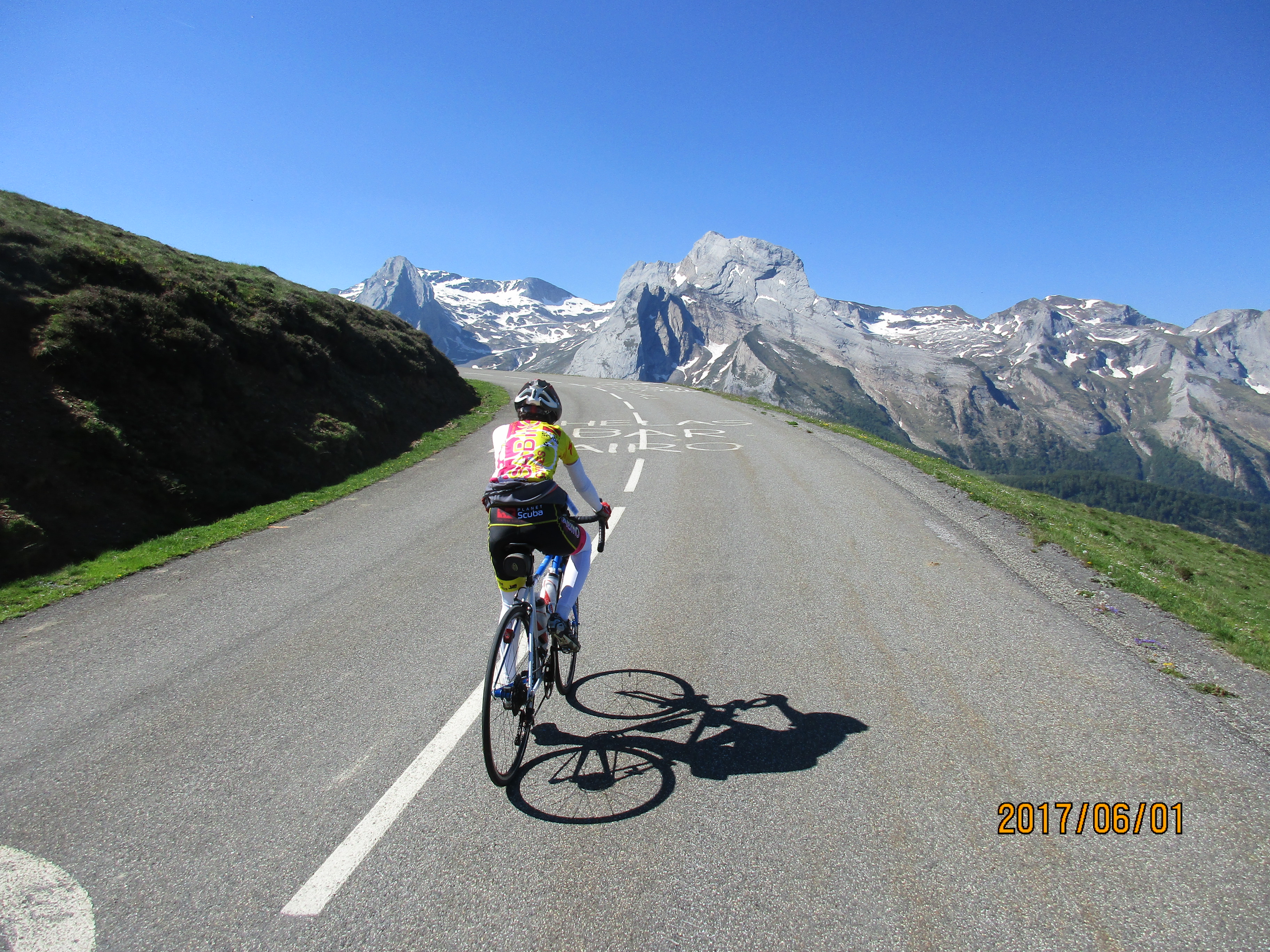
One of the great cols of the Pyrennes, the Col d’Aubisque starts in Laruns and climbs steadily for about 17 km. There are regular Kilometer Markers (KmM) that tell you how far you still have to climb, and show the gradient for the next kilometer.
Unlike the super steep climbs of Spain, this climb doesn’t have anything too steep, although between KmM 11 and 10 there is a short section of 13%. The whole climb is about 17 km with 1,190 meters (3,904’) of climbing.
The climb starts as many climbs do, with views of trees. This is broken just after KmM 13 by the cute little town of Eaux-Bonnes and its one-way system. At around KmM 6 you reach the lower part of the Gourette ski area and the first views of the spectacular mountains arrive.
From now on you the mountain views keep getting better and better. You soon reach the ski town of Gourette and as you leave this you have 4 km to go. Looking up you see the road slashing upwards to the left and you see a building perched at the left end of the road. Is this the summit?
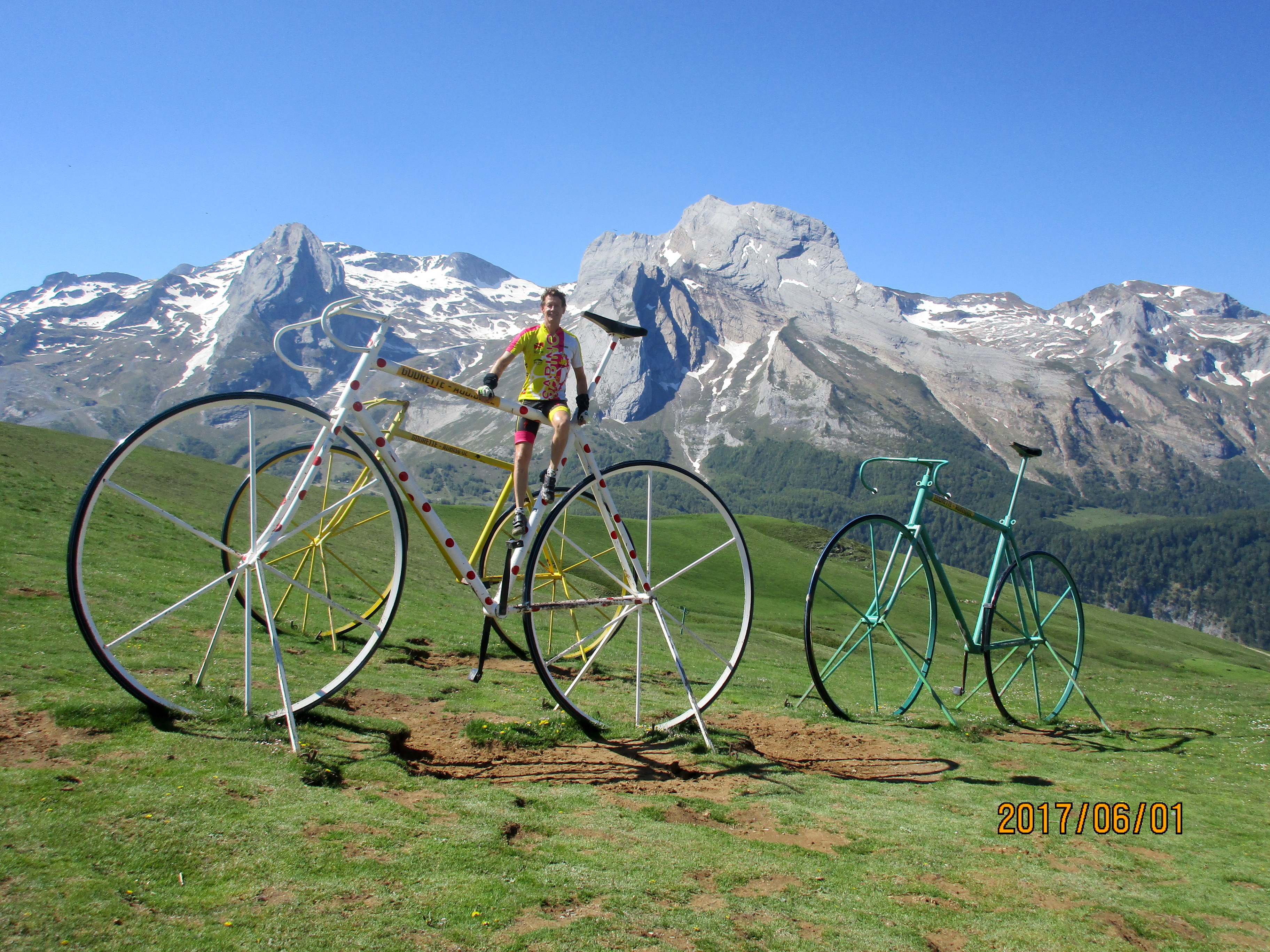 Well, no. The summit is another 1.5 km past this building, winding through high alpine meadows. When you finally reach the Col d’Aubisque you know you are there because there are three enormous bicycles on the right which you can pose on or beside.
Col de Marie Blanque
 With the Col d’Aubisque right next door, the Col de Marie Blanque seems a little less important. However, it’s a good climb and very different on both sides. I rode it over and back from Laruns, and that is how I’ll describe it. The whole ride was 57 km with 1,403 meters (4,603’) of climbing.
From the roundabout in the center of Laruns follow the road towards Pau, then turn left at one of the roundabouts following the sign for Bielle and the Col de Marie Blanque. Ride through Bielle, and just the other side, at km 8.4 turn left at the sign for the Col de Marie Blanque.
Both sides have big signs at the start showing the distance to the top, and and the starting and finishing elevations. The east side from Bielle is 11.23 km with an elevation gain of 587 meters (1,925’). The west side from Escot is 9.3 km with an elevation gain of 705 meters (2,313’).
The east side from Bielle is a much more interesting climb. It starts with several kilometers of lovely switchbacks, has great views, some steep uphill and a lot of easy riding through beautiful meadows. It’s not dramatic, but it’s very pretty.
So, from Bielle ride up the switchbacks for about 4.5 km, then after you cross a cattleguard you enter a different world. You are now in a peaceful, rural world of beautiful meadows, cows, and horses, and a lot of flattish riding. You continue is this world until shortly after KmM 4 the road rears up again for a few switchbacks, before leveling off to the col.

Ride down to the T-junction in Escot then turn round and ride tediously back up. The west side from Escot is boring. There are no views, you are mostly in trees, and the road simply goes straight up the valley.
The reason people do the west side is that it’s the harder side, and the last four kilometers are tough, with the kilometer markers showing gradients of 11, 12, and 13%.
