
 June 2017
Map showing the location of the rides in Andorra described in the pages below.
KmM = Kilometer Marker. Where the markers are specifically for cyclists, they count down towards the top, although unlike the French markers, these ones start counting at the start. So, where French markers will say 7, 6, 5, 4 etc as you approach the top, the Andorra markers might say 6.6, 5.6, 4.6, 3.6.
I drove to Andorra from Bagnères-de-Luchon, and what a beautiful drive it was. So many hills to drive over and gorgeous rivers to follow. One of the best parts was driving over the Port de la Bonaigua – the east side is simply stunning. I’d love to ride it one day but unfortunately, as Gertrude Stein might have said, it’s not really near anywhere.
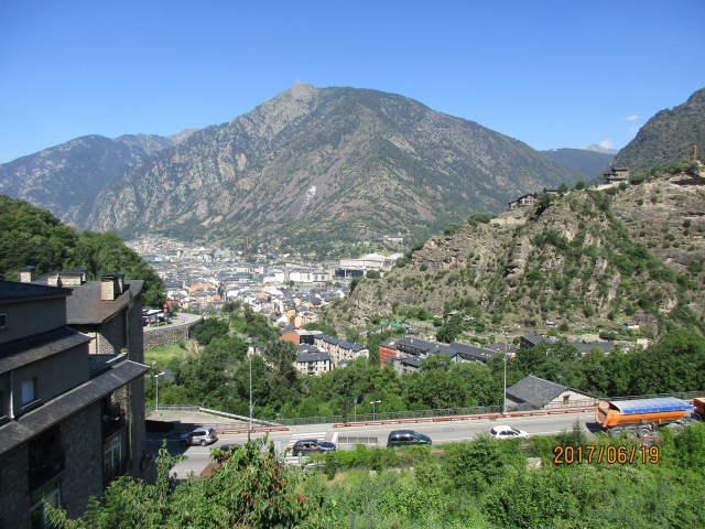
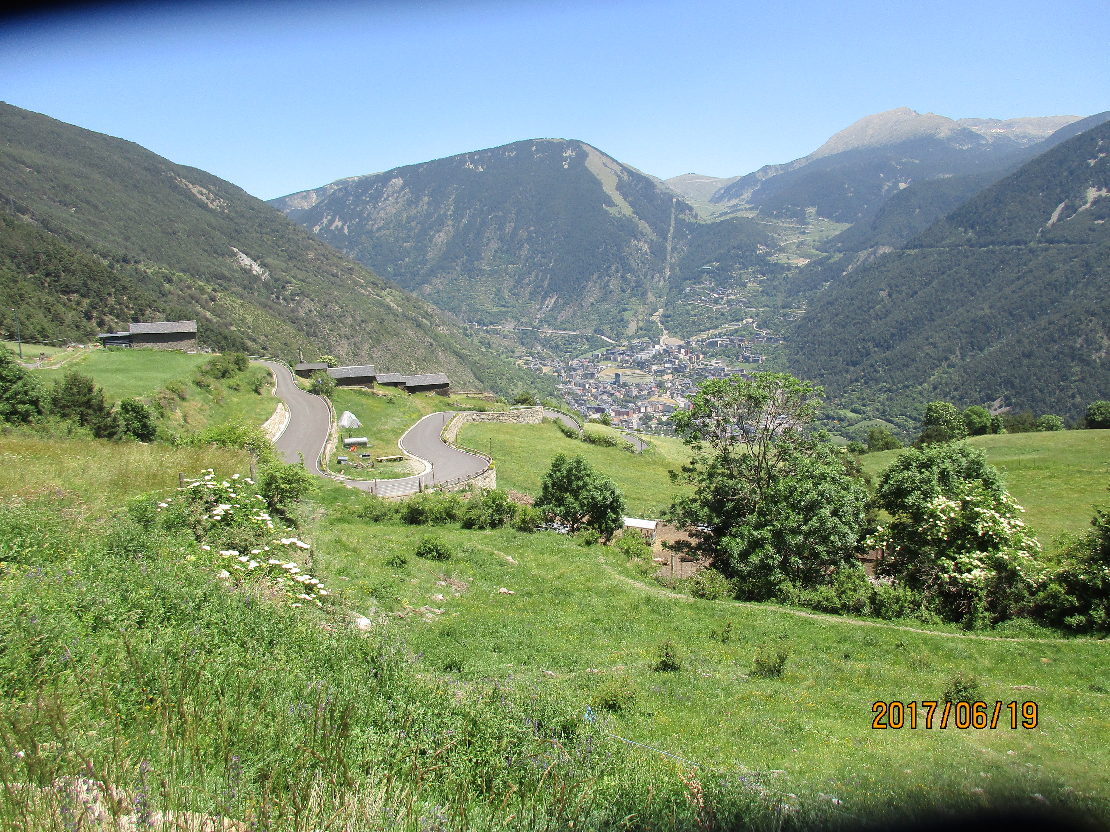
Entering Andorra from Spain was easy. Andorra is not in the EU and not in the Shengen zone, but you simply drive straight through the border control (although be ready to stop if you are told to.) Andorra is mountainous and everything seems steep. The main road through Andorra just keeps climbing, climbing, climbing, passing gas station after store after gas station after store. But it’s so busy that I wouldn’t want to ride on it. There are so many cars on the road during the week – I’d hate to see what it’s like in prime tourist season.
Andorra is a rich country. 80% of its economy is tourism, and tourists come partly because things are duty-free and thus a lot cheaper than in France or Spain. So there are lots of cars, lots of stores, lots of hotels, and lots of restaurants. In fact driving through Andorra on the main road feels a bit like being in Las Vegas except for the casinos. Once you get off the main drag the backroads are beautiful, but the main drag….well, Andorra has been called the Ugliest Country in Europe. I’m not sure I’d go that far because almost all the buildings are beautiful stonework – I rarely saw an ugly building. After Andorra, France seems very shabby. Andorra’s official language is Catalan although most people also speak Spanish.
Anyway, on to the rides. I came here to ride Arcalis and Col d’Ordino as they were the only climbs I’d read about. But I looked at a map and realized there are lots of squiggly roads which meant steep climbs. So I did some research and discovered Cycle Fiesta’s pages about Andorra. I also picked up a very good brochure and map about all the rides at one of the Tourist Information offices (strangely, the route numbers on the kilometer markers bore no resemblance to the numbers in the cycling brochure, so it may have been old stock.) Andorra is a popular base for professional cyclists – partly the training and partly the tax situation.
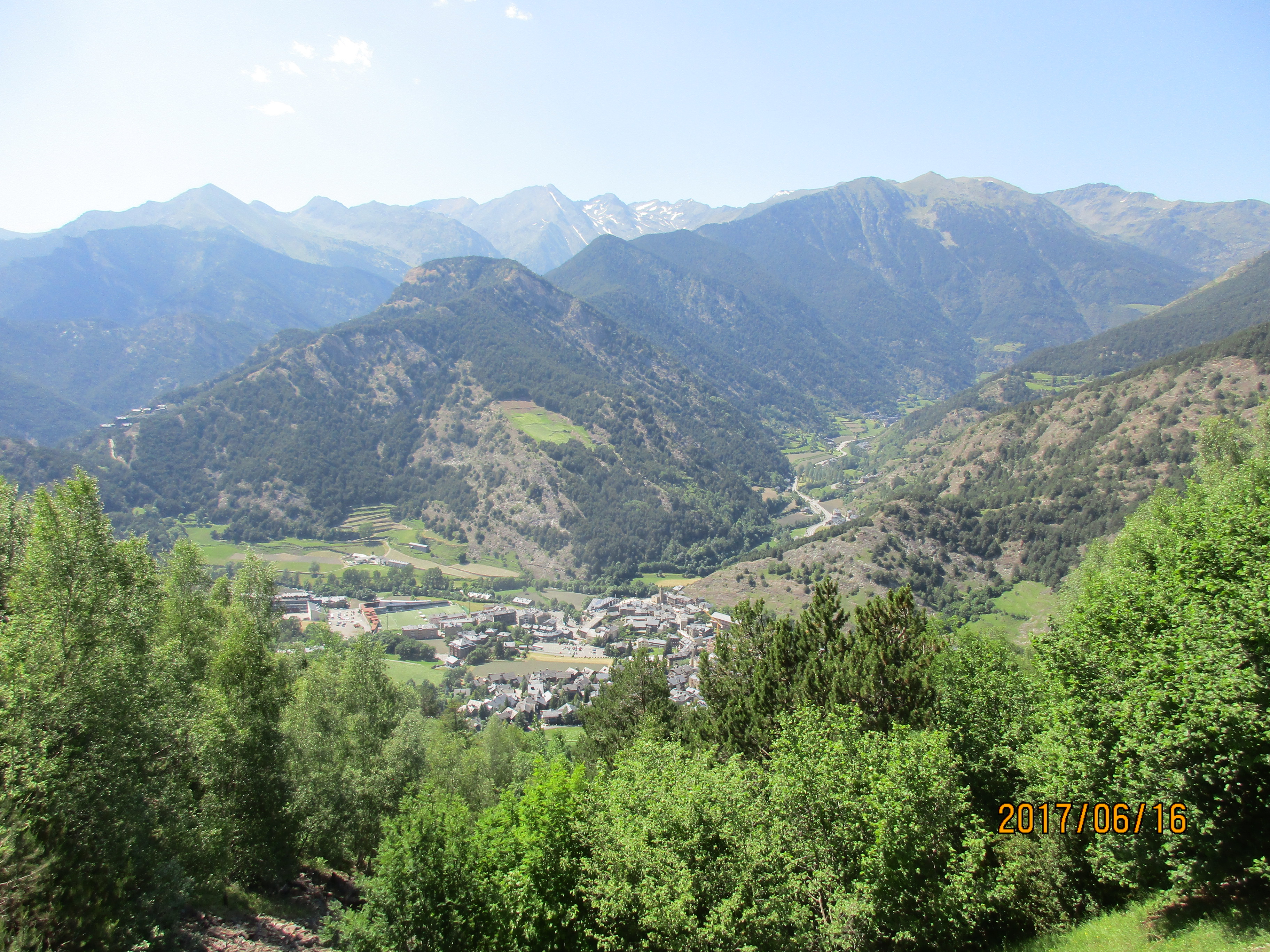
Andorra is a climber’s paradise. I saw far more cyclists on these climbs than on any in the French Pyrenees. And the weather is better here than in the French Pyrenees. While the main roads are packed with cars, especially during the week, I rarely saw cars on any of the climbs. The road surfaces are generally fantastic and a delight to ride.
I was staying in Ordino because it’s the start of the two climbs I knew about, but Andorra is so small you could stay anywhere. In fact, Ordino is rather too small and quiet and I’d recommend somewhere else, especially since you may be driving to the start of some of the rides. La Massana might be a good choice as it’s a bit lower down the valley than Ordino, has a lot more going on, and still has good access to several of the rides. It’s also apparently the choice of several pro riders.
One thing to note is parking. Because there are so many cars, parking can be difficult. Parking spots within white lines are free; blue lines are paid parking, although I was told blue line spots are free at weekends. I sometimes had to drive up the ride a short way to find free parking.
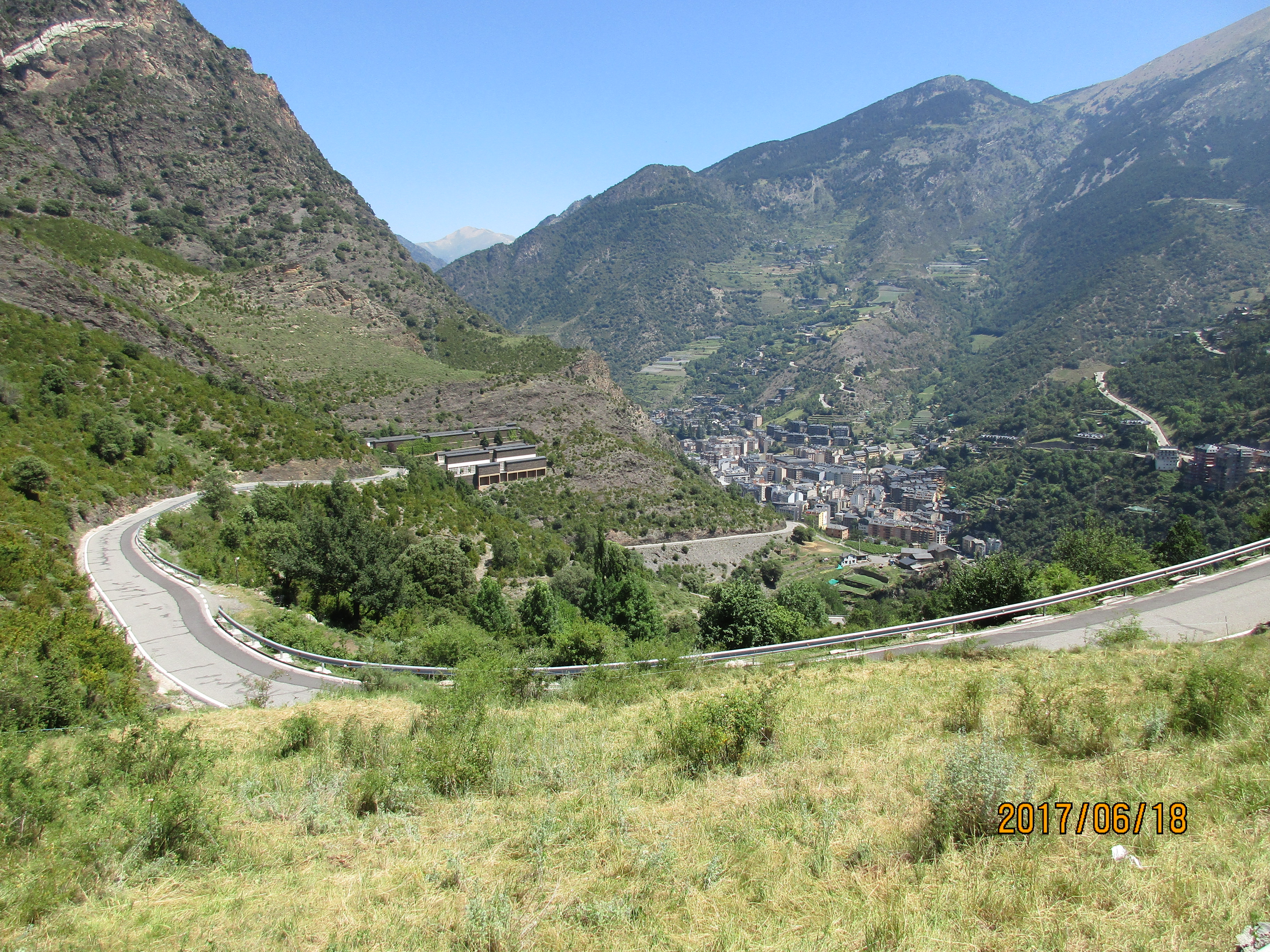
Arcalis
 The most famous climb in Andorra because it’s been used several times as the finish of a Tour de France stage. It’s never too steep but has a fantastic finish with beautiful switchbacks leading up to an incredible road cutting across a rock face.
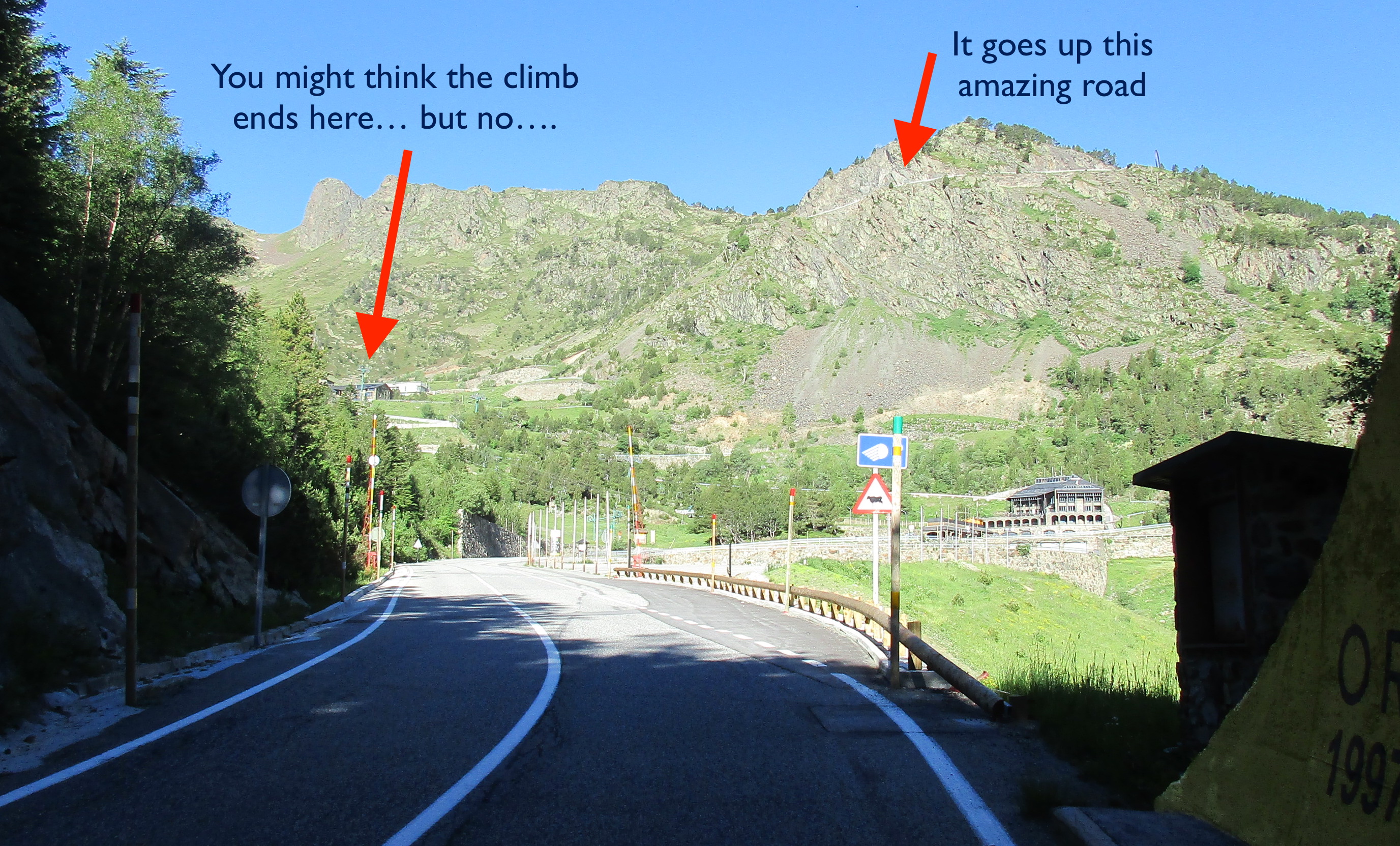
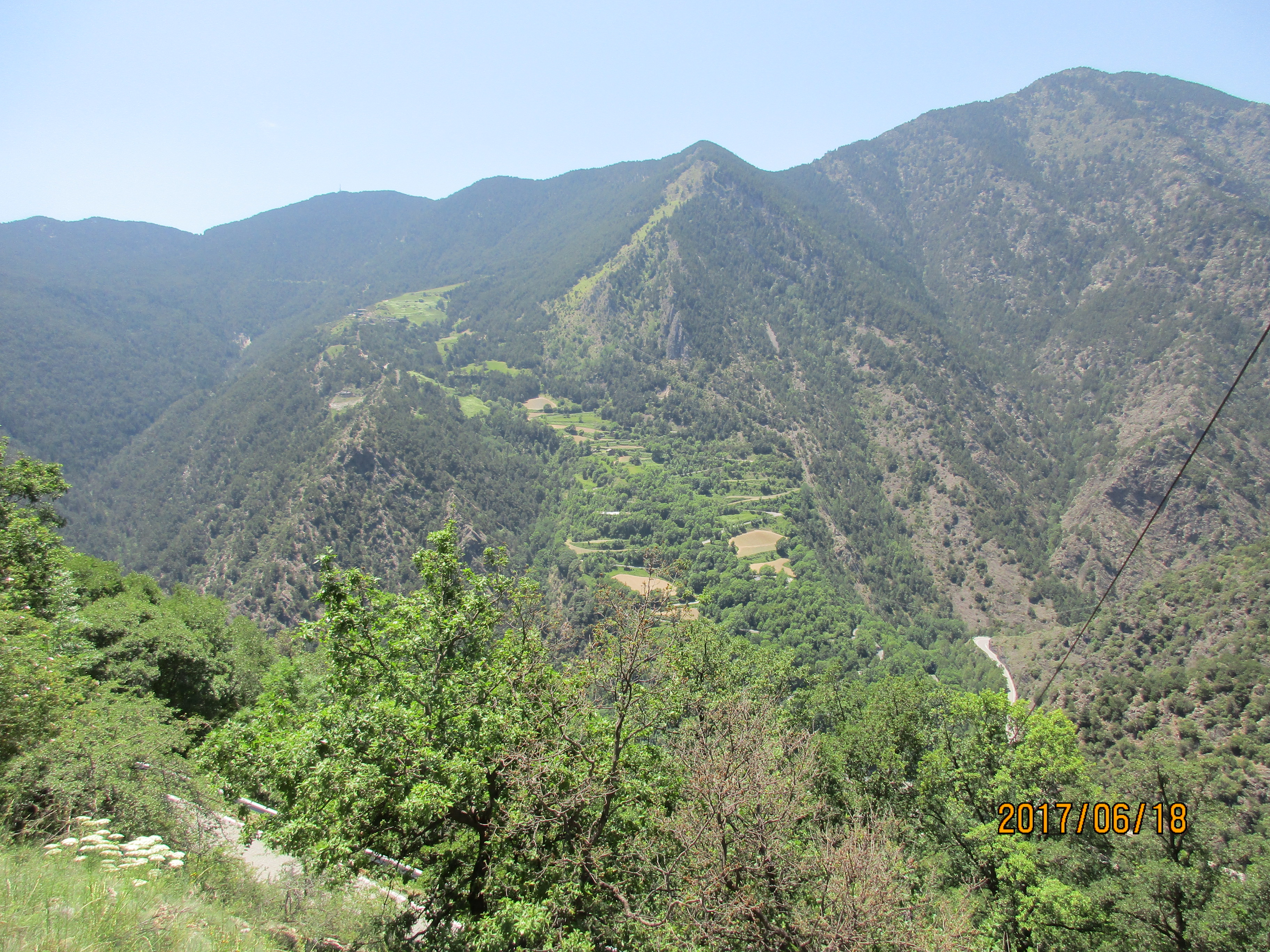
From Ordino it’s about 18 km with 943 meters (3,094′) of climbing. The first few kilometers are pretty easy, and the real climb starts at El Serrat. At least that’s where the “official” start is, with the start of the cycling kilometer markers – 10.5 km to the top. You climb steeply through El Serrat, and this is the steepest gradient on the whole climb. The rest of the climb averages 6 or 7% for each kilometer.
As you climb higher, you start to see a white line cutting up and right across a rock face. Is this the road? Or maybe just a hiking trail. As you get closer it becomes increasingly apparent that it’s the road. Some beautiful switchbacks into and through the ski station then you are on the cliff-face road. Another 1.5 km after that you finally reach the top. This is a very popular hiking area – the trails and mountains they ascend are simply beautiful.
Col d’Ordino
 I did this the afternoon I arrived, partly for something to do and partly because it’s one of the two climbs done in the Tour de France. It’s nothing special, but the views down into Ordino are lovely. From Ordino it’s 9.9 km and 693 meters (2,274′) of climbing for an average gradient of 7%.
However, the side from Canillo, which I didn’t ride, looks far better, with wonderful views.
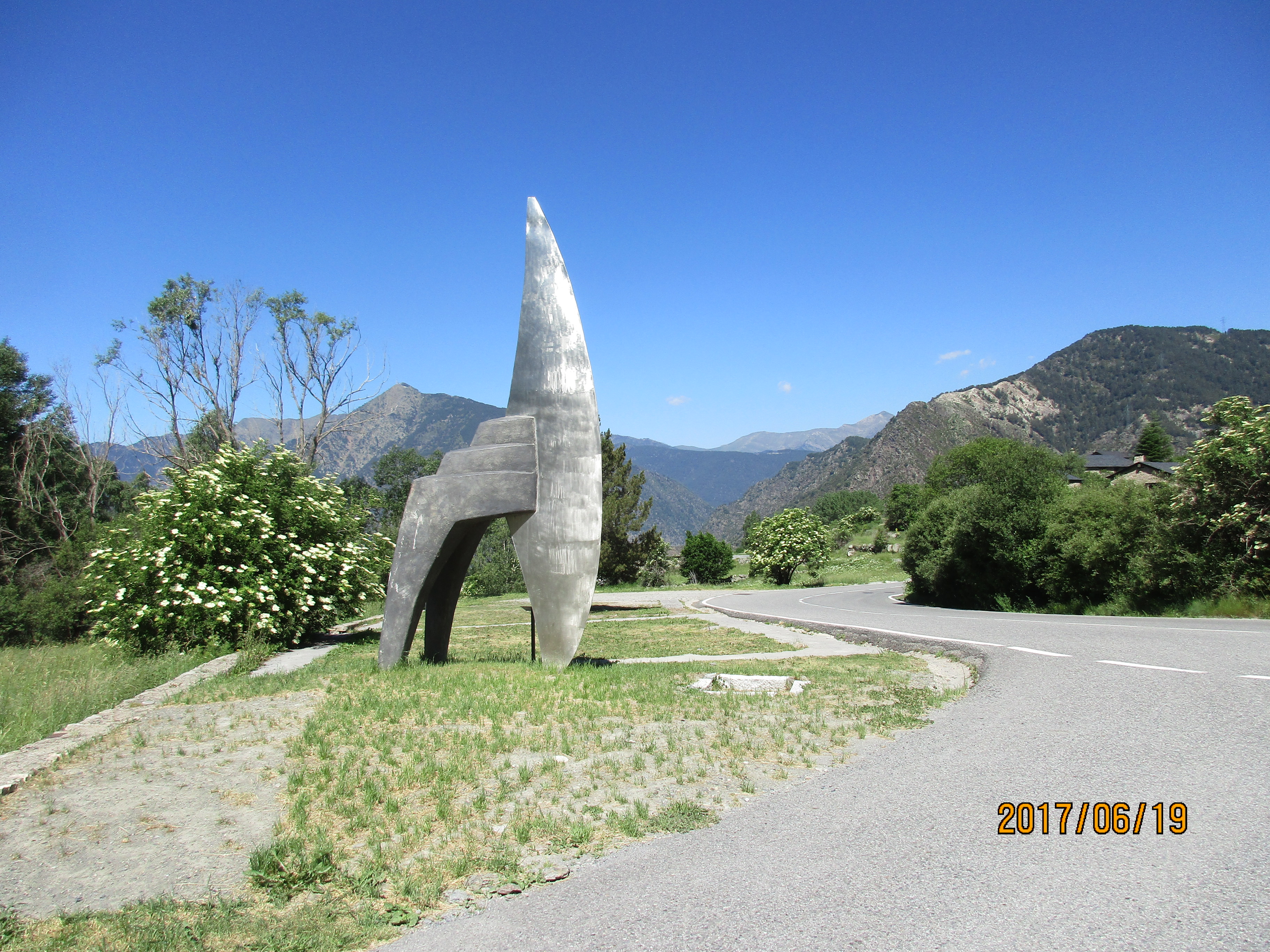
Port de Cabús
Another beautiful ride, especially in the upper section. Start in La Massana and follow the CG-4 up past Erts and Pal. The climb is 18 km and 1073 meters (3,520′) of climbing.
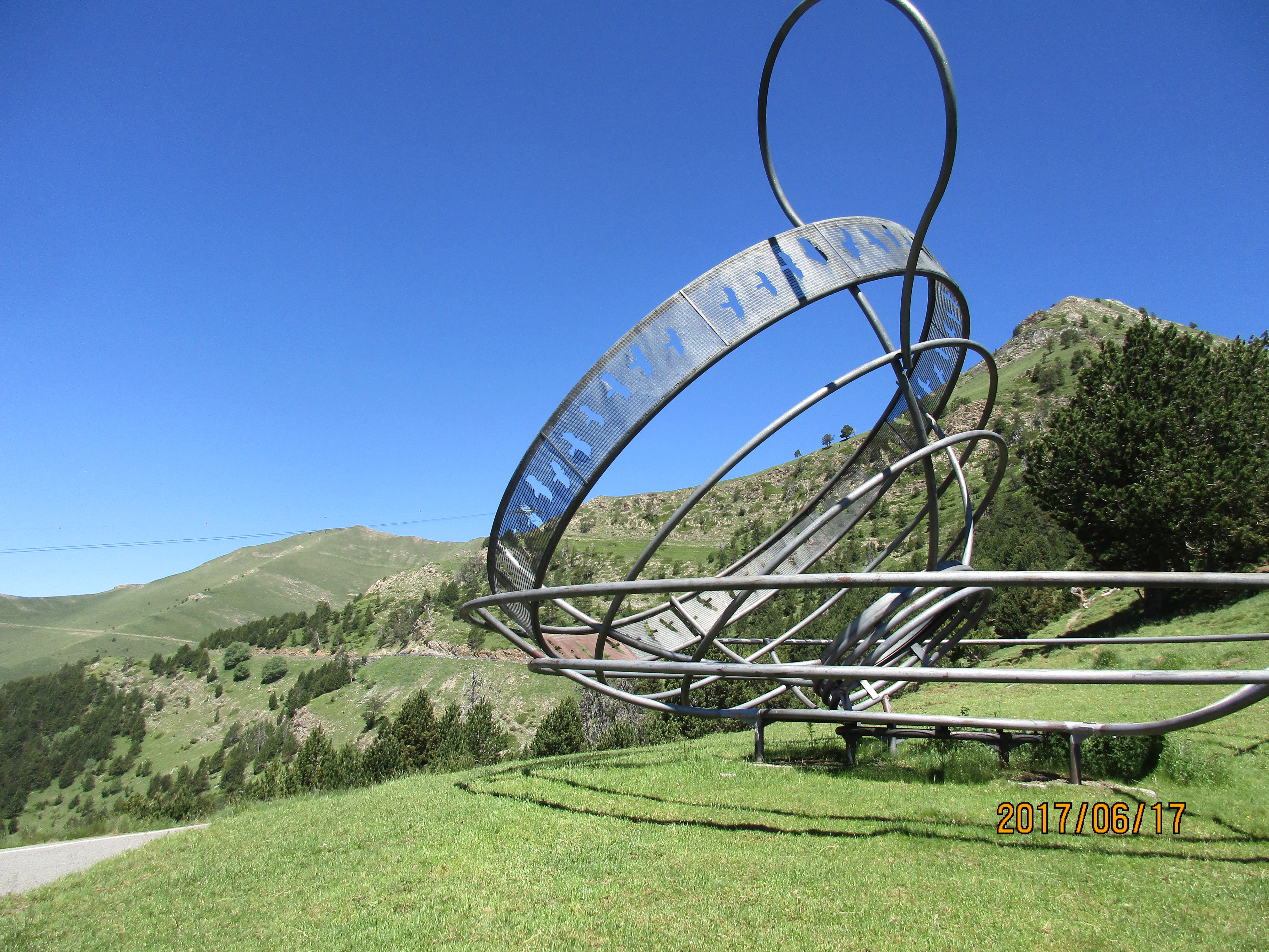 The “offical” climb starts in Erts and the sign says 15.6km and 962 meters of climbing from here. Wind your way up until after about 8 km from La Massana you break out of the valley and the views start to get better. Somewhere around km 12.3 from La Massana you reach Col de la Botella although it’s hard to pinpoint its exact location as you keep going uphill. Somewhere around the Col you see the strange metal sculpture called Storm in a Teacup by Dennis Oppenheim, created to celebrate the 25th Anniversary of the Andorra Bureau of Social Security(!). The last 6 km have a lower gradient but are so wonderful, with lovely views.
Coll de la Gallina
This can be climbed either from the south, starting in Sant Julià de Lòria and climbing via Fontaneda, or from the north, starting in Aixovall and climbing via Bixessarri. Both sides are tough and Cycle Fiesta calls the south side “the most challenging road climb in Andorra.” Definitely one to do.
I rode up and down both sides, but if you only want to do one side I would recommend climbing the south side via Fontaneda, then descending the north side. This is a bit of a false recommendation though because the hard part of the south route is one-way uphill. So the only “official” way you get to see both sides is up the south and down the north.
Coll de la Gallina via Fontaneda
 In the southern part of Sant Julià de Lòria take the exit for Fontaneda. I had to drive up several switchbacks before I could find easy parking. I then rode back down to the main road to start. The climb is 12.2 km and 1,019 meters (3,343′) of climbing for an average gradient of 8.4%.
But what a climb. It’s a pretty climb, no stunning views but worth doing for its steepness. The steepest single kilometer averages 11.9% but the climb has plenty of sections of 14-18%.
The last few kilometers are a sensational one lane uphill only road, beautifully paved for the 2015 Vuelta, and steep, oh so steep. Around 8 km into the climb the one-lane road just stretches steeply, brutally, out in front of you through the trees and this is where you find the 11.9% average – which of course touches 18%. Fortunately the next kilometer is much easier – it only averages 10.6% 😀. After you reach the top you have to descend the northern side, so I’ll describe the descent there.
Coll de la Gallina via Bixessarri
 Just north of Sant Julià de Lòria take the exit for Aixovall. There’s good parking on the right immediately off the main road. From here the climb is 11.9 km and 982 meters (3,222′) of climbing (or so the sign says; my Garmin registered only 825 meters.) The average gradient is 8.3%.
The first 3.6 km are up a decently sized road that leads eventually to a very popular picnic spot. At 3.6 km in Bixessarri turn left across the bridge. The road narrows now and you are faced with about 8 km of switchback after switchback. The valley below you drops precipitously although you don’t get many views into it because of the trees, just the occasional glimpse. This climb is not as hard as the southern side but it’s still steep, with plenty of sections ranging between 13-18%.
Once at the top, turn round and descend the way you came up. You now experience one of the best and sweetest set of switchbacks you are ever likely to ride. A switchback-lover’s heaven.
Extra credit: Aixàs. As you descend from Coll de la Gallina to Bixessarri, you can see some lovely switchbacks across the valley. These lead up to the tiny hamlet of Aixàs. Once you reach Bixessarri turn left then immediately turn right following the sign to Aixàs. The climb is only 3.8 km with 344 meters (1,129′) of ascent but the first two kilometers average 10.3 and 10.5%, with sections of 13-15% thrown in.
Extra credit: Os de Civís. Since you are here you might as well continue up the main road to Os de Civís, which is 4.1 km and 312 meters (1,024′) of ascent from Bixessarri. The road starts steeply out of Bixessarri but then eases off as it follows the river through the canyon. After about 2 km you come across a very popular picnic spot by the river with lots of picnic areas and stone grills. There were lots of families enjoying themselves when I rode this. Shortly after the picnic area you leave Andorra and enter Spain. The road surface gets considerably worse and steepens seriously. From there to Os de Civis there’s plenty of 10-12% to keep you working. It’s strange having this road in Spain but accessibly only through Andorra – it made me wonder how it’s maintained.
Els Cortals d’Encamp
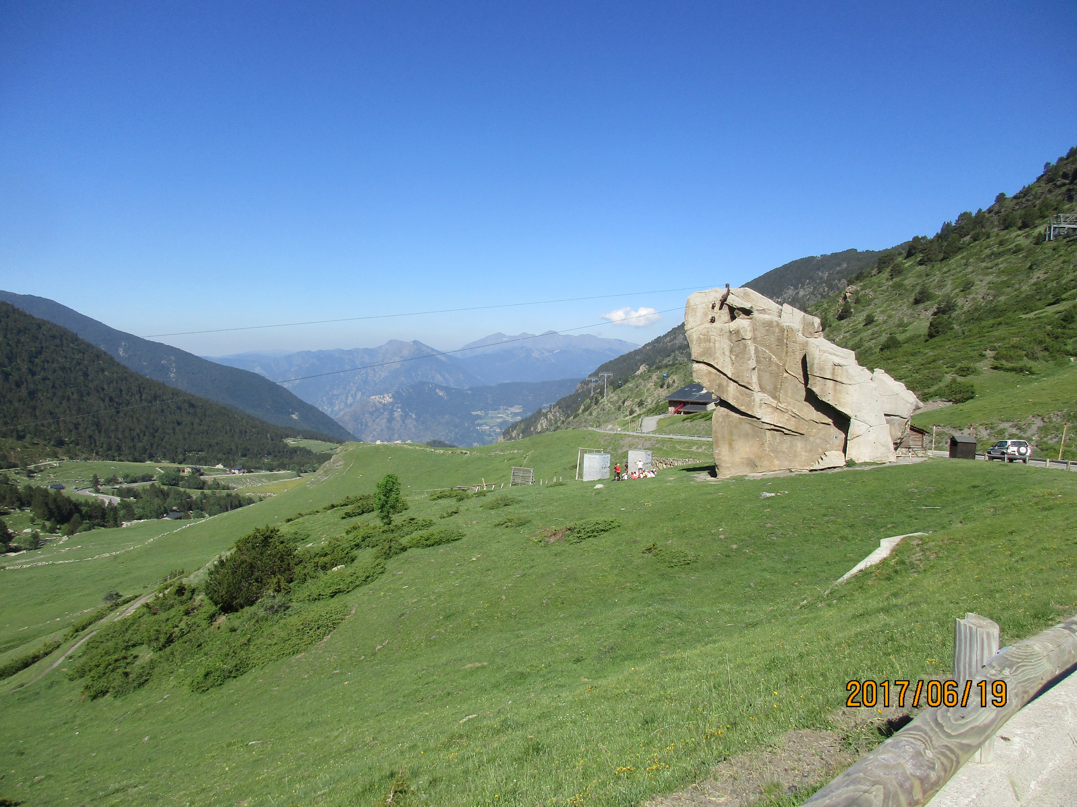
Artificial climbing rock near the top
A lovely climb with a brutal start. From Encamp it’s 8.9 km with 754 meters (2,474′) of climbing for an average gradient of 8.5%.
To get to the climb, don’t go into Encamp itself but stay on the main road to France, looking out for the sign to Els Cortals. I parked a few hundred meters up the road, out of the blue zone.
The first two kilometers are simply brutal, especially if you are not warmed up – 10.2 and 10%. Fortunately the climb gradually eases as you climb higher and the views get better. You even get to see gondolas hanging from the cable on the left as you climb. About 2 km from the top there are a couple of switchbacks with lovely rock walls, then just below the top you come across this bizarre artificial rock with climbing holds bolted all over it.
Engolasters
Scary sculpture on the way up
A lovely little climb with beautiful views of the city below. It climbs steeply, eases off in the middle, then steepens.
From the main road near Escaldes-Engordany, look for the turnoff signed to Llac d’Engolasters. Again, I drove up this road looking for a parking spot before riding back down to start the climb.
It’s short, only 6.4 km, with 540 meters (1,772′) of climbing, for an average gradient of 8.4%, with a couple of spots that hit 15%. In the easy section in the middle you come across a very strange and rather scary sculpture of a hatchet-like blade.
Collada de Beixalís
The most fun I’ve had on a bike
What can I say about this climb? Climbing this from the west, through Anyós was going to be my last ride in Andorra. But when I got to the top I saw that the east side had one kilometer that averaged 12%. I had to ride it, so down I went.
I haven’t had so much fun descending in a long time, and I was either laughing or had a big grin on my face the whole way down. If you think you know twisty, you don’t know twisty until you’ve ridden down the east side of Collada de Beixalís. (Strangely this side is not written up the booklet I got from the tourist office.) So I ended up doing this as an over and back.
Collada de Beixalís via Anyós. Driving up the main road towards Ordino, just after the tunnel you see the turn for Anyós. The climb starts at this intersection so find somewhere to park on the main road. The climb is 8.7 km with 594 meters (1,949′) of climbing, for an average gradient of 6.8. It’s not a particularly special climb.
Collada de Beixalís via Vila. This starts somewhere around Encamp but I don’t know exactly where as I did it as an over and back. As I said, one of the best descents I’ve ever done, and a wonderful climb back up. It’s 6.6 km with 556 meters (1,824′) of climbing for an average gradient of 8.4%. The second kilometer averages 12% and is on the roughest section of road on the whole climb. Go figure. After this steep section the road is newly paved and silky smooth. It’s a narrow road, quiet, peaceful, with lovely views – a true delight. This was one of my favorite rides in Andorra.
Note: A fun ride without too much main-road riding would be climb the west side of Collada de Beixalís, descend the east side, ride up Els Cortals, then come back the same way. This would be a ride of about 51 km and a bit over 1,900 meters.
Links and Other Clicks
Cycle Fiesta describes many of the climbs in Andorra. Here’s a link to Arcalis, and at the bottom of that page you can find links to other climbs.
You can pick up a fantastic booklet about all the great climbs in Andorra at the Tourist offices (the booklet I picked up may have been out of date but it didn’t show all the climbs, and the route numbers didn’t match the signs on the road.) You can also download a pdf of the brochure. Or you can read about the climbs individually online – if that link doesn’t work you can get to it from here.
Here are a couple of pages about the incredible stage 11 of the 2015 Vuelta a España, designed by Andorra’s favorite cycling son, Joaquim Rodriguez (born in Barcelona), and won by Mikel Landa. This stage has the reputation of being the hardest stage ever in a Grand Tour. It does several of the climbs described here, but all in a single brutal day: Collada de Beixalís from the east, Coll de la Gallina from the south, Coll d’Ordino and Els Cortals. Here is a preview describing the stage. And here’s an article by a writer who went out to watch the stage.

I’d love to explore those beautiful backroads someday.
LikeLike