
 Linda Vista Ridge¹ follows the ridge line that bounds Finger Rock Canyon on the right (east). The obvious interesting part is the big cliff-like bulge up near the top. Strangely this is actually one of the less interesting parts of the hike because it turns out to be easy to get up, while there are several other places where scrambling or bypassing is required. But I’m getting ahead of myself.

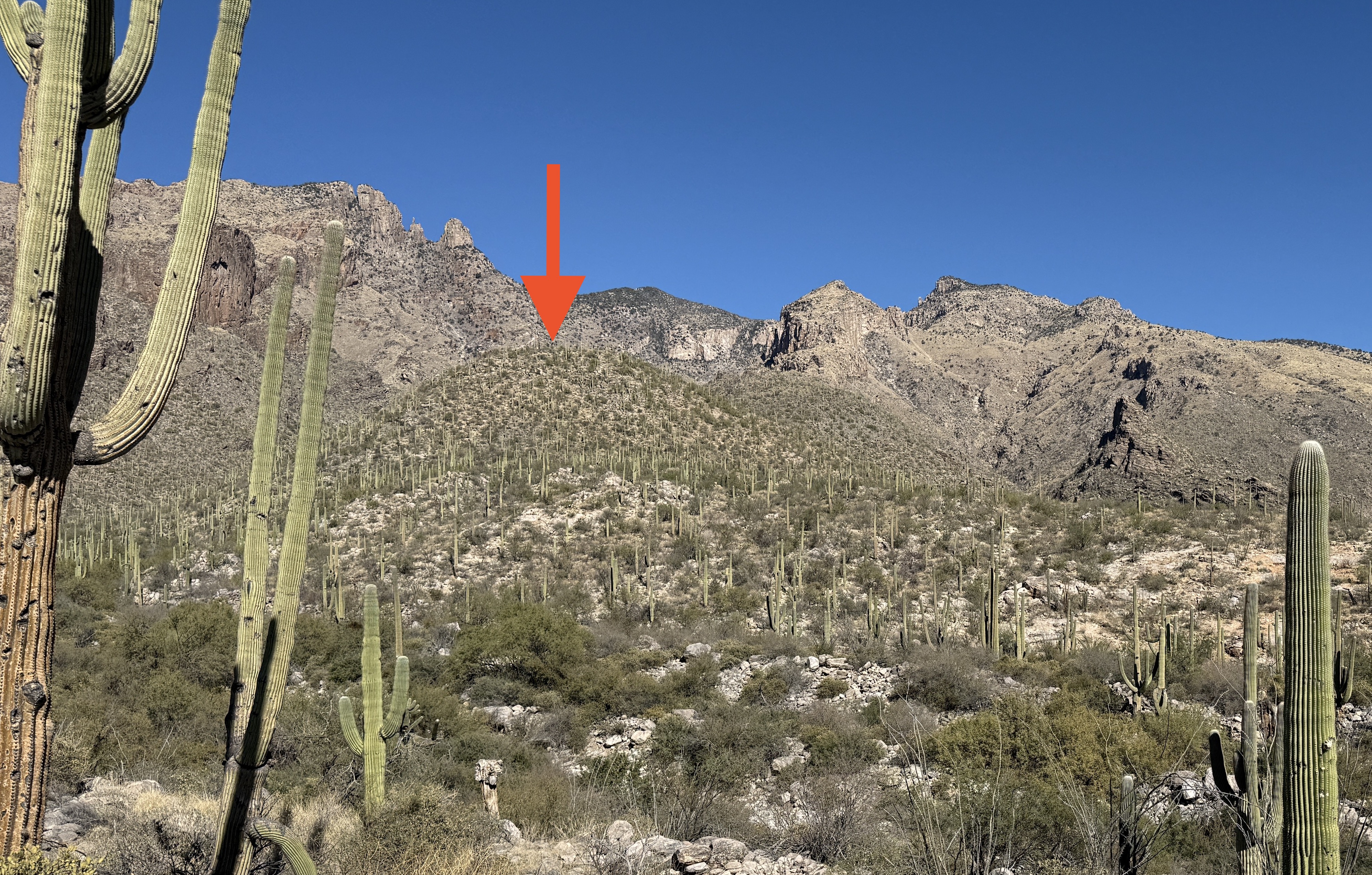
Park in the Finger Rock parking area near the very top of N Alvernon Way (32.33617103105634, -110.91009262061056), then walk up the road to the start of the Finger Rock trail and start walking up this. Your first goal is the cactus-covered rounded lump that starts the ridge (shown below), and you can approach this either from the Finger Rock trail or from the Pontatoc Ridge trail. I did it from the Finger Rock trail, crossing a dry river bed to get to the lump.
After this initial lump the ridge becomes a bit rockier. Stay on the top of the ridge as much as possible as it’s more interesting and fun. Small bumps are followed by short downhills, often protected by steep little cliffs that you have to descend, usually by fairly easy scrambling down on the left side.
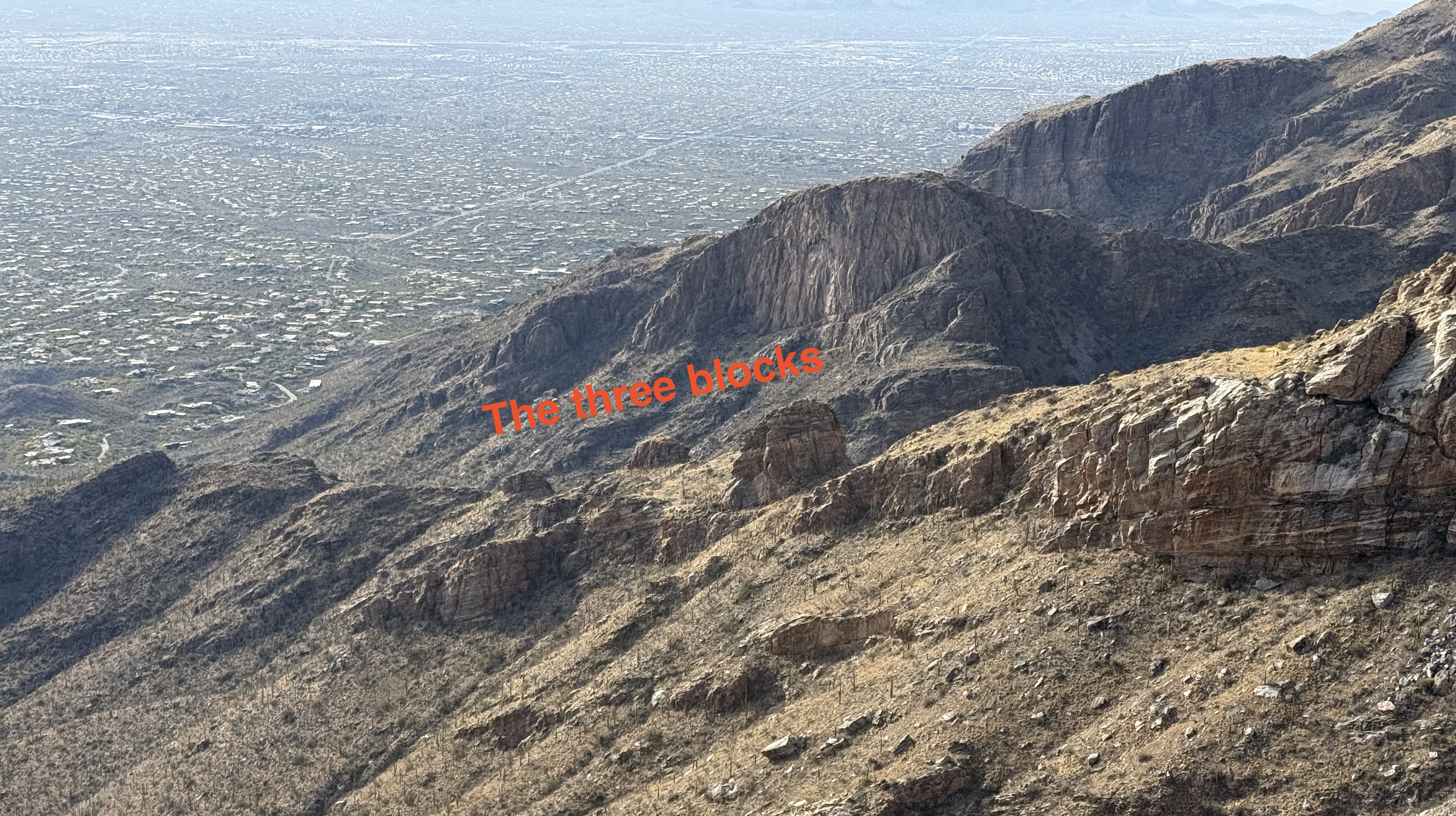
As you climb higher you encounter shin daggers but they are easily avoided. Eventually you’ll reach a series of three blocks before you reach the dramatic cliff-like bulge. I climbed to the top of each one, hoping I’d be able to descend the other side. Here’s my advice:
Bypass the first block on the right, staying as close to its base as possible.
Climb the second block. You can scramble down the other side on the left side, moving right as you descend.
Bypass the third block on the right, again staying as close to its base as possible.
Finally you reach the cliff-like bulge, which turns out to be straightforward hiking up its middle, followed by a long hike up the steep slope above.
Eventually you’ll reach the final two blocks. Climb the first of the two and scramble down the other side to the left.
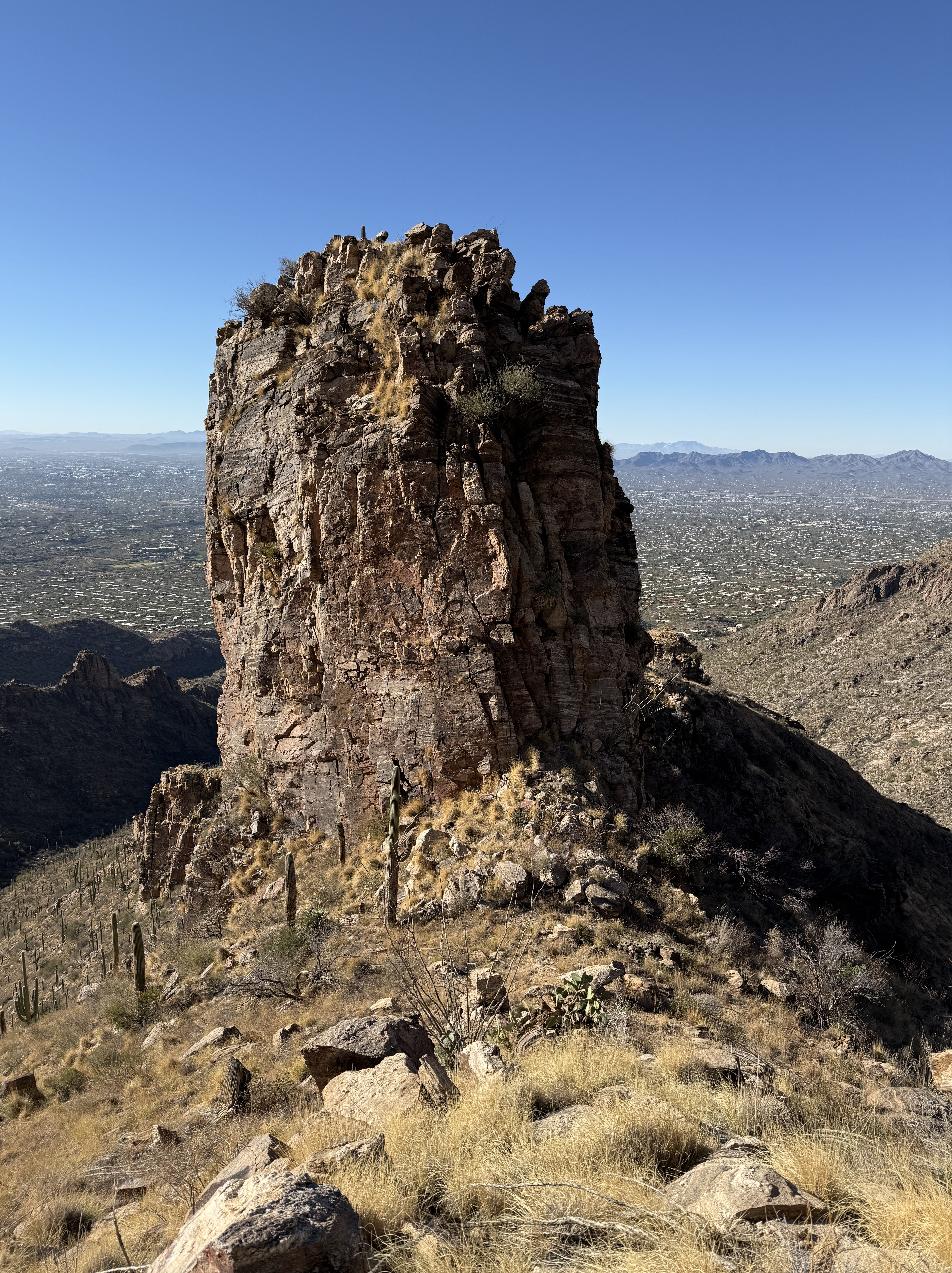
Now you have the final, biggest block. Even though you can’t descend the north side you might as well climb to the top of the tower and look down at the Linda Vista saddle and the good trail that leads to it. Then come back down to the col and bypass the final block on its left (west side), staying close to the cliff, and then ascending slightly to reach the Linda Vista Saddle. Here’s a picture showing why you didn’t come down the north side.
The trail is actually an offshoot of the Finger Rock trail, so follow it westwards to the Finger Rock trail. Turn left and follow the trail back to the bottom of Finger Rock Canyon.
Hiked 12/10/2024
¹ You might be confused by the name Linda Vista (Pretty View) since there is another Linda Vista in Oro Valley at the start of the Pusch Peak Trail. However, the Linda Vista Saddle was perhaps first named and described in 1975 in The Trail Guide to the Santa Catalina Mountains by Eber Glendening & Pete Cowgill. Thus the Linda Vista Ridge follows the ridge up to the Linda Vista Saddle.
Links and Other Clicks
The Earthline page about hiking Linda Vista Ridge, which has a lot of gorgeous photos.
