
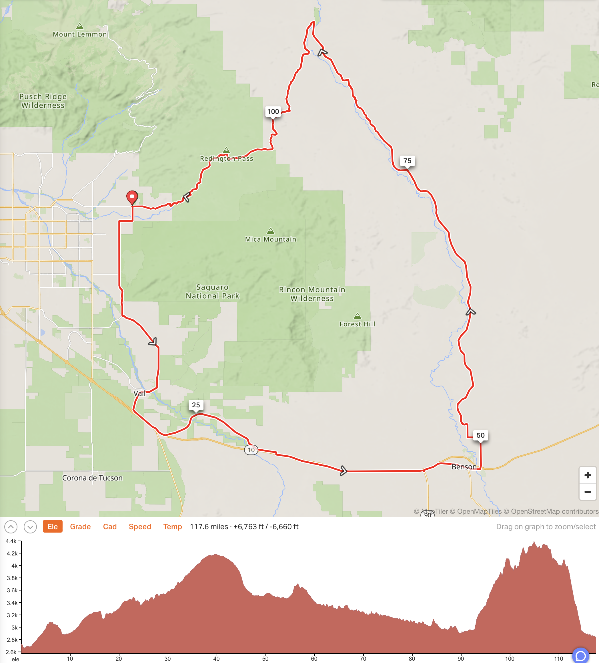
This is a tough loop around the Rincon Mountains, about about 117 miles with 6,400 feet of climbing. Approximately 71 miles are on pavement and 46 miles are dirt, 24 of those dirt miles being up and over Redington Pass. You can obviously ride it either way and I chose to do it counter-clockwise so the hardest riding was at the end 😁.
Benson is the last place you can buy food or drink, which means you’ll be riding about 70 miles, including the most difficult riding, without being able to refuel. So it’s worth considering either driving the route and stashing food and water, or having someone drive support for you. Fortunately Tanya and our friend Steve supported me on this ride, which I rode on April 10, 2024.
Click on the map above, or click here to see the ride on Ride with GPS.
I started at the intersection of Tanque Verde Road and Wentworth Road, so all the distances are based on this. I’m assuming you will be downloading the GPX file from Ride with GPS so won’t go into great detail about all the turns.
However, when you get to I-10, you’ll turn left just before the Interstate on Benson Hwy, then when this is about to Cross I-10 towards Sonoita, turn left again on Marsh Station Road. This is a wonderful road to ride, with a good surface and lovely rollers. But all good things come to an end and you eventually have to cross I-10, then ride east on I-10 for about 11 miles.
Riding on the Interstate is allowed in Arizona if there is no alternate route that is better in terms of convenience and safety. Here’s a Bicycle User Map produced by the Arizona Department of Transportation – cyclists are only prohibited on roads that show dashed lines. While I was riding on I-10 I saw a sign saying that bicycles should use the shoulder only. Fortunately the shoulder is very wide the whole way to Benson and I never felt in any danger from traffic.
I got off at Exit 302, signed to Fort Huachuca, as I wanted to refuel at McDonalds, then got back on the Interstate and exited at Exit 303 into Benson. Ride through Benson then at the east end follow signs for I-10, then signs for Pomerene and Cascabel.
From where you turn onto Pomerene Road, you will ride about 20 miles on pavement. You’ll very soon see a sign saying 3 miles to Pomerene and 26 miles to Cascabel. The paved road is a pretty ride, wide open, with a few little rollers.
At W Lara Lane, about 4 miles after the start of the dirt on Cascabel Road
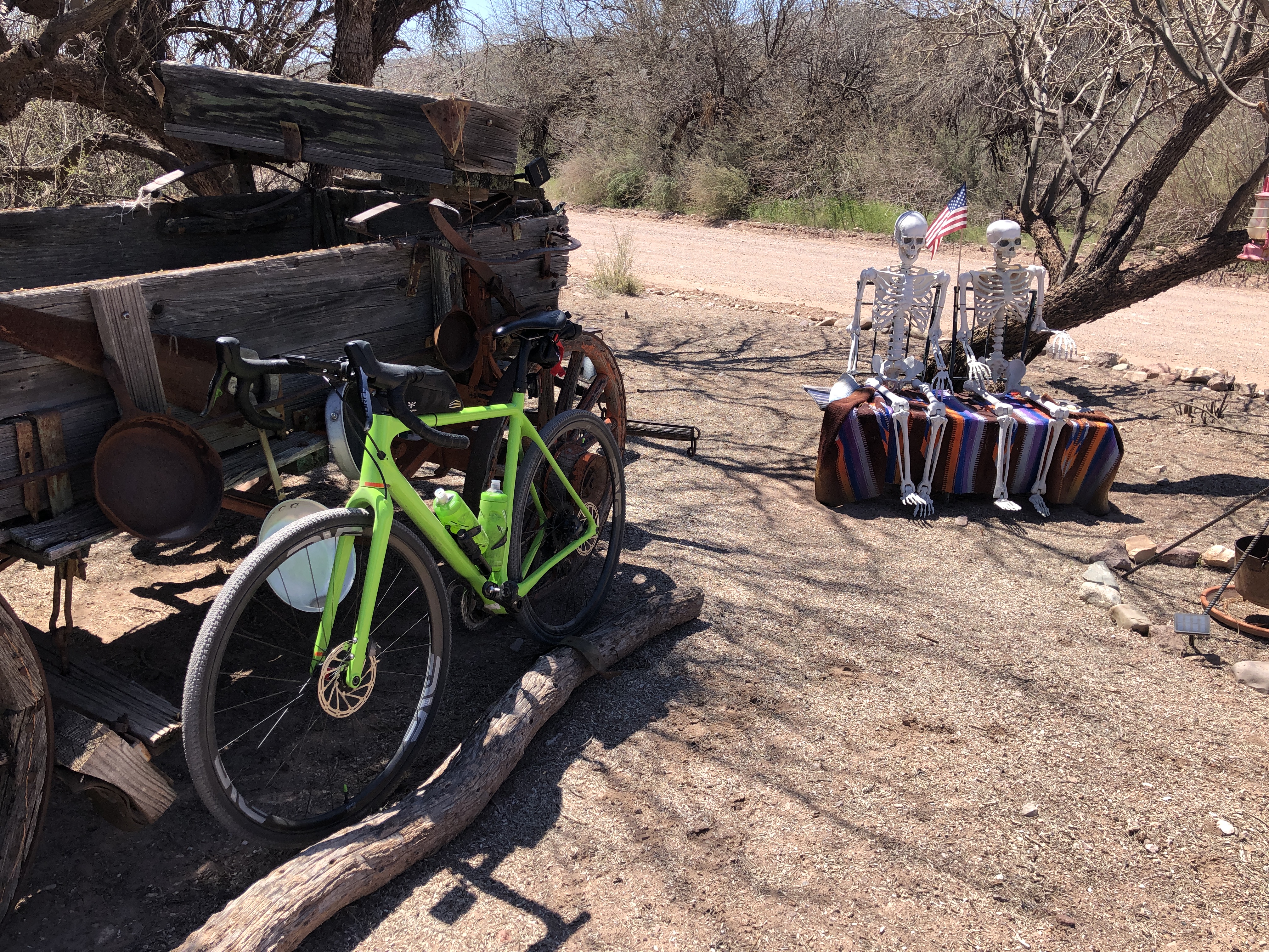
After 20 miles the road turns to dirt and you’ll be riding on dirt for the next 46 miles. A bit after Mile Marker 20 there’s a property on the left that has some big dogs that sometimes like to chase cyclists. Fortunately there’s a fast downhill just after this property.
I confess that I didn’t notice Cascabel when I rode through it and only later wondered where it has been. At one time there was a grocery store/restaurant/music venue called Sun Station but this is long gone. And every December for 39 years there was a Cascabel Community Fair, but the last fair was held in 2019.

On Cascabel Road
After 22 miles of dirt, again with some good rollers in places, at about mile 90, you turn very sharp left at the obvious turn onto Redington Road, then follow this South and Southwest for 24 miles, with some great views of Mica Mountain on the left.
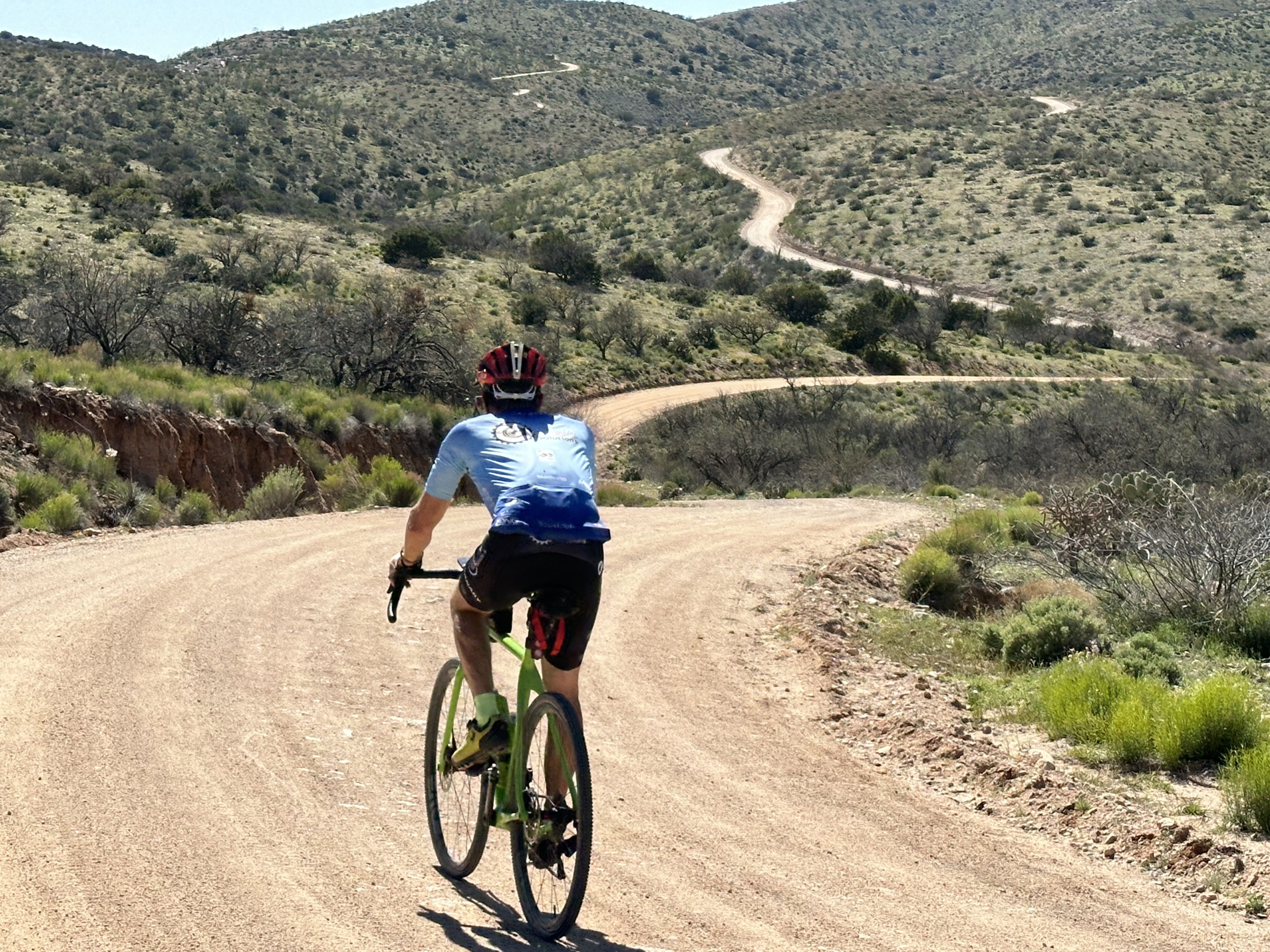 There’s no obvious top on Redington Road, just lots of ups and downs, some very steep and some very rough. There were times when I wished I was on a mountain bike.
Finally there’s a pure downhill of maybe 3 miles, then at mile 114 the road turns back to pavement. Another 3 miles on the beautifully resurfaced rolling road takes you back to the start at Wentworth Road, at the end of a tough and satisfying day.
Links and Other Clicks
A page about the last Cascabel Community Fair
An article from 2004 about Cascabel that mentions the Sun Station store
Two articles, with photos, about riding Cascabel Road from Benson by the same writer, one from 2020 and the other from 2022.
