
One thing you may find in the Santa Barbara area is that the sea fog can come in and hang over the coastal area, especially in the mornings. But even when the coast is gray and gloomy, doing these climbs can take you up into the world of sunshine and light.
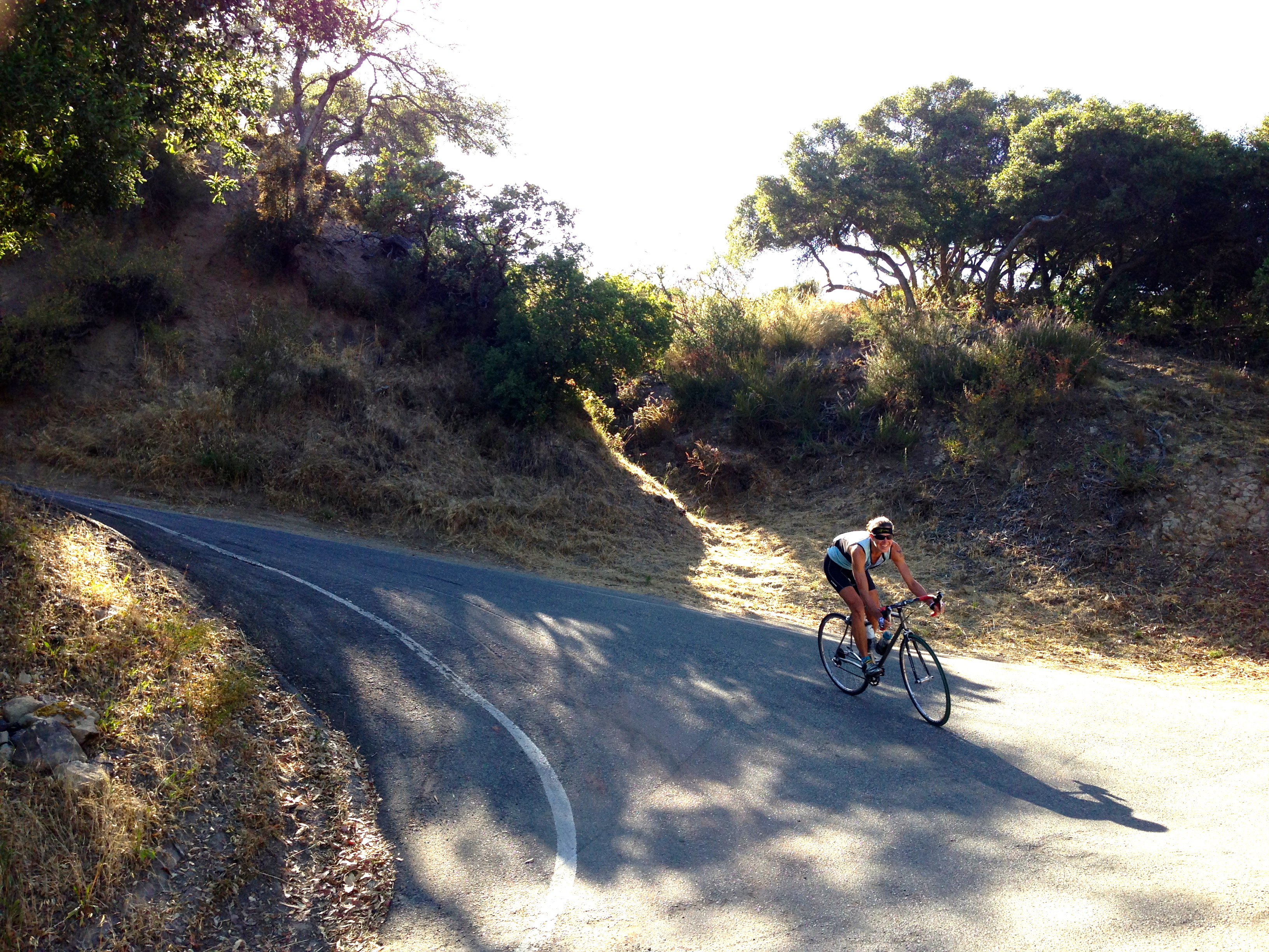
San Marcos Road / Painted Cave (S-1)
Not my photo
This is lovely climb, only 5.5 miles with 3,485 feet of climbing. The upper (Painted Cave) part has some fantastic steep riding, then finishes along a single-lane road through a lovely wood. There’s even a huge boulder that overhangs the road and is a popular spot for rock climbers. If you are driving to the start, a good place to park is at Tucker’s Grove Park on Cathedral Oaks Road, just a short way east of San Marcos Rd.
Gibraltar Road (#85, S-1)
A beautiful and tough climb of 10.2 miles with 3,560 feet of climbing. There’s a section maybe a mile long in the upper part that needs some repair work so be careful coming down that part. Updated May, 2021: the upper part has been repaved and is now gloriously smooth and delightful. It’s now a great climb and beautiful descent. If you are driving to the start a good place to park is at Rocky Nook Park on E. Los Olivos Street, a hundred feet from the start of Mountain Drive.
Ride up Mountain Drive until it splits then continue up Gibraltar Road. At the ridge where a road head right to Divide Peak OHV, follow the main road left, do a short downhill, then continue climbing E. Camino Cielo until you reach the obvious antennae.
Extra Credit: 13.4 miles and 1,400 feet of climbing. At the ridge a road turns right towards Divide Peak OHV; take this right turn. Continue along the ridge as it twists and rolls for 6.7 miles to where it turns to dirt. At this point you will have descended about 900 feet and climbed about 500 feet. Turn round and ride back.
Mountain Drive
This is actually a mailbox!
Since you are in the Gibraltar area, a fun ride is to continue along Mountain Drive until it finishes at the intersection with San Ysidro Lane in Montecito. Mountain Drive actually continues a bit further but becomes a private road.
The whole out-and-back ride is about 15.7 miles with 1,400 feet of climbing, marginally more on the way out than the way back.
Starting near Rock Nook Park, ride east on first Mountain Drive then E. Mountain Drive. The road surface in Santa Barbara is very varied, but in Montecito it becomes much smoother. The road twists and turns and climbs and descends, and there are plenty of beautiful looking properties to keep you entertained.
Painted Cave / Gibraltar Loop
 In 2014 I combined the Painted Cave climb with Gibraltar Road, going up SanMarcos/Painted Cave, along Camino Cielo (which has beautiful views of the ocean and endless climbing), and down Gibraltar Road, then turned round at Mountain Drive and reversed the route. It was the most fun and twisty ride I’d done in a long time. So many turns. The whole ride was about 46 miles with 8,000 feet of climbing.
But rather than doing an out-and-back, the two climbs make a fantastic loop of about 29 miles and 4,400 feet of climbing. Some people say it’s one of the best rides they’ve ever done. Both ways are good but I think clockwise is best because Gibraltar Road is a much nicer descent than Painted Cave. The easiest way to connect the two climbs at the bottom is along Hwy 192 and Cathedral Oaks Road, which can be busy, especially on the eastern end. If you are doing the loop, a great place to park is Tucker’s Grove Park at the intersection of Cathedral Oaks Road and N. Turnpike Road. We rode this loop in 2021.
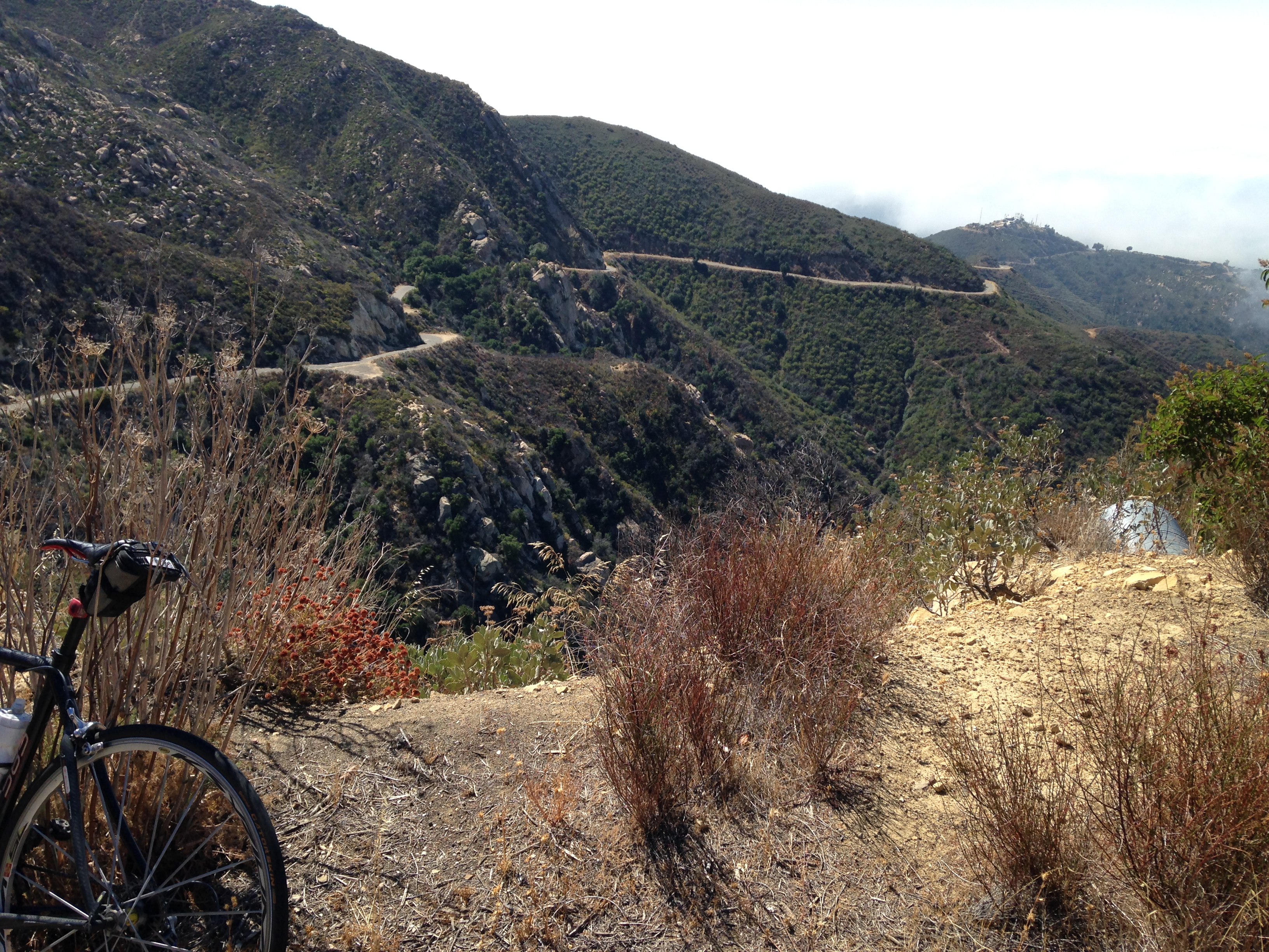
Gibraltar Reservoir Gravel Ride
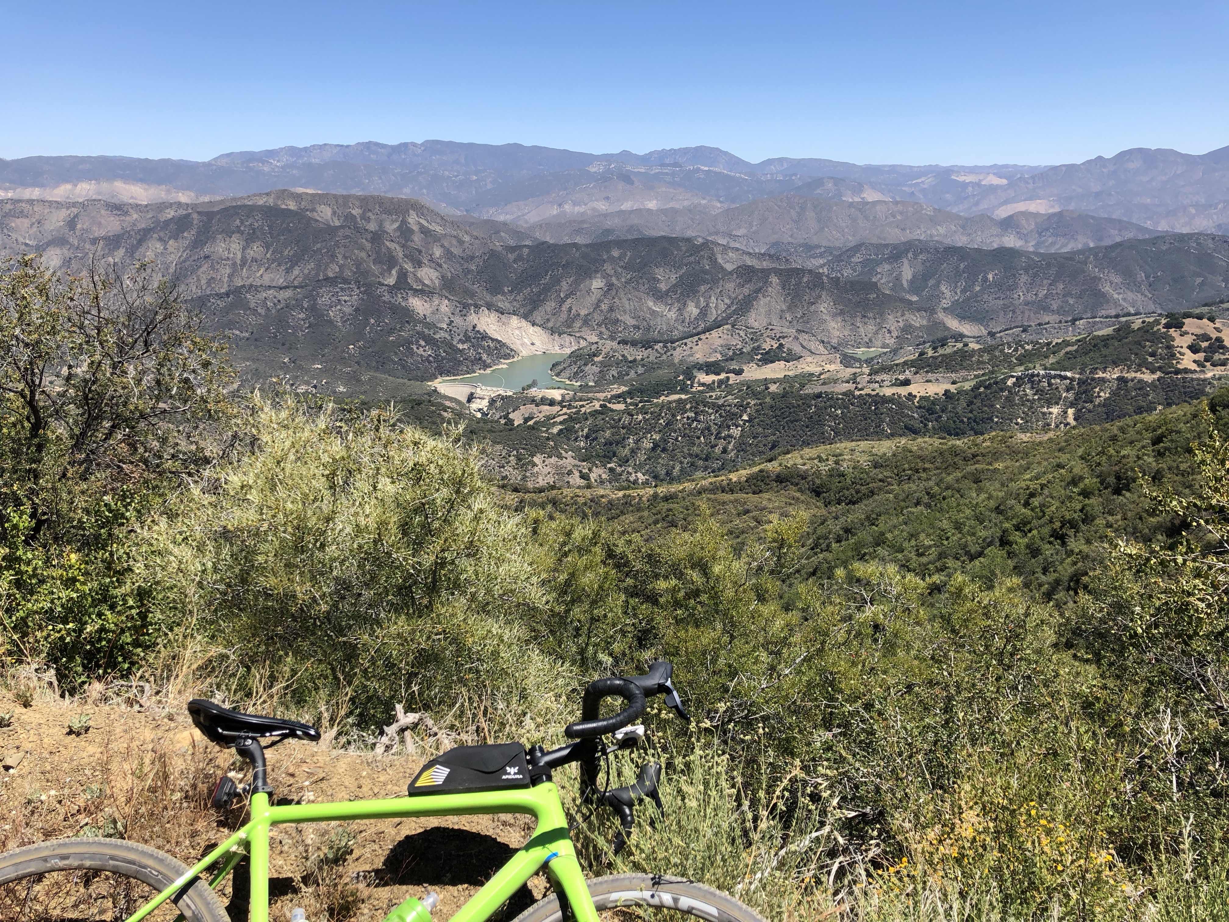 This is a beautiful ride on the back side of the front range, which drops down to Gibraltar Reservoir then climbs back out, through very gorgeous country. The out-and-back is about 19.7 miles and 3,380 feet of climbing.
From Angostura Pass (okay, where Gibraltar Road hits the ridge, drop down to the left, and where the road starts to climb again up E. Camino Cielo, Gibraltar Road actually becomes a gravel road and drops down the north side of the ridge) follow the gravel road down to the reservoir about 6.6 miles below. Continue down the road (take the left fork where it splits) then climb several hundred feet before dropping again until the gravel road becomes paved at the large Red Rock trailhead parking area. Turn around and ride back out.
I learned about this ride watching this video, but decided to do an out-and-back rather than climbing Arroyo Burro because the out-and-back gave more gravel riding. Now that I’ve done it I’d love to do more gravel riding in the Santa Barbara area.
Refugio Road (#51, S-1)
Not my photo
About 10.9 miles with 3,857 feet of climbing, this is a strange climb. Summerson describes it as “a stunning climb” but I wasn’t as impressed. The steep first part of the climb has a very poor road surface in places. After about 5 miles you turn right and follow the ridge on an easier but much better road.
From the intersection of Hwy 101 and Refugio Road, drive inland for 1.8 miles to the start of the climb. Or simply ride from the intersection.
Ronald Reagan had a big ranch up Refugio Road, Rancho del Cielo, also known as the Western White House, to which he invited world leaders such as Margaret Thatcher, Queen Elizabath, and Mikhail Gorbachev. I suspect they got there by helicopter rather than along the road.
Figueroa Road East (S-1)
 A tough climb, with some sustained climbing, about 9.7 miles with 3,342 feet of climbing. When I rode this in 2014 I couldn’t find the start to the east side (didn’t have Google Maps) so I started up the west side and went down the east side, then returned the same way to give an out-and-back ride of 38.6 miles with about 6,500 feet of climbing. The road from the west varies in quality, while from the east it’s more consistently good. Except for a one mile dirt section near the bottom of the east side that exists for no apparent reason.
Figueroa Road West (S-1)
 However, the east side of Figueroa Road is not nearly as good as the west side, which is much more beautiful and varied, with constant changes in gradient. The west side was in the first edition of Summerson’s book but has been dropped from the second edition (it’s still in the California book). A shame because while the west side may be slightly easier than the east side, it’s a lot more fun and has much better views.
If you want to drive to the start, go north on Figueroa Mountain Road from Hwy 154 at Los Olivos. After about 7 miles the the road turns sharply right and starts climbing. There are two big parking areas just before and after the turn. From here, the climb is about 9.3 miles and 3,280 feet of climbing. Alternatively, ride from Los Olivos up the pretty valley to the start of the climb.
If you do either side of Figueroa Road (or both sides), visit the nearby town of Solvang, a very cutesy Danish-style town.
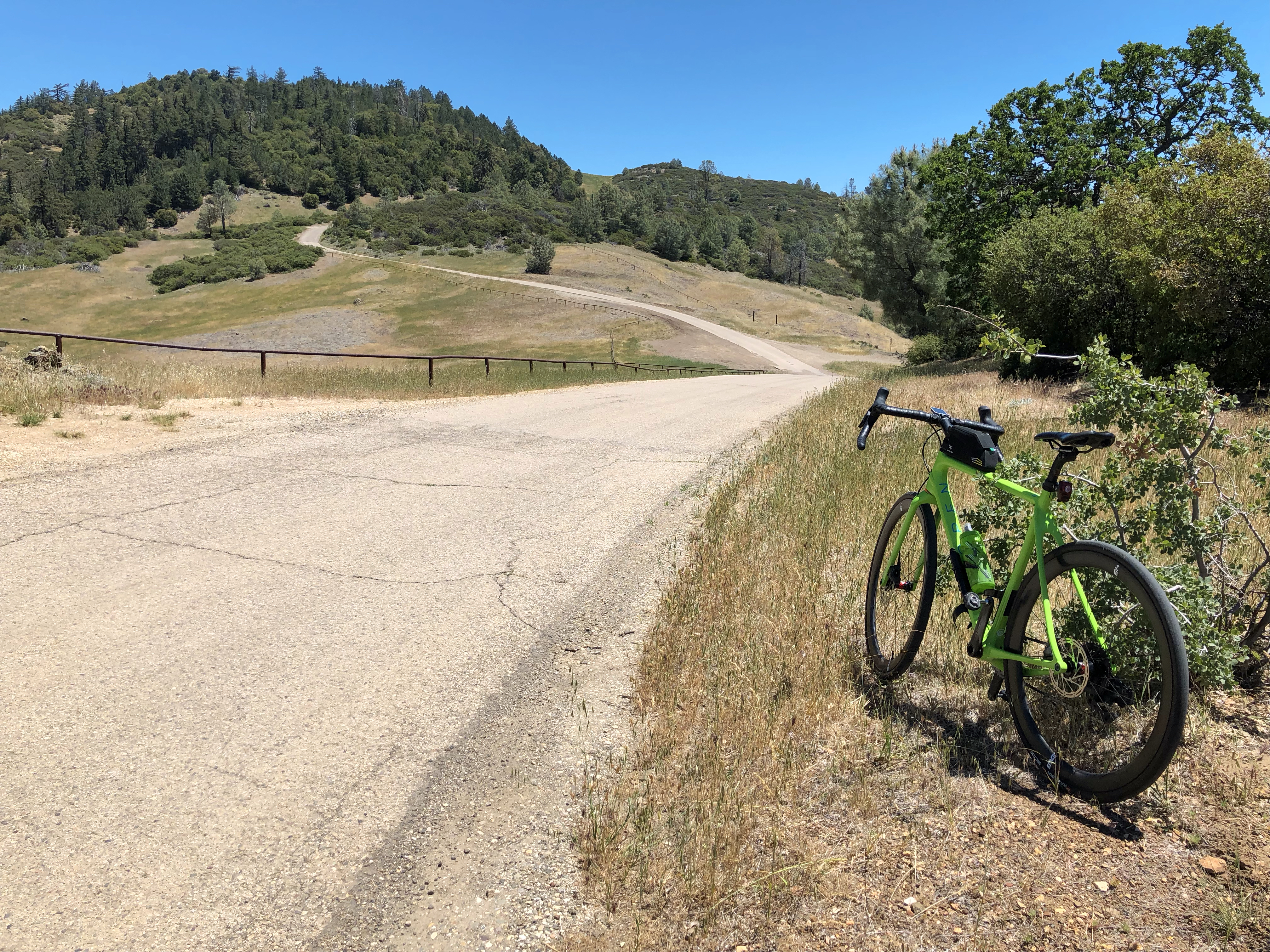
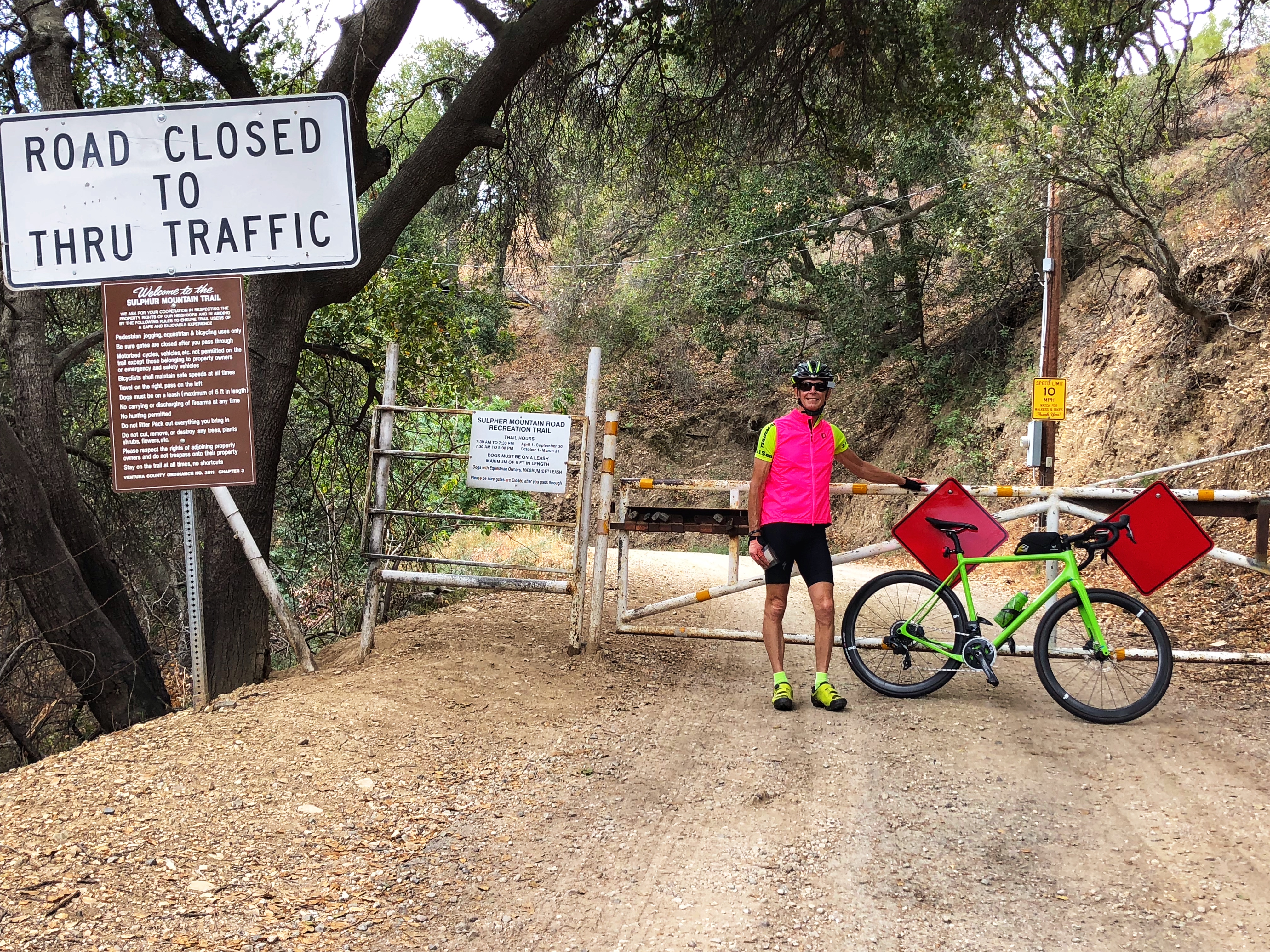
Sulphur Mountain Road (S-2)
 This is a lovely little climb just east of the pretty town of Ojai. There is a big parking lot a few hundred yards down Montgomery Street from Hwy 150. From the intersection of Montgomery and 150 the out-and-back ride is about 22 miles with 2,400 feet of climbing.
Head east on Hwy 150. After about 2 miles you now have a lovely 1.5 mile twisty climb that gains several hundred feet. After 6.3 miles from the start, turn right on Sulphur Mountain Road. In another 0.4 miles the big climb starts. It’s fun, twisty, and as Summerson says, it’s a Must Do climb in this area. The true climb ends at 9.6 miles but the road continues, mainly descending, to where the paved road ends at a gate at 11 miles.
At this point the road turns to dirt and is apparently a popular gravel ride. Unless you want to continue for about 11 miles, mainly downhill, on the dirt road, turn round and retrace your path back to Ojai.
