
There are some lovely rides in San Luis Obispo County, many of them centered on Paso Robles. The San Luis Obispo Bicycle Club has a great web page that lists all its weekly scheduled rides, and lower on the page several lists of its favorite rides. And here’s another web site with photos and descriptions of many Central Coast routes.
Nacimiento-Fergusson Road
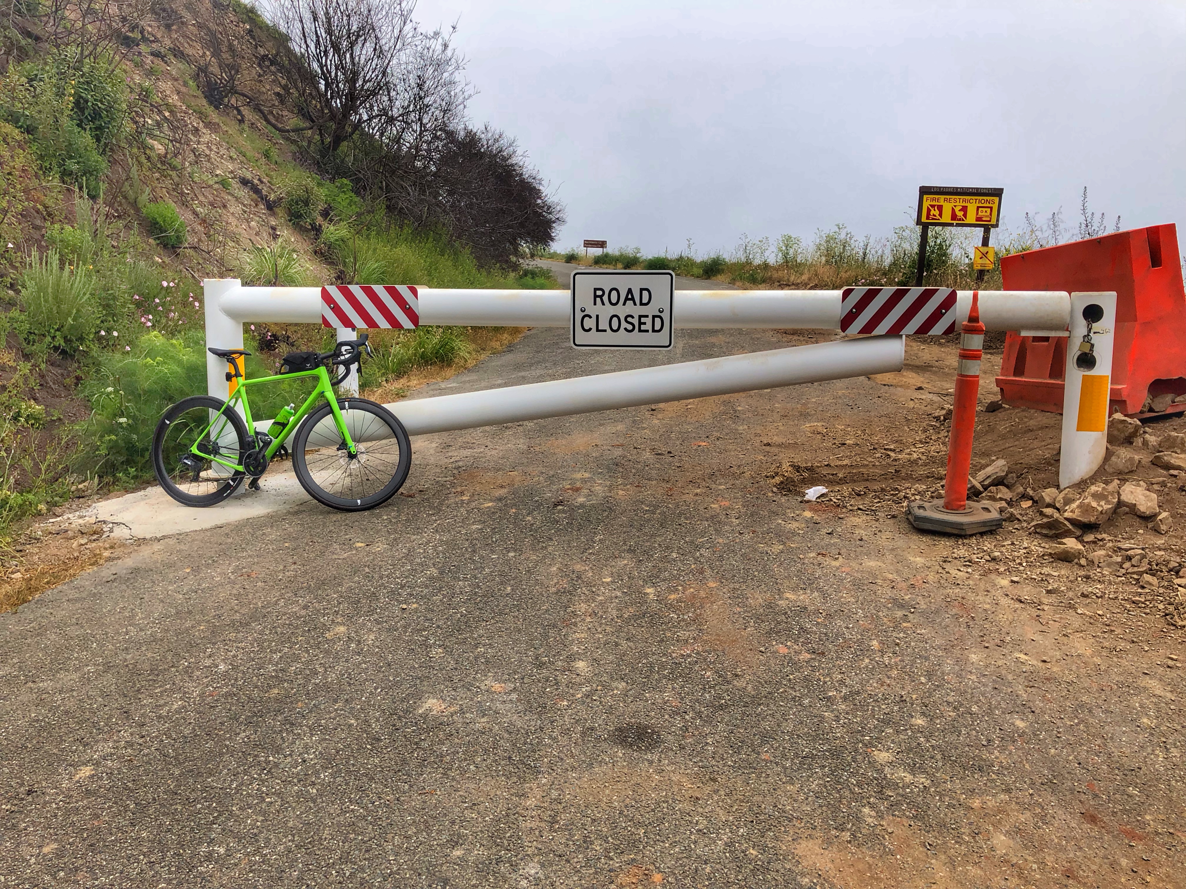 This is a beautiful road, California at its best with its steep, yellow hills and gorgeous views. The classic ride is a 53 mile out-and-back from Fort Hunter Liggett to Hwy 1 and back, but the best part is the descent to and climb out from Hwy 1. However, when I did the climb in June 1, 2021, the road was officially closed due to damage from a fire in 2020 and huge flooding in January 2021.
Because of the closure I chose to just do the climb from Hwy 1, which is a climb of 7 miles and 2,590 feet of climbing. The start is about 43 miles north of Cambria, and I parked at the Vicente Trailhead. There are several big parking pullouts in the half mile south of Nacimiento-Fergusson Road. Okay, I know this is slightly outside San Luis Obispo County but it’s in the general area.
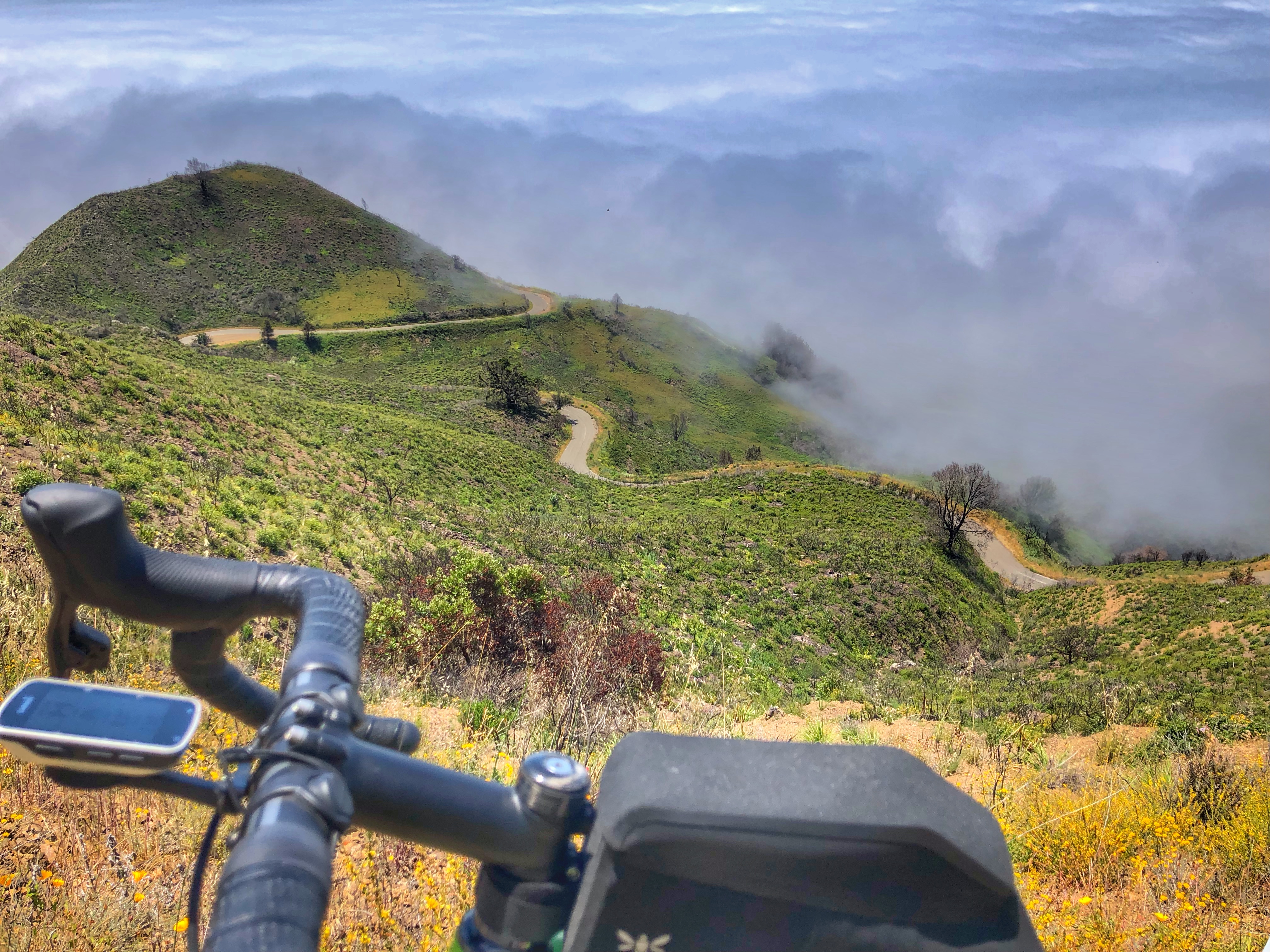 Fortunately the road was not as bad as I had read. The road has been repaired enough that I was on asphalt the whole way, although in the absence of cars there was a fair amount of sand on the road in the upper section. On the other hand, in the absence of cars it was a wonderfully quiet and peaceful ride.
Ride up the road as it twists and turns, with beautiful views of the golden hills. At the obvious top, turn round and ride back down, taking care on the sandy curves. While not paying attention to the turns, enjoy the gorgeous views. Unfortunately I was in sea fog for the lower 1.5 miles so I never got to see the views of the sea.
Summerson says it is “a solid climb that is perhaps the most scenic in the U.S.” Jack Rawlins says the full ride from Fort Hunter Liggett and back is “the best ride in California and Oregon.”
Santa Rosa Creek Road
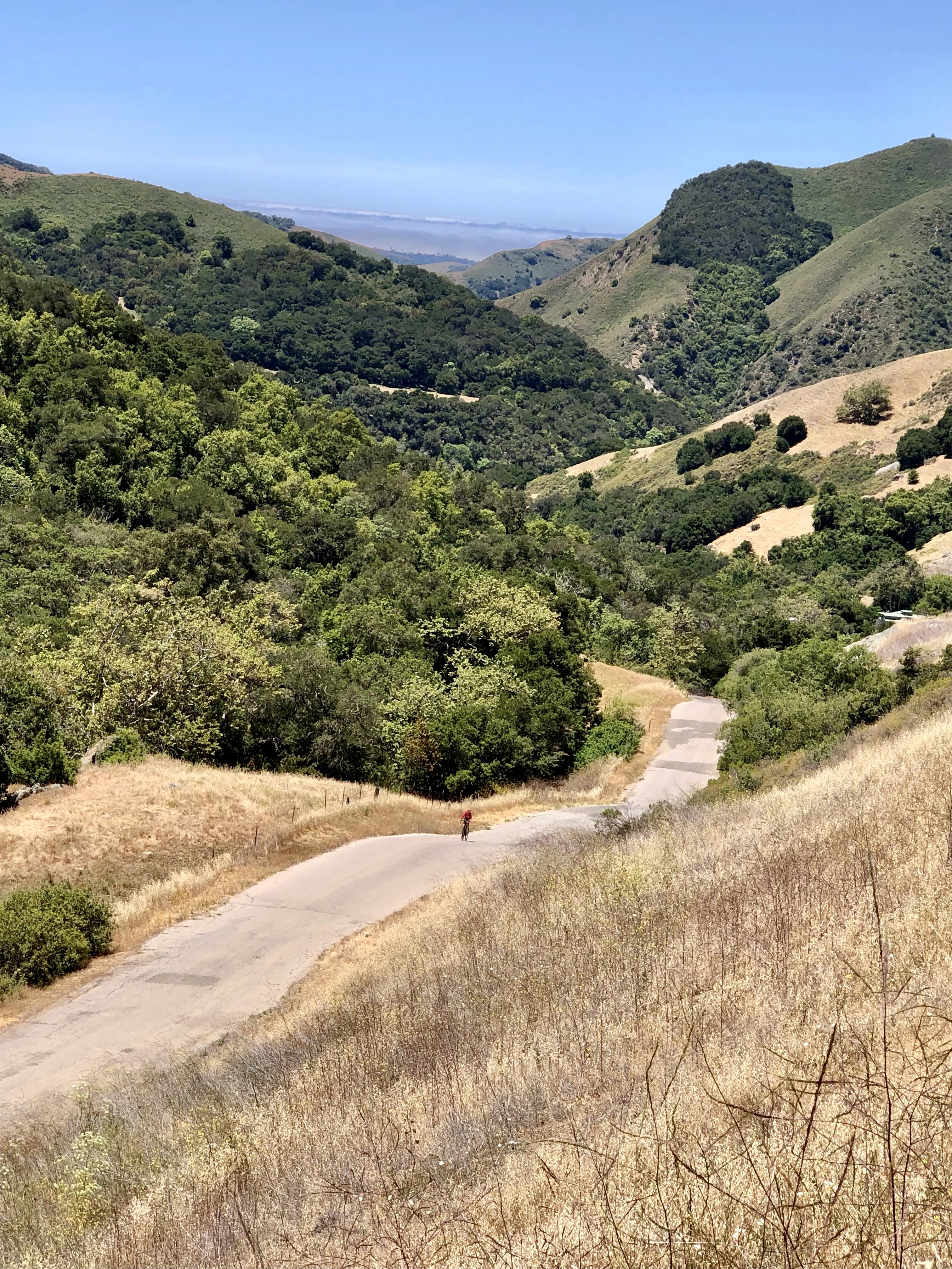 This is a very interesting ride that leaves directly from the pretty town of Cambria on the coast. I say interesting because it has the most varied road surfaces I’ve ever ridden on, changing frequently from silky to rough to cracked and potholed then back again (as of June 2021). And yet it’s beautiful and varied, with incredible climbing and views near the top. If the road surface was uniformly silky it would be one of the best rides anywhere. The climb from Cambria to the top of the climb is 12.3 miles with 2,100 feet of climbing.
The first few miles are relatively flat on nice roads. Then the canyon closes and the road twists and turns and rolls through the trees. In places the road is slowly falling down into the river below(!) – these places are generally marked with poles.
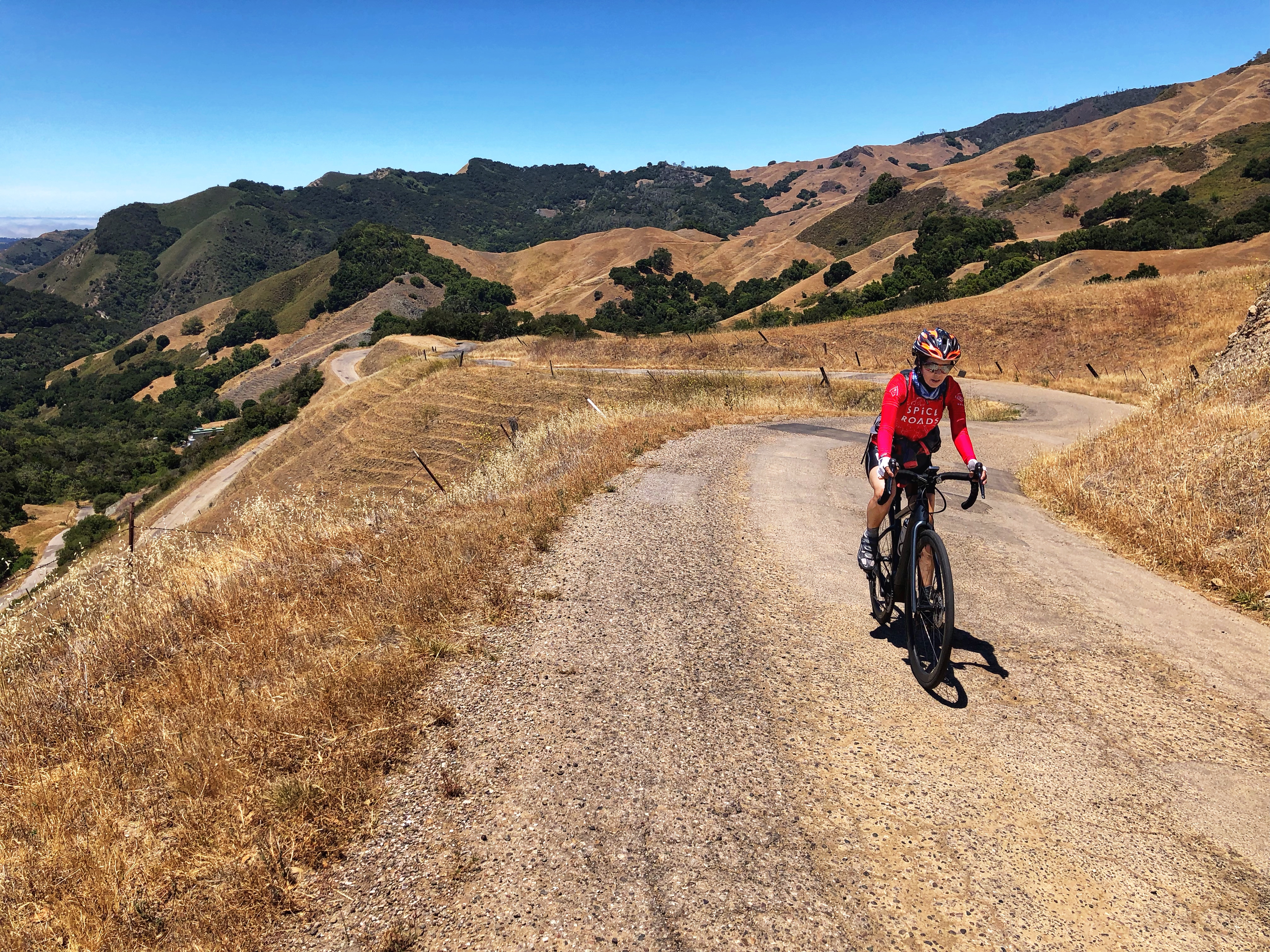 Then the valley widens and things open up. Just under two miles from the top you are faced with some viciously steep but thankfully short ramps, and then it becomes just steep up to the top. This upper section has some horrible road surface which isn’t so bad on the way up, but much less pleasant on the way down, but the situation and the views make it totally worthwhile.
Once at the top you have various choices. We turned round and rode back down, but you could continue another 4 miles to Hwy 46 then turn round (the final mile back up to the summit from the other side is also brutally steep). For other suggestions, see Jay Rawlins’ wonderful page on this ride.
Paso Robles
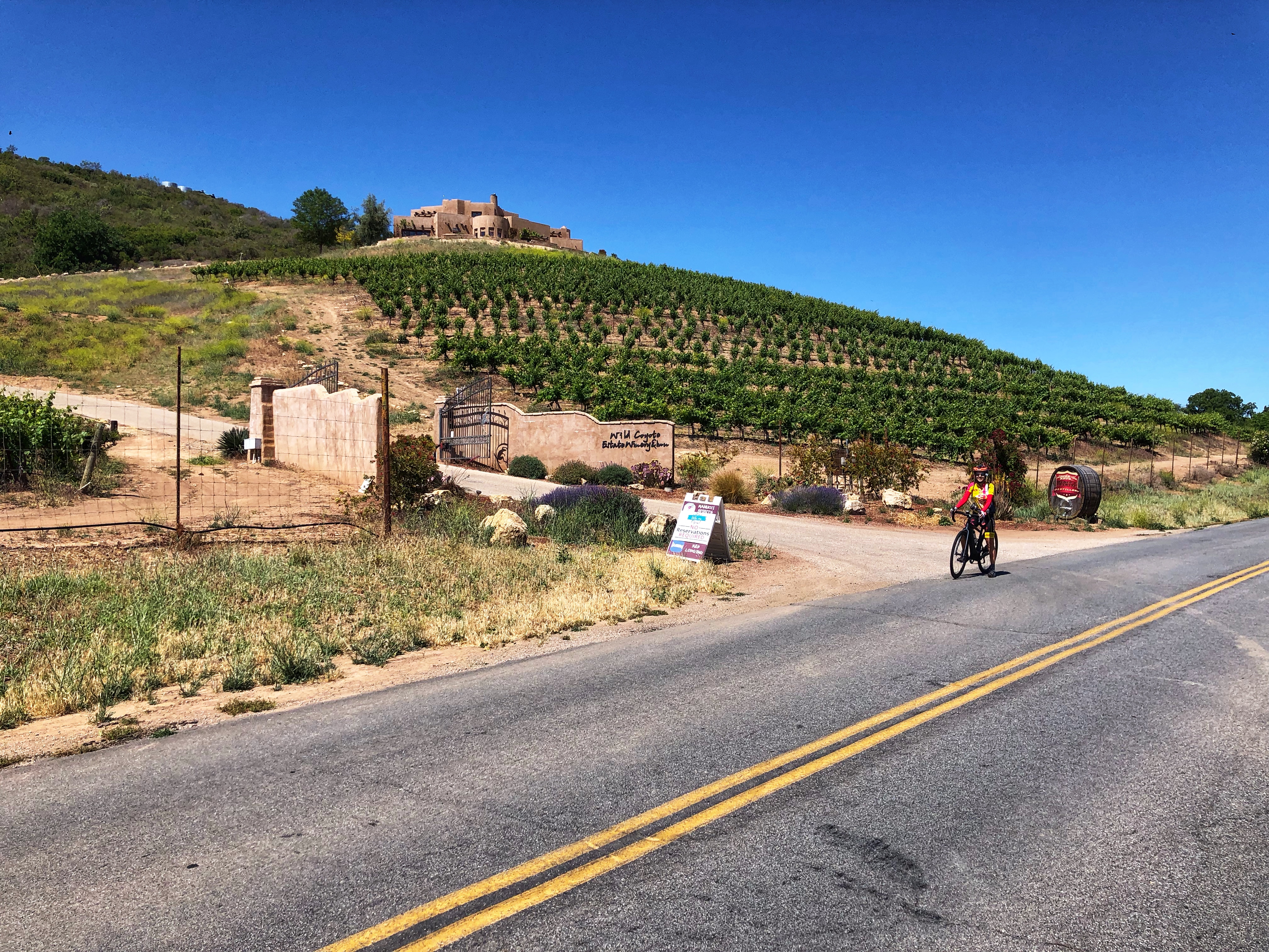
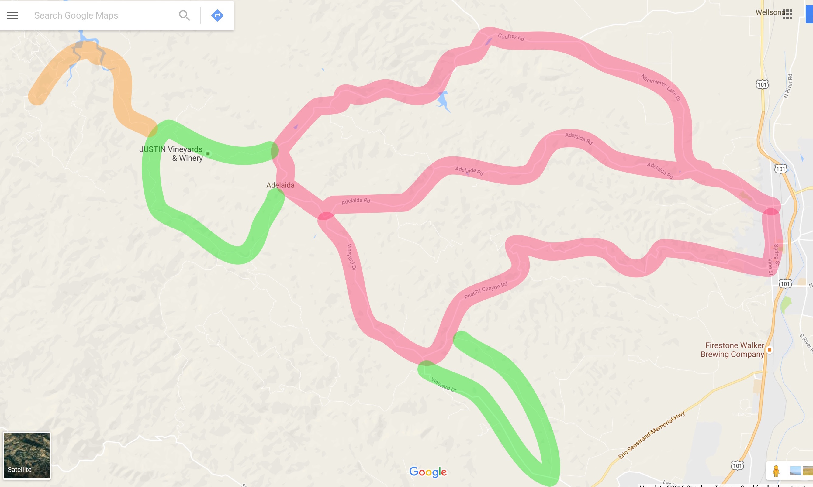 Some of the best rides in San Luis Obispo County are in the wine country to the west of Paso Robles. There are three main roads that head west: Nacimiento Lake Drive / Chimney Rock Road, Adelaida Road, Peachy Canyon Road – and you can make a big loop or two smaller loops out of them. Then there are a few add-ons.
The riding is all wonderful – rolling and twisting through beautiful hilly wine country. As you ride up and down and around, you pass many vineyards, wineries, and ranches. Of all these great roads, the one that you really have to do is Peachy Canyon as it returns to Paso Robles. This ride is superb and complex on a beautiful road – it’s, well, peachy. It has very little traffic, as do all the roads except Nacimiento Lake Rd.
 A very good shorter ride is to go out Adelaida and come back along Peachy Canyon. This gives you the most climbing on the best roads. Nacimiento Lakes Rd is busy but with a good shoulder. When it turns into Chimney Rock Rd you lose the shoulder and the traffic, and the road surface becomes cracked but still fairly smooth. The worst road surfaces are on part of the Cypress Mountain loop
 and on most of Willow Creek Rd. A good extension is to continue up Chimney Rock Rd instead of turning left on Cypress Mountain Rd.
Update, May 2021: Willow Creek Road has been resurfaced and is now a delight to ride. A very good ride is to go out Peachy Canyon Road to its end at Vineyard Drive, then turn left on Vineyard. Follow this rolling road for 4 miles then turn left on Willow Creek Road. Follow this gently uphill for 4 miles until it ends at Peachy Canyon Road. Turn right and return back on Peachy Canyon Road. From the intersection of Pacific Avenue and Olive Street this gives you a beautiful ride of about 29 miles with 2,800 feet of climbing.
Rather than trying to describe all the options in this beautiful area, I’ll simply point you to San Luis Obispo Bicycle Club’s page about their favorite rides (scroll down pas the organized ride section). And Jay Rawlins raves about Peachy Canyon as an out-and-back.
Santa Rita Road-Cypress Mountain Road Loop
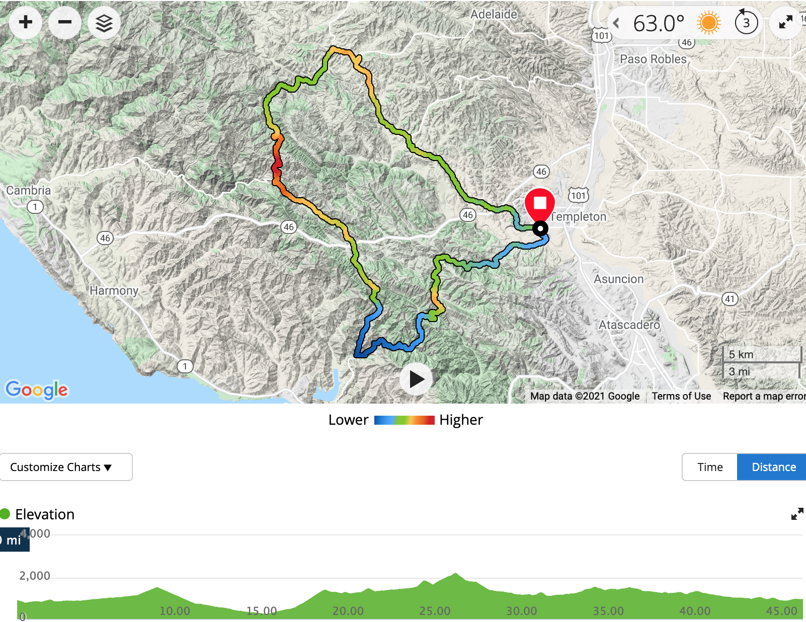 This is a tough and varied loop: easy rolling, brutally steep hills, rough pavement, silky pavement, hard-pack gravel. It goes through some beautiful country with some spectacular views, and will give you 45.3 miles and 4,750′ of climbing.
The ride has almost 16 miles of gravel, so you have to make the decision about what type of wheels to use. I chose gravel wheels but many people choose road wheels as the dirt is mainly hard-pack. Unless you want to do lots of uphill riding on gravel, go clockwise – that way you only have 1.3 miles up uphill gravel.
Start in Templeton, at the intersection of Vineyard Road and S. Bethel Road. I parked 100 feet down the S. Bethel Road on Via Rojas.
The ride can be considered to have several parts:
- Ride down S. Bethel Road, which becomes Santa Rita Road, and continue for roughly 13 miles, of which about 9 miles are downhill gravel road, mainly through the wooded canyon, until you reach the intersection with Old Creek Road.
- Turn right on Old Creek Road and follow this for just over 5 miles to Hwy 46. There’s some very steep climbing in the first 3.4 miles, then it rolls prettily to Hwy 46.
- Cross the busy Hwy 46 onto Santa Rosa Creek Road, where the road surface becomes much more cracked. In just under 4 miles you reach the high point of this road, with spectacular views looking down the valley and over towards the sea. The last mile up to the high point is brutally steep.
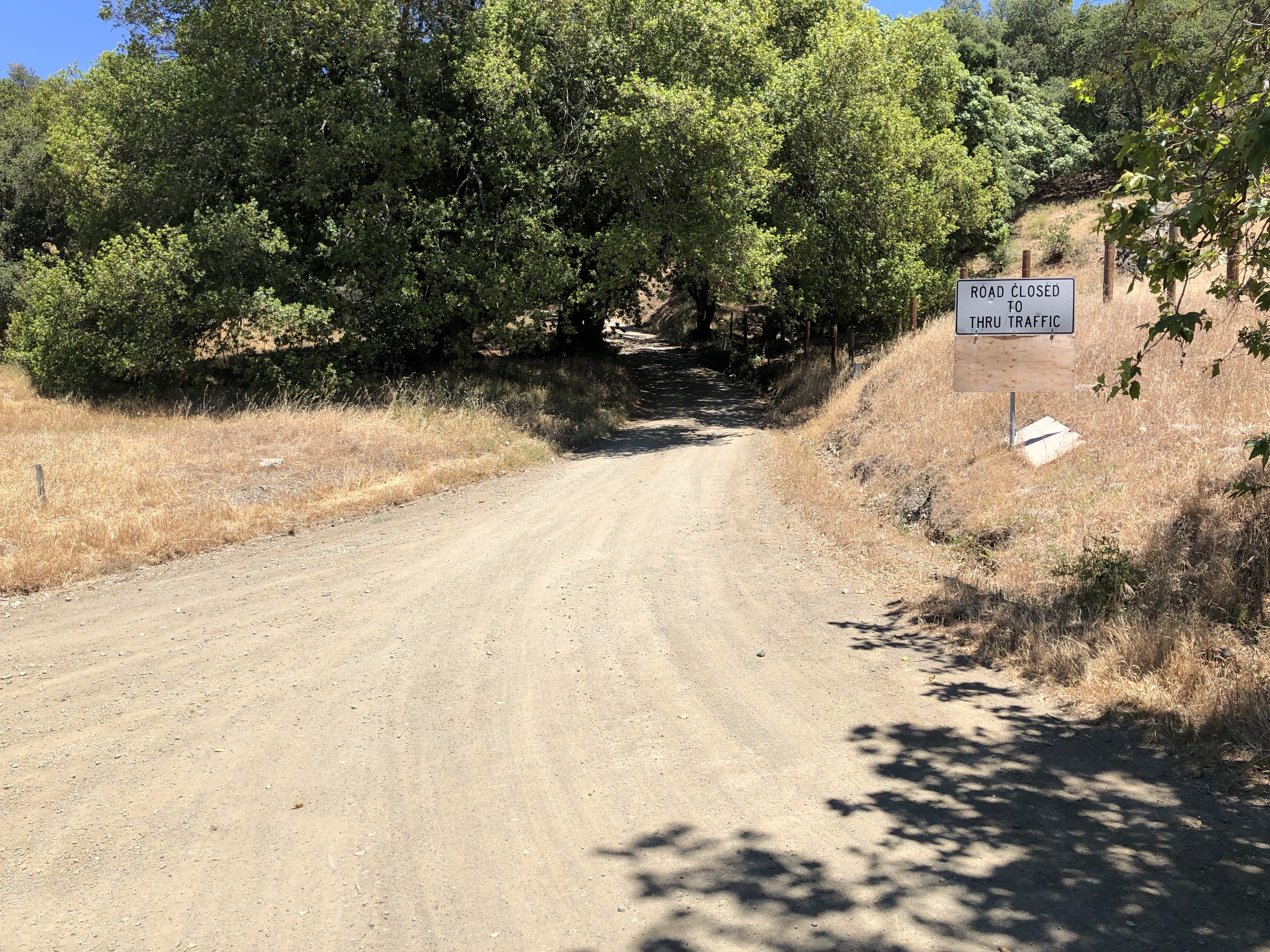
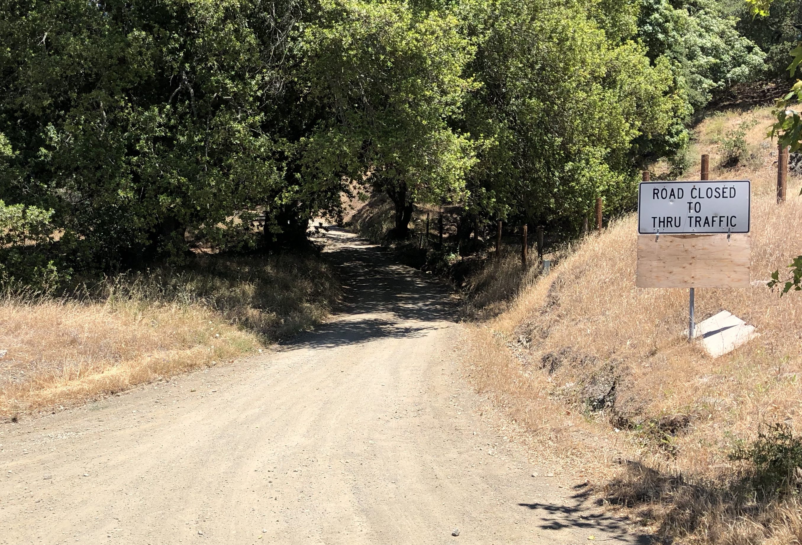 Continue down the other side for about 0.5 miles to where Cypress Mountain Road, a dirt road, heads off to the right. It has a sign saying the the road is closed to through traffic, which is not true. I think they just want to discourage people using the road as a shortcut. (The name of the road is confusing, being called Cypress Mountain Road on the street sign, but Cypress Mountain Drive in Google Map and Apple Maps. But no matter, the road you follow is totally obvious.)
- Ride up Cypress Mountain Road for 1.3 miles, very steeply at first then more easily and with beautiful views, until you reach the high point. Another 5 miles of downhill gravel road and you reach pavement again at Klau Mine Road.
- From now on the riding is much easier, rolling and very pretty. Every turn is to the right. Turn right on Klau Mine Road and follow this for just over 2 miles. Turn right on Adelaida Road and follow this for just over a mile. Turn right on Vineyard Road and follow this for about 11 miles until you reach S. Bethel Road again.
Prefumo Canyon & See Canyon
 I didn’t think there was much good cycling around San Luis Obispo – except for the tough ride from SLO to Avila Beach via Prefumo Canyon and See Canyon. As an out-and-back, this gives a ride of 31 miles with 3,040 feet of climbing. But what climbing! On the way out my Garmin registered some ramps of 13% and on the way back sections of 17% and one brutal ramp of 19%. I don’t really trust my Garmin to tell the truth, but I do know that these ramps felt steep.
Park at side of Prefumo Canyon Road at the intersection of Los Oscos & Prefumo Canyon. The climb up Prefumo Canyon has variable road quality and very variable gradients, including some ramps my Garmin showed as 13%. At about 4.5 miles you leave the canyon and have gorgeous vistas. The road surface become silky smooth and you’ll see some incredible houses whose inhabitants get to enjoy the gorgeous views.
A short steep downhill on poor road surface leads to 1.1 miles of hard-packed gravel road. In this gravel section the road changes name from Prefumo Canyon Road to See Canyon Road, which you will now follow until it dead ends at San Luis Bay Drive at about 13 miles.
Turn right and follow SLBD a short way, almost to the bridge and traffic lights. Just before the bridge, turn right into Avila Village, where you will find the Bob Jones bike path on the left by the Woodstone Marketplace. Turn right and follow the bike path into the pretty little town of Avila Beach.
Return the same way. On the way back See Canyon starts easily then the gradient changes drastically – my Garmin was showing a long section of 17%. Repeat the 1.1 miles of gravel then you’ll be faced with a ferociously steep little section to the top of the climb. Enjoy the gorgeous views again then enjoy the twisty descent back to SLO.
