
 In June 2025, we spent a few days in Malibu after reading about the cycling in the Santa Monica Mountains on PJAMM Cycling: “In our opinion, the Santa Monica Mountains is the best area to climb by bike in the US taking into account weather, scenery, challenge, safety and number of climbs.”
Palisades Fire
As of June 2025, the area was still recovering from the devastating Palisades fire that destroyed large parts of Pacific Palisades, Topanga, and Malibu in January 2025. The Pacific Coast Highway (PCH or Highway 1) was closed between Santa Monica and Malibu from January until shortly before Memorial Day.
While we were here the PCH was open, but the eastern section seemed dangerous and scary to ride along as there was still a lot of construction work being done, with shoulder closures and barriers along much of the road. We did see a few cyclists braving the roads but we chose not to ride this part, which ruled out loops involving the eastern part of the Santa Monica Mountains.
Most of the climbs were open but there was serious construction work with lots of steel plates on the road in the lower part of Las Flores Canyon.
Roads
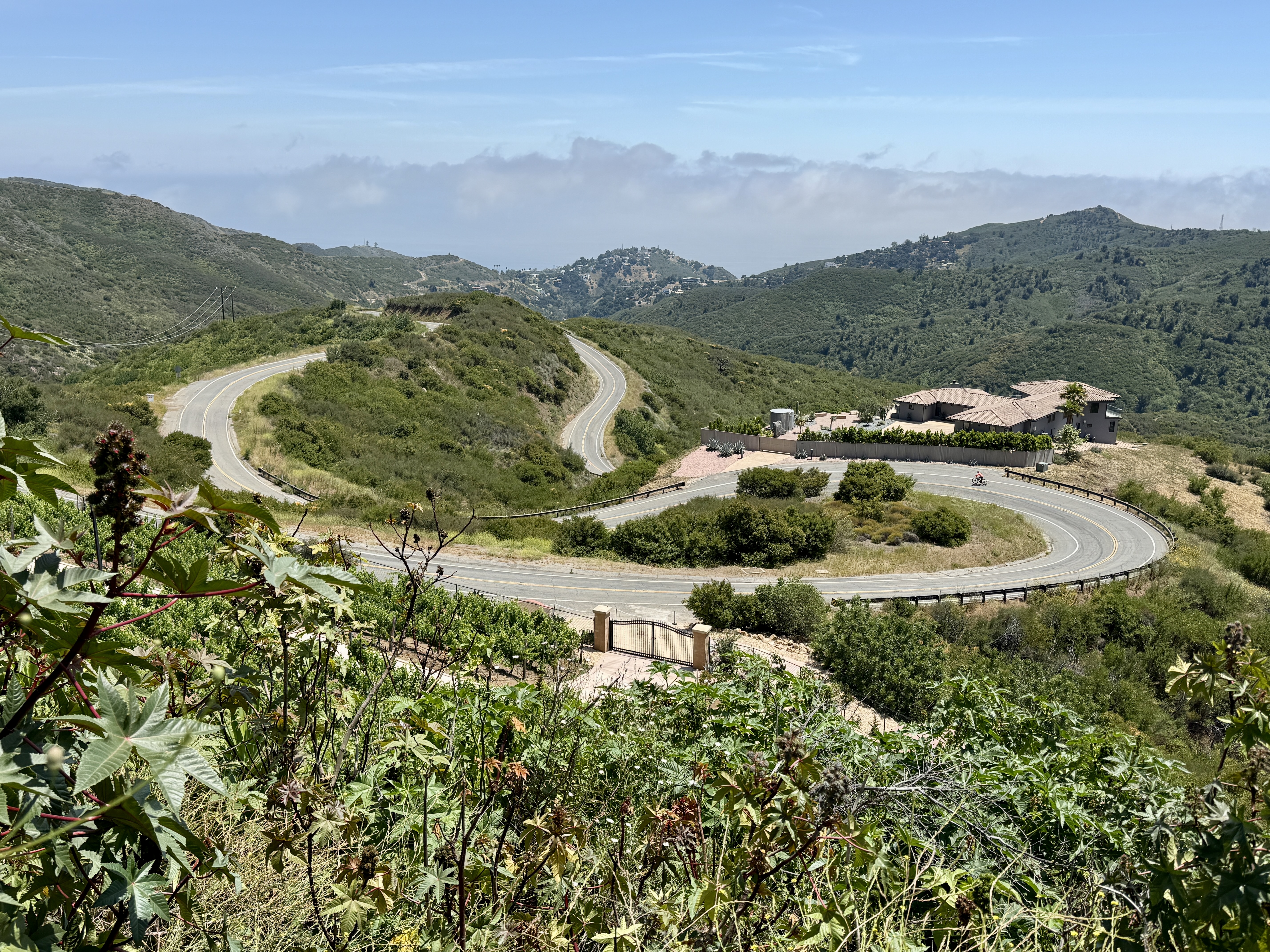
Apart from the steel plates at the base of Las Flores Canyon, every climb we did had good road surfaces. We rarely saw traffic on the climbs, and the only roads that had some traffic (but not much) were Encinal Canyon, some of Mulholland Hwy, and Stunt Road.
Parking and Riding on the PCH
Many of the climbs involve parking on the PCH (unless you ride to them) and many of the loops involve riding on the PCH. For the most part you can park on the PCH except where the curb is painted red, or there are No Parking signs.
Most of the PCH has very wide shoulders which can be great for riding on. The section of the PCH between Santa Monica and Malibu is the busiest (and as of June 2025 has lots of construction going on). West of Malibu is quieter, and heading west is safer than heading east (because of beach parking).
But you need to pay attention because wherever there is beach parking you have the potential danger of people trying to park, trying to leave, and opening car doors as you are riding past. And sometimes vehicles may completely block the shoulder, forcing you into a traffic lane – as do trash cans on trash day.
The Rides
My favorite overall climb was Yerba Buena Road and my favorite hard climb was Corral Canyon Road. My favorite descent was the upper part of Yerba Buena Road, with Piuma Road and Decker Road close behind. I did not ride Tuna Canyon which is supposed to be a great descent because I didn’t want to ride on that part of the PCH with all the construction work that was happening.
From west to east, the climbs described here are as follows:
Deer Creek Road
Yerba Buena
Mulholland Highway
Decker Road
Latigo Canyon
Corral Canyon
Piuma Road to Stunt Road
Rambla Pacifico – Piuma Road
Las Flores Canyon to Stunt Road
The distances I show for out-and-back climbs are for the climb only.
Deer Creek
Climb: 2.3 miles, 1,360 feet. This is one of the steepest climbs in the area, averaging about 11.3%. This means there is plenty of 12 and 13% to keep you entertained. Too short to be great, it’s still a climb to do if you are in the area. And of course the descent is screamingly fast.
Here’s the ride on Ride with GPS.
Yerba Buena + Yellow Hill Road
Climb: 10 miles, 3,100’. I loved the climb up Yerba Buena. The views in the upper section are big and beautiful, and the delicious descent is one of the most fun I’ve done in a while. After about mile marker (MM) 6.5 the road rolls and you can pretty much decide where to turn around. We turned around just after MM 8.
But the killer part of this ride is the climb up (private) Yellow Hill Road, which you reach after about 2.3 miles. You’ll spend much of the next mile in the 16-19% gradient. Finish where the road becomes rough, or continue up the rough road for a couple of hundred yards to amazing views. There’s an incredible property, the Malibu Dream Resort on your right. Ignore Yellow Hill Road if you just want a nice ride 😁. John Summerson says this about Yellow Hill Road: “the next mile may be the 2nd steepest in California.”
Here’s the ride on Ride with GPS.
Yerba Buena – Decker Road Loop
Loop: 20 miles with 2,740 feet of climbing. This is a lovely ride up the beautiful Yerba Buena Road and along Little Sycamore Canyon, followed by a sensational descent down Decker Road. The only decision point is where Little Sycamore Canyon Road meets Mulholland Hwy – you turn left at this intersection then in about half a mile turn right on Decker Road. I made the mistake of going down Mulholland and had to retrace my pedal strokes, so ignore that little spur if you are following the GPS track. As you are riding around where Yerba Buena becomes Little Sycamore Canyon, you can see the three large satellite dishes of Triunfo Pass Earth Station off to the right.
Here’s the ride on Ride with GPS.
Mulholland Hwy – Yerba Buena – Cotharin – Deer Creek
Loop: 24 miles with 3,300 feet of climbing. A wonderful and varied loop that starts up the lovely Mulholland Hwy. This has two short downhills in the first 3 miles then another around mile 5. At mile 7, turn left on Little Sycamore Canyon Road and follow this as it traverses west with beautiful views. At mile 8.5 you leave Los Angeles County and enter Ventura County, at which point the road name changes to Yerba Buena Road, and the road quality improves 😁. Follow Yerba Buena Road as it rolls west then head down its delicious descent to the Stop sign.
Turn right on Cotharin Road and follow this up a brutally steep hill with plenty of 12-15% gradient. Follow Cotharin Road then Pacific View Road as the road descends and rolls. Just before Pacific View Road you’ll see a beautiful gate on the right (11688 Cotharin Rd), which is the entry to the 747 Wing House, created from the wings of an old Boeing 747.
Follow Pacific View Road down until it turns left and climbs easily to the top of Deer Creek Road. A wickedly fast and steep descent brings you to the PCH. Turn left and ride back to the start.
Here’s the ride on Ride with GPS.
Decker Road – Encinal Canyon Road
Loop: 9.4 miles with 1,500 feet of climbing. After a tough start the climb up Decker Road opens up with pretty views. It starts steeply, with the first half mile having plenty of 12-14%. The next half mile relaxes slightly but is still steep. After this the climb becomes more open and with better views until you reach a big intersection after 4 miles. Turn right here and descend the much easier angled Encinal Canyon road. Park on the sea-side of the PCH slightly to the west of Decker Road.
Here’s the ride on Ride with GPS.
Latigo Canyon
Climb: 6.9 miles, 2,000’. This is a good introduction to the climbs in the Santa Monica mountains. It’s never too hard, it’s twisty, peaceful, and there’s very little traffic. You’ll have views of some incredible houses as you climb. Finish at the obvious top. You can park on the PCH, sea-side, just east of the start of the canyon. This parking spot also gives you easy access to Corral Canyon which is just a few hundred yards to the east.
Here’s the ride on Ride with GPS.
Latigo Canyon – Mulholland Hwy – Stunt Road – Piuma Road Loop
Loop: 43 miles with 5,300 feet of climbing. This is a good loop, never too steep and with good views. There are two stunning descents: the section on Mulholland Highway called The Snake, which has been closed to cars since 2019, and Piuma Road. Both are great but I’d rate Piuma Road as the better descent.
Park on the PCH or in the dirt at the base of Latigo Canyon Road, then climb Latigo Canyon and follow the descent until you reach the busy Kanan Dume Road in about 10 miles. Turn right and ride Kanan Dume for just over half a mile then turn right on Mulholland. Within a few hundred yards you’ll reach the road closure (for cars, not bikes), and the start of the lovely Snake descent.
You’ll be on Mulholland Hwy for about 13 miles until you reach Stunt Road at about 23 miles. Mulholland Hwy east of Malibu Canyon gets a bit tedious, and Stunt Road was a less interesting climb than most of the others in the area. My bike computer seemed to agree because it paused for maybe half a mile up Stunt Road.
But the ride from the top of Stunt Road down Schueren Road then up and down Piuma Road is beautiful, with great views. Unfortunately all good things end, and Piuma Road ends at the busy Malibu Canyon. I did not enjoy riding down Malibu Canyon to the PCH.
Here’s the ride on Ride with GPS.
Corral Canyon
Climb: 4.2 miles, 1,890’. I loved this climb. It’s short, only about 4.2 miles to where the road is closed, but what a climb! It climbs across hillsides and along a ridge so the views are always good. It’s deliciously steep, with one section near the start reaching over 17%. As well as the open spaces it traverses, the climb goes through two small residential areas. This climb is one of the steepest and most sustained climbs in the Santa Monica Mountains. Park on the PCH, sea-side, a short way to the west of the canyon.
Here’s the ride on Ride with GPS.
Piuma Road to Stunt Road
Out-and-back: 16.4 miles, 2,600‘. This ride has some of the best views around and one of the best descents. The initial hill is about 5.5 miles, then there’s a 1 mile downhill, then you turn left on Schueren Road and follow this for 1.8 miles to the Lois Ewen Overlook. The ride back down the lower part of Piuma Road is sensational, with stunning views (if you can look up from the road 😀). Start at the intersection of Malibu Canyon Road and Piuma Road; there is a dirt parking area on the SE corner of the intersection.
Here’s the ride on Ride with GPS.
Rambla Pacifico
Climb: 4.4 miles, 2,100’. Another tough and pretty climb, with the initial pitch reaching over 19%. Unfortunately there is a gate at the start of the climb. I talked with the guard and told him that Rambla Pacifico is a very famous bicycle climb and that I’d come to Malibu to ride it. He allowed me through, telling me to go through the small gate to the right of the main gate.
At the end of the steep section there is another gate, again with a small gate at the side. After this the gradient eases considerably, although there is still a lot of 10 and 11% on the climb. But after 19% it feels very reasonable. After about 3.5 miles Rambla Pacifico becomes Piuma Road. Continue on this to the high point then turn round. Park a couple of hundred yards up Rambla Pacifico where there are lots of parking spots on the right.
Here’s the ride on Ride with GPS.
Las Flores Canyon to Stunt Road
Climb: 5.8 miles, 2,305’. This maybe the toughest climb around Malibu, with a sustained mile-long section of 12-13%. Brutal. The road starts in the canyon but after just over a mile it starts to climb very steeply out of the canyon (this is the toughest section). Even after the 13% is done, the climb is still tough. Eventually, after about 3.4 miles, you reach Rambla Pacifico and turn right. In another 0.6 miles turn right again on Schueren Road. Follow this pretty road more easily for 1.8 miles to the Lois Ewen Overlook, where Stunt Road comes out. You have great views in all directions from here.
When I did this climb there was a lot of construction, single lane traffic, and lots of steel plates on the road in the lower section of Las Flores Canyon Road, so I descended Rambla Pacifico to avoid the construction on the way down. Park as for Rambla Pacifico. Las Flores Canyon is right next to Rambla Pacifico.
Here’s the ride on Ride with GPS.
