
In June, 2020, we spent three days in Visalia, which lies in the Central Valley and is the closest decent-size town to Sequoia and Kings Canyon National Parks. All the rides in the mountains require a bit of a drive from Visalia, especially Kings Canyon.
Sequoia (#31, S-HC/1)
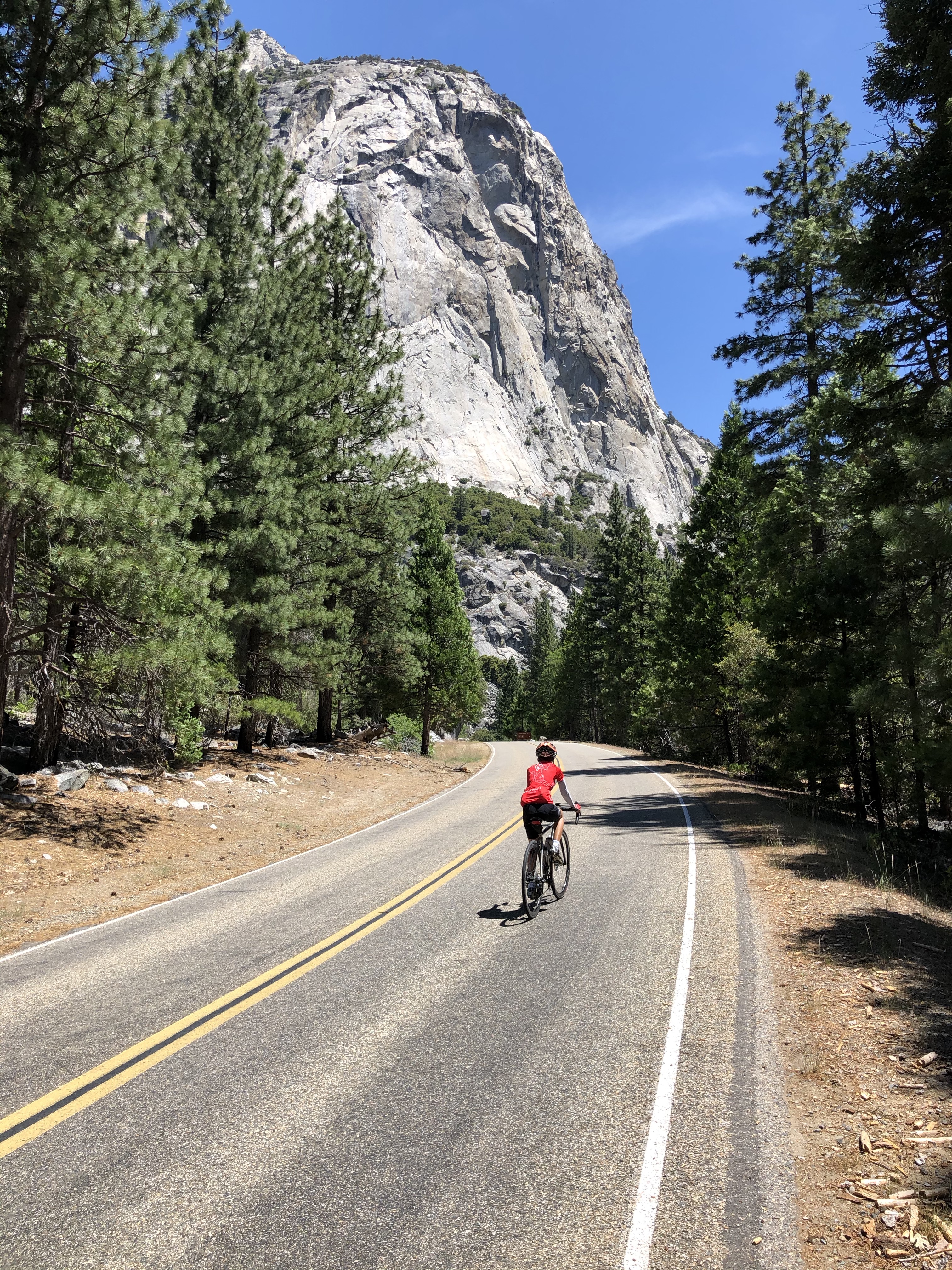
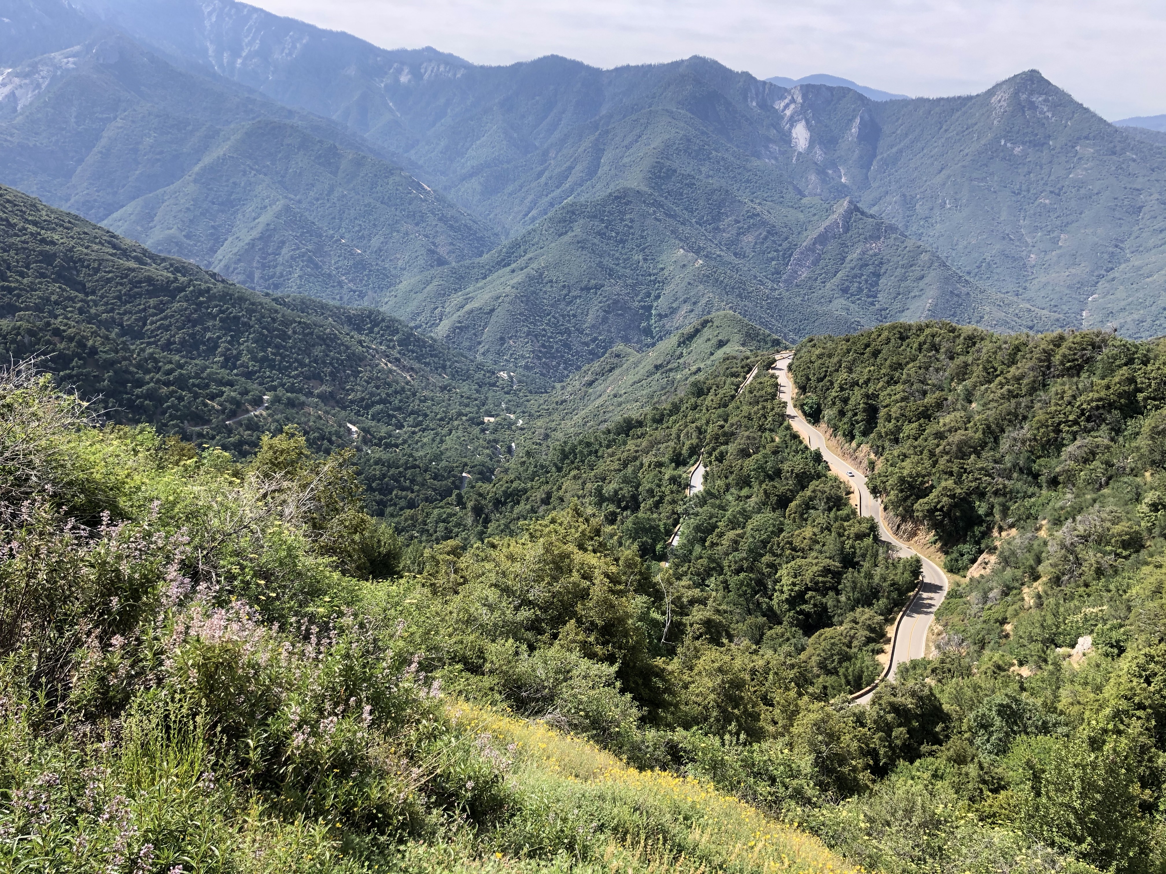 This is a lovely climb on a beautifully smooth road up into Sequoia National Park. The road gets a lot of traffic so it’s best to start early. Unfortunately, on the initial part of the climb you are looking into the sun so the views are not so great. However, the descent gives you much better views, and best of all, the road is smooth, the curves are never too tight, and it’s a wonderful and fun descent. The climb is about 16.6 miles with 4,965 feet of climbing.
Drive up Hwy 198 through the ridiculously long village of Three Rivers to Sequoia National Park. I parked my car just above the pay station in a parking area to the right, then I rode back down to the Park entrance to start.
 Follow the road up the valley for a few miles and then the road starts switchbacking up to the left. The gradient varies, with plenty of 6-8%, and a small amount of 9-10%. For parts of the ride there is a beautiful stone wall on the outside of the road.
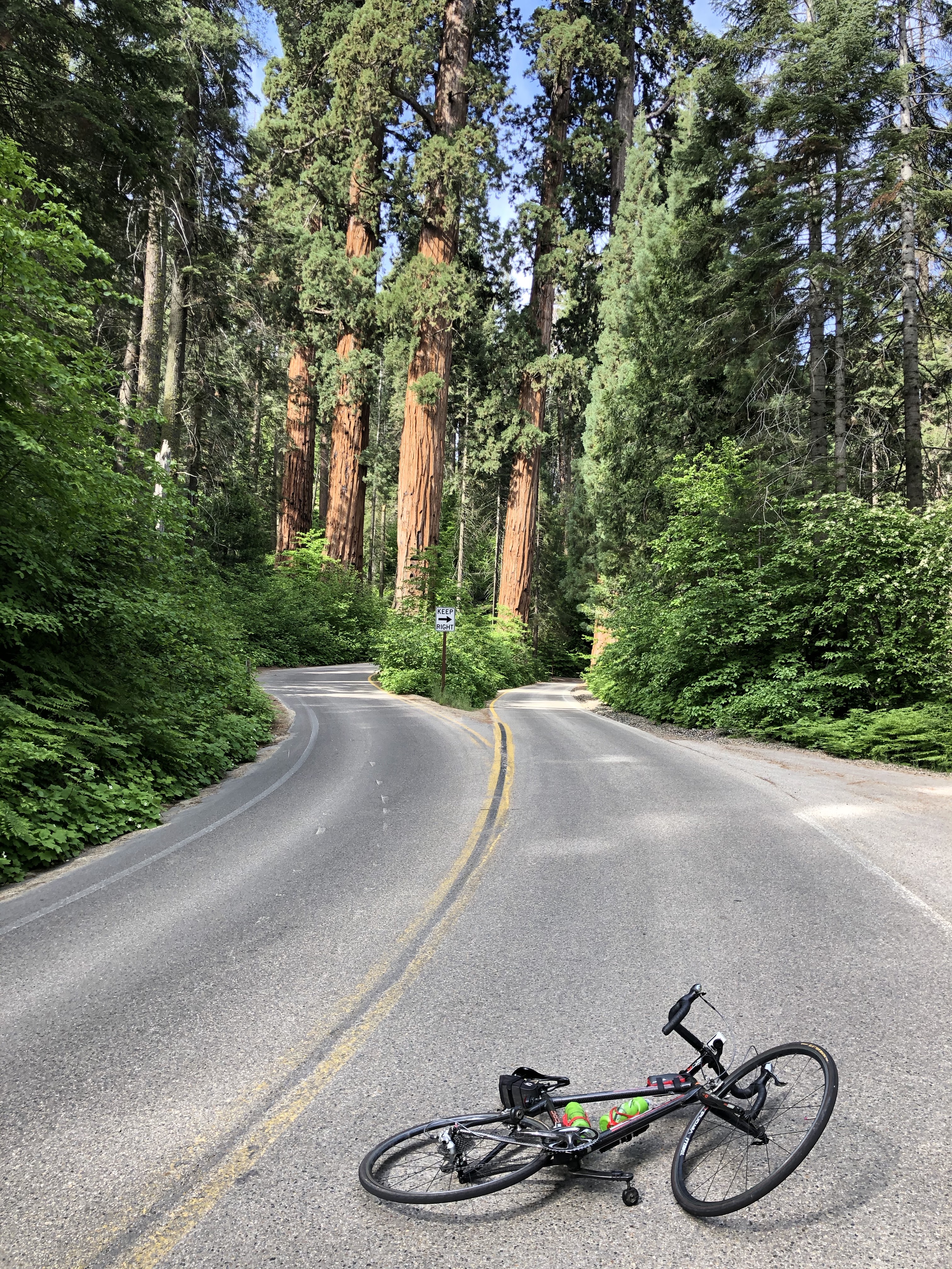
At mile 14.3 you enter the Giant Forest where you’ll see lots of very tall trees, and a few sequoias (at one point the road splits and both directions pass between sequoias. The next three miles is the steepest section of the climb. Once you reach the Moro Rock turnout on the right, the road starts to descend, so this is where the main climb finishes. You could continue to the Sherman Tree or even further, but by Moro Rock you’ve done the big climb.
Mineral King Road (#30, S-HC/1)
 This is a wonderful climb in a remote setting on a road that varies between adequate and very rough (this just adds to the sense of adventure.)
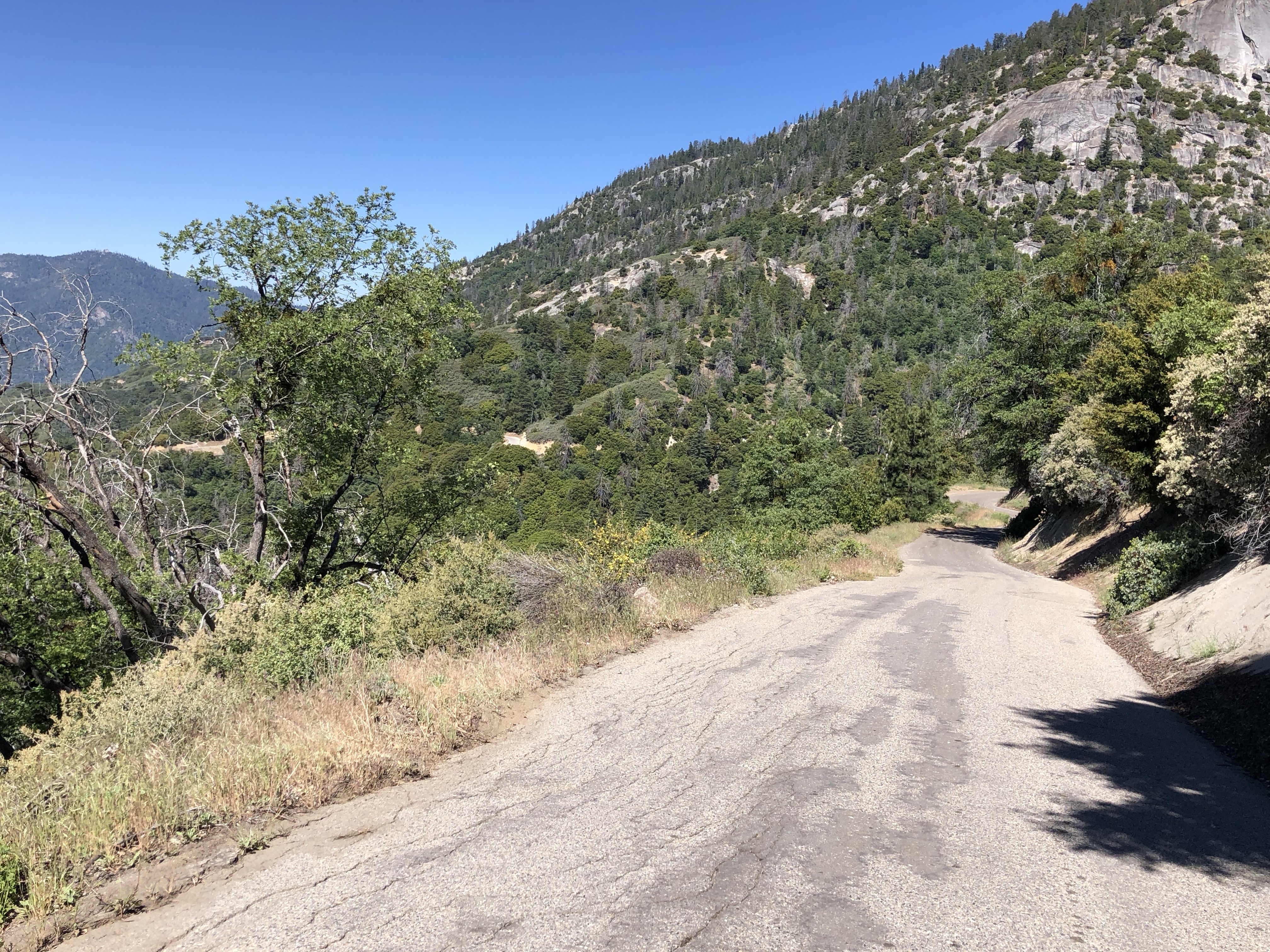
The paved-road climb is about 19.5 miles with 5,440 feet of climbing. It starts in the eastern part of Three Rivers, about two miles before the entrance to Sequoia National Park, and the Mineral King Road turnoff on the right is well marked.
I started early to beat the heat, but unfortunately I had the sun in my eyes for much of the ascent. The first 9 miles of the climb have the most inconsistent road surface, and there are some steep sections, but overall the climb is not too bad.
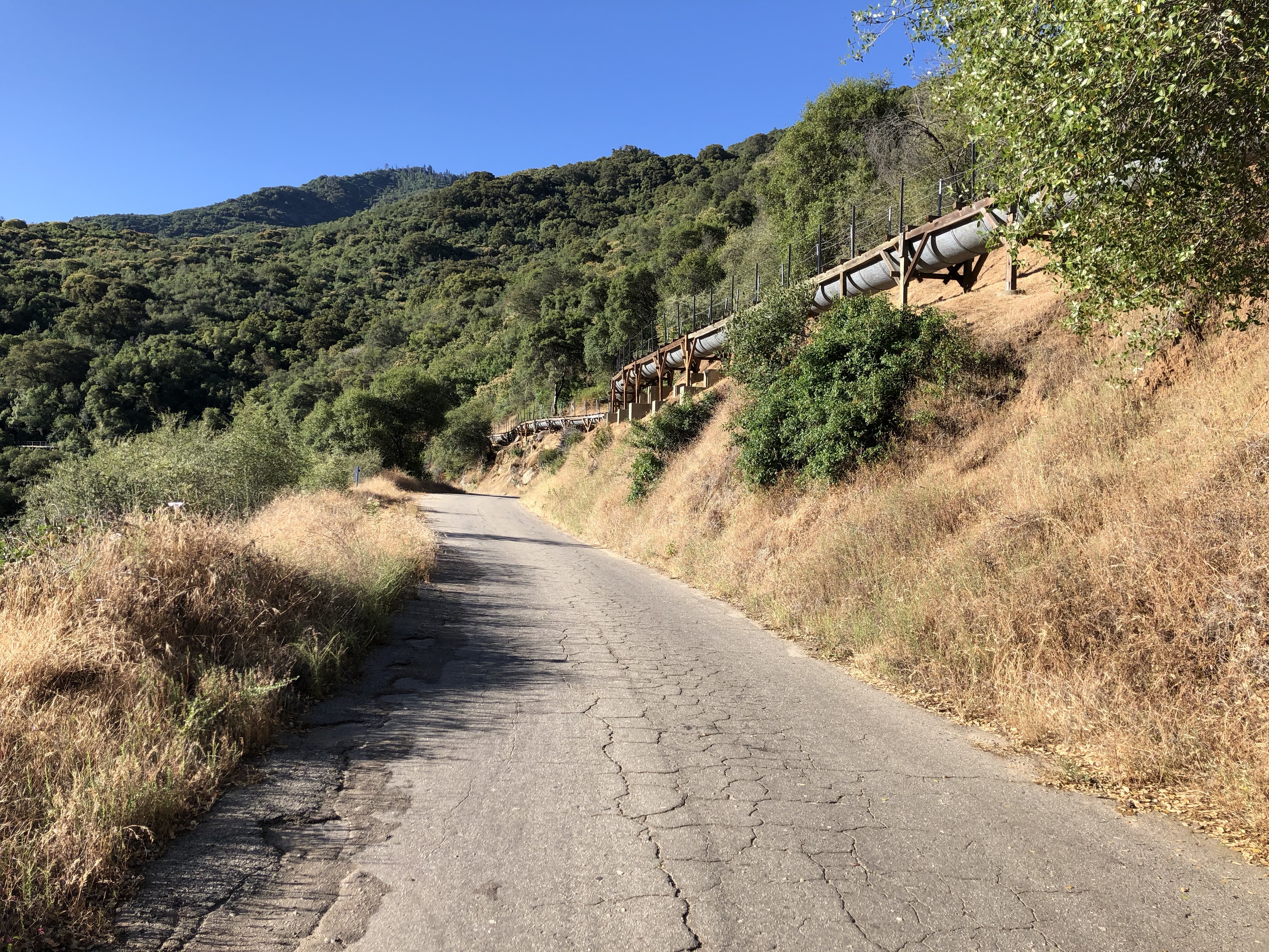 At mile 6.5 you see a pipe up on the hillside above you, then you cross a bridge to the left. At about mile 9 you pass a beautiful granite slab on the left with water cascading down it. At mile 9.3 you see a sign saying “End of County Maintained Road” and you wonder, given the rough surface, how they can claim to have maintained it at all.
At mile 9.5 you enter Sequoia National Park and the road surface becomes better. But on your way down you remember that “better” is a relative term.
Then at 10.3 miles you turn a corner to the left and a whole new valley opens up with new views. The rest of the climb is significantly steeper than the previous 10 miles, with plenty of 10-13% grade. I stood a lot on this section. Just above Atwell Campground, at about mile 19.5, with no warning the road simply turns to dirt. I turned around here.
The descent is steep and rough. In a couple of places there are signs that say “Save Your Brakes. Use a Lower Gear.” On a bicycle you don’t have a choice.
Kings Canyon (S-1)
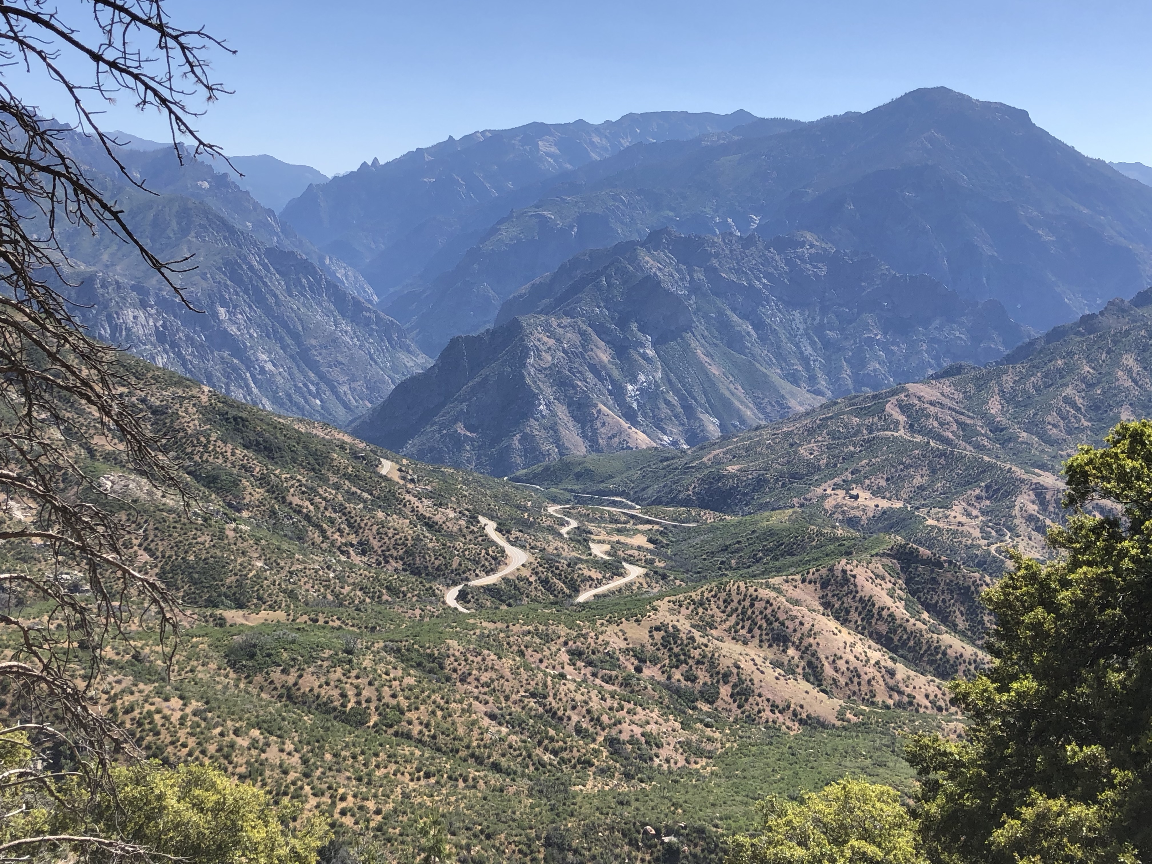 What an incredible ride in big, magnificent country! Jay Rawlins says “one of the best rides I know of anywhere and a hands-down Best of the Best ride“. The ride as I did it is 53.5 miles with 5,250 feet of climbing and is absolutely worth doing.
The ride starts with a fantastic and fun descent, continues along a sensational shelf above the river bottom, descends to the river, then follows the crystal-clear river uphill for about 16 miles, then returns the same way.
It’s along drive from Visalia but worth it. Use Google Maps to get you there. We didn’t do the full ride as described by Rawlins, but took one of his suggestions about shortening the ride. We drove into the Canyon from Grant Grove Village, to where you suddenly leave the trees and see the canyon open up in all its vast magnificence. This is a good place to start.
Start with a delightful 5.5 mile descent down to the gas station and restaurant where Kings Canyon Lodge used to be, then another mile takes you to the start of a delicious shelf that rolls for three miles above the river. Just as you reach the end of the canyon and wonder where to go, the road makes a wonderful S-bend and in another two miles you are crossing a bridge across the river.
 Follow the rushing, crystal-clear river uphill for about 16 miles to Road’s End, with quite a lot of gradual climbing. The first 10 miles are nothing special, apart from the amazing river, but after Cedar Grove the valley opens up and you have spectacular views of some amazing granite cliffs on the left.
Turn around at Road’s End and head back. The shelf above the river was vastly more interesting this way, with its sensational S-bend, then the five mile climb back above Kings Canyon Lodge is just pure delight with all the magnificent views of the Sierras.
