
May, 2024
KmM = Kilometer Marker
Malaga is a lovely city with a beautiful carless downtown area covered with glistening tiles and a zillion restaurants of different types. Once away from the sea it has hills galore.
However, I wasn’t interested in riding in Malaga itself so I drove to the start of the rides I wanted to do. There are lots of amazing rides and climbs around Malaga and I did only a very few, coming to Spain this year the heaviest, least fit, and with the worst knees of my life. Ah, such is aging.
Puerto del Léon
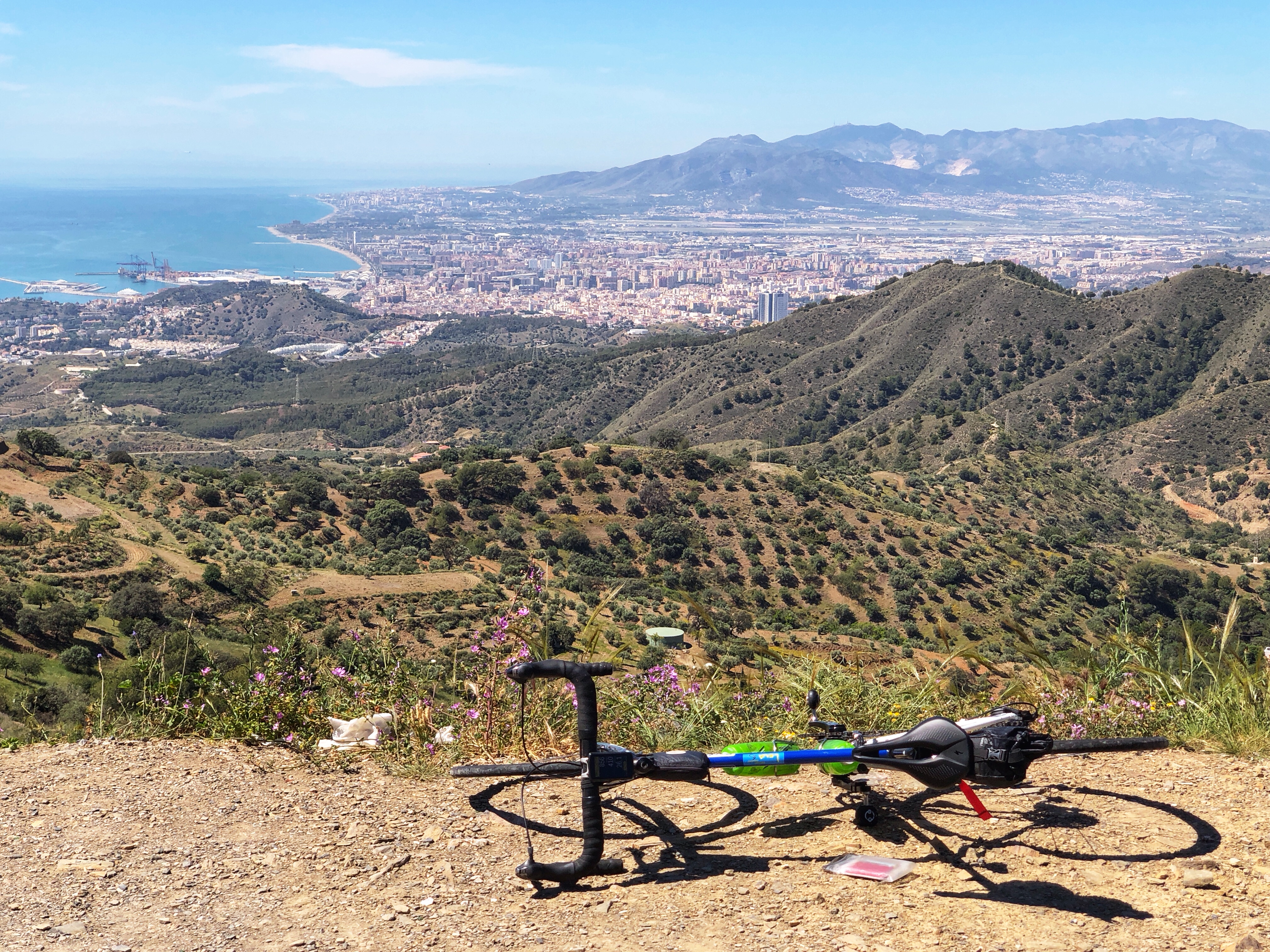 Looking down over Malaga
This is a popular climb up a lovely winding road, right out from Malaga. The gradient varies quite a bit, with a few short sections of 8-10%. The road surface is smooth and the descent is delicious. The out-and-back ride is 34.4 km with 857 meters of climbing.
I rode it on a Saturday and there were many cyclists on the road, mostly in groups, and very few cars. Interestingly only two of the many cyclists were women, both of whom looked non-Spanish.
Rather than figure out how to ride through Malaga, I drove to a good parking spot on the outskirts of Malaga, at location 36.737193145994155, -4.4121477716330455
From here you simply follow the A-7001 for a bit over 15 km as it winds its way to the high point. There are two 360 degree turns to gain height, although I could only tell they were 360 from the map, not from riding.
After the high point, continue slightly downhill for about 2 km to where a smaller road heads down to the right, by the Venta Galwey restaurant, signed to Olias and Comares. This road is an alternative climb to Puerto del Léon and I suspect many cyclists use it to do a loop ride. Google Maps showed that it was closed when I did this ride, possibly for repaving.
Unless you are doing the loop, or a longer ride, turn around and ride back the way you came, enjoying the delicious twisting downhill.
Here is the ride on Ride with GPS.
A-7075
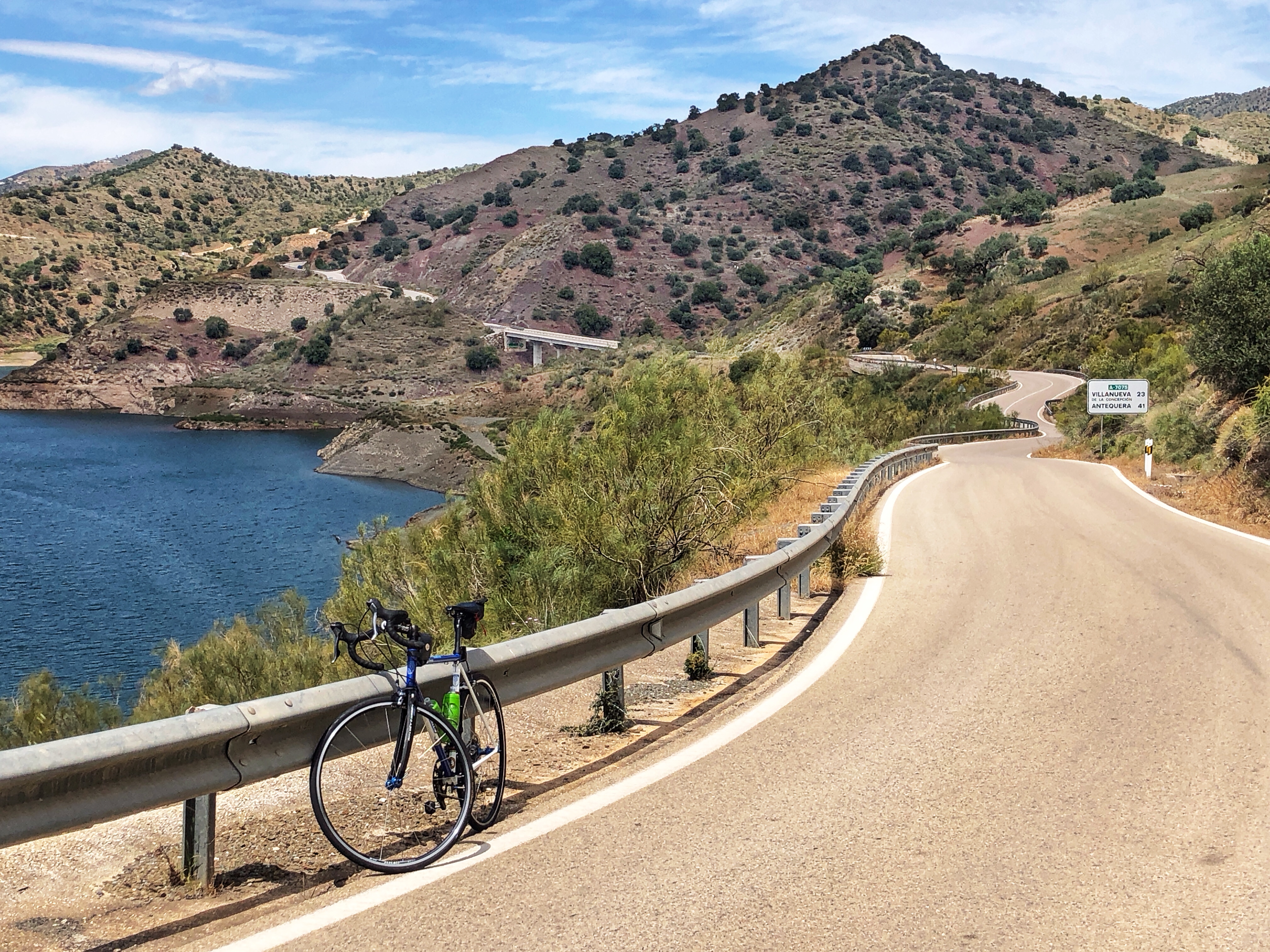 I’d originally planned on doing the tough climb from Villanueva de la Conceptión to El Cortal, but we decided to hike the 3 km loop at El Cortal and to get there we drove up the scenic road, the A-7075. I decided that this was such a lovely road that I’d rather ride it than do the El Torcal climb. As an out-and-back it is 48.6 km with 978 meters of climbing.
So I drove to the start of the road and parked at location 36.7534624, -4.4933116
From here, ride north on the wonderfully twisty and rolling road for about 6.3 km then turn right, following the signs for the A-7075. The road now becomes quieter and more peaceful, with some long rolling hills. I saw only one car on this section of the ride.
Just after KmM 26 you see the town of Villanueva de la Concepción spread out in front of you, and the rocky landscape of El Torcal de Antequera high above it. If you are in the area it’s definitely worth visiting El Torcal and hiking the 3 km loop around this rocky wonderland.
A few kilometers later you reach a T-junction. Turn round here and ride back the way you came. Of it you prefer, turn left and ride another 6 km to Villanueva, and maybe even do the tough climb up to El Torcal.
Here is the ride on Ride with GPS.
Cerro del Moro

This is an interesting climb with a stunning finish. The reason to do this ride is the last 5 km to the radio towers at the top of Cerro del Moro, but you have to get to the start of this climb somehow, and this is one way to get there.
I found the route on Cycle Fiesta and created my own GPX file from the map on Cycle Fiesta. The route is non-obvious in places, and I wasn’t paying attention to my bike computer and just going the obvious way, so I went wrong several times. So if you are using my GPX file, just ignore the obvious mistakes. With mistakes, the ride was about 30 km with 1,080 meters of climbing.
I drove to the start from Malaga and parked at 36.57817928549289, -4.570898708044697
From here, ride 100 meters down to the N-340 because why not? Turn round and start the climb up Carreterra Costa del Sol. It starts surprisingly steeply but varies a lot. After 2 km, opposite the incredible fairytale-like castle of Castillo Monumento Colomares, turn left. Follow the GPX route up to and along the A-368 until you eventually turn left on a slightly rough one-lane concrete road. (I continued too far up the A-368 until I realized I was off-route and came back down.)
You could ignore the concrete road and simply continue up the A-368. This would be both easier and shorter, but you would be missing out on an adventure. The concrete road takes you by some incredible cliffs and houses, up a hill that is steeper than 22%, and another hill of about 19%, until you finally reach the A-368 again.
Turn right and in a few hundred meters turn left at a sharp turn in the road. You are now starting the climb that is the whole purpose of this ride. After a few hundred meters of slightly rough asphalt, you see a chain across the road preventing cars from going up. Go around the chain and enjoy about 5 km of delightfully quiet road as it climbs to the radio towers at the top. This section is a popular climb and I saw six other cyclists on it.
Come back more or less the same way. I skipped the concrete road on the way down and instead turned left once back on the A-386 (okay, ignore the GPX track that showed that I mistakenly turned right). I stopped at the golden Stupa Benalmádena on the way down to take a look inside.
Here is the ride on Ride with GPS.
Links and Other Clicks
Cycling Fiesta has an interactive map that allows you to see and read about many of the climbs in Spain.
Cycle Fiesta’s page about Puerto del León.
Cycle Fiesta’s page about El Torcal.
Cycle Fiesta’s page about Cerro del Moro.
