
July/August, 2025
KmM = Kilometer Marker
This page is about climbs in Catalonia (Catalunya) that are not near Girona. (The climbs around Girona are fun but I sometimes need a real climbing fix.) We drove to the start of all the rides on this page. Stronger riders than me may prefer to ride to the climbs, but I mostly subscribe to the Skip to the Fun Parts philosophy 😀.
Note that for these rides I set my Karoo bike computer to record distance in kilometers and elevation gained in feet, thus maximizing both numbers 🙂
At the tourist office in Girona you can pick up a brochure and map of Road Cycling which shows loops and climbs, some of them quite a distance from Girona. This is also available electronically at Issuu.
There is a separate page about cycling in the general Girona area.
Coll de la Creueta
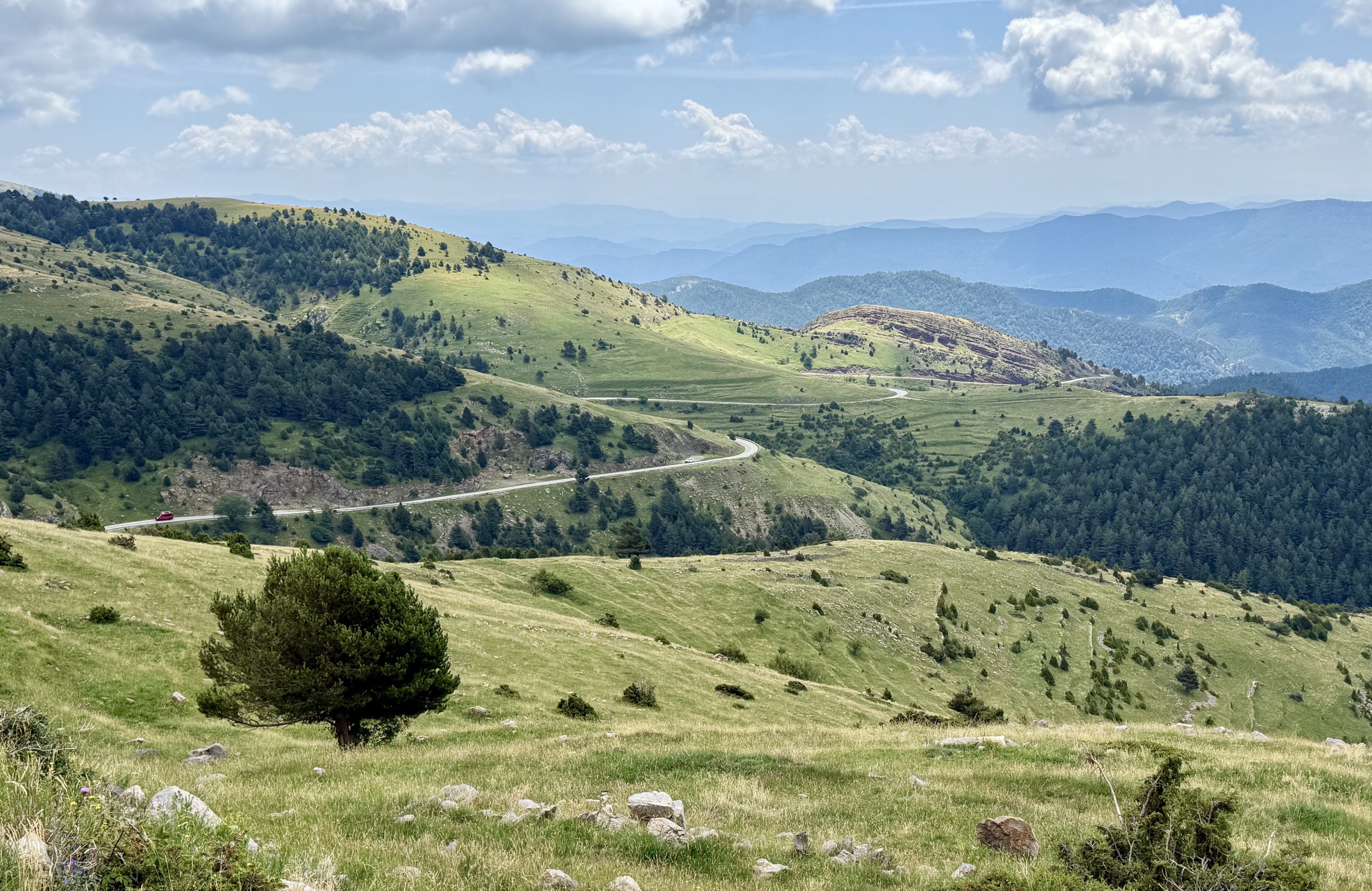
La Creueta (The Cross in Catalan) is a beautiful climb from either side. You get well above the tree line, with gorgeous views of the surrounding area. I climbed both sides, doing the ride as an over-and-back from La Pobla de Lillet to Alp and back, which makes the whole ride about 64 km with 7,100 feet of climbing.
I drove from Girona to La Pobla de Lillet, which took just under two hours, and parked two hundred meters past the start of the BV-4031, at location 42.245113781625705, 1.9773035640292906. The last section of the road from Gombrèn is incredibly twisty.
Ride 200 meters back up to the BV-4031 and turn left. After about 12 km you break out from the trees into wide-open country with beautiful views all around. It’s a lovely climb.
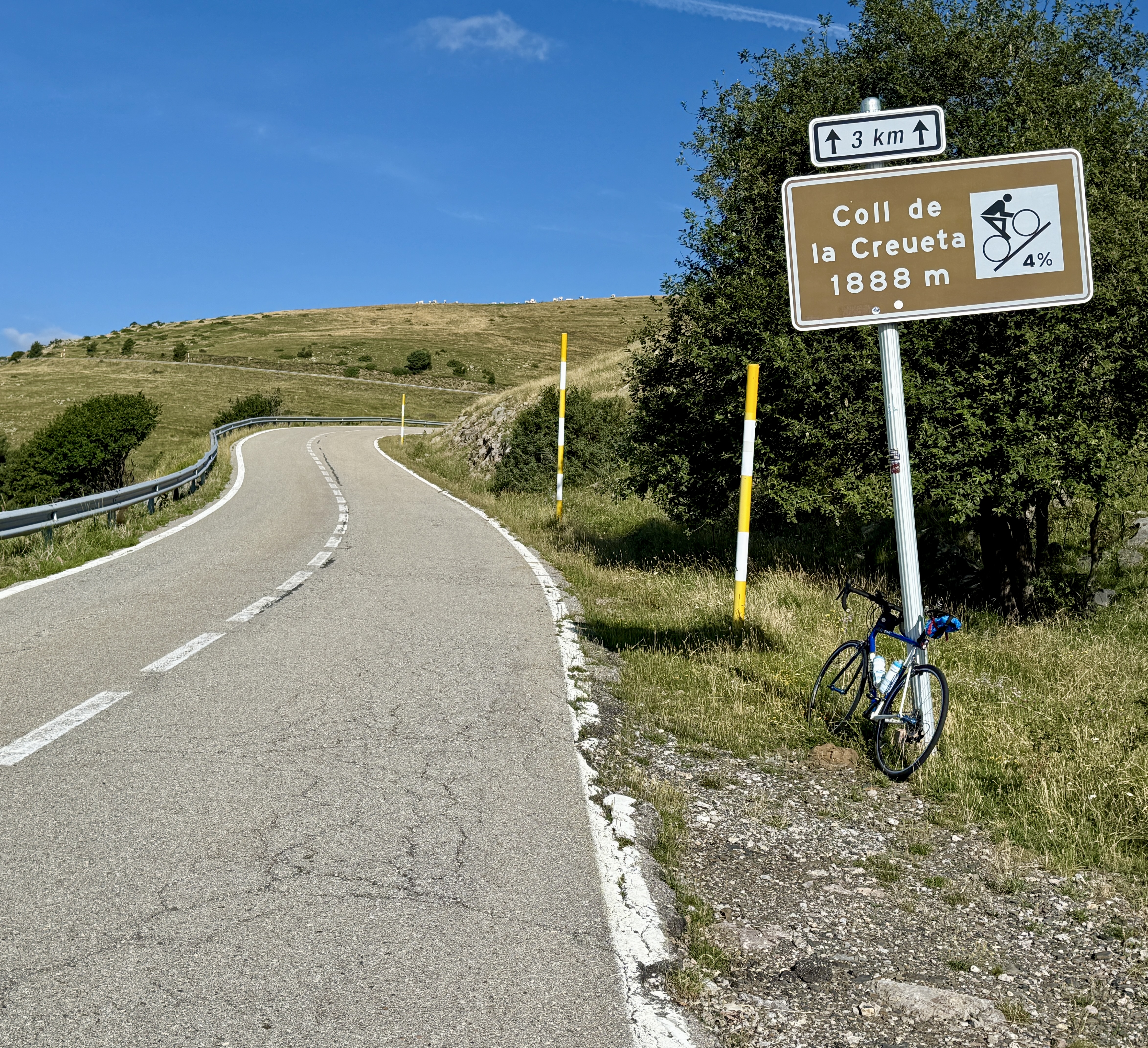 Eventually, you’ll see a sign telling you it’s 3 km to the Coll de la Creueta with a gradient of 4%. Neither number is true. It’s further and steeper, and strangely I saw no signs at the actual Coll.
So, keep riding down the other side, passing through the small ski towns of La Molina and Masella, and climbing two climbs of about 2km each on the descent. Where there was just a single road, the BV-4031, on the way up from La Pobla, you now descend the BV-4031 (and do your first 2 km climb) to an intersection with the GI-400. Turn left and follow this down to La Molina (with a short well-lit tunnel just above the town).
In La Molina, pay attention because the GI-400 turns sharply left off the main road, signed to Masella. Turn left and follow the GI-400 with another climb of just under 2km before you reach Masella. Keep following the lovely GI-400 down to Alp.
In Alp I found a restaurant that looked closed as it was too early for lunch, but I was able to refuel with ice cream and drinks. Turn around and follow the same road back to La Pobla de Lillet, enjoying the two 2 km downhills you had to ride up on the way down 😀.
Here’s the ride on Ride with GPS
These next two climbs both start off the C-16, the busy road that leads towards France and Andorra, so this area may get much busier in August, the French vacation month. The climbs start in two towns about a 20 minute drive apart – Berga and Bagà – so if you are in the area you might as well do both climbs.
Rasos de Peguera
 I really liked this climb. It’s quiet, peaceful, with lovely views that are dramatic in an understated way. You are basically following a valley up into the mountains, then after the biggest peak the road heads round to the right and climbs up behind the peak. The climb is about 16.5 km with 3,530 feet of climbing.
I parked in a small dirt parking area at location 42.10733428534503, 1.8501868592724182, just at the start of the BV-4241. From Google Maps I thought I could parking in the big parking lot just before this, but there are signs saying it’s reserved for clients of the restaurant just across the road, and I didn’t want to risk being towed.
So, start up the BV-4241 and follow this for about 1.7 km then take the BV-4242 on the right. Follow this for another 1.7 km then turn right on the BV-4243. Follow this to the top with views of dramatic cliffs. Much of the climb is not too steep but there is also plenty of 8-10% with the occasional 11% thrown in.
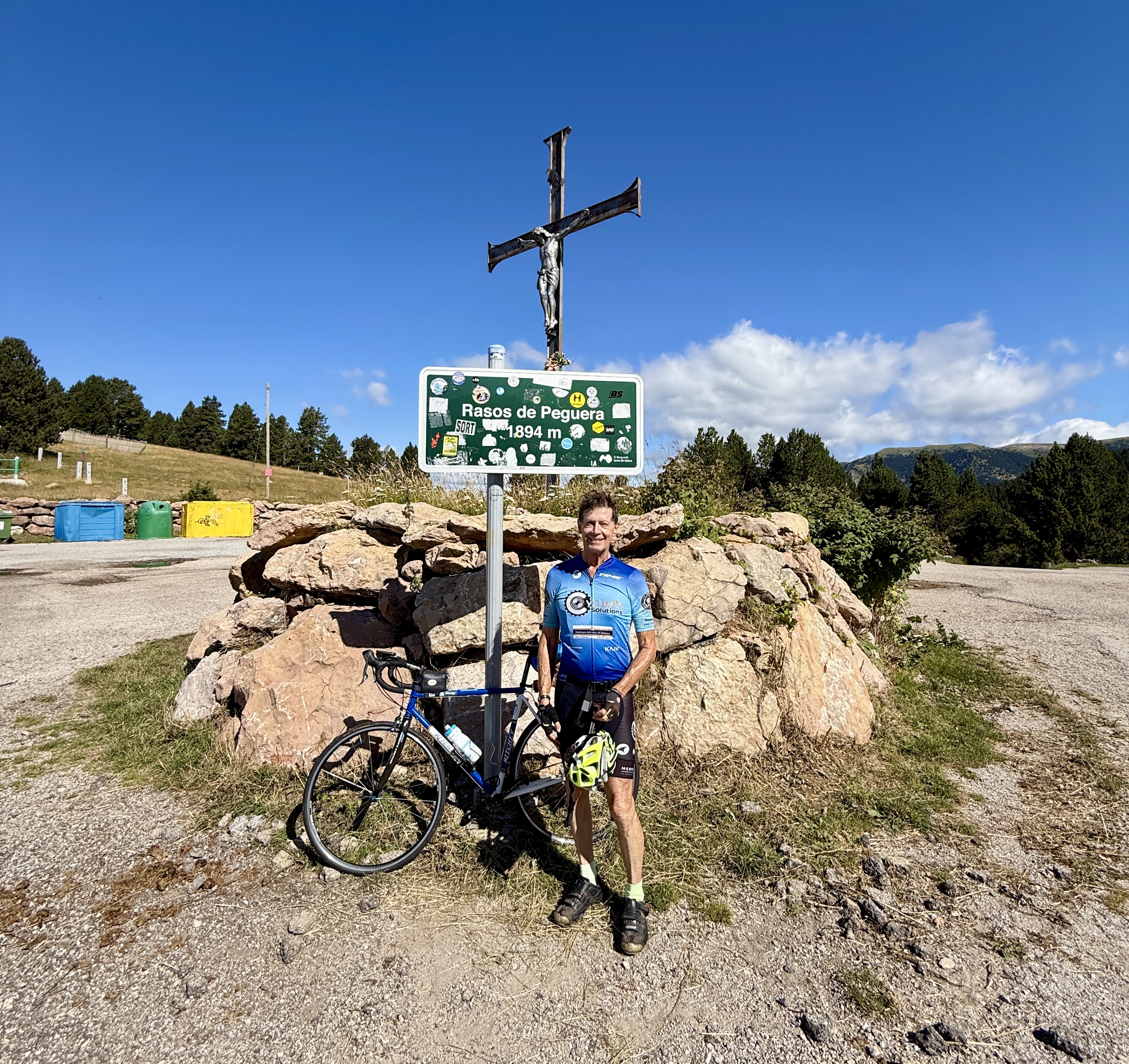 Finally you reach the one-way loop just below the top and follow this to the top just after KmM 13. At the top there is a summit sign and a cross with crucifixion.
The one-way loop has two lanes. There used to be a ski area up here which opened in 1975 and closed in 2004 due to lack of reliable snow, and the right-hand lane was used for ski area parking.
Turn around and enjoy the wonderful descent.
Here is the ride on Ride with GPS.
Coll de Pal
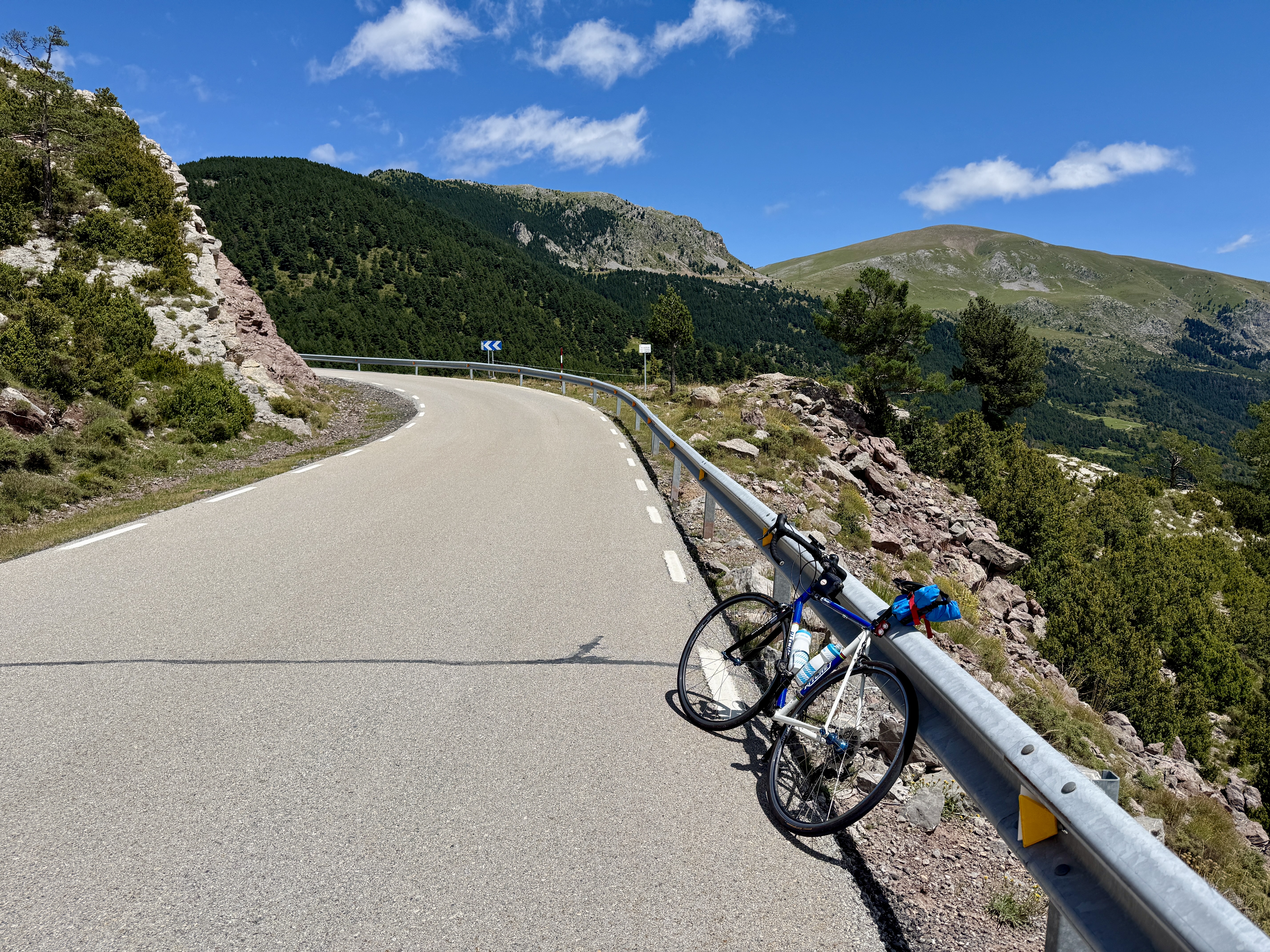 Coll de Pal is a stunning climb with ever changing views and I loved it. One moment you are riding under the C-16 as it makes its way to France and Andorra. The next moment you are riding across a strange man-made shelf. The next moment you are in high alpine meadows. The road is lovely and the views are wonderful and ever-changing. Cycle Fiesta says this is one of the more enjoyable climbs in the region.
It felt much bigger than its numbers would suggest, perhaps because it is so varied, perhaps because I’d just ridden Rasos de Peguera, perhaps because I had a vicious headwind in the upper section. Whatever the reason, this felt like a big climb to me.
The climb itself is about 19 km with 4,060 feet of climbing.
It starts in Bagà, about 20 minutes drive up the C-16 from Berga. There is a public parking area at location 42.253725421542825, 1.8630061623375918 but this was full when I got there so I parked at 42.25383006761472, 1.8604058995955044 which is very close to the start of the BV-4024, which is the road you climb.
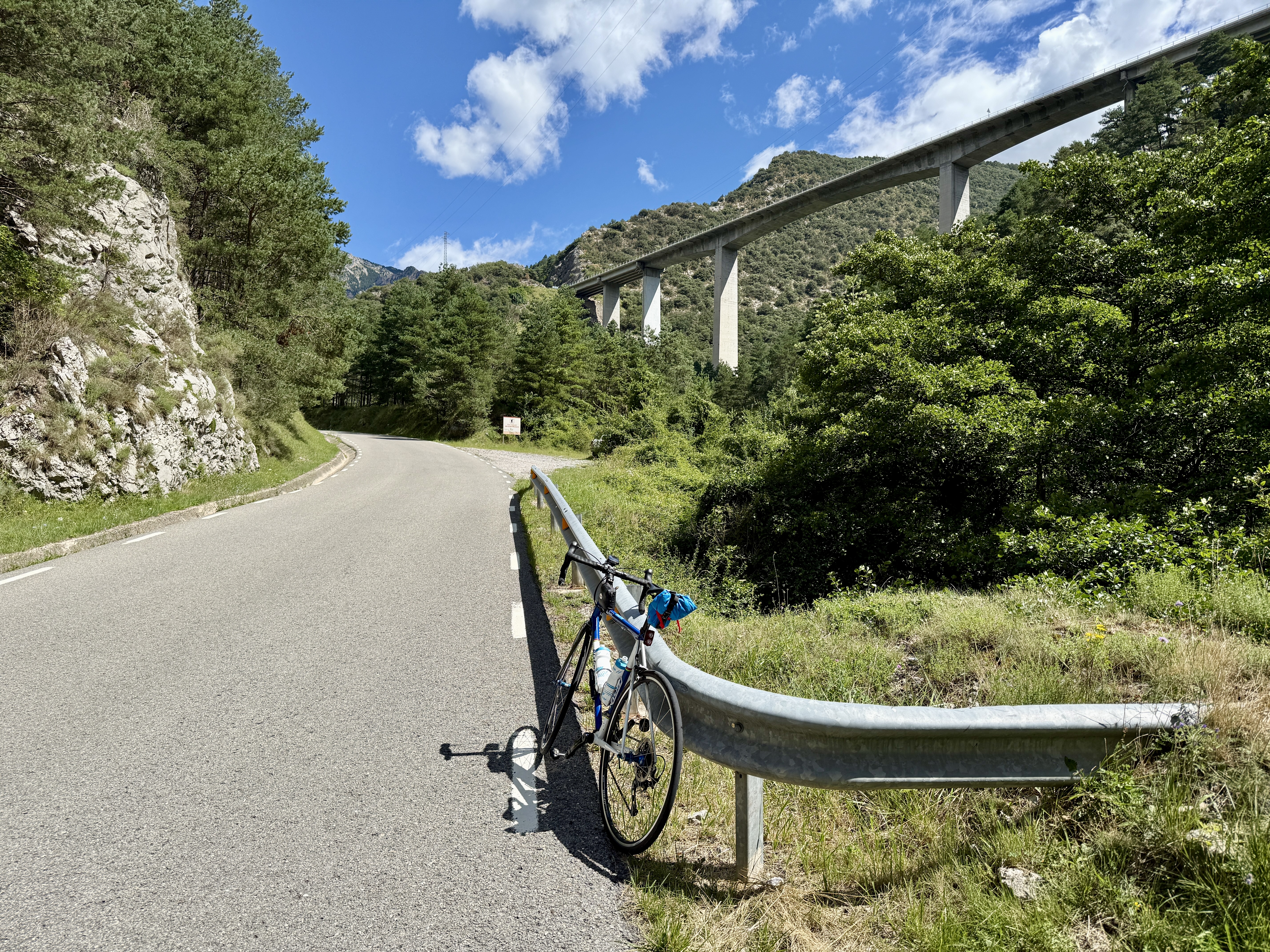
For the first 6 km you are pretty much paralleling the C-16, which you can sometimes see, and often hear.
In a bit over 2 km you enter a short rocky canyon with a steep cliff on the left. If you look closely you can see slings and carabiners left on the rock by rock climbers. The gradient now increases and you are faced with some 8-10%.
Around 11 km you start to cross a shelf on the side of the mountain that was created by blasting the hillside. The rock is unstable enough that there are big nets and cables on the cliffs and slabs to prevent rockfall on the road.
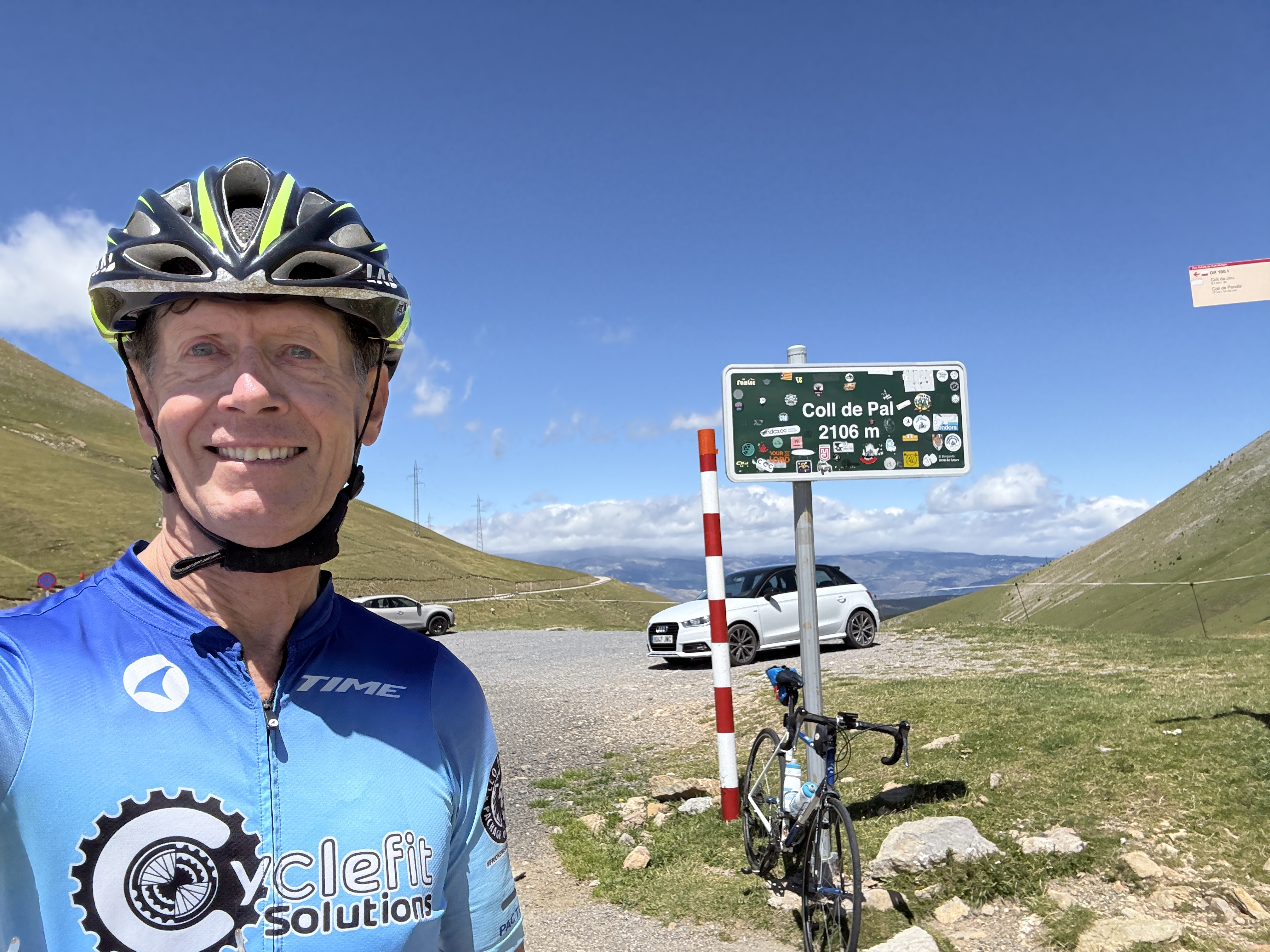
The climb ends by reaching high alpine meadows, and there is a sign showing that you are now at the Coll de Pal, at about 6,909 feet.
Again, enjoy a delicious descent back to the car.
Here is the ride on Ride with GPS.
Coll de Pradell
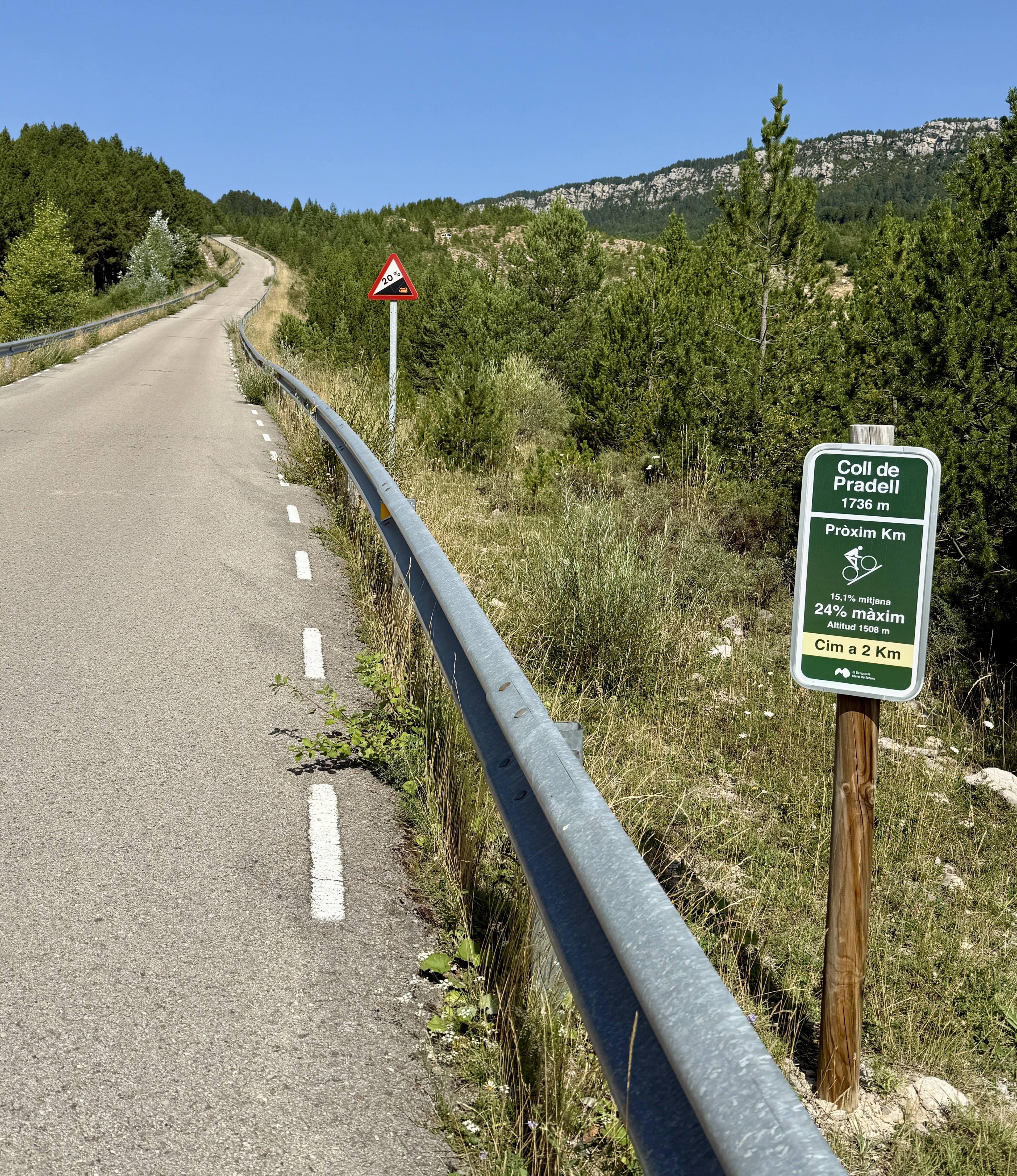
Coll de Pradell is easily 🤣 the hardest climb I’ve done in Catalonia. There are two difficult starts to it, the hardest being the one that goes through Sant Corneli. This is the route described here. The climb to the Coll de Pradell is about 17 km with 3950 feet of climbing, and 650 of descent, which means the climb with return is about 34 km with 4,600 feet of climbing. The Super Hard section is about 3.3 km, but oh so steep.
It’s a pretty climb although without the beautiful open views that some of the other climbs in this area have. But you are not here for the views; you are here because you love to suffer on difficult climbs 😋.

Locals would like to see this climb included in the Vuelta a España because of its difficulty. In 2024 it was included in the Volta a Catalunya, on a stage from Berga to Queralt won by Tadej Pogačar.
Below in the Links section is a clip showing the racers climbing the steepest section in the 2024 Volta.
I parked in a small dirt parking area at location:
42.17438047318724, 1.8617864965808966
This is directly across the road from the BV-4025, which you will be climbing. It’s on the C-16 between the starts of Rasos de Peguera and Coll de Pal.
The climb starts steeply and you’ll soon discover that there is so much climbing in the 9% and 10% range and so little below 8%. You climb some big switchbacks through Sant Corneli then the road leads westwards until after about 10.7 km you turn right following a sign for Coll de Pradell – the sign boasts of 20% gradients.
Just after the turn there is a big quarry and a visitor center for looking at Dinosaur Tracks. See below for a link to their web page.
Soon there’s a steep and fun downhill for just over 2 km and you reach an intersection. Turn left, again following the sign for Coll de Pradell, which is about 3.3 km and 1,140 feet above you. Now things start to get tough. You’ll see names painted on the road, encouraging the Volta competitors for the steepest part above.
Eventually you’ll reach a point where the road rears up in front of you and the surface changes from asphalt to cement for better friction. This is the section that the sign says has a maximum gradient of 24%. Struggle up this and finally reach the top.
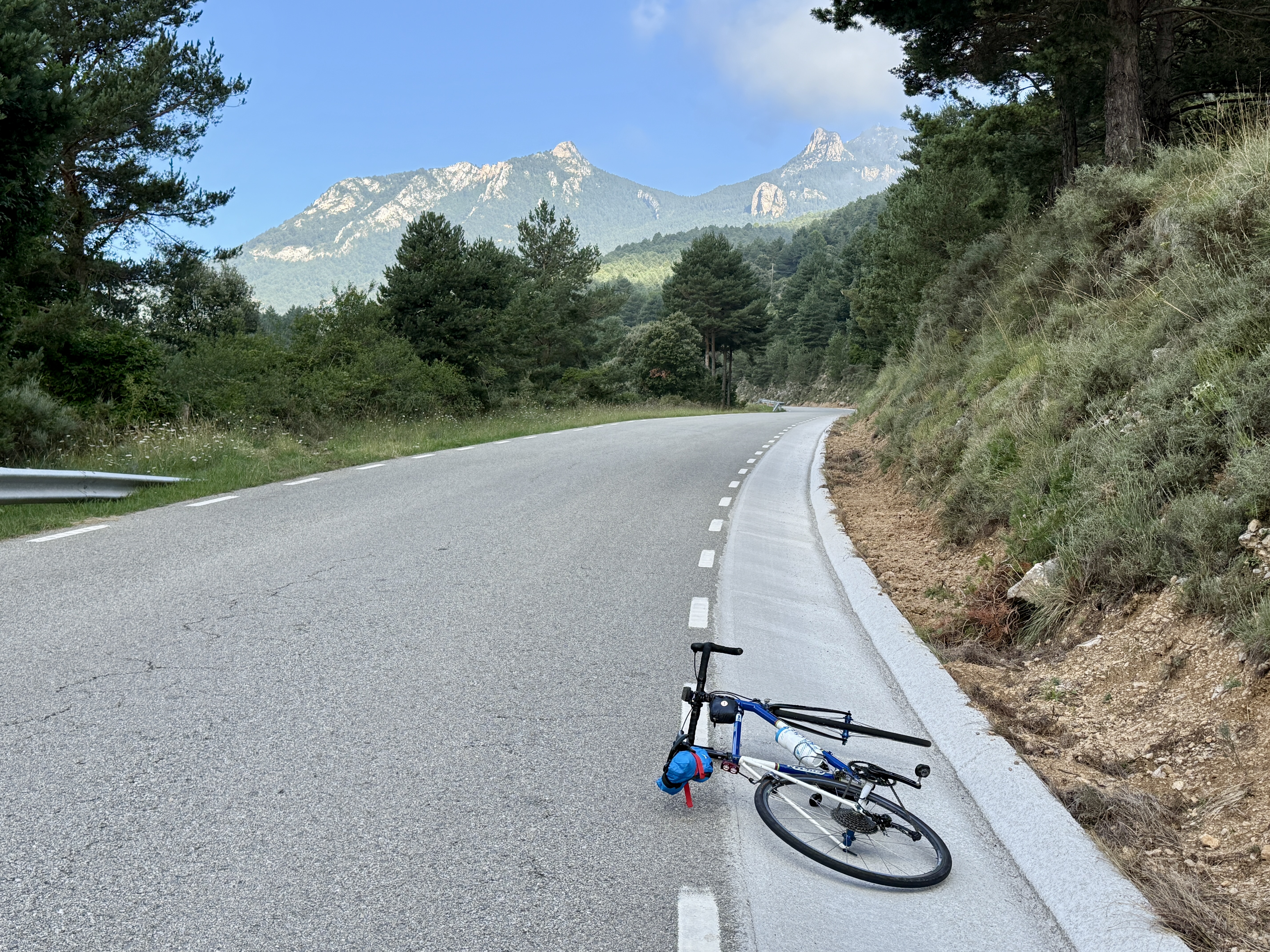
From here I went down the other side to the intersection with the main road at the bottom. This side has some spectacular views of Pedraforca, the huge rocky mountain ahead of you.
Turn round and climb back up. Again there’s plenty of 9% and 10% in the lower part but fortunately the upper part eases off. There’s an Adventure Park about half way up the climb if you feel like an adventure 😀 and there are many hiking trails. The climb back up to the Coll de Pradell is about 6.8 km with 1,290 feet of climbing.
Going back down the steep section, you’ll probably be riding your brakes a lot. At the bottom of the steep section turn right and climb back up the 2 km hill you previously descended. You might have enjoyed this descent, but the ascent is tough on tired legs. There are three steep sections, and my Karoo recorded gradients of 14%, 16%, and 17% respectively.
You now have a fun descent back to the start 😅.
Here’s the ride on Ride with GPS.
Turó de l’Home
The climb finishes at the radio tower on the furthest peak
This is one of the tough climbs of Catalonia, with the biggest elevation gain of any road climb in Catalonia. Most of the climb is in the trees, although you occasionally get views of the radio tower at the top of the climb, high, high above. The last three kilometers have great views of the sea and the valley below, then from the top you have views in all directions. The climb itself is about 25.6 km with 4,820 feet of climbing. The total route is 54.6 km with 5,070 feet of climbing.
I parked in Sant Celoni at a public parking lot at:
41.69005031299533, 2.4873746528268983
From there you ride up the BV-5114 for about 4 km to a roundabout. Take the BV-5119 up to the left and follow this relentlessly to the turnoff to the left to Turó de l’Home, which you reach at about 19.4 kms from the start.
The next 6 kms to the radio tower at the top are the steepest part of the climb, with sections of 10 and 11%. The first 4 kms are on a lovely surface, inexplicably interspersed with crappy road, until you reach a parking lot with a barrier to prevent cars going further.
The final 2 kms to the top are on crappy road, inexplicable interspersed with lovely road. The final hundred meters to the radio tower are the worst, but at least you get lovely views up here 😀.
Once you are back down at the BV-5119 you have a choice. You can go back down the way you came, or turn left, which I think is the much better option, and which I did. A bit more climbing leads to a downhill through a fairytale forest until you reach the BV-5114. Turn right and follow this deliciously down and back to Sant Celoni.
I rode this on a Saturday and it seems to be a popular weekend climb. I was overtaken by about 30 cyclists on the way up the initial 20km but saw very few cyclists on the final 6 km, which suggested than some of them were just there to ride a big loop.
Here’s the ride on Ride with GPS.
Vallter 2000
 This is a steep climb up to the Vallter 2000 ski area. Normally I would have driven to Camprodon and ridden from there, but while we were in Girona, Eat Sleep Cycle put on their annual Vallter Slayer event and I rode Vallter 2000 from Girona. From Girona to Vallter 2000 it’s about 104 km with 8,525 feet of climbing.
If you just want to do the Vallter 2000 climb there are two main possibilities. Start in Setcases, which is where the real climb starts. Cycle Fiesta gives the statistics as 12.2 km with 2884 feet of climbing.
However, I would recommend starting in Camprodon, which will add another 10 km with lovely views, starting as a false flat and gradually increasing in gradient as you approach Setcases. Both Camprodon and Setcases have plenty of free parking, although they get quite full at weekends.
The road from Setcases to Vallter 2000 has markers every kilometer showing you the average gradient for the next kilometer. Several of them show gradients in the 8 and 9% range, which means there are plenty of sections in the 9-12% range. Additionally the road surface is not as good as some of the other big climbs described here, especially when you are coming downhill. The main view is of the ski area as you slowly approach it.
I thought the climbs further west were better, but this climb seems to be more popular, probably because access is easier.
Here’s the Vallter Slayer ride on Ride with GPS.
Sant Pere de Rodes
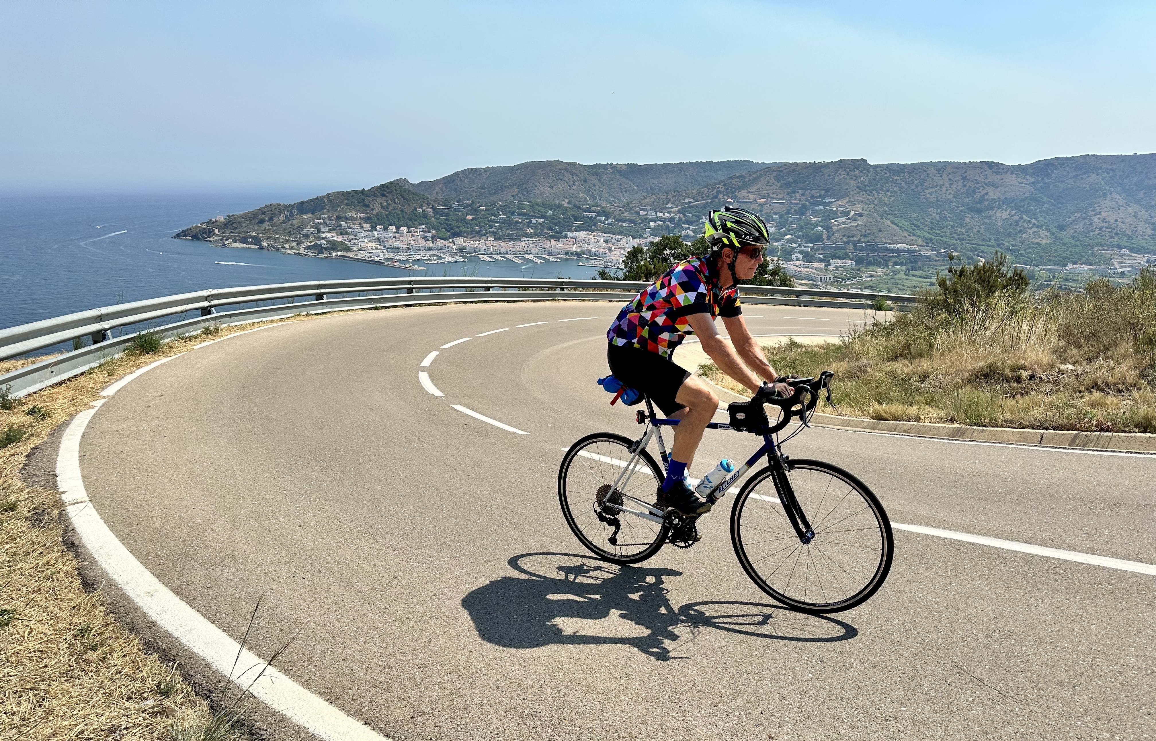
This is a short – roughly 9 km – climb that you can do from two different sides. The climb from El Port de la Selva is one of the most enjoyable climbs in the Girona area.
Many people seem to do Sant Pere de Rodes as a loop but this involves riding on the very busy, twisting Cadaqués road (the GI-614). We chose to ride it as an over-and-back so we could enjoy both climbs.
At the top of the road is the Sant Pere de Rodes Monastery, and above you can see the ruins of the Sant Salvador de Verdera castle, which was apparently used by the monks to watch out for pirates.
We parked in Vilajuïga in the big public parking lot at location 42.323775152090946, 3.091521556630753.
From Vilajuïga
From here follow the GIP-6041 through the town for about 400 meters then turn right, then quickly left, following the signs for Sant Pere de Rodes. After this the route is obvious. The climb from Vilajuïga is about 8.8 km with 1,590 feet of climbing. The climb itself I found rather tedious, a lot more fun on the descent as you can see the nice views below. At the intersection where the GIP-6041 continues down to El Port de la Selva, follow the road gently up to a car park, then along a rougher concrete road to the monastery.
Back at the intersection, take the road down to El Port de la Selva. This descent – and then climb – is delicious, on a much better road surface and with gorgeous views of the sea and town below. At the base of the descent you can you can turn right and find cafes along the waterfront if you want refreshments. Otherwise, turn around and start back up the climb.
From El Port de la Selva
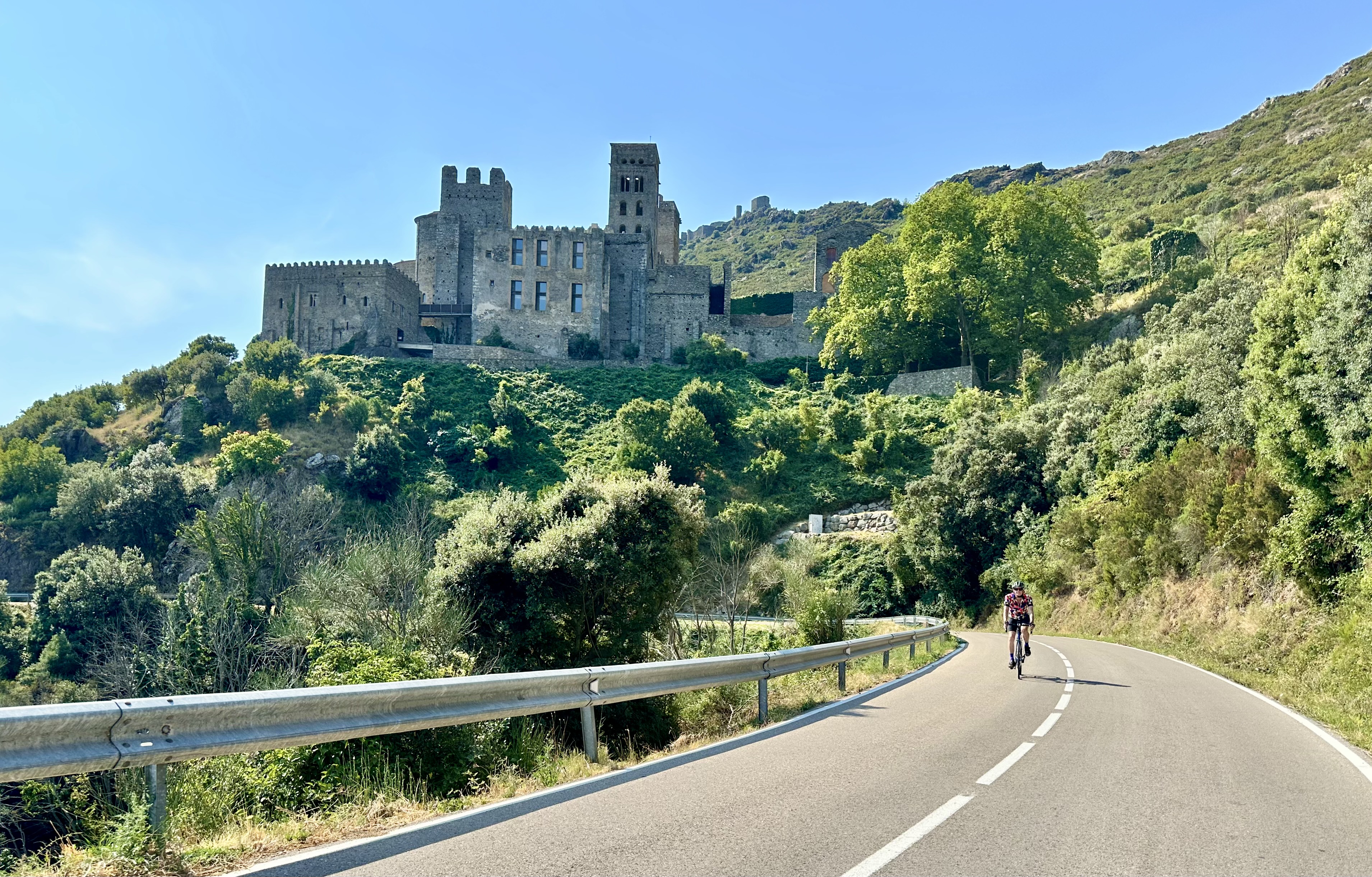
From El Port de la Selva the climb to the monastery is wonderful. The road is smooth, the views are gorgeous, and the gradient varies wildly. It’s a much more fun climb than from Vilajuïga. It starts with a short brutal section of 14%, and has two short sections where my Karoo showed high 15%. All interspersed with much easier climbing. As you approach the top you get wonderful views of the monastery and castle above it.
Again, at the intersection at the top, turn left and go up to the monastery, which you reach after 8.9 km and 1,670 feet of climbing.
Back down to the intersection then turn left and do a fun descent back to Vilajuïga.
Links and Other Clicks
Cycle Fiesta’s pages about riding Coll de la Creuta from La Pobla de Lillet and from Alp.
Cycle Fiesta’s page about climbing Rasos de Peguera.
Cycle Fiesta’s page about climbing Coll de Pal.
Cycle Fiesta’s page about climbing Coll de Pradell through Sant Corneli and from the west.
The Fumanya page about their Dinosaur Tracks.
A short YouTube video of the racers in the 2024 Volta a Catalunya climbing the steepest section of the Coll de Pradell.
Cycle Fiesta’s page about climbing Turó de l’Home.
Cycle Fiesta’s page about climbing Vallter 2000.
Cycle Fiesta’s pages about the Sant Pere de Rodes climb from Vilajuïga and from El Port de la Selva. And here’s a page about the monastery of Sant Pere de Rodes.
The wonderful book, Skip to the Fun Parts.
