
July, 2023
KmM = Kilometer Marker
Read this page for a lot of background information about cycling in the French Alps.
We came to Cluses as I was hoping to do a couple of big rides, but a broken spoke while climbing the Col de Joux Plane put paid to that plan. So I’ll also describe some climbs around Cluse that I didn’t do.
Cluses
Cluses is a small, busy town of about 17,000 people on the road down to Chamonix and Mont Blanc. We were amazed at how many cars we driving through Cluses despite there being a motorway a few hundred meters away. But the main downtown street is fun to walk along, and there are lots of Kebab restaurants 🙂 Most of the parking along the streets is pay parking, but there are also several big free parking lots. There is a Decathlon store just up the road from the town center.
Col de Joux Plane
 This is a tough but popular climb. I saw so many people riding up this from Samoëns. I suspect most people do it as a loop, descending into Morzine, as I only saw one person riding down. Unfortunately I only rode up the climb as a spoke broke 2 km from the top and I had to finish with the back wheel rubbing against the frame. Fortunately Tanya had driven up so at the top I put the bike in the car. Anyway….
I started in Samoëns at the big free parking lot at 46.08273346203113, 6.722851284368717
From here you just follow the signs for Col de Joux Plane. The ride starts easily and fairly soon you even have a section of downhill before the climb really starts in earnest. The gradient, and road quality, varies, and there’s a lot of 8-10% on the climb. The climb from Samoëns is 14 km with 969 meters of climbing.
I didn’t think the views were anything special on the way up, but coming back down the same way the views were wonderful. I guess the views are mainly behind you on the way up – either that or I was too focused on the climb to appreciate them.
Col de Romme + Col de la Colombière
I’d wanted to do this combination but it took a while to find a bike shop that could replace my broken spoke, so we ended up just driving it. Col de Romme is steep! It starts with an 11% kilometer, followed by 10%, and for the most part each kilometer sign says either 9% or 10%. Romme itself is a pretty little village. Then you get a gradual descent to the D4. Turn left at the intersection and climb up to the Col de la Colombière, with beautiful views for the last few kilometers. On the way down most people stick to the D4 all the way down rather than climbing back up to the Col de Romme.
Here’s a page about riding the Col de Romme and Col de la Colombière on Cycling-Challenge.
Col de Pierre Carrée
This is a long but not particularly steep 21 km climb with some lovely views. It’s apparently the highest paved road in the Haute Savoie, cresting at 1,844 meters, and there’s even a golf course at the top. If you want more climbing before you descend the way you came up, continue for 4 km down to the ski town of Flaine then ride back up to the Col.
Directions: From Cluses, follow the D1205 south to the big Super U on the right. At the roundabout, turn left up the D6 to Flaine.
Will at Cycling-Challenge has several pages about the Col de Pierre Carrée. Here is one of them.
Moûtiers
Moûtiers is a small town of about 3,500 people, the access point for the Trois Vallées (Three Valleys) ski region: the largest interconnected ski area in the world. From a cycling perspective Moûtiers is the base for climbs to Col de la Loze via Courchevel or Méribel, and to Val Tourens.
Col de la Loze
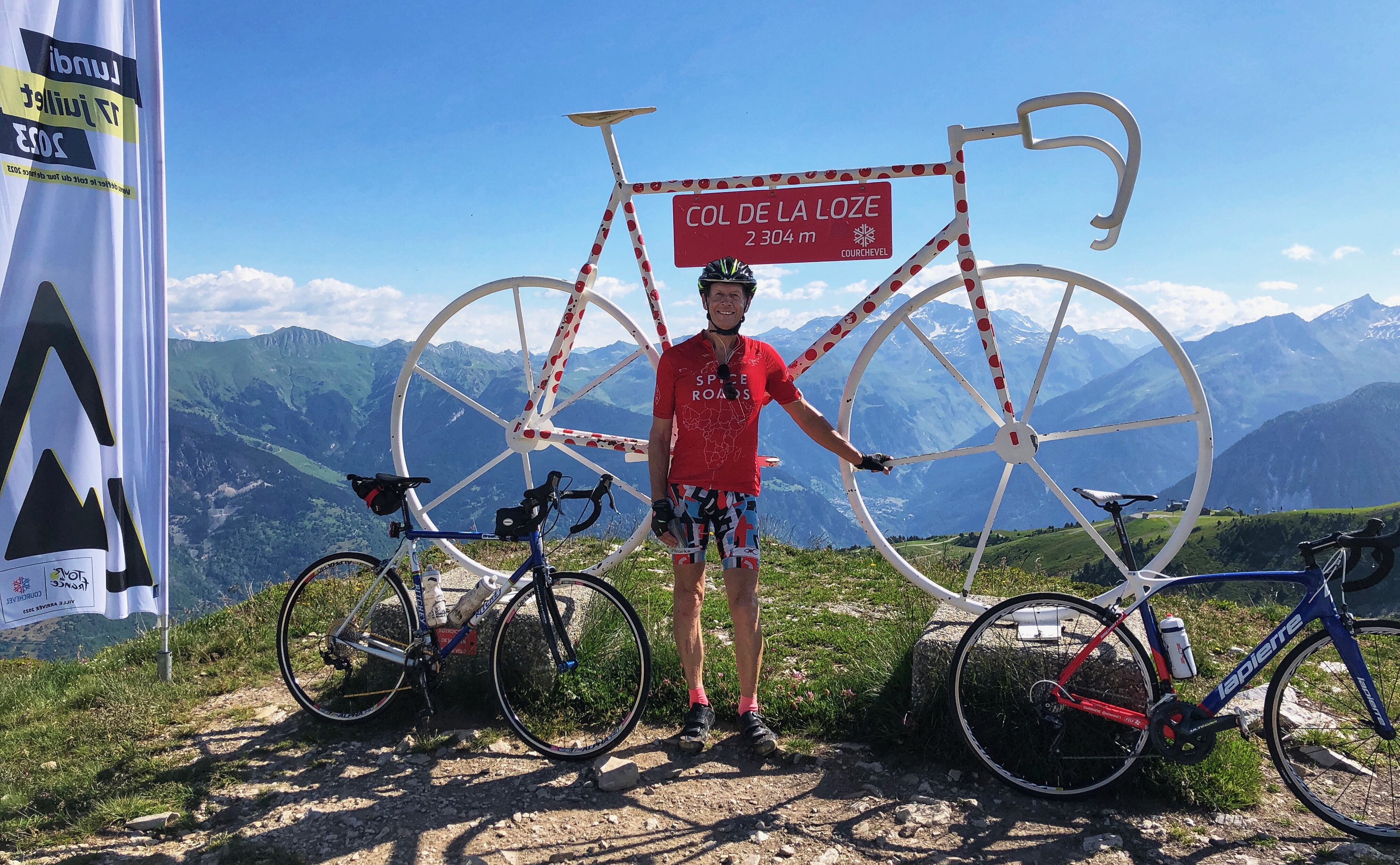 Col de la Loze via Méribel is a modern classic, supposedly one of the hardest climbs in France. The last 7 km is on a bike path up on the open hillside with beautiful views all around. As of 2023, it’s been ridden twice in the Tour de France: a summit finish in 2020, and in 2023 as the final climb before the finish in Courchavel.
You can start in Moûtiers but the first few kilometers up the D915 are busy with traffic, so many people start in Brides-les-Bains, about 6 km from Moûtiers. If you are doing this, drive up the D915 for a few kilometers than follow the sign left for Brides-les-Bains. Another kilometer takes you into town where a very sharp left takes you down to a big free parking area at 46.08273346203113, 6.722851284368717
From here, the whole ride up through Méribel to the Col de la Loze then down through Courchevel and back to Brides-les-Bains is 51km (31.7 miles) with 1,693 meters (5,554 feet) of climbing.
From Brides-les-Bains ride back to the D915, turn left, and in a few hundred meters turn right on the D90 following the sign for Méribel. You’ll soon see a kilometer sign for Col de la Loze, 21 km away.
The first 14 kilometers, up to and through Méribel are nothing special, just your typical ride up through small villages and through a ski resort. The route can be confusing once you reach Méribel but fortunately there are signs to Col de la Loze at all the obvious intersections as well as paint markings on the road.
About 14 km from the start of the D90 you reach a small roundabout where the Col de la Loze bike path starts. There’s also a public bathroom should you need to use it.
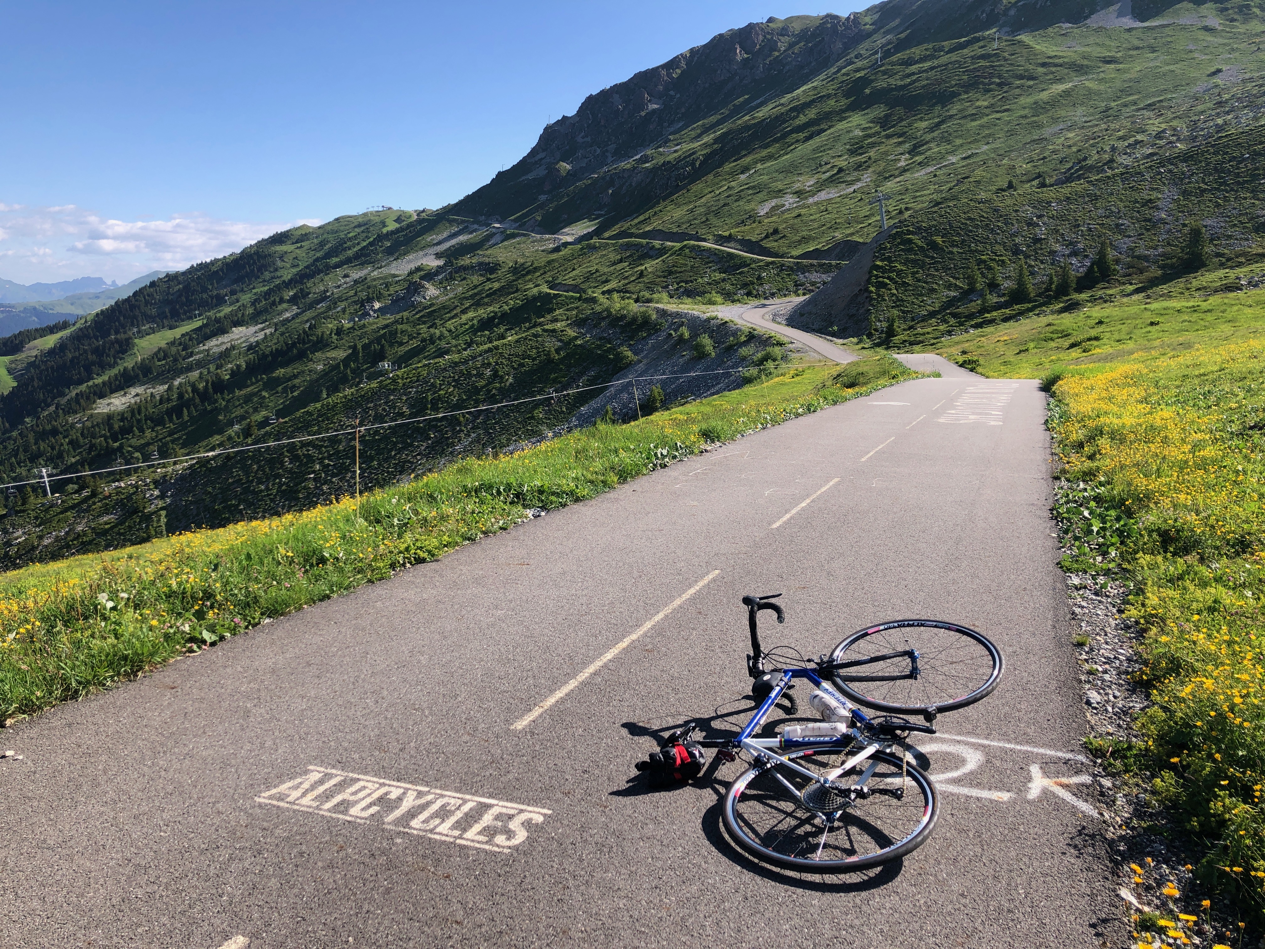 From here you follow the bike path and this is where the ride gets beautiful. The gradient varies incredibly, from almost flat, to viciously steep. Fortunately the vicious ramps are never too long so you’ll soon get some respite. As you climb the views get better and better, then there’s one final brutal ramp before the col itself.
From the top, continue down the other, easier, side into Courchevel, then follow the seemingly endless road down until you finally reach Brides-les-Bains.
Here’s the route on Ride with GPX.
Col de Petit Saint Bernard
 Bourg-Saint-Maurice is a 30 minute drive from Moûtiers, and the start of two big climbs: the Cormet de Roselend, and the Col de Petit Saint Bernard. I decided to ride up to the Col de Petit Saint Bernard. What a great climb! I loved it. The whole ride is 56.2 km with 1,313 meters of climbing.
I parked in Bourg-Saint-Maurice by the soccer stadium at 45.622548, 6.776560
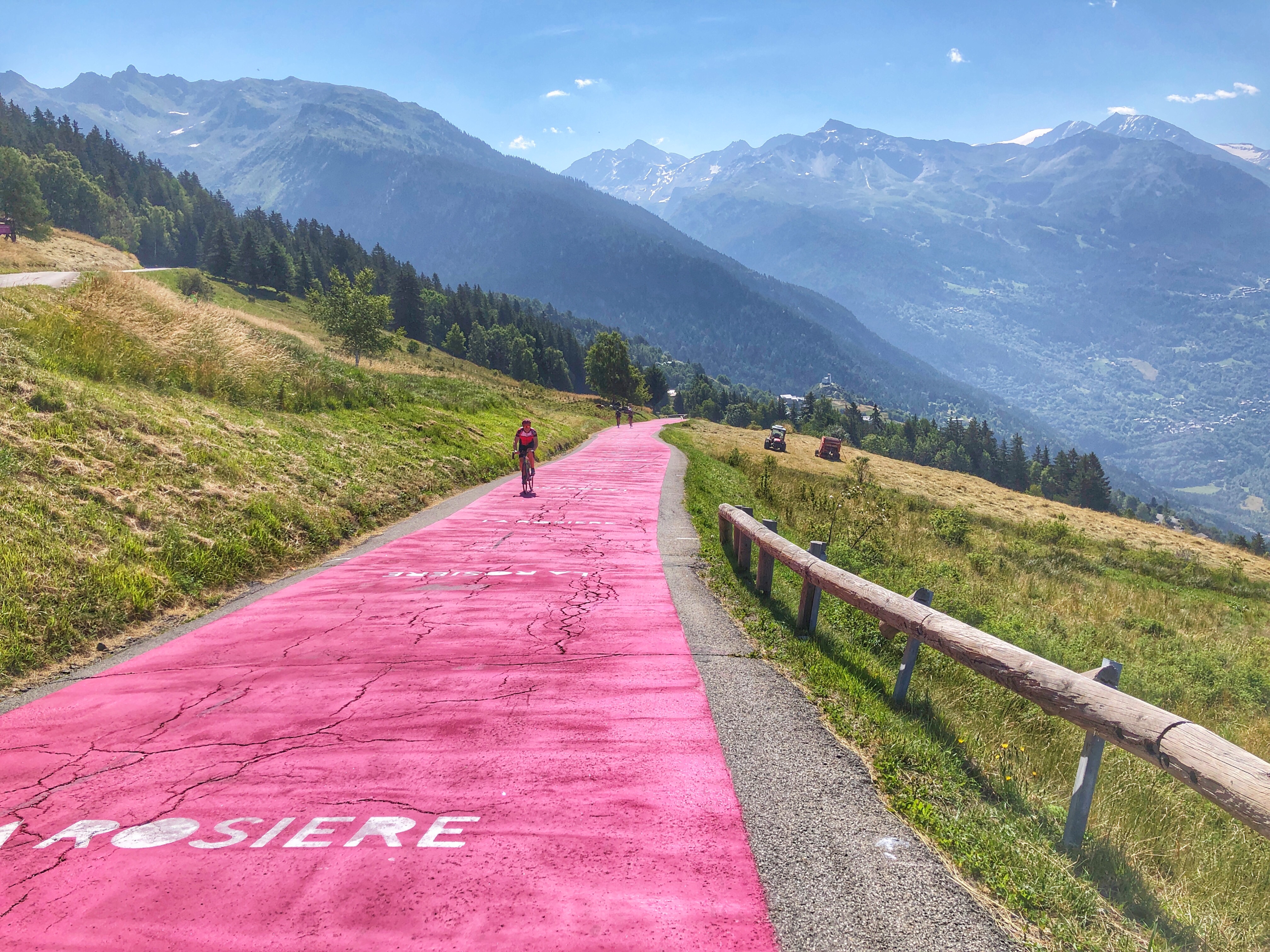
From here follow the signs for Col de Petit Saint Bernard up the D1090 for 6 switchbacks. At the 7th switchback, follow to D84 to Montvalezan. This gives you some steeper and much more interesting climbing, including a section of road that has been painted pink. It also cuts almost 4 km off the climb to the col. It has kilometer signs showing the distance to the village of La Rosiere.
Just above the pink section you rejoin the main D1020 and the gradient eases for the rest of the way to the Col de Petit Saint Bernard. After you ride through the village of La Rosiere, everything opens up and you have beautiful views all the way to the col.
Here’s the route on Ride with GPS.
Italian side: I didn’t ride this, but we did drive down it on our way to Ceresole Reale. From the base in Pré-Saint-Didier, it’s 23 km to the pass. It’s very pretty and less busy than the French side, and has 8 lovely tight switchbacks at the bottom. There are also a few short tunnels so having a back light might be sensible. It looked like a good climb.
Links and Other Clicks
