
September 2025
KmM = Kilometer Marker.
The western Basque Pyrenees are more isolated than the more famous parts of the Pyrenees, and apparently the passes are often shrouded in clouds. We paid close attention to the weather forecasts and when we saw two days of perfect weather, we headed out there and stayed in the little village of Arette, which is at the base of the Col de la Pierre Saint-Martin, and about a 30 minute drive from the start of the climb to Port de Larrau.
Port de Larrau
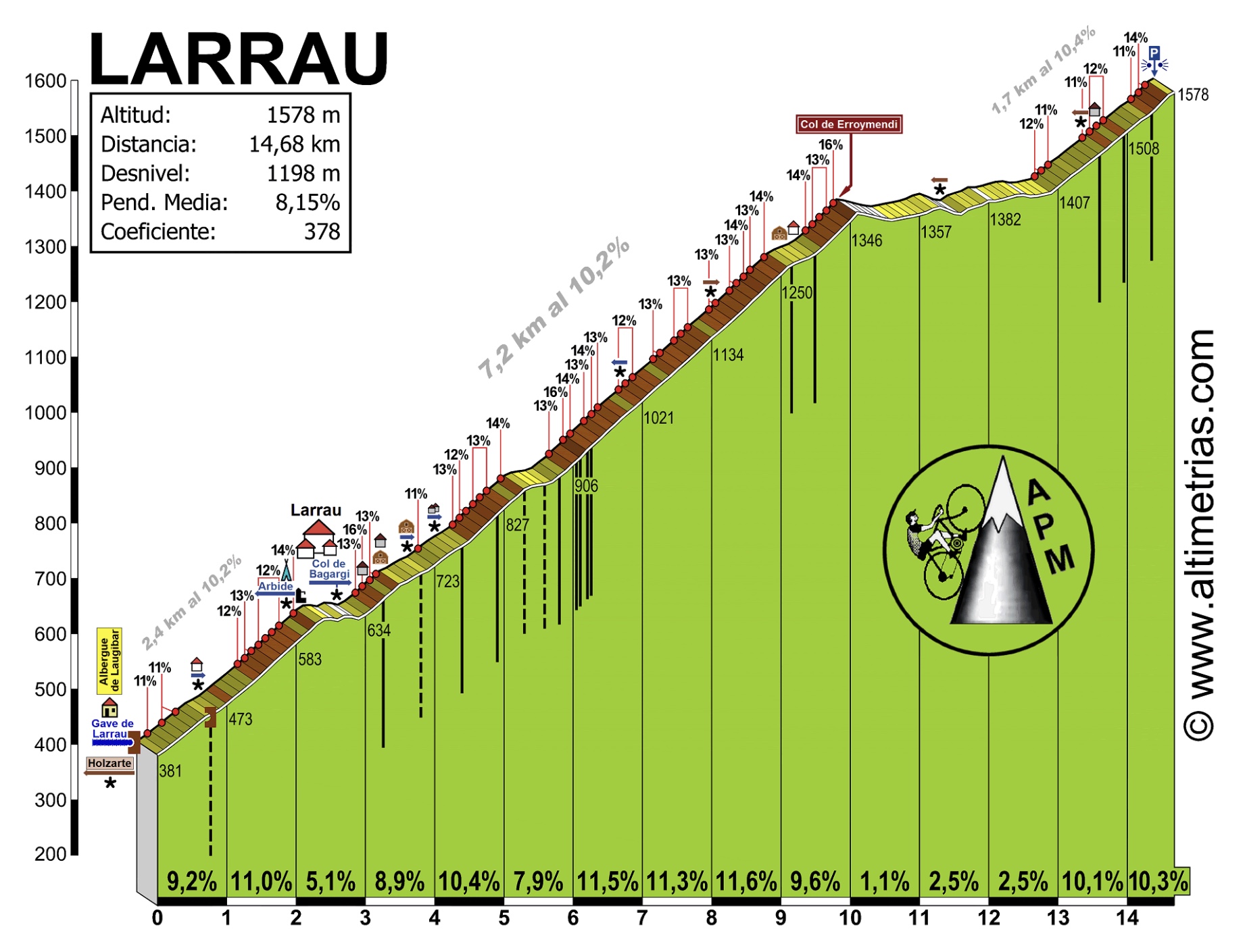
 The Port de Larrau from Pont de Logibar in France is a tough climb, one of the hardest in the Pyrenees. It’s the climb that put an end to Miguel Indurain’s bid in 1996 to win his 6th consecutive Tour de France.
You can also ride to the Port from Spain, and the whole over-and-back ride is about 51 km with 6,110 feet of climbing. Just the climb from Pont de Logibar is about 15 km with 3,860 feet of climbing. But what a 3,860!
I drove from Arette and parked at a big dirt parking lot at 43.01921591947572, -0.9252432965175107
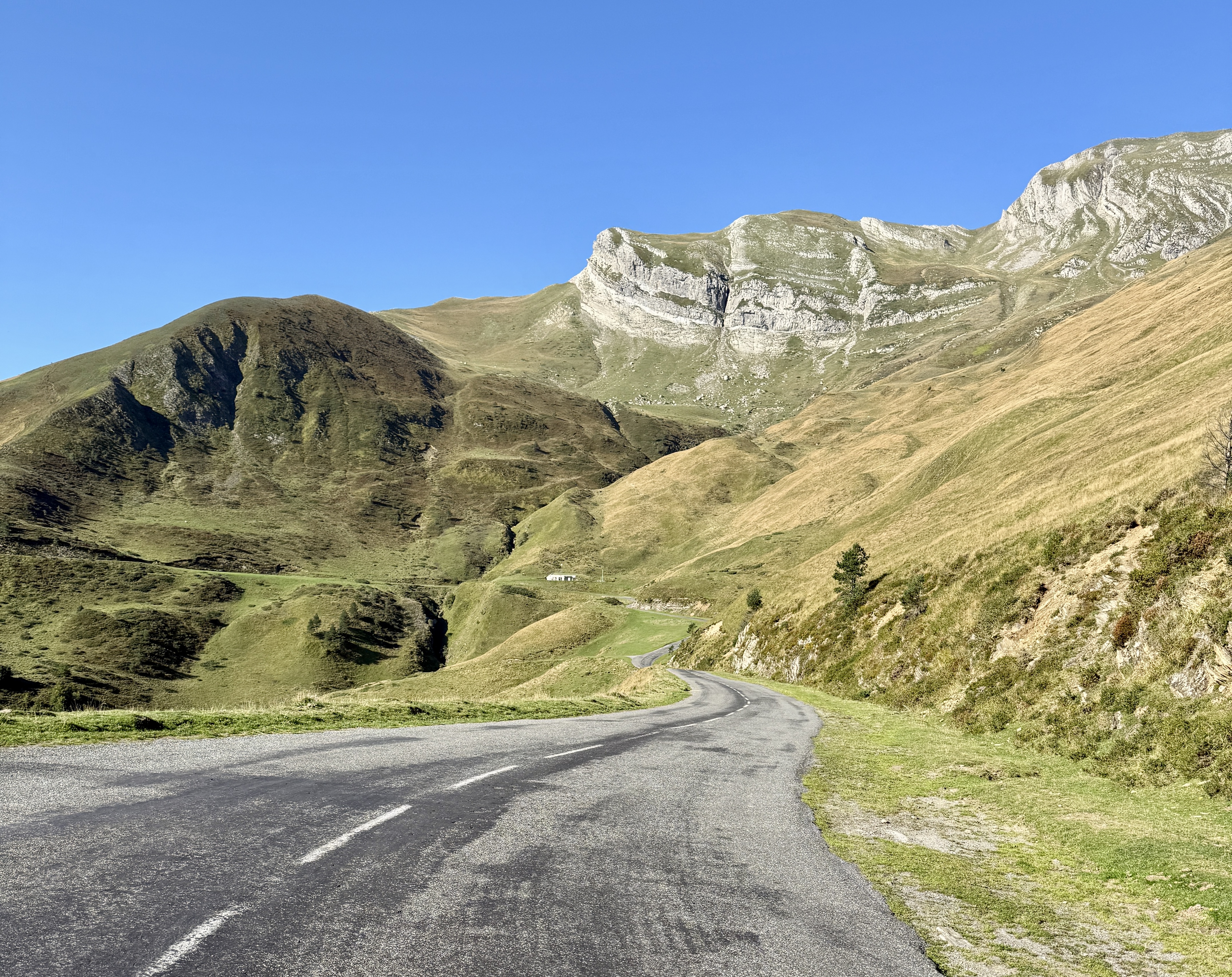
The climb starts for real just after you cross the Pont de Logibar bridge. It starts steep then you get a short downhill through the village of Larrau. After this the views are pretty and bucolic for a while but as you climb higher you lose the views and enter the steep forest.
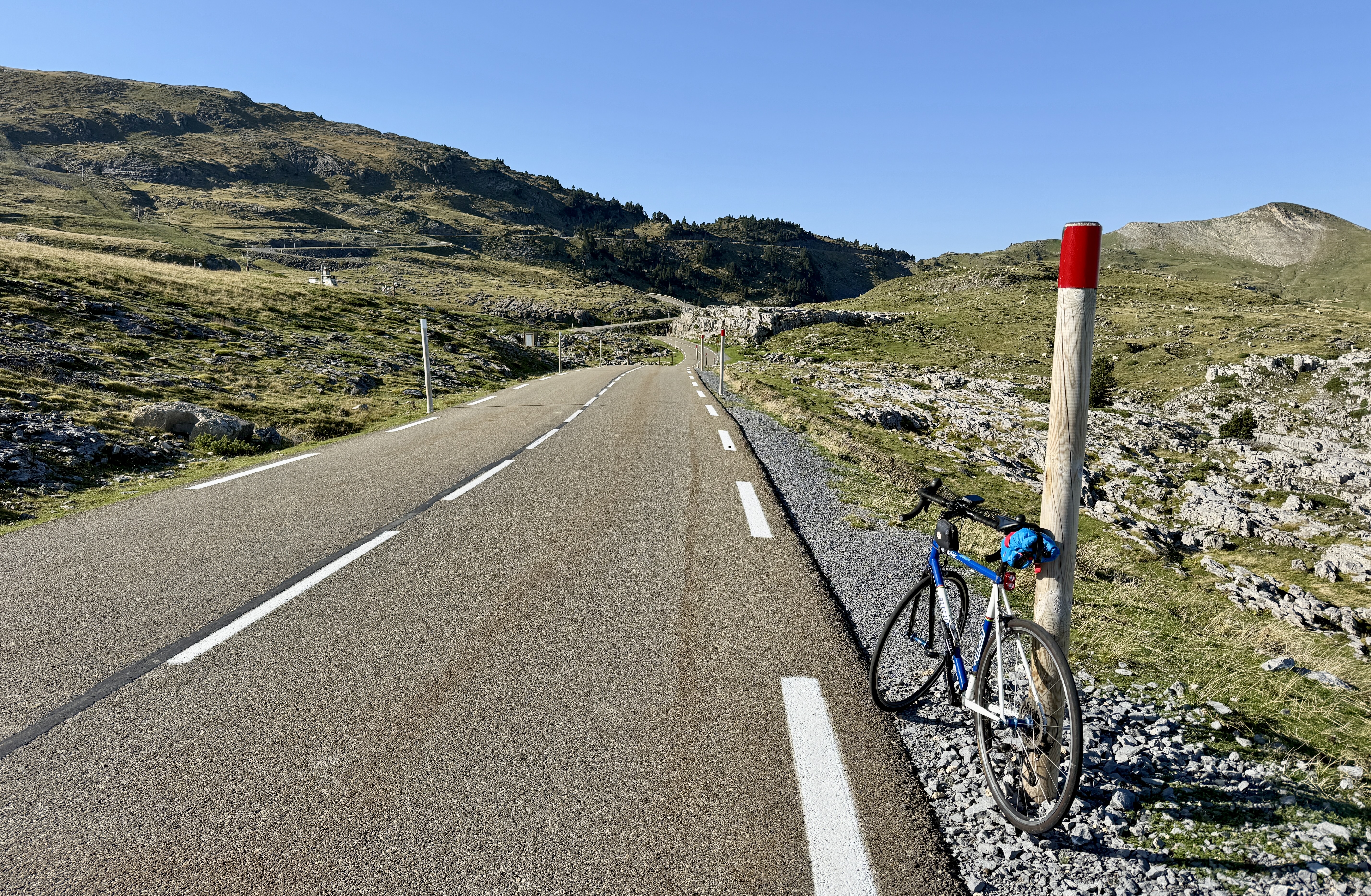
After you exit the trees everything opens out and the gradient eases and the road rolls up and down (mainly up) for a while. Then you round a corner and are faced with daunting switchbacks up the wall in front of you. It’s almost enough to make you weep, but eventually they are over and you reach the Port.
Continue down the Spanish side for about 10.6 km until you reach the stop sign where the road reaches the NA-140. It’s a nice descent as the gradient on the Spanish side is much easier than the French side.
Turn around and ride back up to the top. You are now faced with the much steeper descent on the French side. The compensation for having to ride your brakes more is that the views as you descend are very dramatic and spectacular.
Col de la Pierre Saint-Martin

This climb is tough – very tough. What makes it tough is that the gradient is so inconsistent. The sign at the side of the road may tell you that the average gradient for the next kilometer is 10%, but this might mean that some of that is 7% and some of it is 13%. It’s brutal. It’s also the highest pass in the Basque Pyrenees. The climb is about 25.5 km with 4,520 feet of climbing.
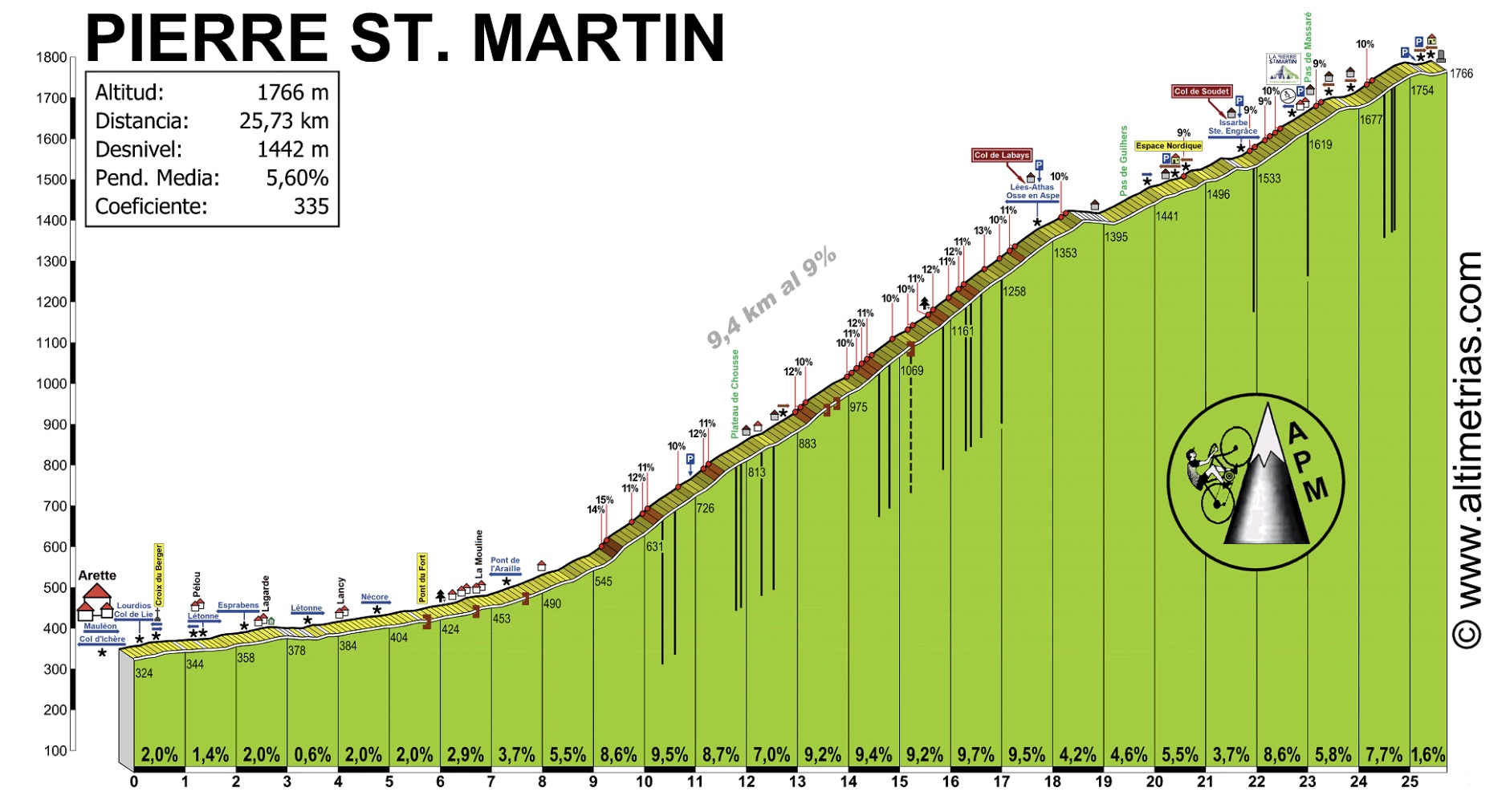
Starting in Arette, follow the signs for Col de la Pierre Saint-Martin. The ride starts very easily, basically a false flat for about 8 km. It then steepens, with constantly changing gradients. You are riding in the trees until at ab0ut kilometer 19 the views open up and you see the ski area of Pierre Saint-Martin above you.
 Now the ride is much prettier, until you finally reach the Col.
Links and Other Clicks
Cycle Fiesta’s pages about riding the Port de Larrau from Pont de Logibar and from Spain.
Cycle Fiesta’s page about riding the Col de la Pierre Saint-Martin.
Altimetrias’ pages showing the gradient for Port de Larrau and Col de la Pierre Saint-Martin.
Altimetrias’ main page where you can find very beautiful gradient diagrams for many climbs, especially in Spain and France.
